
The Block House is a historic building located off Naamans Road in Claymont, Delaware. The Block House is believed to be the only structure remaining of original settlement on Naamans Creek.
The Block House is a historic building located off Naamans Road in Claymont, Delaware. The Block House is believed to be the only structure remaining of original settlement on Naamans Creek.

The Block House is believed to have been constructed in 1654 under instruction of Johan Risingh, who was the last Governor of the Colony of New Sweden. Chief Peminacka of the Minqua tribe had deeded the large tract of land along Naaman's Creek to John Risingh on behalf of the Swedish colony. The structure was originally designed for defense. During September 1655, the Block House was taken by the Dutch West India Company under Peter Stuyvesant at the same time Dutch forces captured Fort Christina. In 1671, the Block House was attacked by Native Americans. It was captured by the British Army in 1777 during the American Revolutionary War. [1] [2]
Several yards south of the Block House is the Robinson House. The Block House consists of one room with a lower and upper level. Inside is a relatively large fireplace and the former living quarters for the Robinson House cook. The correct date of construction has recently been disputed.[ by whom? ] Some[ who? ] say the Block House was not built until later, possibly around the time the Robinson House was built in 1723.

New Sweden was a colony of the Swedish Empire along the lower reaches of the Delaware River between 1638 and 1655 in present-day Delaware, Maryland, New Jersey, and Pennsylvania in the United States. Established during the Thirty Years' War when Sweden was a great power, New Sweden formed part of the Swedish efforts to colonize the Americas.
Claymont is a census-designated place (CDP) in New Castle County, Delaware. As of the 2020 U.S. census, the population of Claymont was 9,895.

Fort Christina was the first Swedish settlement in North America and the principal settlement of the New Sweden colony. Built in 1638 and named after Queen Christina of Sweden, it was located approximately 1 mi (1.6 km) east of the present-day downtown Wilmington, Delaware, at the confluence of the Brandywine River and the Christina River, approximately 2 mi (3 km) upstream from the mouth of the Christina on the Delaware River.

The Delaware Colony, officially known as the three "Lower Counties on the Delaware", was a semiautonomous region of the proprietary Province of Pennsylvania and a de facto British colony in North America. Although not royally sanctioned, Delaware consisted of the three counties on the west bank of the Delaware River Bay. In the early 17th century, the area was inhabited by Lenape and possibly Assateague Native American Indian tribes. The first European settlers were Swedes, who established the colony of New Sweden at Fort Christina in present-day Wilmington, Delaware, in 1638. The Dutch captured the colony in 1655 and annexed it to New Netherland to the north. Great Britain subsequently took control of it from the Dutch in 1664. In 1682, William Penn, the Quaker proprietor of the Province of Pennsylvania to the north leased the three lower counties on the Delaware River from James, the Duke of York, who went on to become King James II.

Johan Classon Risingh was the last governor of the Swedish colony of New Sweden.

Fort Nya Elfsborg was a fortification and settlement established as a part of New Sweden. Built in 1643 and named after the Älvsborg Fortress off Gothenburg, Fort Nya Elfsborg was located on the New Jersey side of the Delaware River, between present day Salem and Alloway Creek.
Brandywine Hundred is an unincorporated subdivision of New Castle County, Delaware. It is located to the north and northeast of the city of Wilmington. Hundreds were once used as a basis for representation in the Delaware General Assembly. Brandywine Hundred and North Wilmington are commonly used colloquial names for this area. However, while their names still appear on all real estate transactions, all other hundreds in Delaware presently have no meaningful use or purpose except as a geographical point of reference. In the 2010 census, Brandywine had 77,182 people.
The history of Delaware as a political entity dates back to the early colonization of North America by European settlers. Delaware is made up of three counties established in 1638, before the time of William Penn. Each county had its own settlement history. The state's early colonists tended to identify more closely with their county than Delaware as a whole. Large parts of southern and western Delaware were thought to have been in Maryland until 1767. The state has existed in the wide economic and political circle of the nearby Pennsylvanian city of Philadelphia.

The Robinson House is a historic guest house located at the junction of Naamans Road and The Kings Highway in Claymont, Delaware, in the United States. It was built in 1723, on the site of the original settlement on Naaman's Creek. The Block House, which stands a few yards northeast of the Robinson House, is the only remaining building from the original 1654 settlement.

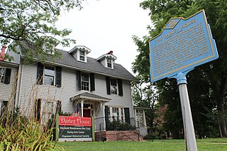
The Claymont Stone School, also known as Naaman's Creek School #1, is a historic schoolhouse built in 1805, on land donated by Founding Father John Dickinson, in Claymont, Delaware, on the Philadelphia Pike just south of the Darley House. The school was listed in the National Register of Historic Places in 1990. Its official Delaware State Historic Marker indicates that the school "may have been the first racially integrated public school in the State."
Måns Andersson, was a pioneer in the Swedish colony of New Sweden.

Fort Casimir or Fort Trinity was a Dutch fort in the seventeenth-century colony of New Netherland. It was located on a no-longer existing barrier island at the end of Chestnut Street in what is now New Castle, Delaware.
Fort Nassau was a factorij in New Netherland between 1627–1651 located at the mouth of Big Timber Creek at its confluence with the Delaware River. It was the first known permanent European-built structure in what would become the state of New Jersey. The creek name is a derived from the Dutch language Timmer Kill as recorded by David Pietersen de Vries in his memoirs of his journey of 1630–1633. The Delaware Valley and its bay was called the "South River" ; the "North River" of the colony was the Hudson River. The factorij was established for the fur trade, mostly in beaver pelts, with the indigenous populations of Susquehannock, who spoke an Iroquoian language, and the Lenape, whose language was of the Algonquian family. They also wanted to retain a physical claim to the territory.
Fort Beversreede was a Dutch-built palisaded factorij located near the confluence of the Schuylkill River and the Delaware River. It was an outpost of the colony of New Netherland, which was centered on its capital, New Amsterdam (Manhattan), on the North River.

Overlook Colony is an unincorporated community in Claymont, New Castle County, Delaware, United States.
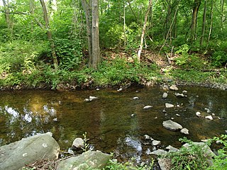
Naamans Creek is a tributary of the Delaware River that is located in northeast New Castle County, Delaware and southeast Delaware County, Pennsylvania.

Olof Persson Stille (1610–1684) was a pioneer settler of New Sweden, a colony along the lower reaches of the Delaware River in North America claimed by Sweden from 1638 to 1655. Stille served as the first chief justice of the Upland Court, the governing body of the New Sweden colony following Dutch West India Company annexation from Swedish colonial rule.

Armegot Printz (1625–1695) was a Swedish noble. She was the daughter of Johan Björnsson Printz, governor of New Sweden, and she married her father's successor, governor Johan Papegoja. She is the most well documented and known woman of New Sweden.
Hans Månsson (1612–1691) was a Swedish soldier and a convicted criminal who was sent to New Sweden along the lower reaches of the Delaware River in what is now the United States in 1641. After serving six years on a tobacco plantation, he was freed and became a respected leader in Dutch New Netherland, serving as a spokesman for the settlers, and as commanding officer of the militia at Wicaco. He purchased land and was one of the first European settlers in what is now New Jersey.
In September 1655, Dutch soldiers from New Netherland under the command of Peter Stuyvesant conquered the Delaware River colony of New Sweden. Under the terms of surrender the Swedish settlements were incorporated into the Dutch colony.
39°48′37″N75°26′30″W / 39.8103°N 75.4416°W
| | This article about a building or structure in Delaware is a stub. You can help Wikipedia by expanding it. |