Bluff, KwaZulu-Natal

Last updated

Bluff
Bluff, Durban.jpg
The Bluff as seen from Greens Walk, Durban
South Africa KwaZulu-Natal location map.svg
Red pog.svg
Bluff
South Africa adm location map.svg
Red pog.svg
Bluff
Coordinates: 29°55′29″S31°0′14″E / 29.92472°S 31.00389°E / -29.92472; 31.00389
Country South Africa
Province KwaZulu-Natal
Municipality eThekwini
Main Place Durban
Area
[1]
  Total21.68 km2 (8.37 sq mi)
Population
 (2011) [1]
  Total68,124
  Density3,100/km2 (8,100/sq mi)
Racial makeup (2011)
[1]
   Black African 15.6%
   Coloured 36.6%
   Indian/Asian 30.1%
   White 17.1%
  Other0.6%
First languages (2011)
[1]
   English 79.8%
   Zulu 8.1%
   Afrikaans 7.2%
   Xhosa 1.7%
  Other3.3%
Time zone UTC+2 (SAST)
Postal code (street)
4052
PO box
4036

Bluff or The Bluff is a geographical area, containing eight suburbs in Durban, eThekwini Metropolitan Municipality, KwaZulu-Natal Province, South Africa. The Bluff forms a large part of the South Durban Basin, a sub-region located south of Durban.

Contents

History

The promontory on which Bluff is situated is Durban's most prominent natural landmark. Accordingly, it probably served as an important visual reference for navigational approaches into Durban Harbour. [2]

Between 1907 and 1975, the exposed south-east side of The Bluff housed a whaling station. Since the mid-Nineteenth Century, the region has been purposed for navigational and military uses. This use has provided protection for much of the area's native vegetation. Today, the area is considered important in the ecological management of Durban and environment. [2]

Etymology

The traditional Zulu name for Bluff is isibubulungu, meaning a long, round-shaped ridge. It also means "white man’s bluff", which may be a reference to habitation by shipwreck survivors. [2]

The name of the area is derived from the long bluff - two ancient sand dunes on which most of the suburbs lie.

Geography

The Bluff promonotory is a remnant of an extensive coastal dune system that formed along the shoreline of KwaZulu-Natal between two and five million years ago. [2]

Lying just south of the Durban city centre, the Bluff is one of the main enclosing elements of the Port of Durban from the Indian Ocean, and forms the southern quayside of the port. The coastal area is bounded by the Port of Durban (Island View) to the northwest, the defunct Durban International Airport and the SAPREF Petrochemical Refinery to the south, Mobeni to the southwest and the Port of Durban (Bayhead) and Clairwood to the west.

Within the area referred to as "The Bluff" lie the suburbs of Brighton Beach, Fynnland, Grosvenor, Jacobs, Merebank, Ocean View, Treasure Beach and Wentworth.

Recreation

Beaches

The Bluff is a popular holiday destination, with extensive accommodation and plentiful seaside recreation. The area is known for its abundant sea life, including dolphins, and, in the winter months, whales. [3]

The Bluff has access to six beaches including Ansteys Beach, Brighton Beach, Cuttings Beach, Garvies Beach and Treasure Beach. Amongst these beaches Ansteys and Brighton beaches are the most popular with Ansteys Beach home to two pools and Brighton Beach to three pools including one tidal pool. Most of the other beaches along the Bluff remain quiet and unspoilt.

Sports

Bluff National Park Golf Club is a large 18-hole golf course situated between the suburbs of Grosvenor and Ocean View. [4]

Economy

Industries

At the south end of the Bluff are two main residential suburbs: Wentworth and Merebank. Interspersed among the houses are a number of industries, including two of South Africa's largest oil refineries (Sapref and Engen facilities), the Mondi Paper Mill and other smaller factories. Durban's main airport was nearby until 2010. Durban International Airport moved and changed its name on 1 May 2010, relocating from the South Durban Basin to La Mercy on the North Coast.

The mixture of residential homes and large industries in the basin creates a challenge for all those who live and work in the area. Air pollution, water pollution, overcrowding and litter are some of the problems that residents and industries need to deal with. Community groups are attempting to resolve the issue by working with the large industries in the area.

Retail

There are two shopping centres in Wentworth serving the Bluff, namely Bluff Towers and Hillside Mall. Other shopping centres serving the area include Merebank Mall in Merebank and the Bluff Shopping Centre in Grosvenor. [5] [6]

Infrastructure

Healthcare

Wentworth District Hospital is a government-funded hospital and is the sole hospital in the Bluff, aimed at serving the area. [7]

Policing

The Bluff is divided over two SAPS precincts with the southern part including Merebank, Merewent, Treasure Beach and Jacobs covered by Wentworth SAPS while the northern part including Wentworth, Brighton Beach, Ocean View, Fynnlands and Grosvenor covered by Brighton Beach SAPS. [8]

Transport

Roads

The main freeway passing the Bluff is the M4 (Inkosi Albert Luthuli Freeway), connecting the Durban CBD to the north with the South Coast (via the N2) to the south. The M7 connects the Bluff with Queensburgh to the west and is formed by many roads such as Solomon Mahlangu Drive (previously Edwin Swales VC Drive), Bluff Road, Old Mission Road and Grays Inn Road.

The main suburban routes in the Bluff include Marine Drive, which is the coastal road connecting Merebank and the coastal suburbs of Treasure Beach, Brighton Beach and Ocean View and Tara Road, which is the inland road connecting Merebank and the suburbs of Jacobs, Wentworth, Grosvenor and Fynnlands.

Related Research Articles

<span class="mw-page-title-main">KwaZulu-Natal</span> Province in South Africa

KwaZulu-Natal is a province of South Africa that was created in 1994 when the government merged the Zulu bantustan of KwaZulu and Natal Province.

<span class="mw-page-title-main">Durban</span> Third largest city in South Africa

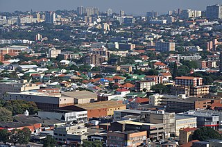
Durban is the third-most populous city in South Africa, after Johannesburg and Cape Town, and the largest city in the province of KwaZulu-Natal. Situated on the east coast of South Africa, on the Natal Bay of the Indian Ocean, Durban is South Africa's busiest port and was formerly named Port Natal. North of the harbour and city centre lies the mouth of the Umgeni River; the flat city centre rises to the hills of the Berea on the west; and to the south, running along the coast, is the Bluff. Durban is the seat of the larger eThekwini Metropolitan Municipality, which spans an area of 2,556 km2 (987 sq mi) and had a population of 4.2 million in 2022, making the metropolitan population one of Africa's largest on the Indian Ocean. Within the city limits, Durban's population was 595,061 in 2011. The city has a humid subtropical climate, with hot, wet summers and mild, dry winters.

<span class="mw-page-title-main">Ballito</span> Place in KwaZulu-Natal, South Africa

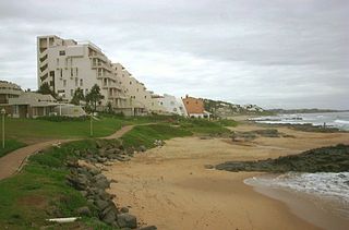
Ballito is an affluent coastal town located in KwaZulu-Natal, South Africa. Ballito is about 40 kilometres (25 mi) north of Durban and 24 kilometres south of KwaDukuza. It forms part of the KwaDukuza Local Municipality, and iLembe District Municipality. Dolphins and Whales are common on this stretch of the North Coast shoreline, hence the nickname Dolphin Coast. The name of the town Ballito is named after the Italian word for "small ball".

<span class="mw-page-title-main">Port Edward, South Africa</span> Seaside town in KwaZulu-Natal, South Africa

Port Edward is a small resort town situated on the south coast of KwaZulu-Natal in South Africa and lies on the border between KwaZulu-Natal and the Eastern Cape. It is situated on the R61 road between Port Shepstone and Lusikisiki.

<span class="mw-page-title-main">Amanzimtoti</span> Settlement in South Africa

Amanzimtoti, locally nicknamed Toti, and officially renamed to eManzimtoti, is a coastal town just south of Durban in KwaZulu-Natal, South Africa. Situated along the Sapphire Coast, the town is well known for its warm climate and numerous beaches, and is a popular tourist destination, particularly with surfers.

Isipingo is a town situated 19 kilometres (12 mi) south of Durban in KwaZulu-Natal, South Africa and currently forms part of eThekwini Metropolitan Municipality. The town is named after the Siphingo River, which in turn is thought to be named for the intertwining cat-thorn shrubs (Scutia myrtina) present in the area, or the river's winding course.

Winklespruit is a small seaside resort on the South Coast of KwaZulu-Natal in South Africa and now forms part of the coastal town of Kingsburgh and the eThekwini Metropolitan Municipality, the Greater Durban metropolitan area.

Queensburgh is a town in KwaZulu-Natal, South Africa that is situated inland (southwest) from Durban and now forms part of eThekwini, the Greater Durban metropolitan area.

Westville is an area in KwaZulu-Natal, South Africa, and is just west and 10 km inland from the Durban CBD. It was a formerly independent municipality however it became part of the eThekwini Metropolitan Municipality in 2002.

<span class="mw-page-title-main">N2 (South Africa)</span> National road in South Africa

The N2 is a national route in South Africa that runs from Cape Town through George, Gqeberha, East London, Mthatha, Port Shepstone and Durban to Ermelo. It is the main highway along the Indian Ocean coast of the country. Its current length of 2,255 kilometres (1,401 mi) makes it the longest numbered route in South Africa.

Chatsworth is a large township in KwaZulu-Natal, South Africa established in the 1950s to segregate the Indian population and create a buffer between the white suburbs of Durban to the north and the black townships of Durban to the south. Located in the Southern Durban basin and roughly bordered by the Umhlatuzana River in the North and Umlaas River in the South, the suburb is made up mainly of Indian/Asian and Black African people.

uMhlanga, KwaZulu-Natal Place in KwaZulu-Natal, South Africa

uMhlanga, alternatively rendered Umhlanga, is a residential, commercial and resort town north of Durban on the coast of KwaZulu-Natal, South Africa. It is part of the eThekwini Metropolitan Municipality, which was created in 2000 and includes the greater Durban area. The name means "place of reeds" in the Zulu language, and the correct pronunciation of "hl" in uMhlanga is similar to the Welsh "ll".

La Lucia is a wealthy suburb located in uMhlanga in the KwaZulu-Natal province of South Africa and is situated approximately 14 kilometres north of the Durban CBD. It was named after Lucia Michel. She and her husband Albert Michel founded the sugar cane farm La Lucia.

<span class="mw-page-title-main">Morningside, Durban</span> Place in KwaZulu-Natal, South Africa

Morningside is an affluent suburb of Durban, KwaZulu-Natal, South Africa.

Wentworth is an area of Durban, South Africa in the province of KwaZulu-Natal. It is completely located inside the South Durban Basin. The Wentworth area is located near the major freeways M4 and M7 and is approximately 11 km south of the Durban city center.

Umbogintwini is a suburb located approximately 23 km south-west of Durban, in the KwaZulu-Natal province of South Africa and it forms part of the eThekwini Metropolitan Municipality.

<span class="mw-page-title-main">Southbroom</span> Coastal village in KwaZulu-Natal, South Africa

Southbroom is a coastal village on the South Coast of the KwaZulu-Natal province of South Africa situated approximately halfway between Port Shepstone – 23 km (14 mi) and Port Edward – 18 km (11 mi).

Athlone Park is a small coastal suburb located between Durban and Amanzimtoti in KwaZulu-Natal, South Africa. Considered as one of Amanzimtoti’s most sought-after suburbs, Athlone Park forms part of the eThekwini Metropolitan Municipality as a Southern Suburb.

<span class="mw-page-title-main">South Coast (KwaZulu-Natal)</span> Coastal region in KwaZulu-Natal, South Africa

KwaZulu-Natal South Coast is a region along the southern stretch of coastline of KwaZulu-Natal, South Africa, south of the coastal city of Durban.

References

  1. 1 2 3 4 "Sub Place Bluff". Census 2011.
  2. 1 2 3 4 "Durban South Tourism Route". Open Africa. Archived from the original on 27 September 2010. Retrieved 9 March 2010.
  3. "Bluff, Durban Information". WhereToStay. Retrieved 9 March 2010.
  4. "Bluff Golf Club – Bluff National Park Golf Club" . Retrieved 1 May 2022.
  5. "Smartmall". www.blufftowers.co.za. Retrieved 1 May 2022.
  6. "hillside mall - Google Search". www.google.com. Retrieved 1 May 2022.
  7. "Wentworth Provincial Hospital". www.kznhealth.gov.za. Retrieved 1 May 2022.
  8. "Crime Stats SA". www.crimestatssa.com. Retrieved 1 May 2022.