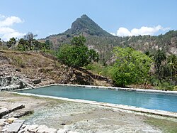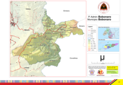
Bobonaro is a municipality in the Democratic Republic of Timor-Leste commonly known as East Timor. It is the second-most western municipality on the east half of the island. It has a population of 92,045 and an area of 1,376 km².

Aileu is a municipality, and was formerly a district, of East Timor. It has a population of 48,554 and an area of 737 km². The municipality's capital is also named Aileu. Its administrative posts are Aileu, Laulara, Lequidoe and Remexio.

Liquiçá is one of the municipalities of East Timor. Its capital is also called Liquiçá.

Lautém is one of the municipalities of East Timor, at the eastern end of the country. It has a population of 64,135 and an area of 1,813 km². Its capital is Lospalos, which lies 248 km east of the national capital, Dili.
Ermera is one of the municipalities of East Timor, located in the west-central part of the country. It has a population of 117,064 and an area of 756.5 km².

Cova Lima is a municipality of East Timor, in the Southwest part of the country. It has a population of 59,455 and an area of 1,230 km2. The capital of the municipality is Suai, which lies 136 km from Dili, the national capital.

Ainaro is one of 13 municipalities of East Timor, in the southwest part of the country. It has a population of 59,175 and an area of 804 km2. Its capital is the city of Ainaro, a small mountain town.

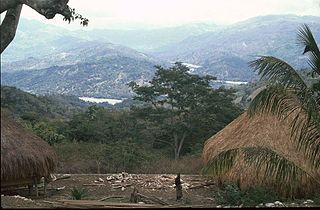
The Kemak people are an ethnic group numbering 80,000 in north-central Timor island. They primarily live in the district of Bobonaro, East Timor, while the rest live in the East Nusa Tenggara province of Indonesia.

Laga, officially Laga Administrative Post, is an administrative post in Baucau municipality, East Timor. Its population in 2010 was 14,000.

Tilomar, officially Tilomar Administrative Post, is an administrative post in Cova Lima municipality, East Timor. Administration center is Casabauc.

The Loes River is a river in East Timor and one of the few perennial rivers in its north. It combines with its tributaries to make up the country's largest river system, and its catchment or drainage basin extends into the province of East Nusa Tenggara in Indonesia.

Atabae, officially Atabae Administrative Post, is an administrative post in Bobonaro municipality, East Timor. Its population at the 2010 census was 10,976. The capital of the administrative post is Aidabaleten, which is sometimes wrongly named Atabae, too.

Oecusse, also known as Oecusse-Ambeno and formerly just Ambeno, officially the Special Administrative Region Oecusse-Ambeno, is an exclave, municipality and the only Special Administrative Region (SAR) of East Timor.

Alas, officially Alas Administrative Post, is an administrative post in the centre of Manufahi municipality, which lies in the centre of East Timor, and is divided into five sucos: Aituha, Dotik (Dotic), Mahaquidan, Taitudac und Uma Berloic.

Cailaco, officially Cailaco Administrative Post, is an administrative post in Bobonaro municipality, East Timor. Its population at the 2004 census was 8,374.

Balibo, officially Balibo Administrative Post, is an administrative post in Bobonaro municipality, East Timor.

Lolotoe, officially Lolotoe Administrative Post, is an administrative post in Bobonaro municipality, East Timor.

Maliana, officially Maliana Administrative Post, is an administrative post in Bobonaro municipality, East Timor.