Black Elk Peak is the highest natural point in the U.S. state of South Dakota and the Midwestern United States. It lies in the Black Elk Wilderness area, in southern Pennington County, in the Black Hills National Forest. The peak lies 3.7 mi (6.0 km) west-southwest of Mount Rushmore. At 7,244 feet (2,208 m), it is the highest summit in the United States east of the Rocky Mountains. Though part of the North American Cordillera, it is generally considered to be geologically separate from the Rocky Mountains.
The Pacific Northwest Seismic Network, or PNSN, collects and studies ground motions from about 400 seismometers in the U.S. states of Oregon and Washington. PNSN monitors volcanic and tectonic activity, gives advice and information to the public and policy makers, and works to mitigate earthquake hazard.

State Route 6 (SR 6) is a 51.37-mile (82.67 km) long state highway in Pacific and Lewis counties in the U.S. state of Washington. The highway, which extends from U.S. Route 101 (US 101) in Raymond east to Interstate 5 (I-5), co-signed with US 12, in Chehalis. Major communities located on the highway include Raymond, Pe Ell, Adna and Chehalis. The first state highway that used the current route of SR 6 was State Road 19, established in 1913. State Road 19 became State Road 12 in 1923, which became Primary State Highway 12 (PSH 12) in 1937. In 1964, PSH 12 became SR 6 and since, three minor construction projects have been arranged, only two have been completed.
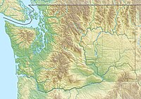
The Willapa Hills is a geologic, physiographic, and geographic region in southwest Washington. When described as a physiographical province, the Willapa Hills are bounded by the Pacific Ocean to the west, the Columbia River to the south, the Olympic Mountains to the north, and the Cascade Range to the east. Some definitions place the Puget Lowland physiographic province east of the Willapa Hills. Included within the province are the Black Hills, the Doty Hills, and a number of broad river valleys, some of which open up into broad estuaries on the Pacific such as Grays Harbor and Willapa Bay. Other definitions do not include the Black Hills. The USGS GNIS defines the Willapa Hills as bounded by the Columbia River to the south and the Chehalis River to the north, without giving specific east and west bounds. The Willapa Hills are one of the Pacific Coast Ranges, which continue north as the Olympic Mountains and south, across the Columbia River, as the Oregon Coast Range.

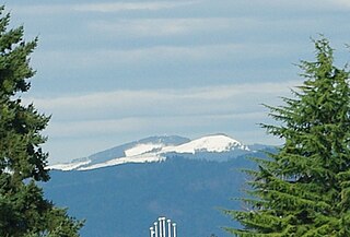
Maiden Peak is a steep-sided shield volcano in the Cascade Range of central Oregon. It is the highest point in the 43-mile (69 km) distance between Mount Bachelor and Diamond Peak. Ice Age glaciers carved a large cirque into the northeast flank of the mountain, exposing magma which hardened in the volcano's conduits to form the numerous rock pinnacles now found in the upper part of the cirque.

Union Peak is a heavily eroded shield volcano in the Cascade Range of central Oregon, located along the Cascade Crest less than 7 miles (11.3 km) southwest of the rim of Crater Lake. Ice age glaciers eroded away most of the flanks of the volcano, leaving numerous deep cirques surrounding a central glacial horn. This is the same process that formed the summit horns of Three Fingered Jack, Mount Washington, Howlock Mountain, and Mount Thielsen from other shield volcanoes farther north in the Oregon Cascades.
South Saddle Mountain is the tallest mountain in Washington County, Oregon, United States. Part of the Oregon Coast Range, the peak is located in the Tillamook State Forest in the northwest section of the state of Oregon. It is the eighth-highest peak of the Oregon Coast Range.
Black Mountain is a mountain located in Washington County, New York, of which its peak is the highest point. Isolated from the rest of the Adirondack Mountains by Lake George, Black Mtn. has the seventh highest topographic prominence of all the mountains in New York. Black Mountain also has the highest elevation of any of the peaks which surround Lake George and offers unobstructed views of the lake from its summit.

The Watchman Lookout Station No. 168 is one of two fire lookout towers in Crater Lake National Park in southern Oregon. For many years, National Park Service personnel used the lookout to watch for wildfires during the summer months. It is also a common hiking destination because of its views of Crater Lake and the surrounding area. The building is unusual because it serves the dual purpose of fire lookout and museum. The Watchman Lookout Station is listed on the National Register of Historic Places.
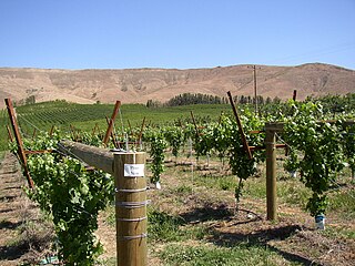
The Rattlesnake Hills, also known as Rattlesnake Ridge, is a 16-mile (26 km) long anticline mountain ridge in Yakima County and Benton County in the U.S. state of Washington. It should not be confused with the much smaller Rattlesnake Ridge located near the west end of Ahtanum Ridge just south of Yakima, Washington and west of Union Gap, Washington. The highest point in the hills is the 3,629 feet (1,106 m) Lookout Summit, which surpasses the more well-known Rattlesnake Mountain by approximately 100 ft (30 m). The Rattlesnake Hills are part of the Yakima Fold Belt of east-tending long ridges formed by the folding of Miocene Columbia River basalt flows.

Mount Rainier, also known as Tahoma, is a large active stratovolcano in the Cascade Range of the Pacific Northwest in the United States. The mountain is located in Mount Rainier National Park about 59 miles (95 km) south-southeast of Seattle. With a summit elevation of 14,417 ft (4,394 m), it is the highest mountain in the U.S. state of Washington and the Cascade Range, the most topographically prominent mountain in the contiguous United States, and the tallest in the Cascade Volcanic Arc.
The 1965 Puget Sound earthquake occurred at 08:28 AM PDT on April 29 within the Puget Sound region of Washington state. It had a magnitude of 6.7 on the moment magnitude scale and a maximum perceived intensity of VIII (Severe) on the Mercalli intensity scale. It caused the deaths of seven people and about $12.5–28 million in damage. There were no recorded aftershocks.

Mount Terrible is a mountain within the Great Dividing Range, located to the south-west of Kevington in Victoria, Australia. The mountain is located within the 100 hectares Mount Terrible Natural Features and Scenic Reserve.

Gold Mountain is a 1,761-foot (537 m) summit in the Blue Hills on the Kitsap Peninsula of Washington state, in the United States' Pacific Northwest. It is the highest point on the Kitsap Peninsula and the highest point in Kitsap County, Washington, and nearby 1,639-foot (500 m) Green Mountain is the second-highest point.

The Satsop Hills are foothills of the Olympic Mountains in Mason County, Washington north of Matlock, Washington, between Wynoochee Lake to the west and Lake Cushman to the east.

Hager Mountain is a volcanic peak in Oregon in the northwest corner of the Basin and Range Province in the United States. The mountain is located south of the small unincorporated community of Silver Lake in south-central Oregon, and it is in the Fremont–Winema National Forest. On the summit, there is a fire lookout operated during the summer and fall by the United States Forest Service. There are several hiking trails that lead to the lookout station.

The Doty Hills are hills in Lewis County and Grays Harbor County in southwest Washington. The hills lie north of Doty, Washington and west of Chehalis, between the Black Hills to their north and the Willapa Hills to their south. They are considered part of the Willapa Hills physiographic province.

Cone Peak is the second highest mountain in the Santa Lucia Range in the Ventana Wilderness of the Los Padres National Forest. It rises nearly a vertical mile only 3 miles (4.8 km) from the coast as the crow flies. This is one of the steepest gradients from ocean to summit in the contiguous United States. The average gradient from sea level to summit is around 33%, which is steeper than the average gradient from Owens Valley to the summit of Mount Whitney. Near the mountain summit, the oak woodland and chaparral transitions to a pine forest with a few rare Santa Lucia Firs. Junipero Serra Peak at 5,865 feet (1,788 m) is the highest peak in the coastal region.

McGregor Mountain is an 8,122-foot (2,476-metre) elevation massif located in the Stehekin Valley of the North Cascades, in Chelan County of Washington state. McGregor Mountain is situated northwest of Lake Chelan in the northern Methow Mountains, on the shared border of North Cascades National Park and Lake Chelan National Recreation Area. The closest community is Stehekin, and the nearest higher neighbor is Goode Mountain, 7.3 miles (11.7 km) to the northwest. Precipitation runoff from the mountain drains into tributaries of the Stehekin River. Topographic relief is significant since the southern aspect of the mountain rises 6,600 feet above this river in approximately two miles. The famous Pacific Crest Trail traverses the western base of this mountain, and the strenuous 7.7-mile (12.4 km) McGregor Mountain Trail gains 6,400 feet of elevation to take hikers within a half-mile of the summit. Reaching the summit requires exposed scrambling the final 1,100 feet, and an ice axe is needed if the trail remains covered by snowpack. The summit was the site of an old fire lookout cabin from 1923 until 1955, but now has a radio repeater for the National Park Service. The views from the top include Glacier Peak, Black Peak, Corteo Peak, Frisco Mountain, Tupshin Peak, Dome Peak, Glory Mountain, and many others. This mountain was named for Billy McGregor, a Stehekin Valley resident who had a cabin and homestead at the base of this mountain during the 1890s. In May 1901, Billy disappeared overnight from a boat docked in Lake Chelan, and was never seen or heard from again.

Kelly Butte is a 5,417-foot-elevation (1,651-meter) summit located in the southeast corner of King County in Washington state. It is set on land managed by Mount Baker-Snoqualmie National Forest. It is situated 3.1 mi (5.0 km) northwest of Colquhoun Peak and five miles west of the crest of the Cascade Range. Precipitation runoff from Kelly Butte drains into tributaries of the Green River. Topographic relief is significant as the west aspect rises 3,000 feet above Rock Creek in one mile. Access is via the 1.7-mile Kelly Butte Trail which leads to a restored, historical fire lookout tower originally constructed in 1926 and occupies the summit. Flora along the trail includes lilies, bear grass, Indian paintbrush, penstemon, arnica, columbine, lupine, phlox, and huckleberry. This geographical feature's name has been officially adopted by the U.S. Board on Geographic Names.