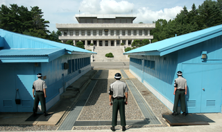
A demilitarized zone is an area in which treaties or agreements between states, military powers or contending groups forbid military installations, activities, or personnel. A DZ often lies along an established frontier or boundary between two or more military powers or alliances. A DZ may sometimes form a de facto international border, such as the Korean Demilitarized Zone. Other examples of demilitarized zones are a 9-mile wide area between Iraq and Kuwait; Antarctica ; and outer space.
Borders are usually defined as geographical boundaries, imposed either by features such as oceans and terrain, or by political entities such as governments, sovereign states, federated states, and other subnational entities. Political borders can be established through warfare, colonization, or mutual agreements between the political entities that reside in those areas.

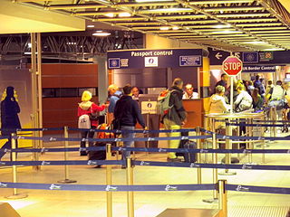
Border control comprises measures taken by governments to monitor and regulate the movement of people, animals, and goods across land, air, and maritime borders. While border control is typically associated with international borders, it also encompasses controls imposed on internal borders within a single state.

The Soviet Union incorporated an area of over 22,402,200 square kilometres (8,649,500 sq mi), covering approximately one-sixth of Earth's land surface. It spanned most of Eurasia. Its largest and most populous republic was the Russian SFSR which covered roughly three-quarters of the surface area of the union, including the complete territory of contemporary Russia.

A border checkpoint is a location on an international border where travelers or goods are inspected and allowed passage through. Authorization often is required to enter a country through its borders. Access-controlled borders often have a limited number of checkpoints where they can be crossed without legal sanctions. Arrangements or treaties may be formed to allow or mandate less restrained crossings. Land border checkpoints can be contrasted with the customs and immigration facilities at seaports, international airports, and other ports of entry.
The special territories of members of the European Economic Area (EEA) are the 32 special territories of EU member states and EFTA member states which, for historical, geographical, or political reasons, enjoy special status within or outside the European Union and the European Free Trade Association.
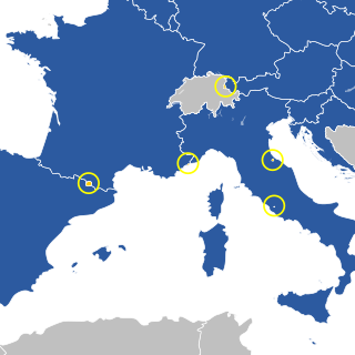
Currently, all of the European microstates have some form of relations with the European Union (EU).
The Yantar Special Economic Zone is a Special Economic Zone in Russia that was established in 1996 in the Kaliningrad Oblast of the Russian Federation.

The Schengen Area is an area comprising 27 European countries that have officially abolished border controls at their mutual borders. Being an element within the wider area of freedom, security and justice policy of the European Union (EU), it mostly functions as a single jurisdiction under a common visa policy for international travel purposes. The area is named after the 1985 Schengen Agreement and the 1990 Schengen Convention, both signed in Schengen, Luxembourg.

The border between Norway and Russia consists of a 195.7-kilometer (121.6 mi) land border between Sør-Varanger, Norway, and Pechengsky District, Russia, and a 23.2-kilometer (14.4 mi) marine border in the Varangerfjord. It further consists of a border between the two countries' exclusive economic zones (EEZ) in the Barents Sea and the Arctic Ocean. Between 1944 and 1991 the border was between Norway and the Soviet Union. There is a single border crossing, on E105, located at Storskog in Norway and Borisoglebsky in Russia. The Norwegian side is patrolled by the Garrison of Sør-Varanger and is under the jurisdiction of the Norwegian Border Commissioner, while the Russian side is patrolled by the Border Guard Service of Russia. Two-thirds of the border follows two rivers, the Pasvikelva and Jakobselva.
A customs territory is a geographic territory with uniform customs regulations and there are no internal customs or similar taxes within the territory. Customs territories may fall into several types:

The Norway–Sweden border is a 1,630-kilometre (1,010 mi) long land national border, and the longest border for both Norway and Sweden. It is an external border both for EU (Sweden) and NATO (Norway).

The international border between Finland and Russia is 1,340 km (830 mi) long and runs approximately north to south, mostly through taiga forests and sparsely populated rural areas. It does not follow any natural landmarks, such as rivers. It is also an external border of the European Union and NATO.

Xibaipo is a township-level division of Pingshan County, Shijiazhuang, Hebei, China. Xibaipo is known for being the location which the Chinese Communist Party was driven back to by Nationalist forces in the late 1940s, after which the Chinese Communist Party and Mao Zedong used it as a launching pad for their final offensive against the Nationalists, which led to the Chinese Communist Party taking control of all mainland China. As one of the revolutionary sites in China, it is a national key cultural relic protection unit and a national AAAAA level tourist attraction.
Juxtaposed controls are a reciprocal arrangement between Belgium, France, the Netherlands and the United Kingdom whereby border controls on certain cross-Channel routes take place before boarding the train or ferry, rather than upon arrival after disembarkation. With the exception of the Eurotunnel Shuttle route, customs checks remain unaffected by juxtaposed immigration controls and continue to take place upon arrival after disembarkation. Belgium, France and the Netherlands are all member states of the European Union and part of the border-free Schengen Area. The United Kingdom, on the other hand, has never participated in the Schengen Area, even when it was a member state of the European Union. As a result, juxtaposed controls aim to increase the convenience and efficiency of border checks when travelling by train or ferry between the Schengen Area and the UK by removing the need for immigration checks on arrival and by streamlining checks on departure. At the same time, juxtaposed controls are intended to detect and prevent illegal immigration. In 2016, there were over 56,000 instances when people were refused entry to the UK at the juxtaposed controls.
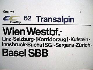
Privileged transit traffic or corridor traffic is traffic of one country across the territory of another country without usual customs and passport checks. The corresponding line of communication is called the (privileged) traffic corridor and a train used in this kind of transit is called a corridor train. The reason for such arrangements is usually border changes or border creation which cut through an existing transport corridor.

The Lithuania–Poland border is the state border between the Republic of Lithuania and the Republic of Poland. The length of the border is 104 kilometres (65 mi). It runs from the Lithuania–Poland–Russia tripoint southeast to the Belarus–Lithuania–Poland tripoint. It is an internal border of the European Union and the Schengen Zone.

The border of the European Union consists of the land borders that member states of the EU share with non-EU states adjacent to the union.
Controls imposed on internal borders within a single state or territory include measures taken by governments to monitor and regulate the movement of people, animals, and goods across land, air, and maritime borders through border controls.