Botad district

Last updated

Botad District
New Swaminarayan Temple, Gadhada - panoramio.jpg
New Swaminarayan Temple, Gadhada
Botad district
Interactive Map Outlining Botad District
Botad in Gujarat (India).svg
Location in Gujarat
Coordinates: 22°10′12″N71°40′12″E / 22.17000°N 71.67000°E / 22.17000; 71.67000
CountryFlag of India.svg  India
State Gujarat
Region Saurashtra
Headquarters Botad
Area
  Total2,564 km2 (990 sq mi)
Population
 (2011) [1]
  Total656,005
  Density260/km2 (660/sq mi)
Languages
  Official Gujarati, Hindi
Time zone UTC+5:30 (IST)
Website https://botad.gujarat.gov.in

Botad District is a is a district in the state of Gujarat, India.

Contents

Botad Districtwas formed on August 15, 2013 from the southwestern section of Ahmedabad District and the northwestern part of Bhavnagar District. Erstwhile, it was part of Bhavnagar District. Botad District is surrounded by Surendranagar District to the northeast, Rajkot District to the west, Bhavnagar District and Amreli District to the south and Ahmedabad District to the East.

Botad district consist of four talukas:

Botad city is the administrative headquarters of the district. [4]

This district is bordered by Surendranagar District to the north and northwest, Amreli District to the southwest, Ahmedabad District to the northeast, and Rajkot District to the west. [3]

The Sukhbhadar River flows at the northern border of Botad district in Ranpur taluka. The Kalubhar River flows in southern part of Botad district in Gadhada taluka. The district is situated between 71E latitude and 22 N latitude &42 E longitudes to 10N longitudes. The district's total area is 2,564 km2 (990 sq mi). Kalubhar, Sukhbhadar, Ghelo, Utavali, and Goma are main rivers in the district.

History

The creation of Botad district was announced by the then Chief Minister of Gujarat Narendra Modi as part of Swami Vivekananda Vikas Yatra on September 23, 2012. Botad district has been formed by splitting two talukas each from Ahmedabad district and Bhavnagar district districts. [5]  Gadhda and Botad talukas of Bhavnagar district and Barwala and Ranpur talukas of Ahmedabad district were included in this new Botad district.

Botad district is administratively divided into 2 provinces and 4 talukas and there are 3 municipalities in the district.

Divisions

Botad District consists of four talukas: [3]

Demographics

The district had a population of 656,005 according to the 2011 census, with an area of 2,564 square kilometres (990 sq mi) and a population density of 255 per square kilometre. 209,542 (31.94%) lived in urban areas. Botad had a sex ratio of 945 females per 1000 males. Scheduled Castes and Scheduled Tribes are 43,270 (6.60%) and 1,298 (0.20%) of the population respectively. [6] [7]

Religions in Botad district (2011) [8]
ReligionPercent
Hinduism
93.32%
Islam
5.65%
Jainism
0.89%
Other or not stated
0.14%

Hindus were 612,159 while Muslims were 37,066 and Jains 5,835. [8]

Gujarati is the predominant language, spoken by 99.66% of the population. [9]

Politics

DistrictNo.ConstituencyNamePartyRemarks
Botad 106 Gadhada (SC)Mahant Tundiya Bharatiya Janata Party
107 Botad Umeshbhai Makwana Aam Aadmi Party

Points of Interest in District

Shree Swaminarayan Temple, Gadhada Gadhada Swaminarayan Temple.jpg
Shree Swaminarayan Temple, Gadhada

[12]

Related Research Articles

<span class="mw-page-title-main">Amreli district</span> District of Gujarat in India

Amreli district is one of the 33 administrative districts of the state of Gujarat in western India. The district headquarters are located at Amreli. The district occupies an area of 6,760 km2 and has a population of 1,514,190 of which 22.45% were urban. Amreli is the land of Yogiji Maharaj (Dhari), Dan Bapu (Chalala), Sage Muldas, Sage Bhojalram Bapa, Sage Muktanand Swami, Magician K.Lal, Zaverchand Meghani's place (Bagasara), Dr. Jivaraj Mehta etc. Amreli covers Dhari Gir National forest sanctuary area. Now it is developing as a Hub of Education.

<span class="mw-page-title-main">Patan district</span> District in Gujarat, India

Patan district is one of the 33 districts of Gujarat state in western India. Its main city is Patan. This district is located in northern Gujarat and bounded by Banaskantha district in the north and northeast, Mehsana district in the east and southeast, Surendranagar district in the south and Kutch District and the Kutch nu Nanu Ran in the west. The district occupies an area of 5792 km2.

<span class="mw-page-title-main">Junagadh district</span> District of Gujarat in India

Junagadh district is a district of the Indian state of Gujarat. Its administrative headquarters is the city of Junagadh.

<span class="mw-page-title-main">Bhavnagar district</span> District in Gujarat, India

Bhavnagar District is a district of southeastern Gujarat, India, on the Saurashtra peninsula. The administrative headquarters is in the town of Bhavnagar.

<span class="mw-page-title-main">Amreli</span> City in Gujarat, India

Amreli is a city and a municipality in Amreli district in Indian state of Gujarat.

<span class="mw-page-title-main">Rajkot district</span> District of Gujarat in India

Rajkot district is one of the 33 districts of the Indian state of Gujarat. Located in Saurashtra peninsula, Rajkot city is the administrative headquarters of the district. It is the third-most advanced district in Gujarat and the fourth most populus.

Botad is a city and district headquarters of Botad district, Gujarat, India. It is about 92 km from Bhavnagar and 133 km From Ahmedabad by road distance.

<span class="mw-page-title-main">Gadhada</span> Town in Gujarat, India

Gadhada is a town and a municipality in Botad District in the state of Gujarat, India. Gadhada is situated at bank of River Ghela. Swaminarayan lived here for more than 25 years.

<span class="mw-page-title-main">Rajula</span> Place in Gujarat, India

Rajula is a city and municipality in Amreli district in the Indian state of Gujarat. City was known as Rajgadh at the time of local ruler daha dhakhda. He founded the official gadh

Sarangpur is a village in the Botad District in the state of Gujarat, India. Sarangpur is known throughout India for the historic Shri Kashtabhanjan Hanumanji temple and BAPS Swaminarayan Mandir located in the village.The village of about 3000 people lies at the border of Ahmedabad district. The nearest town is Botad.The village is about 153 km. away from Ahmedabad.

Khopala is a village and a grampanchayat in Botad district in the state of Gujarat, India. Khopala is situated near Gadhada.

<span class="mw-page-title-main">Bhal region</span> Place in Gujarat, India

The Bhal region is an area of Gujarat, India. It is spread across the political boundaries of the districts of Bhavnagar, Ahmedabad, and Anand. The Bhal region is situated on the deltas of the Sabarmati, Bhogawo, Bhadar, Lilka and other rivers that flow east and southeast off the Kathiawar peninsula into the Gulf of Cambay. The word Bhaal seems to have been derived from the Sanskrit word भाल which means forehead. Such a name is given to this region probably because it is mostly as flat as a forehead with almost entire region's soil without any stones, pebbles or gravel.

<span class="mw-page-title-main">Morbi district</span> District of Gujarat in India

Morbi district is in the state of Gujarat, India. It was formed on August 15, 2013, along with several other districts, on the 67th Independence Day of India. Morbi city is the administrative headquarters of the district. The district has 5 talukas - Morbi, Maliya, Tankara, Wankaner and Halvad. Morbi city is the administrative headquarters of Morbi district. The town of Morbi is situated on the Machchhu River, 35 km from the sea and 60 km from Rajkot. As per 2011 census data, the city had a population of 2,10,451 and average literacy rate of 83.64%.

<span class="mw-page-title-main">Gir Somnath district</span> District of Gujarat in India

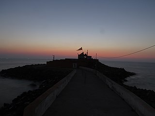
Gir Somnath is a district of Gujarat, India. It is located on the southern corner of the Kathiawar peninsula with its headquarters at the city of Somnath.

Raliyana is a village in Botad district in the state of Gujarat, India. Raliyana is situated on the bank of the River Ghelo.

Babra is a town and the taluka headquarter in the Amreli district, Gujarat, India. It is situated to the north of Amreli. The main road linking Rajkot and Bhavnagar and Amreli passes through Babra.

Vihal Krupa is a Home in Raliyana in the state of Gujarat, India. Vihal Krupa is situated on the bank of the River Ghelo.

References

  1. Botad District Panchayat, Government of Gujarat
  2. Kapil, Dave (14 August 2013). "7 new districts to start functioning from Independence Day". The Times of India . Archived from the original on 27 September 2014.
  3. 1 2 3 "Maps of Gujarat's new 7 districts and changes in existing districts". Desh Gujarat. 13 August 2013. Archived from the original on 16 August 2013.
  4. "Tourist Places | About Botad | About Us | Collectorate - District Botad". Archived from the original on 6 May 2021. Retrieved 7 June 2016.
  5. ""Development will increase as Botad becomes a district: People's suffering will decrease"". www.divyabhaskar.co.in.
  6. "District Census Hand Book – Bhavnagar" (PDF). Census of India . Registrar General and Census Commissioner of India.
  7. "District Census Hand Book – Ahmedabad" (PDF). Census of India . Registrar General and Census Commissioner of India.
  8. 1 2 "Population by Religion - Gujarat". censusindia.gov.in. Registrar General and Census Commissioner of India. 2011.
  9. "Table C-16 Population by Mother Tongue: Gujarat". censusindia.gov.in. Registrar General and Census Commissioner of India.
  10. "Welcome to Kashtbhanjandev Temple-Salangpur". www.salangpurhanumanji.com. Retrieved 25 May 2019.
  11. "Swaminarayan temple head priest 'kicks' elderly devotee". Business Standard India. Press Trust of India. 22 October 2018. Retrieved 25 May 2019.
  12. http://botaddp.gujarat.gov.in/historical-places-eng.htm