Brandon (CDP), Vermont

Last updated

Brandon, Vermont
CDP
Church in Brandon, Vermont.jpg
Coordinates: 43°47′53″N73°5′11″W / 43.79806°N 73.08639°W / 43.79806; -73.08639
CountryUnited States
State Vermont
County Rutland
Area
  Total2.8 sq mi (7.4 km2)
  Land2.8 sq mi (7.4 km2)
  Water0.0 sq mi (0.0 km2)
Elevation
427 ft (130 m)
Population
 (2020)
  Total1,727
  Density620/sq mi (230/km2)
Time zone UTC-5 (Eastern (EST))
  Summer (DST) UTC-4 (EDT)
ZIP code
05733
Area code 802
FIPS code 50-07675 [1]
GNIS feature ID1460649 [2]
Brandon Village Historic District
USA Vermont location map.svg
Red pog.svg
Usa edcp location map.svg
Red pog.svg
LocationU.S. 7, Brandon, Vermont
Coordinates 43°47′52″N73°5′18″W / 43.79778°N 73.08833°W / 43.79778; -73.08833
Area300 acres (120 ha)
Architectmultiple
Architectural styleMid 19th Century Revival, Federal, Late Victorian
NRHP reference No. 76000145 [3]
Added to NRHPDecember 22, 1976

Brandon is an unincorporated village and census-designated place (CDP) in the town of Brandon, Rutland County, Vermont, United States. As of the 2020 census, the population was 1,727. [4]

Contents

Most of the village is listed on the National Register of Historic Places as the Brandon Village Historic District.

History

In 1976, approximately 300 acres (120 ha) along U.S. Route 7 in Brandon and its vicinity were listed as a historic district on the National Register of Historic Places. The district includes nearly 250 buildings significant for their history and their architecture. [3]

Geography

Brandon is located at 43°47′53″N73°5′11″W / 43.79806°N 73.08639°W / 43.79806; -73.08639 (43.798056, 73.086389). [5]

According to the United States Census Bureau, the CDP has a total area of 7.4 km2 (2.8 mi2), all land.

Demographics

As of the census [1] of 2000, there were 1,684 people, 718 households, and 463 families residing in the CDP. The population density was 228.1/km2 (591.7/mi2). There were 781 housing units at an average density of 105.8/km2 (274.4/mi2). The racial makeup of the CDP was 98.46% White, 0.06% Black or African American, 0.24% Native American, 0.12% Asian, and 1.13% from two or more races. Hispanic or Latino of any race were 0.18% of the population.

There were 718 households, out of which 28.8% had children under the age of 18 living with them, 49.9% were married couples living together, 12.4% had a female householder with no husband present, and 35.5% were non-families. 29.7% of all households were made up of individuals, and 15.5% had someone living alone who was 65 years of age or older. The average household size was 2.35 and the average family size was 2.86.

In the CDP, the population was spread out, with 23.8% under the age of 18, 5.6% from 18 to 24, 27.6% from 25 to 44, 27.1% from 45 to 64, and 16.0% who were 65 years of age or older. The median age was 41 years. For every 100 females, there were 83.6 males. For every 100 females age 18 and over, there were 82.0 males.

The median income for a household in the CDP was $34,609, and the median income for a family was $44,514. Males had a median income of $28,382 versus $22,159 for females. The per capita income for the CDP was $23,705. About 6.8% of families and 12.4% of the population were below the poverty line, including 15.7% of those under age 18 and 17.0% of those age 65 or over.

Notable person

Related Research Articles

<span class="mw-page-title-main">Kings Bay Base, Georgia</span> Census-designated place in Georgia, United States

Kings Bay Base is a census-designated place (CDP) in Camden County, Georgia, United States; it is home to the Kings Bay Naval Submarine Base. The population was 1,777 at the 2010 census.

<span class="mw-page-title-main">Hughesville, Maryland</span> Census-designated place in Maryland, United States

Hughesville is a census-designated place (CDP) in Charles County, Maryland, United States. The population was 2,197 at the 2010 census. Truman's Place was listed on the National Register of Historic Places in 1988.

<span class="mw-page-title-main">Newark, Maryland</span> CDP in Maryland, United States

Newark is a census-designated place (CDP) in Worcester County, Maryland, United States. The population was 339 at the 2000 census. It is part of the Salisbury, Maryland-Delaware Metropolitan Statistical Area.

<span class="mw-page-title-main">Marshfield Hills, Massachusetts</span> Census-designated place in Massachusetts, United States

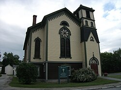
Marshfield Hills is a census-designated place (CDP) in the town of Marshfield in Plymouth County, Massachusetts, United States. The population was 2,356 at the 2010 census. The historic center of the village has been designated a historic district and listed on the National Register of Historic Places.

<span class="mw-page-title-main">Marlboro, New York</span> CDP in New York, United States

Marlboro is a hamlet in Ulster County, New York, United States. The population was 3,669 at the 2020 census. Marlboro is in the southeastern part of the town of Marlborough, located in the southeastern corner of the county.

<span class="mw-page-title-main">Stone Ridge, New York</span> CDP in New York, United States

Stone Ridge is a hamlet in Ulster County, New York, United States. The population was 1,234 at the 2020 census.

<span class="mw-page-title-main">Heritage Hills, New York</span> Census-designated place in New York, United States

Heritage Hills is a hamlet (CDP) located in the town of Somers in Westchester County, New York, United States. The population was 3,975 at the 2010 census.

<span class="mw-page-title-main">Mohegan Lake, New York</span> CDP in New York, United States

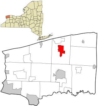
Lake Mohegan, commonly known as Mohegan Lake, is a census-designated place (CDP) located in the Town of Yorktown in Westchester County, New York, United States.

<span class="mw-page-title-main">Lowesville, North Carolina</span> Census-designated place in North Carolina, United States

Lowesville is a census-designated place (CDP) in Lincoln County, North Carolina, United States. The population was 2,945 at the 2010 census, up from 1,440 in 2000.

<span class="mw-page-title-main">Emigsville, Pennsylvania</span> CDP in Pennsylvania, United States

Emigsville is a census-designated place (CDP) in York County, Pennsylvania, United States. The population was 2,672 at the 2010 census.

<span class="mw-page-title-main">Taylors, South Carolina</span> CDP in South Carolina, United States

Taylors is a census-designated place (CDP) in Greenville County, South Carolina, United States. The population was 21,617 at the 2010 census. Taylors is the Greenville/Spartanburg area's largest suburb although it is not incorporated as a city. It is part of the Greenville–Mauldin–Easley Metropolitan Statistical Area.

<span class="mw-page-title-main">Willington, South Carolina</span> CDP in South Carolina, United States

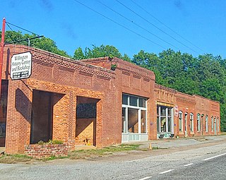
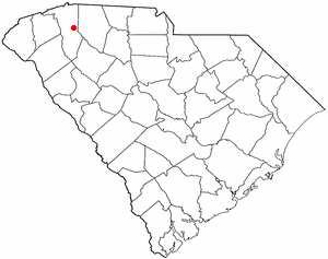
Willington is a census-designated place (CDP) in McCormick County, South Carolina, United States. The population was 177 at the 2000 census.

<span class="mw-page-title-main">Manchester Center, Vermont</span> Census-designated place in Vermont, United States

Manchester Center is a census-designated place (CDP) in the town of Manchester in Bennington County, Vermont, United States. As of the 2010 census, the CDP had a population of 2,120, out of 4,391 people in the entire town of Manchester.

<span class="mw-page-title-main">Wilder, Vermont</span> Census-designated place in Vermont, United States

Wilder is an unincorporated village and census-designated place (CDP) within the town of Hartford in Windsor County, Vermont, United States. It is the location of the Wilder Dam on the Connecticut River. The population of the CDP was 1,690 at the 2010 census. The village center is an early example of a planned mill community, and was listed on the National Register of Historic Places as the Wilder Village Historic District in 1999.

<span class="mw-page-title-main">Weyers Cave, Virginia</span> CDP in Virginia, United States

Weyers Cave is a census-designated place (CDP) in Augusta County, Virginia, United States. The population was 2,473 at the 2010 census. It is part of the Staunton–Waynesboro Micropolitan Statistical Area.

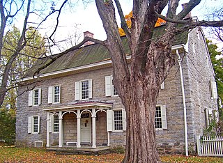
Coeymans is a hamlet in Albany County, New York, United States. It is located on Route 144 in the southeastern part of the Town of Coeymans. The population was 835 at the 2000 census, which listed the community as a census-designated place (CDP), but it was not included as a CDP in the 2010 census.

<span class="mw-page-title-main">Newfane (CDP), New York</span> CDP in New York, United States

Newfane is a census-designated place (CDP) in the town of Newfane in Niagara County, New York, United States, along State Route 78. The population was 3,822 at the 2010 census. It is part of the Buffalo–Niagara Falls Metropolitan Statistical Area.

<span class="mw-page-title-main">Middlebury (CDP), Vermont</span> Census-designated place in Vermont, United States

Middlebury is the main settlement in the town of Middlebury in Addison County, Vermont, United States, and a census-designated place (CDP). The population was 7,304 at the 2020 census, out of a total population of 9,152 in the town of Middlebury. Most of the village is listed on the National Register of Historic Places as the Middlebury Village Historic District.

<span class="mw-page-title-main">Bradford (CDP), Vermont</span> Census-designated places in Vermont, United States

Bradford is a census-designated places in the town of Bradford, Orange County, Vermont, United States. The population was 907 at the 2020 census. The village disincorporated on December 1, 2004. The village became a census-designated place in 2008. The central commercial and residential portion of the village is listed on the National Register of Historic Places as the Bradford Village Historic District.

<span class="mw-page-title-main">Arlington (CDP), Vermont</span> Census-designated place in Vermont, United States

Arlington is a census-designated place (CDP) in the towns of Arlington and Sunderland, Bennington County, Vermont, United States. The population was 1,213 at the 2010 census.

References

  1. 1 2 "U.S. Census website". United States Census Bureau . Retrieved January 31, 2008.
  2. "US Board on Geographic Names". United States Geological Survey. October 25, 2007. Retrieved January 31, 2008.
  3. 1 2 "National Register Information System  (#76000145)". National Register of Historic Places . National Park Service. March 13, 2009.
  4. "Census - Geography Profile - Brandon CDP, Vermont". United States Census Bureau . Retrieved October 28, 2021.
  5. "US Gazetteer files: 2010, 2000, and 1990". United States Census Bureau. February 12, 2011. Retrieved April 23, 2011.