Warren County is a county located in the south central portion of the U.S. state of Kentucky. As of the 2020 census, the population was 134,554, making it the fifth-most populous county in Kentucky. The county seat is Bowling Green. Warren County is now classified as a wet county after voters approved the measure in 2018. The measure became law in January 2019 that allows alcohol to be sold county wide.
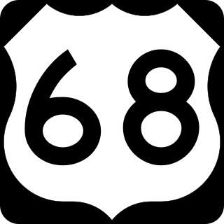
U.S. Route 68 is a United States highway that runs for 560 miles (900 km) from northwest Ohio to Western Kentucky. The highway's western terminus is at US 62 in Reidland, Kentucky. Its present northern terminus is at Interstate 75 in Findlay, Ohio, though the route once extended as far north as Toledo. US 68 intersects with US 62 three times during its route.

Kentucky Route 80 (KY 80) is a 483.55-mile-long (778.20 km) state highway in the southern part of the U.S. state of Kentucky. The route originates on the state's western border at Columbus in Hickman County and stretches across the southern portion of the state, terminating southeast of Elkhorn City on the Virginia state line. It is the longest Kentucky State Highway, though the official distance as listed in route logs is much less due to multiple concurrencies with U.S. Route 68 (US 68) and US 23.

U.S. Route 31W is the westernmost of two parallel routes for U.S. Route 31 from Nashville, Tennessee to Louisville, Kentucky.

Kentucky Route 880 is a three miles (4.8 km) east–west state highway that forms a connector between U.S. Route 231 (US 231) and KY 234 in the city of Bowling Green, Kentucky. The western terminus of the route is at US 231 in Bowling Green. The eastern terminus is at KY 234 near the community of Indian Hills east of downtown.

Kentucky Route 234 is a 20.033-mile-long (32.240 km) north–south state highway in southern Kentucky. The southern terminus of the route is at KY 101 six miles (10 km) north of Scottsville. The northern terminus is at U.S. Route 68 and KY 80 in downtown Bowling Green.

Kentucky Route 242 is a 10.275-mile-long (16.536 km) long east–west state highway located south of the city limits of Bowling Green in rural Warren County, Kentucky. The western terminus of the route is at US 68 and KY 80 northwest of Rockfield. The eastern terminus is at KY 622 south of Plano.

Kentucky Route 185 is a north–south state highway traversing four counties in west-central Kentucky.

Kentucky Route 446 is a state highway in the city of Bowling Green in Warren County, Kentucky. The highway runs 0.970 miles (1.561 km) from U.S. Route 31W, US 68, and KY 80 east to Interstate 65 (I-65). KY 446 is a four-lane divided highway that serves as a connector between the Interstate and U.S. Highways east of Bowling Green and provides access to the National Corvette Museum and the Bowling Green Assembly Plant.

Kentucky Route 526 is a state highway that provides a short rural connecting route between KY 185 and US 31W/US 68/KY 80 north of Bowling Green. Running through the north-central part of Warren County, the route is known locally as Mt. Olivet Road.

U.S. Route 79 enters Kentucky from Tennessee in Todd County west of Guthrie and runs northeast into Logan County, terminating at a junction with US 68, US 68 Business, and Kentucky Route 80 in Russellville. US 79 remains a two-lane road throughout Kentucky.

U.S. Route 231 in Kentucky runs 86.465 miles (139.152 km) from the Tennessee state line near Adolphus to the William H. Natcher Bridge on the Ohio River near Rockport, Indiana. It crosses the state mainly in the west-central region, traversing Allen, Warren, Butler, Ohio, and Daviess Counties.
Several special routes of U.S. Route 68 exist from Kentucky to Ohio. In order from west to east in Kentucky, and south to north in Ohio, these special routes are listed from the beginning of U.S. Route 68 to the end.

Kentucky Route 1297 (KY 1297) is a 22.063-mile-long (35.507 km) east–west state highway that traverses two counties in south-central Kentucky.
Veterans Outer Loop is a major bypass route in Glasgow, Kentucky. It is maintained by the Kentucky Transportation Cabinet (KYTC).

The original alignment of Kentucky Route 67 (KY 67) was a north–south primary state highway that traversed Edmonson and Warren counties in south central Kentucky. It was one of the original state routes of the state highway system maintained by the Kentucky Transportation Cabinet. It was established in 1929 and was officially decommissioned in 1969. At the time of its removal from the state route system, it was estimated to be 21.491 miles (34.586 km) long as determined by the KYTC's state route logs and county road logs.
The Russellville Bypass is a beltway around Russellville in Logan County in south central Kentucky. The 12.260-mile-long (19.731 km) highway comprises overlapping portions of U.S. Route 68 and Kentucky Route 80, US 79, and US 431. The north side of the circumferential highway was conceived in the 1980s to relieve traffic in downtown Russellville and as part of greater improvements along the US 68 corridor. The first two phases of the ring road, from US 79 on the west side to US 68 on the east side, were constructed in the 1990s. The state decided to complete the orbital road in the 2000s to resolve continuing traffic bottlenecks along US 431 and US 79 on the south side. The second two phases of the beltline were started in 2010 and completed in 2017. Construction of the Russellville Bypass led to a series of route changes over 20 years involving the city's U.S. Highways, special routes, and state-numbered highways.
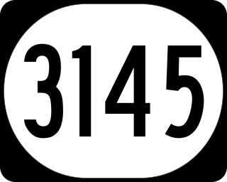
Kentucky Route 3145 is a rural-secondary state highway located entirely in Warren County in South Central Kentucky. The route serves as a connector between U.S. Route 31W and Interstate 65 (I-65) on the far east side of Bowling Green.


