Brookport, Illinois

Last updated

Brookport, Illinois
Brookport-PD-CH-il.jpg
City Hall
Massac County Illinois Incorporated and Unincorporated areas Brookport Highlighted.svg
Location in Massac County, Illinois
Usa edcp location map.svg
Red pog.svg
Brookport
Location in the United States
Coordinates: 37°7′30″N88°37′38″W / 37.12500°N 88.62722°W / 37.12500; -88.62722
CountryUnited States
StateIllinois
County Massac
Government
  MayorRance Phillips
Area
[1]
  Total0.66 sq mi (1.71 km2)
  Land0.65 sq mi (1.69 km2)
  Water0.01 sq mi (0.02 km2)
Elevation
340 ft (100 m)
Population
 (2020) [2]
  Total725
  Density1,110.26/sq mi (428.77/km2)
Time zone UTC-6 (CST)
  Summer (DST) UTC-5 (CDT)
ZIP Code
62910
Area code 618
FIPS code 17-08706
Wikimedia CommonsBrookport, Illinois

Brookport is a city in Massac County, Illinois, United States. The population was 725 at the 2020 census, [2] down from 984 in 2010. It is part of the Paducah, KY-IL Metropolitan Statistical Area.

Contents

History

Brookport was founded by Charles Pell in 1855. It was originally known as "Pellonia," after Pell. The small city declined within a few years, but saw a resurgence with the construction of the Illinois Central Railroad nearby in the late 1880s. It was reincorporated as "Brooklyn" in 1888. The name was changed to "Brookport", a portmanteau of "Brooklyn" and "port," in 1901. [3] [4]

Geography

Brookport is located in southeastern Massac County at 37°7′30″N88°37′38″W / 37.12500°N 88.62722°W / 37.12500; -88.62722 (37.125056, -88.627218). [5] It is situated on the north bank of the Ohio River, opposite Paducah, Kentucky. U.S. Route 45 traverses the city, connecting it with Paducah across the river to the south and Interstate 24 near Metropolis to the northwest. US 45 crosses the river on the Brookport Bridge, which is officially known as the "Irvin S. Cobb Bridge" in honor of author Irvin S. Cobb, who was born in Paducah. The two-lane steel deck truss bridge was completed in 1929. Ohio River Lock and Dam Number 52, operated by the United States Army Corps of Engineers, was located 1 mile (1.6 km) downstream from Brookport.

According to the U.S. Census Bureau, Brookport has a total area of 0.66 square miles (1.71 km2), of which 0.01 square miles (0.03 km2), or 1.06%, are water. [1]

Demographics

Historical population
CensusPop.Note
1870 104
1890 216
1900 865300.5%
1910 1,44366.8%
1920 1,098−23.9%
1930 1,33621.7%
1940 1,247−6.7%
1950 1,119−10.3%
1960 1,1543.1%
1970 1,046−9.4%
1980 1,1287.8%
1990 1,070−5.1%
2000 1,054−1.5%
2010 984−6.6%
2020 725−26.3%
U.S. Decennial Census [6]

As of the U.S. census [7] of 2000, there were 1,054 people, 450 households, and 283 families residing in the city. The population density was 1,321.8 inhabitants per square mile (510.3/km2). There were 519 housing units at an average density of 650.9 per square mile (251.3/km2). The racial makeup of the city was 90.61% White, 7.12% African American, 0.47% Native American, 0.28% Asian, 0.47% from other races, and 1.04% from two or more races. Hispanic or Latino of any race were 1.90% of the population.

There were 450 households, out of which 30.0% had children under the age of 18 living with them, 44.2% were married couples living together, 14.7% had a female householder with no husband present, and 37.1% were non-families. 33.8% of all households were made up of individuals, and 15.1% had someone living alone who was 65 years of age or older. The average household size was 2.34 and the average family size was 2.97.

In the city, the population was spread out, with 28.1% under the age of 18, 8.3% from 18 to 24, 26.7% from 25 to 44, 21.4% from 45 to 64, and 15.6% who were 65 years of age or older. The median age was 35 years. For every 100 females, there were 94.5 males. For every 100 females age 18 and over, there were 90.9 males.

The median income for a household in the city was $24,438, and the median income for a family was $30,000. Males had a median income of $31,250 versus $19,188 for females. The per capita income for the city was $11,751. About 16.2% of families and 19.8% of the population were below the poverty line, including 28.5% of those under age 18 and 17.5% of those age 65 or over.

See also

Related Research Articles

<span class="mw-page-title-main">McCracken County, Kentucky</span> County in Kentucky, United States

McCracken County is a county located in the far west portion of U.S. state of Kentucky. As of the 2020 census, the population was 67,875. The county seat and only municipality is Paducah. McCracken County was the 78th county formed in the state, having been created in 1825. It is part of the historic Jackson Purchase, territory sold by the Chickasaw people to General Andrew Jackson and Governor Isaac Shelby; this territory was located at the extreme western end of Kentucky.

<span class="mw-page-title-main">Livingston County, Kentucky</span> County in Kentucky, United States

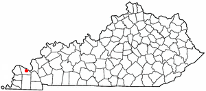
Livingston County is a county located in the U.S. state of Kentucky. As of the 2020 census, the population was 8,888. Its county seat is Smithland and its largest community is Ledbetter. The county was established in 1798 from land taken from Christian County and is named for Robert R. Livingston, a member of the Committee of Five that drafted the U.S. Declaration of Independence. The county was strongly pro-Confederate during the American Civil War and many men volunteered for the Confederate Army. Livingston County is part of the Paducah, KY-IL Metropolitan Statistical Area. It is a prohibition or dry county with the exception of Grand Rivers which voted to allow alcohol sales in 2016.

<span class="mw-page-title-main">Pulaski County, Illinois</span> County in Illinois, United States

Pulaski County is a county located in the U.S. state of Illinois. According to the 2020 census, it had a population of 5,193. Its county seat is Mound City. Its largest city is Mounds. It is located along the Ohio River in the southwestern portion of the state, known locally as "Little Egypt".

<span class="mw-page-title-main">Massac County, Illinois</span> County in Illinois, United States

Massac County is a county in the U.S. state of Illinois. According to the 2020 census, it had a population of 14,169. Established in 1843 and named for a French fort founded in the 18th century, its county seat is Metropolis. Massac County is included in the Paducah, KY-IL Metropolitan Statistical Area. It is located along the Ohio River, in the portion of the state known locally as "Little Egypt".

<span class="mw-page-title-main">Foosland, Illinois</span> Village in Illinois, United States

Foosland is a village in Brown Township, Champaign County, Illinois, United States. The population was 75 at the 2020 census. The village is named after William Foos, who owned 3,500 acres in the area in the 1840s.

<span class="mw-page-title-main">Grayville, Illinois</span> City in Illinois, United States

Grayville is a city in Edwards and White counties in the U.S. state of Illinois. As of the 2020 census, the city's population was 1,550, down from 1,666 at the 2010 census. Grayville is the birthplace of naval hero James Meredith Helm.

<span class="mw-page-title-main">Omaha, Illinois</span> Village in Illinois, United States

Omaha is a village in Gallatin County, Illinois, United States. The population was 266 at the 2010 census.

<span class="mw-page-title-main">Rosiclare, Illinois</span> City in Illinois, United States

Rosiclare is a city in Hardin County, Illinois, along the Ohio River. The population was 1,160 at the 2010 census, down from 1,213 at the 2000 census.

<span class="mw-page-title-main">Joppa, Illinois</span> Village in Illinois, United States

Joppa is a village in Massac County, Illinois, United States, along the Ohio River. The population was 350 as of the 2020 census. It is part of the Paducah, KY-IL Metropolitan Statistical Area.

<span class="mw-page-title-main">Metropolis, Illinois</span> City in Illinois, United States

Metropolis is a city located along the Ohio River in Massac County, Illinois, United States. As of the 2020 census, it had a population of 5,969, down from 6,537 in 2010. Metropolis is the county seat of Massac County and is part of the Paducah, KY-IL Micropolitan Statistical Area in Southern Illinois.

<span class="mw-page-title-main">Kevil, Kentucky</span> City in Kentucky, United States

Kevil is a home rule-class city in Ballard County, Kentucky, United States. The population was 595 as of the 2020 census, It is part of the Paducah KY-IL Metropolitan Statistical Area.

<span class="mw-page-title-main">Carrsville, Kentucky</span> City in Kentucky, United States

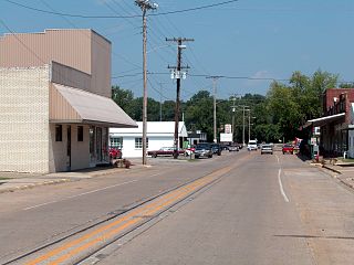
Carrsville is a home rule-class city beside the Ohio River in Livingston County, Kentucky, in the United States. The population was 50 at the 2010 census, declining from 64 as of 2000. It is part of the Paducah, KY-IL Metropolitan Statistical Area. It is situated just west of the junction of where Buck Creek empties into the Ohio River.

<span class="mw-page-title-main">Grand Rivers, Kentucky</span> City in Kentucky, United States

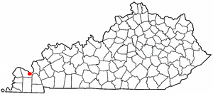
Grand Rivers is a home rule-class city in Livingston County, Kentucky, in the United States. The population was 382 at the 2010 census, up from 343 in 2000. It is part of the Paducah, KY-IL Metropolitan Statistical Area.

<span class="mw-page-title-main">Hendron, Kentucky</span> Census-designated place in Kentucky, United States

Hendron is an unincorporated community and census-designated place (CDP) in McCracken County, Kentucky, United States. The population was 4,774 at the 2020 census. It is part of the Paducah, KY-IL Metropolitan Statistical Area.

<span class="mw-page-title-main">Lone Oak, Kentucky</span> Unincorporated community in Kentucky, United States

Lone Oak is an unincorporated community and former city in McCracken County, Kentucky, United States. The population was 454 at the 2000 census, the last before its disincorporation. It is a part of the Paducah, KY-IL Metropolitan Statistical Area.

<span class="mw-page-title-main">Massac, Kentucky</span> Census-designated place in Kentucky, United States

Massac is a census-designated place (CDP) in McCracken County, Kentucky, United States. The population was 4,635 at the 2020 census. It is part of the Paducah, KY-IL Metropolitan Statistical Area.

Reidland is an unincorporated community and census-designated place (CDP) in McCracken County, Kentucky, United States. The population was 4,526 at the 2020 census. It is part of the Paducah, KY-IL Metropolitan Statistical Area.

<span class="mw-page-title-main">Pell Lake, Wisconsin</span> Former CDP in Wisconsin, United States

Pell Lake is a neighborhood and former census-designated place (CDP) in Walworth County, Wisconsin, United States. The population was 3,722 at the 2010 census. On December 20, 2011, Pell Lake became part of the newly incorporated village of Bloomfield.

The Paducah, KY-IL Micropolitan Statistical Area, as defined by the United States Census Bureau, is an area consisting of five counties – three in the Jackson Purchase region of Kentucky, a fourth Kentucky county bordering the Purchase, and one in southern Illinois – anchored by the city of Paducah, Kentucky.

<span class="mw-page-title-main">Farley, Kentucky</span> Census-designated place in Kentucky, United States

Farley is a census-designated place (CDP) in McCracken County, Kentucky, United States. The population was 4,374 as of the 2020 census, down from 4,701 in 2010. It is part of the Paducah, KY-IL Metropolitan Statistical Area. The area was listed by the U.S. Census Bureau as Woodlawn-Oakdale starting with the 1980 census and as Farley starting with the 2010 census.

References

  1. 1 2 "2022 U.S. Gazetteer Files: Illinois". United States Census Bureau. Retrieved March 2, 2023.
  2. 1 2 "P1. Race – Brookport city, Illinois: 2020 DEC Redistricting Data (PL 94-171)". U.S. Census Bureau. Retrieved March 2, 2023.
  3. Edward Callary, Place Names of Illinois (University of Illinois Press, 2010), p. 46.
  4. George W. May, History of Massac County, Illinois (Wagoner Printing Company, 1955). Accessed at archive.org.
  5. "US Gazetteer files: 2010, 2000, and 1990". United States Census Bureau. February 12, 2011. Retrieved April 23, 2011.
  6. "Census of Population and Housing". Census.gov. Retrieved June 4, 2015.
  7. "U.S. Census website". United States Census Bureau . Retrieved January 31, 2008.