Browning, Illinois

Last updated

Browning
Schuyler County Illinois Incorporated and Unincorporated areas Browning Highlighted.svg
Location of Browning in Schuyler County, Illinois.
Illinois in United States (US48).svg
Location of Illinois in the United States
Coordinates: 40°7′46″N90°22′21″W / 40.12944°N 90.37250°W / 40.12944; -90.37250
CountryUnited States
StateIllinois
County Schuyler
Government
  MayorBurl Boyd
Area
[1]
  Total0.31 sq mi (0.80 km2)
  Land0.31 sq mi (0.80 km2)
  Water0.00 sq mi (0.00 km2)
Elevation
[2]
440 ft (130 m)
Population
 (2020)
  Total117
  Density377.42/sq mi (145.90/km2)
Time zone UTC-6 (CST)
  Summer (DST) UTC-5 (CDT)
Area code 217
FIPS code 17-08953
GNIS feature ID2397471 [2]
Wikimedia CommonsBrowning, Illinois

Browning is a village in Schuyler County, Illinois, United States. The population was 130 at the 2000 census.

Contents

Geography

Browning is located at 40°7′46″N90°22′21″W / 40.12944°N 90.37250°W / 40.12944; -90.37250 (40.129321, -90.372441). [3]

According to the 2010 census, Browning has a total area of 0.31 square miles (0.80 km2), all land. [4]

Demographics

Historical population
CensusPop.Note
1860 219
1870 214−2.3%
1880 2307.5%
1900 455
1910 55121.1%
1920 456−17.2%
1930 4580.4%
1940 402−12.2%
1950 324−19.4%
1960 300−7.4%
1970 276−8.0%
1980 246−10.9%
1990 193−21.5%
2000 130−32.6%
2010 1375.4%
2020 117−14.6%
U.S. Decennial Census [5]

As of the census [6] of 2000, there were 130 people, 57 households, and 38 families residing in the village. The population density was 419.0 inhabitants per square mile (161.8/km2). There were 63 housing units at an average density of 203.1 per square mile (78.4/km2). The racial makeup of the village was 99.23% White and 0.77% Native American. Hispanic or Latino of any race were 1.54% of the population. There were 57 households, out of which 19.3% had children under the age of 18 living with them, 57.9% were married couples living together, 7.0% had a female householder with no husband present, and 31.6% were non-families. 29.8% of all households were made up of individuals, and 21.1% had someone living alone who was 65 years of age or older. The average household size was 2.28 and the average family size was 2.79.

In the village, the population was spread out, with 16.2% under the age of 18, 10.0% from 18 to 24, 18.5% from 25 to 44, 27.7% from 45 to 64, and 27.7% who were 65 years of age or older. The median age was 47 years. For every 100 females, there were 91.2 males. For every 100 females age 18 and over, there were 87.9 males.

The median income for a household in the village was $44,107, and the median income for a family was $50,625. Males had a median income of $31,667 versus $21,667 for females. The per capita income for the village was $18,109. There were no families and 3.7% of the population living below the poverty line, including no under eighteens and 10.3% of those over 64.

Related Research Articles

<span class="mw-page-title-main">Kempton, Illinois</span> Village in Illinois, United States

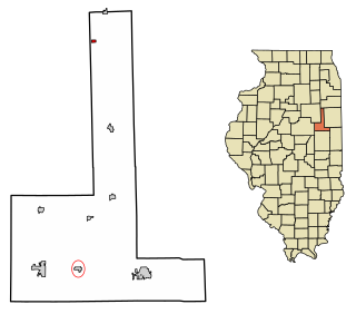
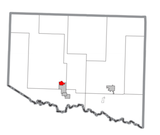
Kempton is a village in Ford County, Illinois, United States. The population was 231 at the 2010 census.

<span class="mw-page-title-main">Oak Grove, Illinois</span> Village in Illinois, United States

Oak Grove is a village in Rock Island County, Illinois, United States. The population was 396 at the 2010 census.

<span class="mw-page-title-main">Beaconsfield, Iowa</span> City in Iowa, United States

Beaconsfield is a city in Ringgold County, Iowa, United States. The population was 15 in the 2020 census, unchanged from 2010 and an increase from 11 in 2000. In the 2000 census Beaconsfield was the least populated incorporated city in Iowa; with the increase in the 2020 census, it is now the second smallest, after with Le Roy.

<span class="mw-page-title-main">Reeves, Louisiana</span> Village in Louisiana, United States

Reeves is a village in Allen Parish, Louisiana, United States. The population was 232 at the 2010 census.

<span class="mw-page-title-main">Wallagrass, Maine</span> Town in the state of Maine, United States

Wallagrass is a town in Aroostook County, Maine, United States. The population was 519 at the 2020 census.

<span class="mw-page-title-main">Mineral Hills, Michigan</span> Former village in Michigan, United States

Mineral Hills was a village in southeastern Iron River Township, Iron County, in the U.S. state of Michigan. In the 2000 census, the village population was 214.

<span class="mw-page-title-main">Deerfield, Missouri</span> Village in Missouri, United States

Deerfield is a village in Vernon County, Missouri, United States. The population was 40 at the 2020 census.

<span class="mw-page-title-main">Brainard, Nebraska</span> Village in Nebraska, United States

Brainard is a village in Butler County, Nebraska, United States. The population was 330 at the 2010 census.

<span class="mw-page-title-main">Stamford, Nebraska</span> Village in Nebraska, United States

Stamford is a village in Harlan County, Nebraska, United States. The population was 183 at the 2010 census.

<span class="mw-page-title-main">Ithaca, Nebraska</span> Village in Saunders County, Nebraska, United States

Ithaca is a village in Saunders County, Nebraska, United States. The population was 160 at the 2020 census.

<span class="mw-page-title-main">Chatfield, Ohio</span> Village in Ohio, United States

Chatfield is a village in Crawford County, Ohio, United States. The population was 205 at the 2020 census.

<span class="mw-page-title-main">Ashley, Ohio</span> Village in Ohio, United States

Ashley is a village in Delaware County, Ohio, United States. The population was 1,198 at the 2020 census.

<span class="mw-page-title-main">Chesterville, Ohio</span> Village in Ohio, United States

Chesterville is a village in Morrow County, Ohio, United States, along the Kokosing River. The population was 191 at the 2020 census. Chesterville is southeast of Mount Gilead, the county seat.

<span class="mw-page-title-main">Venedocia, Ohio</span> Village in Ohio, United States

Venedocia is a village in Van Wert County, Ohio, United States. The population was 124 at the 2010 census. It is included within the Van Wert, Ohio Micropolitan Statistical Area and the Lima-Van Wert-Wapakoneta, OH Combined Statistical Area.

<span class="mw-page-title-main">Rome Township, Bradford County, Pennsylvania</span> Township in Pennsylvania, United States

Rome Township is a township in Bradford County, Pennsylvania, United States. It is part of Northeastern Pennsylvania. The population was 1,191 at the 2010 census.

<span class="mw-page-title-main">Otto Township, McKean County, Pennsylvania</span> Township in Pennsylvania, United States

Otto Township is a township in McKean County, Pennsylvania, United States. The population was 1,506 at the time of the 2020 census.

Milroy is a census-designated place (CDP) that is located in the Kishacoquillas Valley of Mifflin County, Pennsylvania, United States. The population was 1,386 at the time of the 2000 census.

<span class="mw-page-title-main">Flemington, West Virginia</span> Town in West Virginia, United States

Flemington is a town in Taylor County, West Virginia, United States. The population was 311 at the 2020 census. Flemington was incorporated in 1922 by the West Virginia Circuit Court, and named for James Fleming, an early settler in the area originally from Hampshire County.

Eastman is a town in Crawford County, Wisconsin, United States. The population was 790 at the 2000 census. The village of Eastman and the unincorporated community of Charme are located within the town.

<span class="mw-page-title-main">Oakdale, Wisconsin</span> Village in Wisconsin, United States

Oakdale is a village in Monroe County, Wisconsin, United States. The population was 302 at the 2020 census. The village is located within the Town of Oakdale.

References

  1. "2020 U.S. Gazetteer Files". United States Census Bureau. Retrieved March 15, 2022.
  2. 1 2 U.S. Geological Survey Geographic Names Information System: Browning, Illinois
  3. "US Gazetteer files: 2010, 2000, and 1990". United States Census Bureau. February 12, 2011. Retrieved April 23, 2011.
  4. "G001 - Geographic Identifiers - 2010 Census Summary File 1". United States Census Bureau. Archived from the original on February 13, 2020. Retrieved August 2, 2015.
  5. "Census of Population and Housing". Census.gov. Retrieved June 4, 2015.
  6. "U.S. Census website". United States Census Bureau . Retrieved January 31, 2008.