Bull Shoals, Arkansas

Last updated

Bull Shoals, Arkansas
Marion County Arkansas Incorporated and Unincorporated areas Bull Shoals Highlighted 0509790.svg
Location in Marion County, Arkansas
Coordinates: 36°22′58″N92°34′59″W / 36.38278°N 92.58306°W / 36.38278; -92.58306
Country United States
State Arkansas
County Marion
Area
[1]
  Total4.97 sq mi (12.87 km2)
  Land4.90 sq mi (12.70 km2)
  Water0.07 sq mi (0.18 km2)
Elevation
[2]
558 ft (170 m)
Population
 (2020) [3]
  Total1,952
  Density398.20/sq mi (153.74/km2)
Time zone UTC-6 (Central (CST))
  Summer (DST) UTC-5 (CDT)
ZIP code
72619
Area code 870
FIPS code 05-09790
GNIS feature ID2403951 [2]
Website www.cityofbullshoals.org

Bull Shoals is a city in Marion County, Arkansas, United States, founded in 1954. The population was 1,952 at the 2020 census. [3] Primarily a retirement and vacation center, Bull Shoals is bordered in three directions by the clear, deep, man-made Bull Shoals Lake.

Contents

History

The town was created by real estate developers C. S. Woods and C. S. Woods Jr. and was officially established in 1954. Bull Shoals Dam is the threshold into the town from the southeast.

Bull Shoals Dam and the town of Bull Shoals developed together. The developers bought several tracts of the former Newton Flat settlement when they learned that the government planned to build a flood-control and power-generating concrete dam at the site. Construction of the dam took four years, from 1947 to 1951, resulting in one of the largest dams built in the nation at that time.

Geography

Bull Shoals is located in northeastern Marion County and is bordered on three sides by Bull Shoals Lake, with the main channel of the lake, on the White River, to the southeast and northeast, and a long arm of the lake formed by the inlets of Jimmie Creek and Moccasin Creek on the northwest side of the city. The southeast border of the city, in the White River, is the Baxter County line.

According to the United States Census Bureau, the city has a total area of 5.0 square miles (13 km2), of which 0.07 square miles (0.18 km2), or 1.39%, are water. [1]

Arkansas 178.svg Highway 178 is the only highway and only major road in and out of Bull Shoals, which the highway enters just off the Bull Shoal Dam, which begins the Bull Shoals Lake from the White River, near the Arkansas-Missouri border. Highway 178 leads east 9 miles (14 km) to Midway and south the same distance to Flippin. Yellville, the Marion county seat, is 15 miles (24 km) to the southwest of Bull Shoals, and Mountain Home is 15 miles to the southeast.

Demographics

Historical population
CensusPop.Note
1960 268
1970 43060.4%
1980 1,312205.1%
1990 1,53416.9%
2000 2,00030.4%
2010 1,950−2.5%
2020 1,9520.1%
U.S. Decennial Census [4]
2014 Estimate [5]

2020 census

Bull Shoals racial composition [6]
RaceNumberPercentage
White (non-Hispanic)1,77991.14%
Black or African American (non-Hispanic)50.26%
Native American 90.46%
Asian 80.41%
Other/Mixed 964.92%
Hispanic or Latino 552.82%

As of the 2020 United States census, there were 1,952 people, 951 households, and 572 families residing in the city.

2010 census

As of the census [7] of 2010, there were 1,950 people, 1,014 households, and 650 families residing in the city. The population density was 403.0 inhabitants per square mile (155.6/km2). There were 1,226 housing units at an average density of 247.0 per square mile (95.4/km2). The racial makeup of the city was 98.05% White, 0.30% Black or African American, 0.45% Native American, 0.25% Asian, 0.10% Pacific Islander, 0.10% from other races, and 0.75% from two or more races. 1.05% of the population were Hispanic or Latino of any race.

There were 1,014 households, out of which 11.6% had children under the age of 18 living with them, 57.4% were married couples living together, 5.1% had a female householder with no husband present, and 35.8% were non-families. 32.1% of all households were made up of individuals, and 20.9% had someone living alone who was 65 years of age or older. The average household size was 1.96 and the average family size was 2.39.

In the city, the population was spread out, with 11.6% under the age of 18, 4.2% from 18 to 24, 16.1% from 25 to 44, 30.0% from 45 to 64, and 38.3% who were 65 years of age or older. The median age was 59 years. For every 100 females, there were 91.8 males. For every 100 females age 18 and over, there were 90.2 males.

The median income for a household in the city was $27,139, and the median income for a family was $34,219. Males had a median income of $23,125 versus $16,950 for females. The per capita income for the city was $17,636. About 9.1% of families and 12.6% of the population were below the poverty line, including 27.2% of those under age 18 and 9.3% of those age 65 or over.

Culture

Bull Shoals has been honored as an Arkansas Volunteer Community of the Year for five years.

Liquidforce and Brostock 2010 [8] chose Bull Shoals as the location of their professional wakeboarding tournament in July 2010 and June 2011. Surf the Bull, an annual grassroots wakesurfing event and competition, is hosted by Bull Shoals Lake Boat Dock and presented by several members of the wakesurfing community every summer in late July/early August. The lake has also hosted numerous professional bass and walleye fishing tournaments over the years. Additionally, the city co-hosts the annual HillBilly Chili Cookoff [9] selecting Arkansas' Best Chili to compete internationally in the International Chili Society competitions.

Government

Bull Shoals has a mayor/council form of government with six council members. [10] The current mayor of Bull Shoals is Dr. David Nixon. The previous mayor was Bruce Powell, a retired Chicago policeman.

Incoming District 17 Arkansas State Senator Scott Flippo is a businessman in Bull Shoals but resides in his native Mountain Home.

Notable people

Related Research Articles

<span class="mw-page-title-main">White County, Arkansas</span> County in Arkansas, United States

White County is a county located in the U.S. state of Arkansas. As of the 2020 census, the population was 76,822. The county seat is Searcy. White County is Arkansas's 31st county, formed on October 23, 1835, from portions of Independence, Jackson, and Pulaski counties and named for Hugh Lawson White, a Whig candidate for President of the United States. It is an alcohol prohibition or dry county, though a few private establishments can serve alcohol.

<span class="mw-page-title-main">Pike County, Arkansas</span> County in Arkansas, United States

Pike County is a county located in the U.S. state of Arkansas. As of the 2020 census, the population was 10,171. The county seat is Murfreesboro. Pike County is Arkansas's 25th county, formed on November 1, 1833, and named for Lieutenant Zebulon Pike, the explorer for whom Pikes Peak is named. It is an alcohol prohibition or dry county. The current judge is Eddie Howard.

<span class="mw-page-title-main">Marion County, Arkansas</span> County in Arkansas, United States

Marion County is located in the Ozark Mountains in the U.S. state of Arkansas. The county is named for Francis Marion, the famous "Swamp Fox" of the Revolutionary War. Created as Arkansas's 35th county in 1836, Marion County is home to one incorporated town and four incorporated cities, including Yellville, the county seat. The county is also the site of numerous unincorporated communities and ghost towns. The county included part of what is now Searcy County, Arkansas, with many opposing to dividing them, which helped fueled the bloody Tutt-Everett War between 1844 and 1850.

<span class="mw-page-title-main">Little River County, Arkansas</span> County in Arkansas, United States

Little River County is a county located on the southwest border of the U.S. state of Arkansas, bordering a corner with Texas and Oklahoma. As of the 2020 census, the population was 12,026. The county seat is Ashdown.

<span class="mw-page-title-main">Drew County, Arkansas</span> County in Arkansas, United States

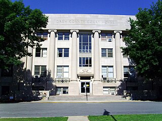
Drew County is a county located in the southeast region of the U.S. state of Arkansas. As of the 2020 census, the population was 17,350. The county seat and largest city is Monticello. Drew County was formed on November 26, 1846, and named for Thomas Drew, the third governor of Arkansas.

<span class="mw-page-title-main">Cleburne County, Arkansas</span> County in Arkansas, United States

Cleburne County is a county located in the U.S. state of Arkansas. As of the 2020 census, the population was 24,711. The county seat and most populous city is Heber Springs. The county was formed on February 20, 1883, as the last of Arkansas's 75 counties to be formed. It is named for Confederate Major-General Patrick Cleburne. Cleburne is an alcohol prohibition or dry county.

<span class="mw-page-title-main">Boone County, Arkansas</span> County in Arkansas, United States

Boone County is located in the U.S. state of Arkansas, along the Missouri border. As of the 2020 census, the population was 37,373. The county seat is Harrison. It is Arkansas's 62nd county, formed on April 9, 1869.

<span class="mw-page-title-main">Baxter County, Arkansas</span> County in Arkansas, United States

Baxter County is a county in the U.S. state of Arkansas. As of the 2020 census, the county's population was 41,627. The county seat is Mountain Home. It is Arkansas's 66th county, formed on March 24, 1873, and named for Elisha Baxter, the tenth governor of Arkansas.

<span class="mw-page-title-main">Cotter, Arkansas</span> City in Arkansas, United States

Cotter is a city in Baxter County, Arkansas, United States. The population was 886 at the 2020 census.

<span class="mw-page-title-main">Mountain Home, Arkansas</span> City in Arkansas, United States

Mountain Home is a city in and the county seat of Baxter County, Arkansas, United States, in the southern Ozark Mountains near the northern state border with Missouri. As of the 2010 census, the city had a population of 12,448. A total of 41,307 persons lived within the city and micropolitan area combined, which encompasses the majority of Baxter County.

<span class="mw-page-title-main">Norfork, Arkansas</span> City in Arkansas, United States

Norfork is a city in Baxter County, Arkansas, United States. The population was 550 at the 2010 census.

<span class="mw-page-title-main">Diamond City, Arkansas</span> City in Arkansas, United States

Diamond City is a city in northeast Boone County, Arkansas, United States. The population was 782 at the 2010 census. It is part of the Harrison Micropolitan Statistical Area.

<span class="mw-page-title-main">Lead Hill, Arkansas</span> Town in Arkansas, United States

Lead Hill is a town in Boone County, Arkansas, United States. The population was 271 at the 2010 census. It is part of the Harrison Micropolitan Statistical Area.

<span class="mw-page-title-main">McGehee, Arkansas</span> City in Arkansas, United States

McGeheemə-GHEE is a city in Desha County, Arkansas, United States. The population was 4,219 at the 2010 census.

<span class="mw-page-title-main">Mountain Pine, Arkansas</span> City in Arkansas, United States

Mountain Pine is a city in Garland County, Arkansas, United States. It is part of the Hot Springs Metropolitan Statistical Area. The population was 770 at the 2010 United States Census. It is located immediately southeast of Lake Ouachita below the Blakely Mountain Dam. The city consists of five defined neighborhoods, Pinewood (north), South Mountain Pine, a business district, Cozy Acres (southwest) and Mountain View/Timberland area.

<span class="mw-page-title-main">Hindsville, Arkansas</span> Town in Arkansas, United States

Hindsville is a town in Madison County, Arkansas, United States. The population was 90 at the 2020 census. It is part of the Northwest Arkansas region.

<span class="mw-page-title-main">Flippin, Arkansas</span> City in Arkansas, United States

Flippin is a city in Marion County, Arkansas, United States. The population was 1,345 at the 2020 census.

<span class="mw-page-title-main">Summit, Arkansas</span> City in Arkansas, United States

Summit is a city in Marion County, Arkansas, United States. The population was 544 at the 2020 census, down from 604 in 2010.

<span class="mw-page-title-main">Yellville, Arkansas</span> City in Arkansas, United States

Yellville is a city in and county seat of Marion County, Arkansas, United States. Yellville is located in the Ozark Mountains along the banks of Crooked Creek, and neighbors the small town of Summit to the north. The population was 1,178 at the 2020 census. The town's original name is preserved in the Shawnee Town Branch, a local creek. The town also holds an annual Turkey Trot Festival.

<span class="mw-page-title-main">Kensett, Arkansas</span> City in Arkansas, United States

Kensett is a city in White County, Arkansas, United States. Located adjacent to the east side of Searcy, the city is the hometown of noted legislator Wilbur D. Mills, who was influential throughout the 1960s and 1970s in the United States House of Representatives.

References

  1. 1 2 "2021 U.S. Gazetteer Files: Arkansas". United States Census Bureau. Retrieved May 31, 2022.
  2. 1 2 U.S. Geological Survey Geographic Names Information System: Bull Shoals, Arkansas
  3. 1 2 "P1. Race – Bull Shoals city, Arkansas: 2020 DEC Redistricting Data (PL 94-171)". U.S. Census Bureau. Retrieved May 31, 2022.
  4. "Census of Population and Housing". Census.gov. Retrieved June 4, 2015.
  5. "Annual Estimates of the Resident Population for Incorporated Places: April 1, 2010 to July 1, 2014". Archived from the original on May 22, 2015. Retrieved June 4, 2015.
  6. "Explore Census Data". data.census.gov. Retrieved January 1, 2022.
  7. "U.S. Census website". United States Census Bureau . Retrieved January 31, 2008.
  8. Brostock 2010 Archived November 24, 2010, at the Wayback Machine
  9. "Arkansas State Championship Hillbilly Chili Cook-Off in Lakeview, Arkansas". Archived from the original on April 26, 2012.{{cite web}}: CS1 maint: unfit URL (link)
  10. "Local.Arkansas.gov Bull Shoals", Local.Arkansas.gov, October 18, 2011
  11. Loren Thompson-obituary