Burford Tolsey Museum

Last updated

Burford Tolsey Museum
Tolsey Museum, Burford (geograph 5658361).jpg
Burford Tolsey Museum
LocationHigh Street, Burford
Coordinates 51°48′26″N1°38′13″W / 51.8073°N 1.6370°W / 51.8073; -1.6370
Built1520
Architectural style(s) Tudor style
Listed Building – Grade II*
Official nameThe Tolsey
Designated12 September 1955
Reference no.1224632
Oxfordshire UK location map.svg
Red pog.svg
Shown in Oxfordshire

The Burford Tolsey Museum is a local museum in the town of Burford, west Oxfordshire, England. [1] [2] [3] It is located in a Tudor style structure, known as The Tolsey, [lower-alpha 1] and was formerly where market tolls were collected and where town meetings may have been held in the upper chamber. It is a Grade II* listed building. [5]

Contents

History

The building

The Tolsey was designed in the Tudor style, built using half-timbering techniques and was completed in 1520. [6] Surveys using dendrology have dated the timbers back to 1525 [7] although the first documented reference to the building was not until 1561. [8] The building was raised on stone pillars so that markets could be held, with an assembly room on the first floor. [9] The design involved a symmetrical main frontage with two bays facing onto the High Street; the first floor was fenestrated by bay windows and surmounted by gables. The ground floor was the place for wool merchants to meet in medieval times. Tolls for the use of the market facilities and taxes were also collected on behalf of the lord of the manor. The assembly room was used as a venue for borough court hearings and also operated as the local town hall. [7] The room was furnished with a chair, a table and a chest of drawers bearing the coat of arms of Burford Corporation. [10]

A lock-up for petty criminals was established at the rear of the building in the late 16th century, [6] a projecting beam which supported a clock, with a bell suspended below, was installed in the right-hand gable in the 17th century, [11] and a horse-drawn fire engine was acquired for the town and stored on the ground floor in the late 18th century. [6] After Burford Corporation was disbanded in 1861, ownership of the building was transferred to trustees. [6] The building fell into a state of disrepair in the first half of the 20th century although it was extensively refurbished in 1955. [6]

The museum

A leading Burford antique dealer, Roger Warner, who had been collecting objects with a known Burford connection since the 1930’s, [12] ranging from rope-making tools to a boxwood clarinet, donated his collection to enable the museum to open as a local history museum in 1960. [6]

The museum which was recorded as such in the BBC Domesday Project in 1986. [13]

The Museum is open 2-5pm every day from April to October, weekends only in November & December and closed January to March. Admission is free. Donations are invited. [14]

The archive

When in November 2022, the Burford Tolsey Archive was opened in an historic nearby barn in Swan Lane to collect, preserve and share Burford’s written and oral stories and images, the Registered Charity No. 309176 was renamed the Burford Tolsey Museum & Archive. [15]

See also

Notes

  1. Tolsey is an ancient word for a tollbooth. [4]

Related Research Articles

<span class="mw-page-title-main">Cotswolds</span> Protected area mostly in South West England

The Cotswolds is a region of central South West England, along a range of rolling hills that rise from the meadows of the upper River Thames to an escarpment above the Severn Valley and the Vale of Evesham. The area is defined by the bedrock of Jurassic limestone that creates a type of grassland habitat that is quarried for the golden-coloured Cotswold stone. The predominantly rural landscape contains stone-built villages, towns, stately homes and gardens featuring the local stone.

<span class="mw-page-title-main">Oxfordshire</span> County of England

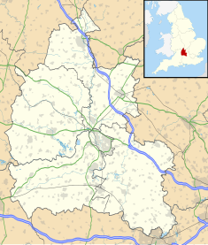
Oxfordshire is a ceremonial county in South East England. The county is bordered by Northamptonshire and Warwickshire to the north, Buckinghamshire to the east, Berkshire to the south, and Wiltshire and Gloucestershire to the west. The city of Oxford is the largest settlement and county town.

<span class="mw-page-title-main">Witney</span> English town in West Oxfordshire

Witney is a market town on the River Windrush in West Oxfordshire in the county of Oxfordshire, England. It is 12 miles (19 km) west of Oxford.

<span class="mw-page-title-main">Burford</span> Town in Oxfordshire, England

Burford is a town on the River Windrush, in the Cotswold hills, in the West Oxfordshire district of Oxfordshire, England. It is often referred to as the 'gateway' to the Cotswolds. Burford is located 18 miles (29 km) west of Oxford and 22 miles (35 km) southeast of Cheltenham, about 2 miles (3 km) from the Gloucestershire boundary. The toponym derives from the Old English words burh meaning fortified town or hilltown and ford, the crossing of a river. The 2011 Census recorded the population of Burford parish as 1,422.

<span class="mw-page-title-main">Chipping Norton</span> Market town in West Oxfordshire, England

Chipping Norton is a market town and civil parish in the Cotswold Hills in the West Oxfordshire district of Oxfordshire, England, about 12 miles (19 km) south-west of Banbury and 18 miles (29 km) north-west of Oxford. The 2011 Census recorded the civil parish population as 5,719. It was estimated at 6,254 in 2019.

<span class="mw-page-title-main">Northleach</span> Market town in England

Northleach is a market town and former civil parish, now in parish Northleach with Eastington, in the Cotswold district, in Gloucestershire, England. The town is in the valley of the River Leach in the Cotswolds, about 10 miles (16 km) northeast of Cirencester and 11 miles (18 km) east-southeast of Cheltenham. The 2011 Census recorded the parish's population as 1,854, the same as Northleach built-up-area.

<span class="mw-page-title-main">Bampton, Oxfordshire</span> Human settlement in England

Bampton, also called Bampton-in-the-Bush, is a settlement and civil parish in the Thames Valley about 4+12 miles (7 km) southwest of Witney in Oxfordshire. The parish includes the hamlet of Weald. The 2011 Census recorded the parish's population as 2,564. Bampton is variously referred to as both a town and a village. The Domesday Book recorded that it was a market town by 1086. It continued as such until the 1890s. It has both a town hall and a village hall.

<span class="mw-page-title-main">Milton-under-Wychwood</span> Human settlement in England

Milton-under-Wychwood is an English village and civil parish about 4 miles (6.4 km) north of Burford, Oxfordshire, just off the A361 road between Burford and Chipping Norton. The 2011 Census recorded the parish's population as 1,648.

<span class="mw-page-title-main">Clayton Hall</span> Building in Greater Manchester, England

Clayton Hall is a 15th-century manor house on Ashton New Road in Clayton, Manchester, England, hidden behind trees in a small park. The hall is a Grade II* listed building, the mound on which it is built is a scheduled ancient monument, and a rare example of a medieval moated site. The hall is surrounded by a moat, making an island 66 by 74 metres. Alterations were made to the hall in the 16th and 17th centuries, and it was enlarged in the 18th century.

<span class="mw-page-title-main">Westwell, Oxfordshire</span> Human settlement in England

Westwell is a small village and civil parish about 2 miles (3 km) southwest of the market town of Burford in Oxfordshire. It is the westernmost village in the county, close to the border with Gloucestershire.

<span class="mw-page-title-main">Taynton, Oxfordshire</span> Human settlement in England

Taynton is a village and civil parish about 1+12 miles (2.4 km) northwest of Burford in West Oxfordshire. The village is on Coombe Brook, a tributary of the River Windrush. The parish is bounded in the south by the River Windrush, in the north partly by Coombe Brook and its tributary Hazelden Brook, in the west by the county boundary with Gloucestershire and in the east by field boundaries. The 2001 Census recorded the parish's population as 108.

<span class="mw-page-title-main">Cotswold architecture</span> Architectural design style

The Cotswold style of architecture is a style based on houses from the Cotswold region of England. Cotswold houses often have a prominent chimney, often near the front door of the house. Other notable features include king mullions and steep roofs. The Cotswold style uses local materials based on geology. This style is renowned for the use of local oolitic limestone.

<span class="mw-page-title-main">Church of St John the Baptist, Burford</span> Church in England

The Anglican Church of St John the Baptist in Burford, Oxfordshire, England is a Grade I listed building.

<span class="mw-page-title-main">Henley Town Hall</span> Municipal building in Henley, Oxfordshire, England

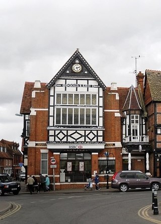
Henley Town Hall is a municipal structure in the Market Place in Henley-on-Thames, Oxfordshire, England. The town hall, which is the headquarters of Henley Town Council, is a Grade II* listed building.

<span class="mw-page-title-main">Redesdale Hall</span> Municipal building in Moreton-in-Marsh, Gloucestershire, England

Redesdale Hall, also referred to as Moreton-in-Marsh Town Hall, is a municipal building in the High Street, Moreton-in-Marsh, Gloucestershire, England. The building, which is used as an events venue, is a Grade II listed building.

<span class="mw-page-title-main">Tetbury Market House</span> Municipal building in Tetbury, Gloucestershire, England

Tetbury Market House, also known as Tetbury Town Hall, is a municipal building in the Market Place, Tetbury, Gloucestershire, England. The building, which was used both as a market house and as a town hall until the late 19th century, is a Grade I listed building.

<span class="mw-page-title-main">Chipping Norton Town Hall</span> Municipal building in Chipping Norton, Oxfordshire, England

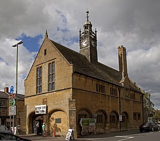
Chipping Norton Town Hall is a municipal building in the Market Place, Chipping Norton, Oxfordshire, England. The building, which is used as an events venue, is a Grade II* listed building.

<span class="mw-page-title-main">Old Town Hall, Wantage</span> Municipal building in Wantage, Oxfordshire, England

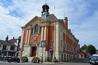
The Old Town Hall is a municipal building in the Market Place in Wantage, Oxfordshire, England. The building, which was the headquarters of Wantage Urban District Council, was converted into apartments in 2018.

<span class="mw-page-title-main">Moot Hall, Aldeburgh</span> Municipal building in Aldeburgh, Suffolk, England

The Moot Hall is a municipal building in Market Cross Place in Aldeburgh, Suffolk, England. The building, which is the meeting place of Aldeburgh Town Council, is a Grade I listed building.

<span class="mw-page-title-main">Malmesbury Town Hall</span> Municipal building in Malmesbury, Wiltshire, England

Malmesbury Town Hall is a municipal building in Cross Hayes in Malmesbury, Wiltshire, England. The structure, which is the meeting place of Malmesbury Town Council and the home of the Athelstan Museum, is a Grade II listed building.

References

  1. "Tolsey Museum". UK: Oxfordshire Museums Council. Archived from the original on 10 February 2020. Retrieved 26 March 2022.
  2. "Tolsey Museum". UK: Oxfordshire County Council . Retrieved 26 March 2022.
  3. "Tolsey Museum". www.oxfordshirecotswolds.org. Oxfordshire Cotswolds. Retrieved 26 March 2022.
  4. Fisher, John (1861). A History of the Town of Burford, Oxfordshire. R. Edwards.
  5. Historic England. "The Tolsey (1224632)". National Heritage List for England . Retrieved 26 March 2022.
  6. 1 2 3 4 5 6 "Burford Timeline". Burford Tolsey. Retrieved 26 March 2022.
  7. 1 2 Steane, John; Ayres, James (2013). Traditional Buildings in the Oxford Region, c. 1300-1840. Oxbow Books. p. 388. ISBN   978-1842174791.
  8. "The Tolsey". Heritage Gateway. Retrieved 26 March 2022.
  9. "Tolsey Museum". thecotswoldgateway.co.uk. UK: The Cotswolds. Archived from the original on 15 June 2021. Retrieved 26 March 2022.
  10. Monk, William John (1891). History of Burford (PDF). C. W. Swatman. p. 158.
  11. Moody, Raymond (2010). Burford Through Time. Amberley Publishing. ISBN   978-1445627205.
  12. "About Us". Burford Tolsey. Retrieved 3 June 2024.
  13. "The Tolsey Museum at Burford". Domesday Reloaded. UK: BBC. Archived from the original on 18 March 2012. Retrieved 26 March 2022.
  14. "Local History Museum | Burford Tolsey | United Kingdom". Burford Tolsey. Retrieved 3 June 2024.
  15. "Burford's heritage on display – The Wychwood Magazine" . Retrieved 3 June 2024.