Limpopo is the northernmost province of South Africa. It is named after the Limpopo River, which forms the province's western and northern borders. The capital and largest city in the province is Polokwane, while the provincial legislature is situated in Lebowakgomo.

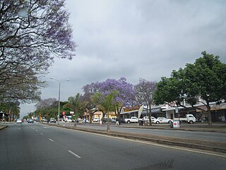
Mbombela, formerly Nelspruit, is a city in northeastern South Africa. It is the capital and the largest city of the Mpumalanga province. Located on the Crocodile River, The city lies about 110 km (68 mi) by road west of the Mozambique border, 330 km (210 mi) east of Johannesburg and 82 km (51 mi) north of the Eswatini border. The city was one of the host cities of the 2010 FIFA World Cup.

Graskop is a small town in Mpumalanga province, South Africa. It was set up in the 1880s as a gold mining camp but it now serves as a tourist destination and the timber industry. “God’s Window”, a scenic view from the escarpment of the Lowveld below, is located outside the town. Graskop is 14 km south-east of Pilgrim's Rest and 28 km north of Sabie. It was laid out between 1880 and 1890 on a farm belonging to Abel Erasmus, Native Commissioner of the Transvaal Republic. The name is Afrikaans for grassy hillock. Originally it was a mining camp. It is the best place to view the "Edge of the Lowveld", with a sudden drop of 700 metres.

Machadodorp, also known by its official name eNtokozweni, is a small town situated on the N4 road, near the edge of the escarpment in the Mpumalanga province, South Africa. The Elands River runs through the town. There is a natural radioactive spring here that is reputed to have powerful healing qualities.
Morgenzon is a small farming town situated on the banks of the Osspruit River (Ox Stream) with an agricultural school in Mpumalanga province, South Africa. The town is 45 km south-west of Ermelo and 35 km south-east of Bethal.
White River is a small holiday and farming town situated just north of Mbombela in Mpumalanga, South Africa. The farms in the region produce tropical fruits, macadamia nuts, vegetables, flowers and timber. As of 2011, White River had a population of 16,639.

The R37 is a provincial route in South Africa that connects Polokwane with Nelspruit (Mbombela) via Burgersfort and Lydenburg.

The R42 is a provincial route in South Africa that connects Vanderbijlpark with Bronkhorstspruit via Vereeniging, Heidelberg, Nigel and Delmas.
The R51 is a provincial route in South Africa that connects Bapsfontein with the N3 north of Villiers, via Springs, Nigel and Balfour.

The R54 is a provincial route in South Africa that connects Potchefstroom with Villiers via Vereeniging.
The R104 is a regional route in South Africa that is the designation for some of the old sections of roads that were previously the N4, prior to upgrading. It connects Rustenburg in the North West province with Witbank in Mpumalanga province via Hartbeespoort, Mooinooi, Pretoria and Bronkhorstspruit. There is also a 50km section in Mpumalanga province connecting Middelburg and Wonderfontein.

The N4 is a national route in South Africa that runs from Skilpadshek on the Botswana border, past Rustenburg, Pretoria, eMalahleni and Mbombela, to Komatipoort on the Mozambique border. It forms the South African section of the Trans-Kalahari Corridor, which runs from Walvis Bay to Maputo, meaning that it links the east and west coasts of Southern Africa.
Bushbuckridge Municipality is a local municipality within the Ehlanzeni District Municipality, in the Mpumalanga province of South Africa. Commercial farming, which consists of pine and bluegum plantations, tobacco, cotton, sub-tropical fruits and vegetables is practised in the municipality's countryside. The municipality includes the southern part of the Kruger National Park. Bushbuckridge is the largest local municipality in Mpumalanga in terms of land size.
Hendrina is a town in Nkangala District Municipality, in the Mpumalanga province of South Africa. The town is 53 km (32.9 mi) northwest of Ermelo, 40 km (24.8 mi) southwest of Carolina, and 53 km (32.9 mi) southeast of Middelburg.
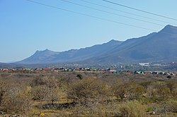
Steelpoort is a mining town on the R555 road in Sekhukhune District Municipality in the Limpopo province of South Africa. It is located on the border with Mpumalanga province.
Mpumalanga, also widely known as Hammarsdale, is a township located in the eThekwini Metropolitan Municipality in the KwaZulu-Natal province of South Africa. It is situated some 10 km south-south-east of Cato Ridge and some 50 km west of Durban. Derived from Zulu, the name means 'sunrise', 'the sun comes out'.
The R555 is a Regional Route in South Africa that connects Springs with Ohrigstad via Delmas, Ogies, Witbank, Middelburg, Stoffberg and Burgersfort.
Kiepersol is a village falling under Mbombela Local Municipality in the Mpumalanga, province of South Africa.
Mac-Mac is a historical area in the Mpumalanga province of South Africa, and the site of the country's earliest gold rush. It is located near the town of Sabie, 5 km from Pilgrim's Rest.