
Berkeley is a village located in Cook County, Illinois, United States. Incorporated in 1924, the population at the 2020 census was 5,338.
Chicago Ridge is a village in Cook County, Illinois, United States. Per the 2020 census, the population was 14,433.

East Hazel Crest is a village in Cook County, Illinois, in the United States. It is a south suburb of Chicago. As of the 2020 census, the village population was 1,297.

Evergreen Park is a village in Cook County, Illinois, United States. In 2020, the population was 19,943.
Frankfort is a village in Will County and Cook County in the U.S. state of Illinois. It is a southern suburb of Chicago, and is approximately 28 miles south the city. As of the 2020 census, the population was 20,296.
Hillside is a village in Cook County, Illinois, United States. As of the 2020 census it had a population of 8,320.

Riverside is a suburban village in Cook County, Illinois, United States. A significant portion of the village is in the Riverside Landscape Architecture District, designated a National Historic Landmark in 1970. The population of the village was 9,298 at the 2020 census, up from 8,875 at the 2010 census. It is a suburb of Chicago, located roughly 9 miles (14 km) west of downtown Chicago and 2 miles (3 km) outside city limits.

Stickney is a village in Cook County, Illinois, United States. The village is named for Alpheus Beede Stickney, a railroad executive who played a central role in establishing the Clearing Industrial District. Per the 2020 census, the population was 7,110. It was well known in the 1920s and early 1930s as the home for several bordellos linked to mobster Al Capone's empire.

Somonauk is a village in DeKalb and LaSalle Counties in the U.S. state of Illinois. The population was 1,786 at the 2020 Census, down from 1,893 at the 2010 Census.

West Chicago is a city in DuPage County, Illinois, United States. The population was 27,086 at the 2010 census. It was formerly named Junction and later Turner, after its founder, John B. Turner, president of the Galena and Chicago Union Railroad (G&CU) in 1855. The city was initially established around the first junction of railroad lines in Illinois, and today is still served by the Union Pacific West Metra service via West Chicago station.

Westmont is a village in DuPage County, Illinois, United States. Located approximately 18 miles (29 km) west of the Chicago Loop in the southeastern portion of DuPage County, Westmont is a community of 5.03 square miles in area with a 2020 population of 24,429.

Chebanse is a village in Iroquois and Kankakee counties in the U.S. state of Illinois. The population was 1,044 at the 2020 census. The Kankakee County portion of Chebanse is included in the Kankakee-Bradley, Illinois Metropolitan Statistical Area.
Reddick is a village in Kankakee County, Illinois, United States. A small portion of the village extends into Livingston County. The population was 163 at the 2010 census, down from 219 at the 2000 census.

Burnside is one of the 77 community areas in Chicago. The 47th numbered area, it is located on the city's far south side. This area is also called "The Triangle" by locals, as it is bordered by railroad tracks on every side; the Canadian National Railway on the west, the Union Pacific Railroad on the south and the Norfolk Southern Railway on the east. With a population of 2,254 in 2016, it is the least populous of the community areas, as well as the second smallest by area after Oakland.
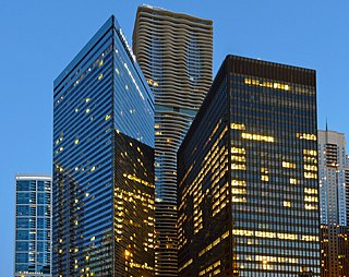
Illinois Center is a mixed-use urban development in downtown Chicago, Illinois, USA, lying east of Michigan Avenue. It is notable in that the streets running through it have three levels. Elsewhere in Chicago, some streets have two levels, with the lower level for through traffic and service vehicles and the upper level for other local traffic. In Illinois Center, the lower level has been split, with a middle level for through traffic and a lower level for service vehicles.

The Illinois Railway Museum is the largest railroad museum in the United States. It is located in the Chicago metropolitan area at 7000 Olson Road in Union, Illinois, 55 miles (89 km) northwest of downtown Chicago.

The Illinois Prairie Path is a network of 61 miles (98 km) of bicycle trails, mostly in DuPage County, Illinois. Portions of the trail extend west to Kane County and east to Cook County. Most of the trail is categorized as rail-to-trail, meaning that the bicycle path is built atop a converted former railroad right of way. In the case of the Prairie Path, the vast majority of its routing runs on the former right-of-way of the Chicago Aurora and Elgin Railroad.
The Beverly/Morgan Railroad District is a historic district in the Beverly, Morgan Park, and Washington Heights community areas of Chicago, Illinois, United States. It was designated a Chicago Landmark on April 15, 1995.
Old Edgebrook is a historic district and neighborhood in the Forest Glen community area of Chicago, Illinois, United States.

The Edward C. Waller Apartments are located from 2840 to 2858 W. Walnut Street in Chicago, Illinois. They were designed by Frank Lloyd Wright and built in 1895 and named after Edward C. Waller, a prominent Chicago developer after the 1871 fire. Waller and Wright collaborated on the Waller apartments and the Francisco Terrace apartments to execute Waller's pioneering idea of subsidizing lower income housing. Each apartment was designed with a parlor, chamber (bedroom), dining room, kitchen, bathroom, and closets.
