Related Research Articles

Purcell is a city in and the county seat of McClain County, Oklahoma, United States. As of the 2020 census, the city population was 6,651, a 13% increase from 2010.
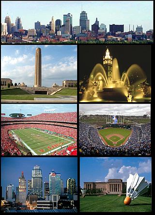
The Kansas City metropolitan area is a bi-state metropolitan area anchored by Kansas City, Missouri. Its 14 counties straddle the border between the U.S. states of Missouri and Kansas. With 8,472 square miles (21,940 km2) and a population of more than 2.2 million people, it is the second-largest metropolitan area centered in Missouri and is the largest metropolitan area in Kansas, though Wichita is the largest metropolitan area centered in Kansas. Alongside Kansas City, Missouri, these are the suburbs with populations above 100,000: Overland Park, Kansas; Kansas City, Kansas; Olathe, Kansas; Independence, Missouri; and Lee's Summit, Missouri.

West Hills is a neighborhood in the western San Fernando Valley region of the city of Los Angeles, California. It is bordered by mountain ranges to the west and the Los Angeles neighborhoods of Chatsworth to the north, Canoga Park to the east, and Woodland Hills to the south.
Oklahoma City's Asia District, also known as the Asian District, is the center of Asian culture and International cuisine and commerce in the state of Oklahoma. It contains the largest population of Asian Americans and descendants from Asia in the state.
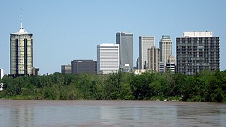
Tulsa is the second-largest city in the state of Oklahoma. It has many diverse neighborhoods due to its size.
The City of Oklahoma City uses Special Zoning Districts as a tool to maintain the character of many neighborhood communities.

The neighborhoods of Milwaukee include a number of areas in southeastern Wisconsin within the state's largest city at nearly 600,000 residents.
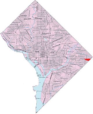
Capitol View is a neighborhood located in southeast Washington, D.C., in the United States. It is bounded by East Capitol Street to the north, Central Avenue SE to the southwest and south, and Southern Avenue SE to the southeast.

The Central Business District is one of seven development districts in Saskatoon, Saskatchewan, Canada. The central business district is Ward 6 of a Mayor-Council government represented by councillor Cynthia Block. Formerly called West Saskatoon, this area arose when the steam engines built their pumping stations on the lower west bank of the South Saskatchewan River. Retail enterprises sprang up around the newly created train station and rail yards. The city of Saskatoon's Central Business District has shopping malls and boutiques.
The city of San Antonio in the U.S. state of Texas is composed of a number of neighborhoods and districts, spreading out surrounding the central Downtown Area.
Uptown is an area of Oklahoma City. It is often bounded by the northernmost edge of downtown Oklahoma to south, and Northwest 23rd Street to the north. The area is known for its upper-scale classical houses, its bar and nightlife district, and being a major cultural hub of Oklahoma City.

Downtown is the central economic, political, and cultural district of the city of Providence, Rhode Island, United States. It is bounded on the east by Canal Street and the Providence River, to the north by Smith Street, to the west by Interstate 95, and to the south by Henderson Street. The highway serves as a physical barrier between the city's commercial core and neighborhoods of Federal Hill, West End, and Upper South Providence. Most of the downtown is listed on the National Register of Historic Places as the Downtown Providence Historic District.
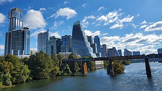
Downtown Austin is the central business district of Austin, Texas, United States. The area of the district is bound by Lamar Boulevard to the west, Martin Luther King Jr. Boulevard to the north, Interstate 35 to the east, and Lady Bird Lake to the south.

Downtown Saint Paul is the central business district of Saint Paul, Minnesota, United States. Its boundaries are the Mississippi River to the south, University Avenue to the north, US 52 to the east, and Kellogg Boulevard to the west. It is bounded by the Dayton's Bluff, Summit-University, West Seventh, Frogtown, West Side, and Payne-Phalen neighborhoods. The West Side neighborhood is on the other side of the river, and can be accessed via the Robert Street Bridge or the Wabasha Street Bridge. Interstate 35E and Interstate 94 run through the north side of the neighborhood, providing a separation between the Minnesota State Capitol and other state government buildings with the rest of downtown.
John A. Brown was an Oklahoma department store chain. It operated under that name from 1932, when its founder bought out its predecessor and renamed the chain for himself. After Mr. Brown died in 1940, his widow took over management until her own death in 1967, forcing a change in ownership. Dayton-Hudson, another retail company, continued operating the chain under the Brown name, until 1984, when Dayton-Hudson sold the Brown chain to Dillard's, another national chain, which combined all of the Brown stores under its own name. The flagship store on West Main Street was closed in 1974 and was subsequently razed as part of an urban renewal project. The project was supposed to result in a new shopping center known as the Galleria. However, the project was never completed, so the Brown chain never returned to downtown.

The Arts & Entertainment District, or previously known as Omni, is a neighborhood of Downtown Miami, Florida. It is bound roughly by North 19th Street to the north, North 10th Street to the south, North West 2nd Avenue to the west, and Biscayne Boulevard to the east.
Hancock is a neighborhood in Austin, Texas. Located in North Central Austin, Hancock encompasses ZIP code 78751 and 78705.

Manchester, the largest city in New Hampshire, is made up of 25 neighborhoods, according to the Manchester Planning Board in its 2010 master plan. Recognition of particular neighborhoods varies, with some having neighborhood associations, but none have any legal or political authority.
South Central is a neighborhood in Wichita, Kansas, United States. A mixed commercial and residential area on the east bank of the Arkansas River, it is among the city’s oldest neighborhoods.
References
- 1 2 "The changing face of Capitol Hill," The Vent (accessed May 26, 2010).
- 1 2 3 4 About Capitol Hill Archived June 29, 2010, at the Wayback Machine (accessed May 26, 2010).
- ↑ "Oklahoma River". Maps 3. Oklahoma City. Retrieved March 1, 2023.
- ↑ Macis, Candice. "The Proof of Capitol Hill's Deep History". Oklahoma Gazette. Retrieved March 1, 2023.
- 1 2 3 Oklahoma City Public Schools Archived 2010-02-18 at the Wayback Machine (accessed May 26, 2010).