History
Castle Heights was established in 1922, and many of the single family residences date from the 1920s to the 1940s and were built in the Spanish Revival style. [1] The last tract of homes was completed in 1962, and many of the multi-family buildings date from around that time. [2]
The second phase of the Expo Line runs adjacent to the neighborhood, along the Santa Monica Freeway, and the Palms Station is located at the border of Castle Heights and Palms. [3]
Castle Heights has historically been less affluent than the surrounding neighborhoods of Cheviot Hills and Beverlywood. Many of the residents are employees at local movie studios, as the neighborhood is a short drive from both Fox Studios and Sony Studios. [1]

Culver City is a city in Los Angeles County, California, United States. As of the 2020 census, the population was 40,779.

Century City is a 176-acre neighborhood and business district in Los Angeles, California. Located on the Westside to the south of Santa Monica Boulevard around 10 miles (16 km) west of Downtown Los Angeles, Century City is one of the most prominent employment centers in the Los Angeles metropolitan area, and its skyscrapers form a distinctive skyline on the city's westside.

Palms is a community in the Westside region of Los Angeles, California, founded in 1886 and the oldest neighborhood annexed to the city, in 1915. The 1886 tract was marketed as an agricultural and vacation community. Today it is a primarily residential area, with many apartment buildings, ribbons of commercial zoning and a single-family residential area in its northwest corner. As of the 2000 census the population of Palms was 42,545.
The Los Angeles Westside is an urban region in western Los Angeles County, California. It has no official definition, but sources like LA Weekly and the Mapping L.A. survey of the Los Angeles Times place the region on the western side of the Los Angeles Basin south of the Santa Monica Mountains.
Beverlywood is a neighborhood in the Westside of the city of Los Angeles, California.

Mar Vista is a neighborhood on the Westside of Los Angeles, California. In 1927, Mar Vista became the 70th community to be annexed to Los Angeles. It was designated as an official city neighborhood in 2006.

Pico-Union is a neighborhood in Central Los Angeles, California. The name "Pico-Union" refers to the neighborhood that surrounds the intersection of Pico Boulevard and Union Avenue. Located immediately west of Downtown Los Angeles, it is home to over 40,000 residents.
West Los Angeles is an area within the city of Los Angeles, California. The residential and commercial neighborhood is divided by the Interstate 405 freeway, and each side is sometimes treated as a distinct neighborhood, mapped differently by different sources. Each lies within the larger Westside region of Los Angeles County.

West Adams is a historic neighborhood in the South Los Angeles region of Los Angeles, California. The area is known for its large number of historic buildings, structures and notable houses and mansions.

Rancho Park is a residential neighborhood in the Westside of the city of Los Angeles, California with mostly single family homes and tree lined streets. The community is nestled between West Los Angeles and Cheviot Hills. This enclave draws young professionals and families and is home to residents working in a variety of professional occupations. History proves the neighborhood was once a part of Westwood until Olympic Blvd. was placed dividing the area North and South. The Southern section, now known as Rancho Park, felt cut off from its North side lobbying for its own identity in the 1930s.

Angelino Heights, alternately spelled Angeleno Heights, is one of the oldest neighborhoods in Los Angeles. Situated between neighboring Chinatown and Echo Park, the neighborhood is known for its concentration of eclectic architectural styles from three eras: The Victorian, Turn of the Century and Revival eras. Carroll Avenue is listed on the National Register of Historic Places and there are over thirty Historic-Cultural Monuments in the neighborhood.
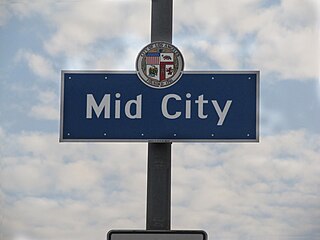
Mid City is a neighborhood in Central Los Angeles, California.

South Robertson is an area on the Westside of Los Angeles that is served by the South Robertson neighborhood council. It contains the following city neighborhoods: Beverlywood, Castle Heights, Cheviot Hills, Crestview, La Cienega Heights and Reynier Village. The area is notable as a center for the Jewish community.
Pico Boulevard is a major Los Angeles street that runs from the Pacific Ocean at Appian Way in Santa Monica to Central Avenue in Downtown Los Angeles, California, United States. It is named after Pío Pico, the last Mexican governor of Alta California.

Robertson Boulevard is a street in Los Angeles, in the U.S. state of California, that also passes through the incorporated cities of West Hollywood, Beverly Hills, and Culver City.
Beverly Glen is a neighborhood in the Santa Monica Mountains region of Los Angeles, California, located around Beverly Glen Boulevard north of Sunset Boulevard and south of Mulholland Drive. Stone Canyon Reservoir lies in the neighborhood.

Beverly Drive is a major north–south roadway in Beverly Hills and Los Angeles.
Cheviot Hills is a neighborhood on the Westside of the city of Los Angeles, California.

Reynier Village is a neighborhood on the Westside of Los Angeles, California.

West Adams Heights is a neighborhood in Central Los Angeles, California. It contains three Los Angeles Historic-Cultural Monuments.


