
Worcestershire is a ceremonial county in the West Midlands of England. It is bordered by Shropshire, Staffordshire, and the West Midlands county to the north, Warwickshire to the east, Gloucestershire to the south, and Herefordshire to the west. The city of Worcester is the largest settlement and the county town.

Kidderminster is a market town and civil parish in Worcestershire, England, 20 miles (32 km) south-west of Birmingham and 12 miles (19 km) north of Worcester. Located north of the River Stour and east of the River Severn, in the 2021 census, it had a population of 57,400. The town is twinned with Husum, Germany.

Droitwich Spa is an historic spa town in the Wychavon district in northern Worcestershire, England, on the River Salwarpe. It is located approximately 22 miles (35 km) south-west of Birmingham and 7 miles (11 km) north-east of Worcester.

Bromsgrove is a town in Worcestershire, England, about 16 miles (26 km) north-east of Worcester and 13 miles (21 km) south-west of Birmingham city centre. It had a population of 34,755 in at the 2021 census. It gives its name to the wider Bromsgrove District, of which it is the largest town and administrative centre. In the Middle Ages, it was a small market town, primarily producing cloth through the early modern period. In the eighteenth and nineteenth centuries, it became a major centre for nail making.

Redditch is a town and borough in Worcestershire, England. It is located south of Birmingham, east of Bromsgrove, northwest of Alcester and northeast of Worcester. The borough had a population of 87,037 in 2021. In the 19th century, it became a centre for the needle and fishing tackle industry.

Bromsgrove is a local government district in north-east Worcestershire, England. It is named after its only town, Bromsgrove, where its council is based, but also includes several villages and surrounding rural areas. It borders the built-up area of Birmingham to the north. Other places in the district include Alvechurch, Aston Fields, Belbroughton, Catshill, Clent, Hagley, Rubery, Stoke Prior and Wythall. The population at the 2021 census was 99,475.

Alvechurch is a large village and civil parish in the Bromsgrove district in northeast Worcestershire, England, in the valley of the River Arrow. The Lickey Hills Country Park is 2.5 miles (4 km) to the northwest. It is 11 miles south of Birmingham, 5 mi (8 km) north of Redditch and 6 mi (10 km) east of Bromsgrove. At the 2001 census, the population was 5,316.
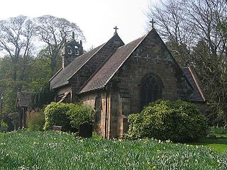
Cofton Hackett is a village and civil parish in the Bromsgrove District of north east Worcestershire, England. It is 10+1⁄4 miles southwest of the city centre of Birmingham and 16 miles (26 km) northeast of Worcester. In 2011, the village had a population of 1,893 but with housing development on the former Austin Rover site, this is expected to double over the five years to 2023. The village is served by two main bus services, these being the 20 and 145/145A operated by National Express and Diamond Bus respectively.

Wychbold is a village in the Wychavon district of Worcestershire. The village is situated on the A38 between Droitwich Spa and Bromsgrove, and by Junction 5 of the M5 motorway.

Hockley Heath is a large village and civil parish in the Arden area mostly within the Metropolitan Borough of Solihull, West Midlands, England. It incorporates the hamlet of Nuthurst, and has a history dating back to the year 705 AD as a wood owned by Worcester Cathedral. The parish, known as Nuthurst cum Hockley Heath, is to the south of the West Midlands conurbation, 12 miles (19 km) southeast of Birmingham 5.5 miles (8.9 km) from Solihull town centre and 13 miles (21 km) north of Stratford-upon-Avon. The village forms part of the border with Warwickshire and the District of Stratford-on-Avon to the south, with some parts of the village on either side of the border. According to the 2001 census, the parish had a population of 6,771, being measured at the 2011 Census as 2,038.
Bromsgrove District Council elections are held every four years. Bromsgrove District Council is the local authority for the non-metropolitan district of Bromsgrove in Worcestershire, England. Since the last boundary changes in 2015, 31 councillors are elected from 30 wards.

Hagley is a village and civil parish in Worcestershire, England. It is on the boundary of the West Midlands and Worcestershire counties between the Metropolitan Borough of Dudley and Kidderminster. Its estimated population was 7,162 in 2019.

Marlbrook is a village in Worcestershire, England.

Dodford is a village in the Bromsgrove district of Worcestershire, England, approximately 3 miles (4.8 km) west of Bromsgrove, officially founded on 2 July 1849 by members of the Chartist movement. It was one of five settlements created in the land scheme and retains a characteristic grid street plan, along with narrow lanes and many plum and pear trees from its market gardening past. The civil parish of Dodford with Grafton has a population of 731.
Bus transport in Bromsgrove has a long and varied history, dating back to Midland Red operations. In recent years, however, First Midland Red, which has evolved from the original Midland Red company, has severely reduced operations, leaving many independent operators running in the town.
Roy Martin Haines, was a British historian.

Worcestershire bus route 144 is a bus service connecting the Worcestershire areas of Catshill, Bromsgrove. Droitwich and Worcester, operated by First Worcestershire. The service dates back to 1914 and was one of the longest-running double-deck bus operated routes, though it is now more common for single decked buses to be used.

The administrative boundaries of Worcestershire, England have been fluid for over 150 years since the first major changes in 1844. There were many detached parts of Worcestershire in the surrounding counties, and conversely there were islands of other counties within Worcestershire. The 1844 Counties Act began the process of eliminating these, but the process was not completed until 1966, when Dudley was absorbed into Staffordshire.

