Rugby is a market town in eastern Warwickshire, England, close to the River Avon. At the 2021 census, its population was 78,117, making it the second-largest town in Warwickshire. It is the main settlement within the larger Borough of Rugby, which had a population of 114,400 in 2021.

The M6 motorway is the longest motorway in the United Kingdom. It is located entirely within England, running for just over 230 miles (370 km) from the Midlands to the border with Scotland. It begins at Junction 19 of the M1 and the western end of the A14 at the Catthorpe Interchange, near Rugby before heading north-west. It passes Coventry, Birmingham, Wolverhampton, Stoke-on-Trent, Preston, Lancaster and Carlisle before terminating at Junction 45 near Gretna. Here, just short of the Scottish border it becomes the A74(M) which continues to Glasgow as the M74. Its busiest sections are between junctions 4 and 10a in the West Midlands, and junctions 16 to 19 in Cheshire; these sections have now been converted to smart motorways.

The M1 motorway connects London to Leeds, where it joins the A1(M) near Aberford, to connect to Newcastle. It was the first inter-urban motorway to be completed in the UK; the first motorway in the country was the Preston Bypass, which later became part of the M6.

The M45 is a motorway in Northamptonshire and Warwickshire, England and is 7.9 miles (12.7 km) long. It runs between junction 17 of the M1 motorway south east of Rugby and a junction with the A45 road southwest of Rugby. It has one of the lowest traffic volumes of the United Kingdom motorway system.
Lutterworth is a market town and civil parish in the Harborough district of Leicestershire, England. The town is located in southern Leicestershire, close to the borders with Warwickshire and Northamptonshire. It is located 6.4 miles north of Rugby, Warwickshire and 12 miles south of Leicester.

The A14 is a major trunk road in England, running 127 miles (204 km) from Catthorpe Interchange, a major intersection at the southern end of the M6 and junction 19 of the M1 in Leicestershire to the Port of Felixstowe, Suffolk. The road forms part of the unsigned Euroroutes E24 and E30. It is the busiest shipping lane in East Anglia carrying anything from cars to large amounts of cargo between the UK and Mainland Europe.
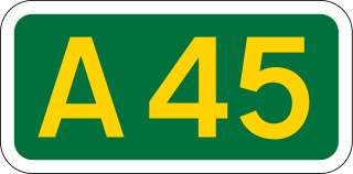
The A45 is a major road in England. It runs east from Birmingham past the National Exhibition Centre and the M42, then bypasses Coventry and Rugby, where it briefly merges with the M45 until it continues to Daventry. It then heads to Northampton and Wellingborough before running north of Rushden and Higham Ferrers and terminating at its junction with the A14 in Thrapston.

The A426 road is a road in England which runs from the city of Leicester to the market town of Southam in Warwickshire via the towns of Lutterworth and Rugby.

Yelvertoft is a village and civil parish in West Northamptonshire, England. At the time of the 2001 census, the parish's population was 821 people, reducing to 764 at the 2011 Census, increasing again to 804 at the 2021 census.
Thornby is a village and civil parish in West Northamptonshire in England. It has a Manor house. At the time of the 2001 census, the parish's population was 162 people, increasing to 189 at the 2011 Census. The village is bisected by the A5199 road between Northampton and Leicester and about 11 miles (17.7 km) north-west of Northampton town centre. It is about 1½ miles south of a junction with the A14 road which joins the M1 Motorway and M6 junction at Catthorpe with Felixstowe, Suffolk.

Lilbourne is a village and civil parish in West Northamptonshire in England. It is close to the M1 motorway which runs east of the village, and the A5 road, west of the village which marks the boundary with Warwickshire, slightly to the north is the River Avon which marks the boundary with Leicestershire. At the time of the 2001 census, the parish's population was 254 people, increasing to 273 at the 2011 Census, and further to 305 at the 2021 census.
Hollowell is a village and civil parish in West Northamptonshire in England. At the time of the 2001 census, the parish's population, including the nearby hamlet of Teeton, was 353 people, increasing to 385 at the 2011 Census. The village was originally a hamlet of Guilsborough, becoming a separate parish from 1850. Hollowell is mentioned in the Domesday Survey of 1086 as belonging the Bishop of Lincoln having "... 4 villeins with 1 bordar having 1 plough. It was, and is worth, 10 schillings. Bardi held (it) freely."

Clay Coton is a village in West Northamptonshire in England. The population of the civil parish at the 2011 census was 271. The nearest large town is Rugby, Warwickshire, about 7 miles (11.3 km) away by road. The village is close to the M1 Motorway with its junction (known as Catthorpe Interchange with the M6 and A14 road which runs very close to the north.
The A427 road is a major road in the English Midlands. It connects the Leicestershire town of Market Harborough and the A6 with the Northamptonshire town of Oundle and the A605.
Harborough Magna is a village and civil parish in Warwickshire, England. The civil parish which also contains the nearby hamlets of Harborough Parva and Cathiron, had a population of 502 at the 2011 Census, decreasing to 481 at the 2021 Census.
The Catthorpe Interchange is a major intersection at the southern end of the M6, the western end of the A14 and junction 19 of the M1 near the village of Catthorpe in Leicestershire, England. It was developed in 1994 when the link to the A14 was added to the pre-existing M1/M6 junction by joining the M1, M6 and A14 to the country lane between Catthorpe and Swinford as part of the Trans European Road Network,.
A smart motorway, also known in Scotland as an intelligent transport system, is a section of motorway in the United Kingdom that employs active traffic management (ATM) techniques to increase capacity through the use of MIDAS technology including variable speed limits and occasionally hard shoulder running and ramp metering at busy times. They were developed at the turn of the 21st century as a cost-effective alternative to traditional carriageway widening, with intended benefits ranging from more reliable journey times to lower vehicle emissions. However, despite the risk of a collision occurring between two moving vehicles being found to be decreased, there has been an acknowledged rise in the incidence of collisions involving vehicles where at least one was stationary in the first few years following the widespread removal of the hard shoulder on the country's busiest sections of motorway. Smart motorways garnered intense criticism from politicians, police representatives and motoring organisations, particularly from 2020 onwards, after a surge in near miss incidents and dozens of fatalities were revealed, and as of April 2023, no new smart motorways will be built.
Rugby services is a motorway service station operated by Moto Hospitality and situated at junction 1 of the M6 motorway in Warwickshire, England.