Cauquenes

Last updated
Cauquenes
Edificio civico cauquenes.JPG


Escudo de Armas de Cauquenes.png
Comuna de Cauquenes.svg
Chile location map.svg
Red pog.svg
Cauquenes
Location in Chile
Coordinates: 35°58′S72°21′W / 35.967°S 72.350°W / -35.967; -72.350
Country Chile
Region Maule
Province Cauquenes
Founded1742
Government
  Type Municipality
   Alcalde Juan Carlos Muñoz Rojas (RN)
Area
[3]
  Total2,126.3 km2 (821.0 sq mi)
 As of 2002
Elevation
135 m (443 ft)
Population
 (2012 Census) [3]
  Total38,522
  Density18/km2 (47/sq mi)
   Urban
30,771
   Rural
10,446
Demonym Cauquenino
Sex
[3]
  Men20,092
  Women21,125
Time zone UTC-4 (CLT [4] )
  Summer (DST) UTC-3 (CLST [5] )
Postal code
3690000
Area code 56 + 73
Climate Csb
Website Official website (in Spanish)

Cauquenes, a city and commune in Chile, is the capital of the Cauquenes Province and is located in the Maule Region.

Contents

History

According to the historical records of Alonso de Ercilla, Cauquenes was originally inhabited by an indigenous community of the Promaucaes, known as the Cauqui by the Inca [6] or cauquenes [7] by the Spanish and that gave their name to Cauquenes River. They lived to the south of the Maule River and north of the Itata River and owned a settlement in the place where the city lies today. The city of Cauquenes was founded on May 9, 1742, de "Villa of Nuestra Señora de las Mercedes de José de Manso del Tutuvén", in the land located between the rivers Tutuvén and Cauquenes, that the Promaucae cacique (chieftain) Ascensio Galdámez and his wife Micaela de Araya donated to the Kingdom of Spain. Cauquenes' founder was the then Governor of the Kingdom of Chile, José Antonio Manso de Velasco. The name of the city changed with time. With the law of 20 August 1826, which created the Maule Province, it became called "Villa de Cauquenes", and finally on 22 December of that year, it acquired the title of "Cauquenes".

Cauquenes is a toponym from the term "cauque", a salmonid species extinct today that inhabited the rivers of the area.

Kiosk in the Central Square of Cauquenes. Kiosko plaza cauquenes.jpg
Kiosk in the Central Square of Cauquenes.

27 February 2010 earthquake

Cauquenes was damaged by the 8.8 magnitude earthquake and subsequent tsunami. Restoring power in the city in the immediate aftermath was impossible because of damage from the tsunami. [8]

Demography

According to the 2002 census of the National Statistics Institute, Cauquenes spans an area of 2,126.3 km2 (821 sq mi) and has 41,217 inhabitants (20,092 men and 21,125 women). Of these, 30,771 (74.7%) lived in urban areas and 10,446 (25.3%) in rural areas. Between the 1992 and 2002 censuses, the population grew by 2.3% (938 persons). [3]

Other localities in the commune of Cauquenes include the following:

Geography

Administration

As a commune, Cauquenes is a third-level administrative division of Chile administered by a municipal council, headed by an alcalde who is directly elected every four years. The 2008-2012 alcalde is Juan Carlos Muñoz Rojas (RN).The municipal council has the following members: [1] [2]

Within the electoral divisions of Chile, Cauquenes is represented in the Chamber of Deputies by Ignacio Urrutia (UDI), Rolando Rentería (UDI), Manuel Matta (PDC) and Jaime Naranjo (PS) as part of the 18th electoral district. The commune is represented in the Senate Ximena Rincón González (PDC), Juan Castro Prieto (Ind-RN), Rodrigo Galilea Vial (RN), Juan Antonio Coloma Correa (UDI) and Álvaro Elizalde Soto (PS) as part of the 9th senatorial constituency (Maule).

Climate

Climate data for Cauquenes
MonthJanFebMarAprMayJunJulAugSepOctNovDecYear
Mean daily maximum °C (°F)29.2
(84.6)
28.3
(82.9)
26.6
(79.9)
22.3
(72.1)
17.8
(64.0)
13.8
(56.8)
13.5
(56.3)
14.7
(58.5)
17.5
(63.5)
19.5
(67.1)
23.6
(74.5)
26.3
(79.3)
21.1
(70.0)
Daily mean °C (°F)22.0
(71.6)
20.2
(68.4)
21.6
(70.9)
14.6
(58.3)
13.9
(57.0)
9.8
(49.6)
8.7
(47.7)
9.8
(49.6)
11.6
(52.9)
13.6
(56.5)
18.1
(64.6)
19.9
(67.8)
15.3
(59.6)
Mean daily minimum °C (°F)12.8
(55.0)
11.6
(52.9)
9.9
(49.8)
7.7
(45.9)
6.3
(43.3)
5.2
(41.4)
4.0
(39.2)
3.8
(38.8)
5.0
(41.0)
6.4
(43.5)
8.8
(47.8)
11.2
(52.2)
7.7
(45.9)
Average precipitation mm (inches)8.1
(0.32)
6.5
(0.26)
15.5
(0.61)
36.8
(1.45)
110.3
(4.34)
153.3
(6.04)
131.4
(5.17)
97.2
(3.83)
56.9
(2.24)
29.5
(1.16)
15.8
(0.62)
9.5
(0.37)
670.8
(26.41)
Source: Meteorología Interactiva [9]

Related Research Articles

<span class="mw-page-title-main">Parral, Chile</span> City and Commune in Maule, Chile

Parral is a city and commune in the Linares Province of Chile's Maule Region.

<span class="mw-page-title-main">Talca</span> City in Chile

Talca is a city and commune in Chile located about 255 km (158 mi) south of Santiago, and is the capital of both Talca Province and Maule Region. As of the 2012 census, the city had a population of 201,142.

<span class="mw-page-title-main">Peñalolén</span> City and Commune in Santiago Metro., Chile

Peñalolén is a Chilean commune in Santiago Province, Santiago Metropolitan Region. It was founded on 15 November 1984.

<span class="mw-page-title-main">San Javier, Chile</span> City and Commune in Maule, Chile

San Javier is a Chilean city and commune located in the Province of Linares, Maule Region. The city lies in the geographical center of the country, some 270 km (168 mi) south of Santiago, 31 km (19 mi) to the northwest of the provincial capital, Linares, and 24 km (15 mi) to the south of Talca, the regional capital. The Pan-American Highway passes through the commune of San Javier, touching tangentially the eastern side of the town. A paved road connects San Javier with Colbún, Colbún dam lake and Panimávida and Quinamávida hot springs.

<span class="mw-page-title-main">Villa Alegre, Chile</span> City and Commune in Maule, Chile

Villa Alegre a commune and city located in Linares Province, Maule Region of Chile. With 189.8 km2 (73 sq mi), Villa Alegre is the smallest commune by area in the Maule Region. It sits 92 m (302 ft) above sea level.

<span class="mw-page-title-main">Pelluhue</span> Town and Commune in Maule, Chile

Pelluhue is a town and commune in the Cauquenes Province of central Chile's seventh region of Maule.

<span class="mw-page-title-main">Chanco, Chile</span> Town and Commune in Maule, Chile

Chanco is a Chilean town and commune located in Cauquenes Province, Maule Region.

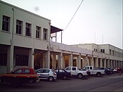
Colbún is a Chilean town and commune in Linares Province, Maule Region. The commune has a population of over 17,000 inhabitants and covers an area of 2,900 km2 (1,120 sq mi), making it the province's largest. Its capital, the town of Colbún, has 3,679 inhabitants. It is 7 km (4 mi) west of the center of continental Chile.

<span class="mw-page-title-main">Longaví</span> City and Commune in Maule, Chile

Longaví is a Chilean city and commune located in Linares Province, one of the four provinces that make up the Maule Region, in the geographical center of Chile.

Retiro is a town and commune in Chile, located in Linares Province, in the seventh region of Maule.

<span class="mw-page-title-main">San Clemente, Chile</span> City and Commune in Maule, Chile

San Clemente is a city and commune administered by the municipality of San Clemente, located in the Talca Province of Chile's Maule Region.

Pencahue is a town and commune in Chile, located in Talca Province, in the seventh region of Maule. The commune spans and area of 956.8 km2 (369 sq mi).

<span class="mw-page-title-main">El Monte, Chile</span> City and Commune in Santiago, Chile

El Monte is a Chilean city and commune in Talagante Province, Santiago Metropolitan Region. As of 2007, it had a population of 29,568.

Maule is a town and commune in Talca Province in central Chile's Maule Region. It takes its name from the Mapudungun words for "valley" (mau) and "rainy" (len).

Melipilla is a Chilean commune and capital city of the province of the same name. It is part of the Santiago Metropolitan Region and is a significant satellite city of the Chilean capital.

<span class="mw-page-title-main">Ñiquén</span> Commune in Ñuble, Chile

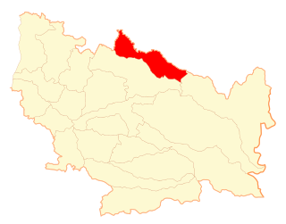
Ñiquén is a commune of the Punilla Province, located in the north of the Ñuble Region of Chile. Geographically, it is delimited by the Perquilauquén River to the north and the Ñiquén River in the south. Its boundary to the north is the commune of Parral and to the west that of Cauquenes both in the Maule Region, to the south with the commune of San Carlos, and to the east with San Fabian de Alico. The town of San Gregorio is the capital of this commune.

<span class="mw-page-title-main">Talagante</span> City and Commune in Santiago Metro., Chile

Talagante is a commune and the capital city of the province of the same name in the Santiago Metropolitan Region of central Chile. The word Talagante in Quechua comes from talacanta, meaning "Lazo de Hechicero", which was the proper name of the curaca, or ruler, who dominated this central valley on behalf of the Inca empire during the arrival of the Spaniards.

San Pedro is a commune of the Melipilla Province in central Chile's Santiago Metropolitan Region.

Santa María is a city and commune in the San Felipe de Aconcagua Province of central Chile's Valparaíso Region.

Nogales is a city and commune in the Quillota Province of central Chile's fifth region of Valparaíso.

References

  1. 1 2 "Asociación Chilena de Municipalidades" (in Spanish). Retrieved 7 February 2011.
  2. 1 2 "Municipality of Cauquenes" (in Spanish). Retrieved 7 February 2011.
  3. 1 2 3 4 "National Statistics Institute" (in Spanish). Retrieved 1 May 2010.
  4. "Chile Time". WorldTimeZones.org. Archived from the original on 2007-09-11. Retrieved 2010-07-29.
  5. "Chile Summer Time". WorldTimeZones.org. Archived from the original on 2007-09-11. Retrieved 2010-07-29.
  6. Inca Garcilaso de la Vega, Comentarios reales, 2da_VII_20 20
  7. Juan Ignacio Molina, Compendio de la historia civil del reyno de Chile, pg. 9.
  8. Wall Street Journal, "Chile Power Firms: Slow Process Restoring Power In Quake Zones", Matthew Cowley, 2 March 2010 (accessed 3 March 2010)
  9. "Información climatológica de estaciones chilenas" (in Spanish). Archived from the original on 5 December 2022. Retrieved 27 May 2024.