Cedar Vale, Kansas

Last updated

Cedar Vale, Kansas
Chautauqua County Kansas Incorporated and Unincorporated areas Cedar Vale Highlighted.svg
Location within Chautauqua County and Kansas
Map of Chautauqua Co, Ks, USA.png
Coordinates: 37°06′20″N96°30′00″W / 37.10556°N 96.50000°W / 37.10556; -96.50000 [1]
Country United States
State Kansas
County Chautauqua
Founded1870
Incorporated 1884
Area
[2]
  Total0.76 sq mi (1.95 km2)
  Land0.75 sq mi (1.95 km2)
  Water0.00 sq mi (0.00 km2)
Elevation
[1]
984 ft (300 m)
Population
 (2020) [3]
  Total476
  Density630/sq mi (240/km2)
Time zone UTC-6 (CST)
  Summer (DST) UTC-5 (CDT)
ZIP code
67024
Area code 620
FIPS code 20-11450
GNIS ID 2393777 [1]
Website cityofcedarvale.com

Cedar Vale is a city in Chautauqua County, Kansas, United States. [1] As of the 2020 census, the population of the city was 476. [3]

Contents

History

Cedar Vale was founded in 1870. [4] Its name is meant to be descriptive of the town's setting. [5]

Geography

According to the United States Census Bureau, the city has a total area of 0.76 square miles (1.97 km2), all of it land. [6]

Climate

The climate in this area is characterized by hot, humid summers and generally mild to cool winters. According to the Köppen Climate Classification system, Cedar Vale has a humid subtropical climate, abbreviated "Cfa" on climate maps. [7]

Demographics

Historical population
CensusPop.Note
1880 218
1890 640193.6%
1900 93245.6%
1910 9481.7%
1920 1,04410.1%
1930 1,000−4.2%
1940 952−4.8%
1950 1,0106.1%
1960 859−15.0%
1970 665−22.6%
1980 84827.5%
1990 760−10.4%
2000 723−4.9%
2010 579−19.9%
2020 476−17.8%
U.S. Decennial Census

2020 census

The 2020 United States census counted 476 people, 184 households, and 108 families in Cedar Vale. [8] [9] The population density was 631.3 per square mile (243.7/km2). There were 305 housing units at an average density of 404.5 per square mile (156.2/km2). [9] [10] The racial makeup was 79.41% (378) white or European American (78.36% non-Hispanic white), 1.89% (9) black or African-American, 9.24% (44) Native American or Alaska Native, 0.84% (4) Asian, 0.0% (0) Pacific Islander or Native Hawaiian, 0.63% (3) from other races, and 7.98% (38) from two or more races. [11] Hispanic or Latino of any race was 4.62% (22) of the population. [12]

Of the 184 households, 31.5% had children under the age of 18; 39.1% were married couples living together; 28.3% had a female householder with no spouse or partner present. 37.0% of households consisted of individuals and 19.6% had someone living alone who was 65 years of age or older. [9] The average household size was 2.3 and the average family size was 2.8. [13] The percent of those with a bachelor's degree or higher was estimated to be 8.8% of the population. [14]

28.2% of the population was under the age of 18, 9.0% from 18 to 24, 23.5% from 25 to 44, 19.1% from 45 to 64, and 20.2% who were 65 years of age or older. The median age was 36.7 years. For every 100 females, there were 89.6 males. [9] For every 100 females ages 18 and older, there were 85.9 males. [9]

The 2016-2020 5-year American Community Survey estimates show that the median household income was $36,098 (with a margin of error of +/- $3,674) and the median family income was $38,409 (+/- $15,446). [15] Males had a median income of $30,119 (+/- $5,278) versus $21,042 (+/- $7,447) for females. The median income for those above 16 years old was $25,893 (+/- $4,956). [16] Approximately, 31.5% of families and 26.0% of the population were below the poverty line, including 22.0% of those under the age of 18 and 30.4% of those ages 65 or over. [17] [18]

2010 census

As of the census [19] of 2010, there were 579 people, 251 households, and 144 families living in the city. The population density was 761.8 inhabitants per square mile (294.1/km2). There were 342 housing units at an average density of 450.0 per square mile (173.7/km2). The racial makeup of the city was 91.5% White, 0.3% African American, 3.5% Native American, 0.2% Asian, and 4.5% from two or more races. Hispanic or Latino of any race were 1.9% of the population.

There were 251 households, of which 30.7% had children under the age of 18 living with them, 41.8% were married couples living together, 10.8% had a female householder with no husband present, 4.8% had a male householder with no wife present, and 42.6% were non-families. 37.8% of all households were made up of individuals, and 19.2% had someone living alone who was 65 years of age or older. The average household size was 2.27 and the average family size was 2.98.

The median age in the city was 43.9 years. 25.4% of residents were under the age of 18; 7.3% were between the ages of 18 and 24; 18.1% were from 25 to 44; 27.2% were from 45 to 64; and 22.1% were 65 years of age or older. The gender makeup of the city was 50.3% male and 49.7% female.

2000 census

As of the census [20] of 2000, there were 723 people, 285 households, and 184 families living in the city. The population density was 758.8 inhabitants per square mile (293.0/km2). There were 344 housing units at an average density of 361.0 per square mile (139.4/km2). The racial makeup of the city was 92.67% White, 0.41% African American, 4.15% Native American, 1.11% from other races, and 1.66% from two or more races. Hispanic or Latino of any race were 2.07% of the population.

There were 285 households, out of which 29.5% had children under the age of 18 living with them, 51.9% were married couples living together, 8.4% had a female householder with no husband present, and 35.1% were non-families. 33.3% of all households were made up of individuals, and 22.5% had someone living alone who was 65 years of age or older. The average household size was 2.29 and the average family size was 2.91.

In the city, the population was spread out, with 24.6% under the age of 18, 4.6% from 18 to 24, 18.3% from 25 to 44, 23.5% from 45 to 64, and 29.0% who were 65 years of age or older. The median age was 47 years. For every 100 females, there were 92.8 males. For every 100 females age 18 and over, there were 84.7 males.

The median income for a household in the city was $27,031, and the median income for a family was $33,889. Males had a median income of $24,167 versus $19,688 for females. The per capita income for the city was $14,410. About 11.1% of families and 14.7% of the population were below the poverty line, including 19.2% of those under age 18 and 14.5% of those age 65 or over.

Education

The community is served by Cedar Vale USD 285 public school district.

Media

The Cedar Vale Star newspaper was created in 1884, and it continued until January 1894. [21] [22]

Related Research Articles

<span class="mw-page-title-main">Cedar Point, Kansas</span> City in Chase County, Kansas

Cedar Point is a city in Chase County, Kansas, United States. As of the 2020 census, the population of the city was 22. It is about 5 miles east of Florence and 0.5 miles south of U.S. Route 50 highway.

<span class="mw-page-title-main">Burlington, Kansas</span> City in Coffey County, Kansas, United States

Burlington is a city in and the county seat of Coffey County, Kansas, United States. As of the 2020 census, the population of the city was 2,634.

<span class="mw-page-title-main">McCune, Kansas</span> City in Crawford County, Kansas

McCune is a city in Crawford County, Kansas, United States. As of the 2020 census, the population of the city was 370.

<span class="mw-page-title-main">Jennings, Kansas</span> City in Decatur County, Kansas

Jennings is a city in Decatur County, Kansas, United States. As of the 2020 census, the population of the city was 81.

<span class="mw-page-title-main">Gove City, Kansas</span> City in Gove County, Kansas

Gove City, more commonly known as Gove, is a city in and the county seat of Gove County, Kansas, United States. As of the 2020 census, the population of the city was 80.

<span class="mw-page-title-main">Ensign, Kansas</span> City in Gray County, Kansas

Ensign is a city in Gray County, Kansas, United States. As of the 2020 census, the population of the city was 166. It is located along U.S. Route 56 highway.

<span class="mw-page-title-main">Hamilton, Kansas</span> City in Greenwood County, Kansas

Hamilton is a city in Greenwood County, Kansas, United States. As of the 2020 census, the population of the city was 182.

<span class="mw-page-title-main">Denison, Kansas</span> City in Jackson County, Kansas

Denison is a city in Jackson County, Kansas, United States. As of the 2020 census, the population of the city was 146.

<span class="mw-page-title-main">Edgerton, Kansas</span> City in Kansas, United States

Edgerton is a city in Johnson County, Kansas, United States, and part of the Kansas City metropolitan area. As of the 2020 census, the population of the city was 1,748. It is home to a large BNSF intermodal train facility named Logistics Park Kansas City.

<span class="mw-page-title-main">Mission, Kansas</span> City in Kansas, United States

Mission is a city in Johnson County, Kansas, United States, and part of the Kansas City Metropolitan Area. As of the 2020 census, the population of the city was 9,954.

<span class="mw-page-title-main">Kingman, Kansas</span> City in Kingman County, Kansas

Kingman is a city in and the county seat of Kingman County, Kansas, United States. As of the 2020 census, the population of the city was 3,105.

<span class="mw-page-title-main">Meade, Kansas</span> City in Meade County, Kansas

Meade is a city in and the county seat of Meade County, Kansas, United States. As of the 2020 census, the population of the city was 1,505.

<span class="mw-page-title-main">Brownell, Kansas</span> City in Ness County, Kansas

Brownell is a city in Ness County, Kansas, United States. As of the 2020 census, the population of the city was 23.

<span class="mw-page-title-main">Ness City, Kansas</span> City in Ness County, Kansas

Ness City is a city in and the county seat of Ness County, Kansas, United States. As of the 2020 census, the population of the city was 1,329. Ness City is famous for its four-story Old Ness County Bank Building located downtown, and nicknamed Skyscraper of the Plains.

<span class="mw-page-title-main">Lyndon, Kansas</span> City in Osage County, Kansas

Lyndon is a city in, and the county seat of Osage County, Kansas, United States. As of the 2020 census, the population of the city was 1,037.

<span class="mw-page-title-main">Minneapolis, Kansas</span> City in Ottawa County, Kansas

Minneapolis is a city in and the county seat of Ottawa County, Kansas, United States. As of the 2020 census, the population of the city was 1,946.

<span class="mw-page-title-main">Louisville, Kansas</span> City in Pottawatomie County, Kansas

Louisville is a city in Pottawatomie County, Kansas, United States. As of the 2020 census, the population of the city was 131.

<span class="mw-page-title-main">Onaga, Kansas</span> City in Pottawatomie County, Kansas

Onaga is a city in Pottawatomie County, Kansas, United States. As of the 2020 census, the population of the city was 679.

<span class="mw-page-title-main">Belleville, Kansas</span> City in Republic County, Kansas

Belleville is a city in and the county seat of Republic County, Kansas, United States. As of the 2020 census, the population of the city was 2,007.

<span class="mw-page-title-main">Cedar, Kansas</span> City in Smith County, Kansas

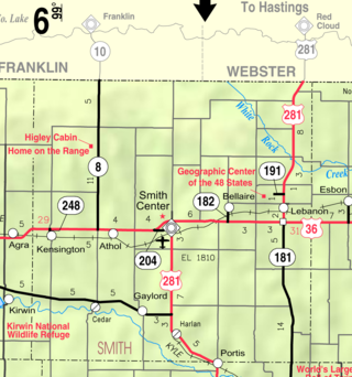
Cedar is a city in Smith County, Kansas, United States. As of the 2020 census, the population of the city was 11.

References

  1. 1 2 3 4 U.S. Geological Survey Geographic Names Information System: Cedar Vale, Kansas
  2. "2019 U.S. Gazetteer Files". United States Census Bureau. Retrieved July 24, 2020.
  3. 1 2 "Profile of Cedar Vale, Kansas in 2020". United States Census Bureau. Archived from the original on May 23, 2022. Retrieved May 23, 2022.
  4. Blackmar, Frank Wilson (1912). Kansas: A Cyclopedia of State History, Embracing Events, Institutions, Industries, Counties, Cities, Towns, Prominent Persons, Etc. Standard Publishing Company. pp.  302.
  5. Kansas State Historical Society (1916). Biennial Report of the Board of Directors of the Kansas State Historical Society. Kansas State Printing Plant. pp.  155.
  6. "US Gazetteer files 2010". United States Census Bureau. Archived from the original on January 25, 2012. Retrieved July 6, 2012.
  7. Climate Summary for Cedar Vale, Kansas
  8. "US Census Bureau, Table P16: HOUSEHOLD TYPE". data.census.gov. Retrieved January 2, 2024.
  9. 1 2 3 4 5 "US Census Bureau, Table DP1: PROFILE OF GENERAL POPULATION AND HOUSING CHARACTERISTICS". data.census.gov. Retrieved January 2, 2024.
  10. Bureau, US Census. "Gazetteer Files". Census.gov. Retrieved December 30, 2023.
  11. "US Census Bureau, Table P1: RACE". data.census.gov. Retrieved January 2, 2024.
  12. "US Census Bureau, Table P2: HISPANIC OR LATINO, AND NOT HISPANIC OR LATINO BY RACE". data.census.gov. Retrieved January 2, 2024.
  13. "US Census Bureau, Table S1101: HOUSEHOLDS AND FAMILIES". data.census.gov. Retrieved January 2, 2024.
  14. "US Census Bureau, Table S1501: EDUCATIONAL ATTAINMENT". data.census.gov. Retrieved January 2, 2024.
  15. "US Census Bureau, Table S1903: MEDIAN INCOME IN THE PAST 12 MONTHS (IN 2020 INFLATION-ADJUSTED DOLLARS)". data.census.gov. Retrieved January 2, 2024.
  16. "US Census Bureau, Table S2001: EARNINGS IN THE PAST 12 MONTHS (IN 2020 INFLATION-ADJUSTED DOLLARS)". data.census.gov. Retrieved January 2, 2024.
  17. "US Census Bureau, Table S1701: POVERTY STATUS IN THE PAST 12 MONTHS". data.census.gov. Retrieved January 2, 2024.
  18. "US Census Bureau, Table S1702: POVERTY STATUS IN THE PAST 12 MONTHS OF FAMILIES". data.census.gov. Retrieved January 2, 2024.
  19. "U.S. Census website". United States Census Bureau . Retrieved July 6, 2012.
  20. "U.S. Census website". United States Census Bureau . Retrieved January 31, 2008.
  21. "The Cedar Vale Star".
  22. "The Cedar Vale Star 12 Jan 1894, page 2". The Cedar Vale Star. January 12, 1894. A page from the last issue. States it is the last issue in the top-left column.

Further reading