Center Township, Clark County, Kansas

Last updated

Center Township
Map highlighting Center Township, Clark County, Kansas.svg
Location in Clark County
Coordinates: 37°11′20″N099°48′41″W / 37.18889°N 99.81139°W / 37.18889; -99.81139
Country United States
State Kansas
County Clark
Area
  Total204.56 sq mi (529.82 km2)
  Land203.93 sq mi (528.17 km2)
  Water0.63 sq mi (1.64 km2)  0.31%
Elevation
2,005 ft (611 m)
Population
 (2000)
  Total1,097
  Density5.4/sq mi (2.1/km2)
GNIS feature ID 0470813

Center Township is a township in Clark County, Kansas, United States. As of the 2000 census, its population was 1,097.

Contents

History

The Cimarron Redoubt, an Army fortification built in 1870, is located along Clark Creek (Redoubt Creek) south of its confluence with the Cimarron River, [1] in southern Clark Township. [2]

Geography

Center Township covers an area of 204.56 square miles (529.8 km2) and contains one incorporated settlement, Ashland (the county seat). According to the USGS, it contains one cemetery, Saint Josephs and Highland.

The streams of Big Sandy Creek, Bullard Creek, Casino Creek, East Branch Bear Creek, Keiger Creek, Little Sandy Creek, Redhole Creek, Redoubt Creek, Spring Creek, Stink Creek and West Branch Bear Creek run through this township.

Transportation

Center Township contains one airport or landing strip, Harold Krier Field.

Related Research Articles

<span class="mw-page-title-main">Ashland, Kansas</span> City in Clark County, Kansas

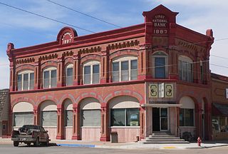
Ashland is a city in and the county seat of Clark County, Kansas, United States. As of the 2020 census, the population of the city was 783.

<span class="mw-page-title-main">Sandy River (Oregon)</span> River in Oregon, United States

The Sandy River is a 56-mile (90 km) tributary of the Columbia River in northwestern Oregon in the United States. The Sandy joins the Columbia about 14 miles (23 km) upstream of Portland.

<span class="mw-page-title-main">Cimarron River (Arkansas River tributary)</span> River in the United States

The Cimarron River extends 698 miles (1,123 km) across New Mexico, Oklahoma, Colorado, and Kansas. The headwaters flow from Johnson Mesa west of Folsom in northeastern New Mexico. Much of the river's length lies in Oklahoma, where it either borders or passes through eleven counties. There are no major cities along its route. The river enters the Oklahoma Panhandle near Kenton, Oklahoma, crosses the corner of southeastern Colorado into Kansas, reenters the Oklahoma Panhandle, reenters Kansas, and finally returns to Oklahoma where it joins the Arkansas River at Keystone Reservoir west of Tulsa, Oklahoma, its only impoundment. The Cimarron drains a basin that encompasses about 18,927 square miles (49,020 km2).

<span class="mw-page-title-main">Aetna Township, Barber County, Kansas</span> Township in Kansas, United States

Aetna Township is a township in Barber County, Kansas, USA. At the 2000 census, its population was 3.

<span class="mw-page-title-main">Medicine Lodge Township, Barber County, Kansas</span> Township in Kansas, United States

Medicine Lodge Township is a township in Barber County, Kansas, USA. As of the 2000 census, its population was 2,573.

<span class="mw-page-title-main">Sharon Township, Barber County, Kansas</span> Township in Kansas, United States

Sharon Township is a township in Barber County, Kansas, USA. As of the 2000 census, its population was 369. However, according to the Kansas State Historical Society, the township had already merged with neighboring Ridge Township as of March 22, 1999. Ridge Township was still listed as a separate entity in the 2000 census. By the 2010 census, Ridge was no longer listed, and only the surviving, now larger, Sharon Township was listed.

<span class="mw-page-title-main">Sun City Township, Barber County, Kansas</span> Township in Kansas, United States

Sun City Township is a township in Barber County, Kansas, USA. As of the 2000 census, its population was 100.

<span class="mw-page-title-main">Cheyenne Township, Barton County, Kansas</span> Township in Kansas, United States

Cheyenne Township is a township in Barton County, Kansas, United States. As of the 2010 census, its population was 207.

<span class="mw-page-title-main">Prospect Township, Butler County, Kansas</span> Township in Kansas, United States

Prospect Township is a township in Butler County, Kansas, USA. As of the 2000 census, its population was 2,033. It is where El Dorado Correctional Facility, a maximum security prison, is located.

<span class="mw-page-title-main">Rock Creek Township, Butler County, Kansas</span> Township in Kansas, United States

Rock Creek Township is a township in Butler County, Kansas, USA. As of the 2000 census, its population was 299.

<span class="mw-page-title-main">Rosalia Township, Butler County, Kansas</span> Township in Kansas, United States

Rosalia Township is a township in Butler County, Kansas, USA. As of the 2010 census, its population was 631.

<span class="mw-page-title-main">Towanda Township, Butler County, Kansas</span> Township in Kansas, United States

Towanda Township is a township in Butler County, Kansas, USA. As of the 2000 census, its population was 2,727.

<span class="mw-page-title-main">Sitka Township, Clark County, Kansas</span> Township in Kansas, United States

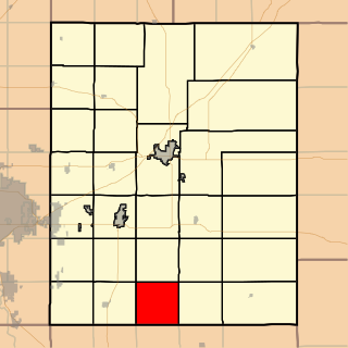
Sitka Township is a township in Clark County, Kansas, USA. As of the 2000 census, its population was 86.

<span class="mw-page-title-main">Center Township, Cloud County, Kansas</span> Township in Kansas, United States

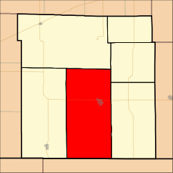
Center Township is a township in Cloud County, Kansas, USA. As of the 2000 census, its population was 172.

<span class="mw-page-title-main">Protection Township, Comanche County, Kansas</span> Township in Kansas, United States

Protection Township is a township in Comanche County, Kansas, United States. As of the 2000 census, its population was 734.

<span class="mw-page-title-main">Union Center Township, Elk County, Kansas</span> Township in Kansas, United States

Union Center Township is a township in Elk County, Kansas, USA. As of the 2000 census, its population was 116.

<span class="mw-page-title-main">Sullivan Township, Grant County, Kansas</span> Township in Kansas, United States

Sullivan Township is a township in Grant County, Kansas, USA. As of the 2000 census, its population was 353.

<span class="mw-page-title-main">Cimarron Township, Gray County, Kansas</span> Township in Kansas, United States

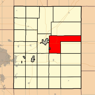
Cimarron Township is a township in Gray County, Kansas, USA. As of the 2000 census, its population was 2,379.

<span class="mw-page-title-main">Madison Township, Greenwood County, Kansas</span> Township in Kansas, United States

Madison Township is a township in Greenwood County, Kansas, USA. As of the 2000 census, its population was 1,155.

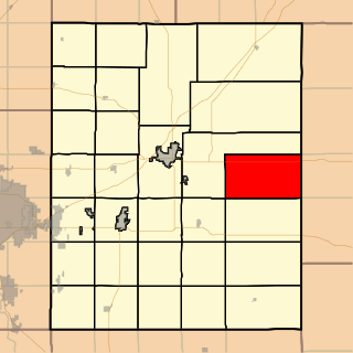
The Cimarron Redoubt was an improvised U.S. Army fortification south of the city of Ashland in Clark County, Kansas, United States. Built in 1870 near a major trade route's crossing of the Cimarron River, it was later used for a variety of civilian purposes, including a post office. Today, it lies abandoned amid farm fields in southern Center Township.

References

  1. Stein, Martin. National Register of Historic Places Inventory/Nomination: Cimarron Redoubt . National Park Service, 1976-04-26, 9. Accessed 2009-09-09.
  2. DeLorme. Kansas Atlas & Gazetteer. 4th ed. Yarmouth: DeLorme, 2009, 70. ISBN   0-89933-342-7.