Chatsworth, Illinois

Last updated

Chatsworth, Illinois
Chatsworth, Illinois panorama.jpg
Buildings along Locust Street
Motto: 
Bluebird capital of Illinois
Livingston County Illinois Incorporated and Unincorporated areas Chatsworth Highlighted.svg
Location in Livingston County, Illinois
Illinois in United States (US48).svg
Location of Illinois in the United States
Coordinates: 40°44′15″N88°17′50″W / 40.73750°N 88.29722°W / 40.73750; -88.29722 [1]
CountryUnited States
StateIllinois
County Livingston
Townships Chatsworth, Charlotte
IncorporatedMarch 8, 1867 (1867-03-08)
Area
[2]
  Total2.69 sq mi (6.96 km2)
  Land2.68 sq mi (6.95 km2)
  Water0.01 sq mi (0.02 km2)
Elevation
[1]
781 ft (238 m)
Population
 (2020)
  Total1,185
  Density441.83/sq mi (170.62/km2)
Time zone UTC-6 (CST)
  Summer (DST) UTC-5 (CDT)
ZIP code
60921
Area code(s) 815 & 779
FIPS code 17-12710
GNIS feature ID2396640 [1]
Wikimedia CommonsChatsworth, Illinois
Website www.chatsworthil.gov
[3]

Chatsworth is an incorporated town in Livingston County, Illinois, United States. The population was 1,332 at the 2020 census. [4]

Contents

Geography

Chatsworth is located in southeastern Livingston County in northern Chatsworth Township, with a small panhandle extending north into Charlotte Township. The town limits also extend south from the town center and include a large undeveloped area in central Chatsworth Township.

U.S. Route 24 runs through the town south of the town center, leading east 15 miles (24 km) to Interstate 57 at Gilman and west 23 miles (37 km) to Interstate 55 at Chenoa.

According to the 2020 census, Chatsworth has a total area of 2.8 square miles (7.25 km2), all land. [5]

History

Founding

Chatsworth was laid out by Zeno Secor (1809 – 1875) [6] and Cornelia Gilman on June 8, 1859. Both founders were from New York. Secor was a member of the Board of Directors of the company that was building the Peoria and Oquawka Railroad. [7] He was a noted civil engineer and marine engine designer, who was involved with a number of railroads. Secor was later president of the Toledo Peoria and Western Railroad. Secor is best known for building a number of ironclad warships for the Union Navy. Cornelia Gilman was perhaps the person of that name who was the wife of Samuel Gilman, another director of the firm, and the man who gave his name to the nearby town of Gilman. [8] The town of Chatsworth is perhaps named for Chatsworth House, the home of the Duke of Devonshire. [9] Trains were running along the Peoria and Oquawka Railroad before the town was platted. The railroad soon became the Toledo, Peoria and Western.

Original design

Chatsworth was surveyed by Nelson Buck, the County Surveyor of Livingston County. [10] However, the plan used was virtually identical to that used at Fairbury, including the street names, and very similar to that used at Gridley, El Paso and other places along the Peoria and Oquawka Railroad. This suggests that the railroad supplied the plan from which Buck worked. Like these other towns, Chatsworth was centered on a long narrow depot grounds rather than a public square. The plat of the original town was exceptionally large, covering 160 acres (0.65 km2) and consisting of 42 blocks, most located north of the railroad. The early depot was on the south side of the tracks. [11] Block 16 of the plat was not divided into lots, and 1878 was listed as the City Park. It was eventually planted with over 500 maple trees, and a pavilion was added in 1962. [12]

Growth

The first building was a 1+12-story frame structure used as both a residence and store, which was built by Charles D. Brooks and Truman Brockway of New York. Brooks was the first postmaster and the first grain dealer. Early growth of the town was very rapid, and by 1870 Chatsworth had 999 people. [13] The first hotel was the Cottage House, built by Samuel Patton. Soon a newspaper, the Plaindealer, was being published. [14] In 1879 a second railroad, the Kankakee and Southwestern, passed through the town and was given a right of way down Second Street. In 1887 the town rendered aid in the train accident known as the Great Chatsworth Train Wreck. Telephone service came in 1883, and an electric light plant was built in 1894. In March 1924 seventy to one hundred men arrived in town to work on a paved highway, at first known as the Corn Belt Trail, which soon became Route 24 and formed an important east-west route across Illinois. [15]

Demographics

Historical population
CensusPop.Note
1860 20
1870 9994,895.0%
1880 1,0545.5%
1890 827−21.5%
1900 1,03825.5%
1910 1,1127.1%
1920 1,087−2.2%
1930 981−9.8%
1940 1,0365.6%
1950 1,1198.0%
1960 1,33018.9%
1970 1,255−5.6%
1980 1,187−5.4%
1990 1,186−0.1%
2000 1,2656.7%
2010 1,205−4.7%
2020 1,185−1.7%
U.S. Decennial Census [13]

As of the census [16] of 2000, there were 1,265 people, 533 households, and 338 families residing in the town. The population density was 1,412.8 inhabitants per square mile (545.5/km2). There were 581 housing units at an average density of 648.9 per square mile (250.5/km2). The racial makeup of the town was 98.81% White, 0.32% African American, 0.16% Native American, 0.16% Asian, 0.08% from other races, and 0.47% from two or more races. Hispanic or Latino of any race were 1.66% of the population.

There were 533 households, out of which 31.0% had children under the age of 18 living with them, 47.5% were married couples living together, 11.6% had a female householder with no husband present, and 36.4% were non-families. 33.6% of all households were made up of individuals, and 18.8% had someone living alone who was 65 years of age or older. The average household size was 2.37 and the average family size was 2.99.

In the town, the population was spread out, with 27.7% under the age of 18, 6.7% from 18 to 24, 25.9% from 25 to 44, 22.2% from 45 to 64, and 17.5% who were 65 years of age or older. The median age was 39 years. For every 100 females, there were 93.7 males. For every 100 females age 18 and over, there were 87.9 males.

The median income for a household in the town was $32,159, and the median income for a family was $42,679. Males had a median income of $31,848 versus $20,667 for females. The per capita income for the town was $15,241. About 13.0% of families and 14.1% of the population were below the poverty line, including 16.3% of those under age 18 and 12.3% of those age 65 or over.

Notable people

Related Research Articles

<span class="mw-page-title-main">Piper City, Illinois</span> Village in Illinois, United States

Piper City is a village in Ford County, Illinois, United States. The population was 745 at the 2020 census.

<span class="mw-page-title-main">Oquawka, Illinois</span> Village in Illinois, United States

Oquawka is a village in Henderson County, Illinois, United States. The population was 1,371 at the 2010 census. It is the county seat of Henderson County.

<span class="mw-page-title-main">Crescent City, Illinois</span> Village in Illinois, United States

Crescent City is a village in Iroquois and Crescent townships, Iroquois County, Illinois, United States. The population was 615 at the 2010 census.

<span class="mw-page-title-main">Gilman, Illinois</span> City in Illinois, United States

Gilman is a city in Douglas Township, Iroquois County, Illinois, United States. The population was 1,738 at the 2020 census.

<span class="mw-page-title-main">Sublette, Illinois</span> Village in Illinois, United States

Sublette is a village in Lee County, Illinois, United States. The population was 449 at the 2010 census.

<span class="mw-page-title-main">Cornell, Illinois</span> Village in Illinois, United States

Cornell is a village in Livingston County, Illinois, United States. The population was 446 at the 2020 census.

<span class="mw-page-title-main">Cullom, Illinois</span> Village in Illinois, United States

Cullom is a village in Livingston County, Illinois, United States. Cullom is situated twenty miles east of Pontiac which is the county seat, and is one mile west of the Ford County line. The population was 555 at the 2010 census.

<span class="mw-page-title-main">Fairbury, Illinois</span> City in Illinois, United States

Fairbury is a city in Livingston County, Illinois, United States. The population was 3,633 at the 2020 census.

<span class="mw-page-title-main">Forrest, Illinois</span> Village in Illinois, United States

Forrest is a village in Livingston County, Illinois, United States. The population was 1,220 at the 2010 census.

<span class="mw-page-title-main">Odell, Illinois</span> Village in Illinois, United States

Odell is a village in Livingston County, Illinois, United States. The population was 1,046 at the 2010 census.

<span class="mw-page-title-main">Livingston, Illinois</span> Village in Illinois, United States

Livingston is a village in Madison County, Illinois, United States. The population was 763 at the 2020 census, down from 858 in 2010.

<span class="mw-page-title-main">Carlock, Illinois</span> Village in Illinois, United States

Carlock is a village in McLean County, Illinois, United States. The population was 548 at the 2020 census. It is part of the Bloomington–Normal Metropolitan Statistical Area.

<span class="mw-page-title-main">Chenoa, Illinois</span> City in Illinois, United States

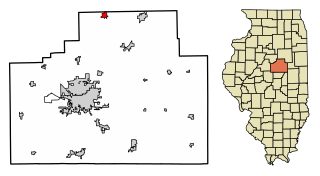
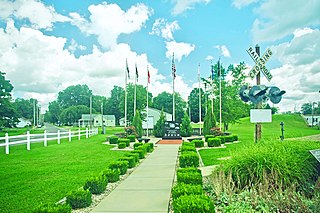
Chenoa is a city in McLean County, Illinois, United States. The population was 1,695 at the 2020 census. The city is located at the intersections of Interstate 55, Historic Route 66, and U.S. Route 24. Founded in 1854 by Mathew T. Scott, Chenoa was created to provide a retail and trade center for his farm tenants as well as a grain shipping facility. The Chenoa Centennial was celebrated in 1954. The town is situated in a highly productive agricultural area. The town school system closed at the end of the 2004 school year, consolidating with the nearby Prairie Central school district. A well attended July 4 celebration is held in Chenoa each year.

<span class="mw-page-title-main">Gridley, Illinois</span> Village in Illinois, United States

Gridley is a village in McLean County, Illinois, United States. The population was 1,456 at the 2020 census. It is part of the Bloomington–Normal Metropolitan Statistical Area.

<span class="mw-page-title-main">Saybrook, Illinois</span> Village in Illinois, United States

Saybrook is a village in McLean County, Illinois, United States. The population was 654 at the 2020 census. It is part of the Bloomington–Normal Metropolitan Statistical Area.

<span class="mw-page-title-main">Alexis, Illinois</span> Village in Illinois, United States

Alexis is a village in Mercer and Warren counties in Illinois, United States. The population was 793 at the 2020 census.

<span class="mw-page-title-main">Glasford, Illinois</span> Village in Illinois, United States

Glasford is a village in Peoria County, Illinois, United States. The population was 866 at the 2020 census. Glasford is part of the Peoria, Illinois Metropolitan Statistical Area.

<span class="mw-page-title-main">Crossville, Illinois</span> Village in Illinois, United States

Crossville is a village in White County, Illinois, United States. The population was 745 at the 2010 census.

<span class="mw-page-title-main">Minonk, Illinois</span> City in Illinois, United States

Minonk is a city in Minonk Township, Woodford County, Illinois. The population was 2,078 at the 2010 census, down from 2,168 in 2000. The city is part of the Peoria, Illinois, metropolitan area.

<span class="mw-page-title-main">Secor, Illinois</span> Village in Illinois, United States

Secor is a village in Clayton Township, Woodford County, Illinois, United States. The population was 373 at the 2010 census. It is part of the Peoria, Illinois Metropolitan Statistical Area. Secor is located just off U.S. Route 24 between El Paso and Eureka.

References

  1. 1 2 3 U.S. Geological Survey Geographic Names Information System: Chatsworth, Illinois
  2. "2020 U.S. Gazetteer Files". United States Census Bureau. Retrieved March 15, 2022.
  3. Illinois Regional Archives Depository System. "Name Index to Illinois Local Governments". Illinois State Archives. Illinois Secretary of State . Retrieved May 2, 2013.
  4. "Profile of General Population and Housing Characteristics: 2010 Census Summary File 1 (DP-1), Chatsworth town, Illinois". American FactFinder. U.S. Census Bureau. Archived from the original on February 13, 2020. Retrieved January 13, 2020.
  5. "G001 - Geographic Identifiers - 2010 Census Summary File 1". United States Census Bureau. Archived from the original on February 13, 2020. Retrieved August 1, 2015.
  6. For a brief obituary and dates see [Chatsworth Illinois Memories] http://sites.google.com/site/chatsworthillinoismemories/ p.4.
  7. American Railroad Manual for the United States and the Dominion of Canada (New York: American Railroad Manual Company, 1874) 1:495.
  8. History of Livingston County, Illinois (Chicago: LeBaron, 1878) p. 379.
  9. Edward Callary, Place Names of Illinois (Urbana: University of Illinois, 2008) p. 66. Callay also includes other possibilities for the name.
  10. History of Livingston, 1878, p.392.
  11. Standard Atlas of Livingston County Illinois (Chicago: George A. Ogle, 1911) pp 25-26.
  12. Chatsworth Area Centennial Celebration (Chatsworth: Centennial Historical Committee, 1967) No page numbers.
  13. 1 2 "Census of Population and Housing". Census.gov. Retrieved June 4, 2015.
  14. History of Livingston, 1858, pp 392-393.
  15. Chatsworth Centennial, 1967.
  16. "U.S. Census website". United States Census Bureau . Retrieved January 31, 2008.