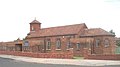
Boston Spa is a village and civil parish in the City of Leeds in West Yorkshire, England. Situated 3 miles (5 km) south of Wetherby, Boston Spa is on the south bank of the River Wharfe across from Thorp Arch. According to the 2001 census, the parish had a population of 4,006 rising to 4,079 in the 2011 census.

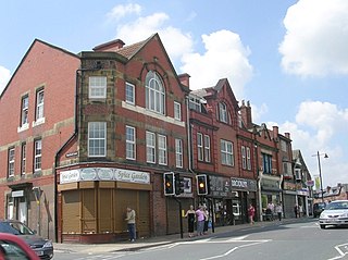
Castleford is a town within the City of Wakefield district, West Yorkshire, England. It had a population of 45,106 at a 2021 population estimate. Historically in the West Riding of Yorkshire, to the north of the town centre the River Calder joins the River Aire and the Aire and Calder Navigation. It is located north east of Wakefield, north of Pontefract and south east of Leeds. Castleford is the largest town in the Wakefield district after Wakefield itself.

Wetherby is a market town and civil parish in the City of Leeds, West Yorkshire, England. It is close to West Yorkshire county's border with North Yorkshire, and lies approximately 12 miles from Leeds City Centre, 12 mi (19 km) from York and 8 mi (13 km) from Harrogate. The town stands on the River Wharfe, and for centuries has been a crossing place and staging post on the Great North Road midway between London and Edinburgh.

Pontefract is a historic market town in the Metropolitan Borough of Wakefield in West Yorkshire, England, east of Wakefield and south of Castleford. Historically part of the West Riding of Yorkshire, it is one of the towns in the City of Wakefield district and had a population of 30,881 at the 2011 Census. Pontefract's motto is Post mortem patris pro filio, Latin for "After the death of the father, support the son", a reference to the town's Royalist sympathies in the English Civil War. Small villages and settlements in the immediate area include Stapleton.

Rothwell is a town in the south-east of the City of Leeds metropolitan borough in West Yorkshire, England. It is situated between Leeds and Wakefield.

Knottingley is a town in the City of Wakefield in West Yorkshire, England on the River Aire and the old A1 road before it was bypassed as the A1(M). Historically part of the West Riding of Yorkshire, it has a population of 13,503, increasing to 13,710 for the City of Wakefield ward at the 2011 Census. It makes up the majority of the Knottingley ward represented on Wakefield Council.

Featherstone is a town and civil parish in the City of Wakefield, West Yorkshire, England, two miles south-west of Pontefract. Historically part of the West Riding of Yorkshire, in 2011 it had a population of 15,244. Featherstone railway station is on the Pontefract Line.

Horsforth is a town and civil parish in the City of Leeds, West Yorkshire, England, five miles north-west of Leeds city centre. Historically a village within the West Riding of Yorkshire, it had a population of 18,895 at the 2011 Census. It became part of the City of Leeds metropolitan borough in 1974. In 1999, a civil parish was created for the area, and the parish council voted to rename itself a town council. The area is within the Horsforth ward of Leeds City Council, which also includes the southern part of Rawdon.

Seacroft is an outer-city suburb/township consisting mainly of council estate housing covering an extensive area of east Leeds, West Yorkshire, England. It lies in the LS14 Leeds postcode area, around 4 miles (6.4 km) east of Leeds city centre.

Gipton is a suburb of east Leeds, West Yorkshire, England, between the A58 to the north and the A64 to the south.

Middleton is a largely residential suburb of Leeds in West Yorkshire, England and historically a village in the West Riding of Yorkshire. It is situated on a hill 4 miles (6 km) south of Leeds city centre and 165 miles (266 km) north north-west of London.

Ireland Wood is a small residential area in north-west Leeds, West Yorkshire, England named after the Woodland Trust wood which it contains. It is approximately 4 miles (6.4 km) to the north-west of Leeds city centre. It was planned by the Leeds Housing Director, R.A.H. Livett, and won the Ministry Housing medal for 1945-9. An early plan of Ireland Wood in 1950 is shown on the Leodis website.

Normanton is a town and civil parish in the City of Wakefield in West Yorkshire, England. It is north-east of Wakefield and south-west of Castleford. The civil parish extends west and north to the River Calder, and includes the large village of Altofts. At the time of the 2011 Census, the population of the civil parish was 20,872.
South Elmsall is a town and civil parish in the City of Wakefield in West Yorkshire, England. South Elmsall lies to the east of Hemsworth. The town had a population in 2001 of 6,107, increasing to 6,519 at the 2011 Census.

Garforth is a town in the metropolitan borough of the City of Leeds, West Yorkshire, England.

Methley is a dispersed village in the City of Leeds metropolitan borough, south east of Leeds, West Yorkshire, England. It is located near Rothwell, Oulton, Woodlesford, Mickletown and Allerton Bywater. The Leeds City Ward is called Kippax and Methley. It is within the triangle formed by Leeds, Castleford and Wakefield, and between the confluence of the River Aire and River Calder. The latter is crossed by Methley Bridge, the A639 road, about a mile south-east of the village.
Woodlesford is a suburban village in the City of Leeds, West Yorkshire, England, 6 miles (10 km) south-east of Leeds city centre. Formerly part of the Rothwell Urban District, it is now within the Rothwell ward of Leeds City Council. The village sits on the banks of the Aire and Calder Navigation and river system.
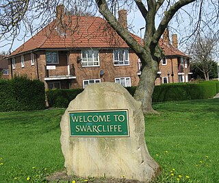
Swarcliffe, originally the Swarcliffe Estate, is a district of Leeds, West Yorkshire, England. It is 4.9 miles (8 km) east of Leeds city centre, and within the LS14 and LS15 Leeds postcode area. The district falls within the Cross Gates and Whinmoor ward of the Leeds Metropolitan Council.

Crofton is a village in West Yorkshire, England, about 4 miles (6 km) south-east of Wakefield, some 6 miles (10 km) to the west of the town of Pontefract, and 4 miles (6 km) from the town of Featherstone. The population of the civil parish at the 2011 census was 5,781.
Greengates is a small suburban area in the north-east of the city of Bradford, West Yorkshire, in England. The area is bordered by Idle and Thackley to the north-west, and the large council estate known as Thorpe Edge to the west. To the south of Greengates is Ravenscliffe housing estate with the village of Eccleshill beyond that. The village of Apperley Bridge lies to the north. To the east in the Leeds Metropolitan District is the village of Calverley.