Cherokee, California

Last updated

Cherokee, California
Historic mining town Cherokee, California, in May 2020.jpg
The Cherokee Museum
Butte County California Incorporated and Unincorporated areas Cherokee Highlighted 0612818.svg
Location of Cherokee in Butte County, California.
USA California location map.svg
Red pog.svg
Cherokee, California
Location in California
Coordinates: 39°38′47″N121°32′18″W / 39.64639°N 121.53833°W / 39.64639; -121.53833
CountryUnited States
State California
County Butte County
Area
[1]
  Total1.922 sq mi (4.976 km2)
  Land1.751 sq mi (4.534 km2)
  Water0.171 sq mi (0.442 km2)  8.9%
Elevation
[2]
1,306 ft (398 m)
Population
 (2020) [3]
  Total88
  Density46/sq mi (18/km2)
Time zone UTC-8 (Pacific)
  Summer (DST) UTC-7 (PDT)
ZIP code
95965
Area code 530
GNIS feature IDs 1655889, 2612476
U.S. Geological Survey Geographic Names Information System: Cherokee, California; U.S. Geological Survey Geographic Names Information System: Cherokee, California

Cherokee is an unincorporated community and census-designated place [4] in Butte County, California. It is an area inhabited by Maidu Indians prior to the gold rush, but that takes its name from a band of Cherokee prospectors who perfected a mining claim on the site. The population was 69 at the 2010 census. It lies at an elevation of 1306 feet (398 m).

Contents

Possibly the site of the historic gold mine, on the 1994 Cherokee, California 7.5-minute quadrangle, a feature named "Cherokee Placer Mine" exists about 0.65 miles southwest of the above coordinates. USGS identifies Cherokee Flat and Drytown as historic variant names for the community. The town is located on Cherokee Road off State Route 70.

Today, Cherokee now consists of a museum and a Cherokee cemetery, as well as a few houses. The Cherokee Heritage and Museum Association maintains both.

The ZIP Code is 95965. The community is inside area code 530.

History

Cherokee is within the traditional territory of the Maidu. Around 1818 Spanish explorers found gold on Cherokee's south side near Table Mountain. In 1849 Cherokee came from Oklahoma. Welsh miners came in the 1850s, naming the town after the Cherokee and constructing many buildings in town.

Ruins of Cherokee Bank Wells Fargo ruins in the historic mining town of Cherokee, California, in May 2020.jpg
Ruins of Cherokee Bank

Thomas Edison owned one of the mines which sprung up in the area, and he saw to it that the mines were electrified to ease the work. The town prospered during the mining period, and Butte County's first homes with running water were built in Cherokee.

In 1880 President Rutherford B. Hayes, his wife Lucy, Civil War General William T. Sherman and General John Bidwell came to visit Cherokee's famous hydraulic gold mine. In the 1890s, the gold mines were sold off because of operational costs. At its boomtime, the town had a population in the thousands.

A post office operated at Cherokee from 1854 to 1912. [5]

Spring Valley Mine

Over time, mines consolidated and by 1870, Cherokee's hydraulic-mining ventures were consolidated into a single operation controlled by the Spring Valley Mining and Irrigation Company. The mine closed in 1894. [6] Still existing in the area are Spring Valley Elementary School, Spring Valley Reservoir, and Spring Valley Gulch (an actual valley) [7]

Cherokee as a tourist attraction

Visitors come to Cherokee to see the museum and the cemetery, and for its two annual festivals, on July 4 and on a weekend near September 24, which is called President Hayes Day.

In the vicinity are Sugarloaf, a nearby promontory which is home to deer, foxes, doves, peacocks and hiking trails. Table Mountain is famous for its springtime wildflowers.

A Chinese Taoist temple, one of America's oldest Taoist establishments (no longer in use), built in the 1860s by the town's small Chinese community, was made a state historic site. [ citation needed ]

Demographics

Historical population
CensusPop.Note
U.S. Decennial Census [8]

The 2010 United States Census [9] reported that Cherokee had a population of 69. The population density was 35.9 inhabitants per square mile (13.9/km2). The racial makeup of Cherokee was 48 (70%) White, 0 African American, 2 (3%) Native American, 8 (12%) Asian, 0 Pacific Islander, 0 from other races, and 11 (16%) from two or more races. Hispanic or Latino of any race were 1 persons (1%).

The Census reported that 69 people (100% of the population) lived in households, 0 lived in non-institutionalized group quarters, and 0 were institutionalized.

There were 26 households, out of which 7 (27%) had children under the age of 18 living in them, 14 (54%) were opposite-sex married couples living together, 3 (12%) had a female householder with no husband present, 1 (4%) had a male householder with no wife present. There were 2 (8%) unmarried opposite-sex partnerships, and 0 same-sex married couples or partnerships. 7 households (27%) were made up of individuals, and 4 (15%) had someone living alone who was 65 years of age or older. The average household size was 2.6. There were 18 families (69% of all households); the average family size was 3.3.

The population was spread out, with 16 people (23%) under the age of 18, 3 people (4%) aged 18 to 24, 19 people (28%) aged 25 to 44, 19 people (28%) aged 45 to 64, and 12 people (17%) who were 65 years of age or older. The median age was 42.8 years. For every 100 females, there were 122.6 males. For every 100 females age 18 and over, there were 103.8 males.

There were 30 housing units at an average density of 15.6 per square mile (6.0/km2). The housing units included 19 (73%) owner-occupied, 7 (27%) occupied by renters, and 4 vacant. The homeowner vacancy rate was 0%; the rental vacancy rate was 0%. 50 people (73% of the population) lived in owner-occupied housing units and 19 people (28%) lived in rental housing units.

Related Research Articles

<span class="mw-page-title-main">Plumas County, California</span> County in California, United States

Plumas County is a county in the Sierra Nevada of the U.S. state of California. As of the 2020 census, the population was 19,790. The county seat is Quincy, and the only incorporated city is Portola. The largest community in the county is East Quincy. The county was named for the Spanish Río de las Plumas, which flows through it. The county itself is also the namesake of a native moth species, Hadena plumasata.

<span class="mw-page-title-main">Jackson, California</span> City in California, United States

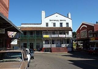
Jackson is a city in and the county seat of Amador County, California. Its population was 4,651 at the 2010 census, up from 3,989 at the 2000 census. The city is accessible by both State Route 49 and State Route 88.

<span class="mw-page-title-main">Concow, California</span> Unincorporated community in California, United States

Concow is an unincorporated community and census-designated place (CDP) in the Sierra Nevada foothills covering eastern Butte County, California. Due to a decline in employment and repeated wildfires, over the past hundred years the population declined from several thousand to several dozen. On November 8, 2018, a wildfire, the Camp Fire, destroyed most of Concow, as well as the adjacent municipality of Paradise.

<span class="mw-page-title-main">Magalia, California</span> Unincorporated community in California, United States

Magalia is an unincorporated community and census-designated place (CDP) in Butte County, California, United States. The population was 11,310 at the 2010 census.

<span class="mw-page-title-main">Oroville, California</span> City in California, United States

Oroville is the county seat of Butte County, California, United States. The population of the city was 15,506 at the 2010 census, up from 13,004 in the 2000 census. Following the 2018 Camp Fire that destroyed much of the town of Paradise, the population of Oroville increased as many people who lost their homes relocated to nearby Oroville. In 2020, the 2020 census recorded the population of Oroville at 20,042.

<span class="mw-page-title-main">Copperopolis, California</span> Census-designated place in California, United States

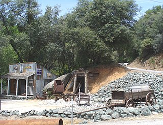
Copperopolis is an unincorporated town and census-designated place (CDP) in Calaveras County, California, United States. The population was 3,671 at the 2010 census, up from 2,363 at the 2000 census. The town is located along State Route 4 and is registered as California Historical Landmark #296.

<span class="mw-page-title-main">Murphys, California</span> Census designated place in California, United States

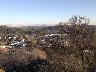
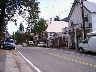
Murphys, originally Murphys New Diggings then Murphy's Camp, is an unincorporated village located in the foothills of the Sierra Nevada mountains in Calaveras County, California, United States. The population was 2,213 at the 2010 census, up from 2,061 at the 2000 census.

<span class="mw-page-title-main">Shingle Springs, California</span> Census-designated place in California, United States

Shingle Springs is a census-designated place (CDP) in El Dorado County, California, United States. The population was 4,432 at the 2010 census, up from 2,643 at the 2000 census. It is located about 40 miles (64 km) from Sacramento in the Gold Country foothills and sits directly on Highway 50. The towns of Coloma and Placerville are less than 15 miles (24 km) away.

<span class="mw-page-title-main">Randsburg, California</span> California Historical Landmark

Randsburg is a census-designated place (CDP) in Kern County, California, United States. Randsburg is located 17 miles (27 km) south of Ridgecrest, at an elevation of 3,504 feet (1,068 m). The population was 69 in the 2010 census, down from 77 in the 2000 census.

<span class="mw-page-title-main">Rocklin, California</span> City in California, United States

Rocklin is a city in Placer County, California, about 22 miles (35 km) from Sacramento, and about 6.1 miles (9.8 km) northeast of Roseville in the Sacramento metropolitan area. Besides Roseville, it shares borders with Granite Bay, Loomis and Lincoln. As of the 2010 census, Rocklin's population was 56,974. The California Department of Finance placed the 2019 population at 68,823.

<span class="mw-page-title-main">Little Grass Valley, California</span> Census-designated place in California, United States

Little Grass Valley is a census-designated place in Plumas County, California, USA. As of the 2010 census, it had a total population of 2.

<span class="mw-page-title-main">Dahlonega, Georgia</span> City in Georgia, United States

Dahlonega is the county seat of Lumpkin County, Georgia, United States. As of the 2010 census, the city had a population of 5,242, and in 2018 the population was estimated to be 6,884.

<span class="mw-page-title-main">Boulder, Montana</span> Town in Montana, United States

Boulder is a town in and the county seat of Jefferson County, Montana, United States. It is on the north bank of the Boulder River between Butte and Helena, slightly east of the Continental Divide, at the intersection of Interstate 15 and Montana Highway 69. The population was 1,201 at the 2020 census. It is part of the Helena Micropolitan Statistical Area, which includes all of Lewis and Clark and Jefferson counties; its population is 83,058 according to the 2020 Census.

<span class="mw-page-title-main">Ducktown, Tennessee</span> City in Tennessee, United States

Ducktown is a city in Polk County, Tennessee, United States. The population was 461 at the 2020 census and 475 at the 2010 census. It is included in the Cleveland Metropolitan Statistical Area.

<span class="mw-page-title-main">Rough and Ready, California</span> Census-designated place in California, United States

Rough and Ready is a census-designated place in Nevada County, California, United States. It is located west of Grass Valley, California, approximately 62 miles (100 km) from Sacramento. The population was 963 at the 2010 census. It has frequently been noted on lists of unusual place names.

<span class="mw-page-title-main">Sierra City, California</span> Census-designated place in California, United States

Sierra City is a census-designated place in Sierra County, California, United States. The elevation of Sierra City is 4,147 feet (1,264 m), and the town is situated in the canyon of the North Yuba River on California State Route 49, twelve miles northeast of the county seat of Sierra County, Downieville. The population was 221 at the 2010 census.

<span class="mw-page-title-main">Benton, California</span> Census-designated place in California, United States

Benton is a census-designated place (CDP) in Mono County, California, United States. It includes the unincorporated communities of Benton and Benton Hot Springs and is 32 miles (51 km) north of the community of Bishop, at an elevation of 5,387 feet (1,642 m). The population of the CDP was 279 at the 2020 census.

<span class="mw-page-title-main">Forbestown, California</span> Census-designated place in California, United States

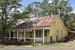
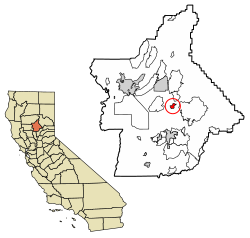
Forbestown is a census-designated place in Butte County, California. It lies at an elevation of 2772 feet. Its zip code is 95941 and its area code is 530. Forbestown had a population of 320 at the 2010 census.

<span class="mw-page-title-main">Butte Valley, California</span> Unincorporated community in California, United States

Butte Valley is an unincorporated community and census-designated place (CDP) named for a former settlement in Butte County, California, United States. It is located 5.5 miles (8.9 km) southeast of Chico. A post office operated at Butte Valley from 1861 to 1871, when it was re-located to Durham. Butte Valley sits at an elevation of 351 feet. The 2010 United States census reported Butte Valley's population is 899.

<span class="mw-page-title-main">Bear Valley, Mariposa County, California</span> Census-designated place in California, United States

Bear Valley is a census-designated place in Mariposa County, California, United States. It is located 10.5 miles (16.9 km) south-southeast of Coulterville, at an elevation of 2,054 feet (626 m). Bear Valley has been designated California Historical Landmark #331. The population was 156 at the 2020 census.

References

  1. "2010 Census U.S. Gazetteer Files – Places – California". United States Census Bureau.
  2. "Cherokee". Geographic Names Information System . United States Geological Survey, United States Department of the Interior . Retrieved February 4, 2015.
  3. "Explore Census Data". data.census.gov. Retrieved June 29, 2023.
  4. "Cherokee Census Designated Place". Geographic Names Information System . United States Geological Survey, United States Department of the Interior . Retrieved February 4, 2015.
  5. Durham, David L. (1998). California's Geographic Names: A Gazetteer of Historic and Modern Names of the State. Clovis, Calif.: Word Dancer Press. p. 211. ISBN   1-884995-14-4.
  6. Smith, Ken (July 8, 2013). "The Ghosts of Cherokee". Chico News & Review. Retrieved June 27, 2016.
  7. "USGS Geographic Names Butte County" . Retrieved June 27, 2016.
  8. "Census of Population and Housing". Census.gov. Retrieved June 4, 2016.
  9. "2010 Census Interactive Population Search: CA - Cherokee CDP". U.S. Census Bureau. Archived from the original on July 15, 2014. Retrieved July 12, 2014.