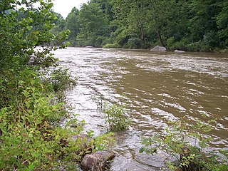
The Cherry River is a tributary of the Gauley River in southeastern West Virginia in the United States. Via the Gauley, Kanawha and Ohio rivers, it is part of the watershed of the Mississippi River. The Cherry River drains mostly rural and forested areas and flows for much of its length through the Monongahela National Forest. Throughout its entire length the Cherry goes over a series of whitewater rapids in a mountainous setting.

Sleepy Creek is an unincorporated community in Morgan County, West Virginia on the Potomac River at the mouth of Sleepy Creek. By 1860, Sleepy Creek had a post office and functioned as an important station on the Baltimore and Ohio Railroad.

Cherry Run is a 7.2-mile-long (11.6 km) meandering stream that forms the northern section of the boundary between Morgan and Berkeley counties in West Virginia's Eastern Panhandle. While it is mostly non-navigable, Cherry Run provides many pools of varying depths for fishing and swimming. As a tributary of the Potomac River, Cherry Run is part of the Potomac and Chesapeake Bay watersheds.

Holton is a small unincorporated community in northeastern Morgan County in the U.S. state of West Virginia. Holton lies on Martinsburg Road at its junction with Cherry Run Road along Cherry Run and the Berkeley County line. Holton had its own post office in operation between 1889 and 1903.

Cherry Grove is an unincorporated community located in Pendleton County, West Virginia, United States. Cherry Grove lies within the Monongahela National Forest at the confluence of Big Run with the North Fork South Branch Potomac River.

Cherry Creek is a large, swift-flowing stream in the Sierra Nevada mountain range, and is the largest tributary of the Tuolumne River. The creek is 40 miles (64 km) long measured to its farthest headwaters; the main stem itself is 26 miles (42 km) long, draining a watershed of 234 square miles (610 km2) in the Stanislaus National Forest. Part of the drainage also extends into the northwest corner of Yosemite National Park.

Fenwick is a census-designated place (CDP) in eastern Nicholas County, West Virginia, United States, adjacent to and immediately west of Richwood. As of the 2010 census, its population was 116. The town is situated at the bottomland surrounding the mouth of the Big Laurel Creek at its confluence with the Cherry River and has an elevation of 649 m (2129 ft). Fenwick is also the location of the convergence of three state highways: WV 55, WV 39, and WV 20 and acts as the western terminus of the Highland Scenic Highway.

Cherry is an unincorporated community in Cherry Township, Saint Louis County, Minnesota, United States.

East Beckley was an unincorporated community located in Raleigh County, West Virginia. Its post office was reopened in February 2014. East Beckley comprised parts of the unincorporated communities of Sylvia and Atkinsville.
Baltimore Run is a stream in West Virginia in Webster County.

Curtin is a nearly abandoned unincorporated community in eastern Nicholas County, West Virginia, United States. The area is situated at the bottomland surrounding the mouth of the Cherry River at its confluence with the Gauley River. Curtin is also the location where West Virginia Route 55 and West Virginia Route 20 cross the Gauley.
Cherry Gardens is an unincorporated community in Richmond County, in the U.S. state of Virginia.

Bristol is an unincorporated community in Harrison County, West Virginia, USA. It is located along U.S. Route 50 1.9 miles (3.1 km) east-northeast of Salem. Bristol had a post office, which closed on October 1, 2005.
Dugout was an unincorporated community located in Raleigh County, West Virginia. Dugout had a Post Office in 1904-1907.

Cherry Falls is an unincorporated community in Webster County, West Virginia.

Cherry Grove is an unincorporated community in Putnam County, West Virginia.

Sattes is an unincorporated community in Kanawha County, West Virginia. Its post office is closed.

Legg is an unincorporated community in Kanawha County, West Virginia, United States. Its post office is closed.

New Market West is a suburban housing community in Frederick County, in the U.S. state of Maryland. The community is located in the foothills of the Blue Ridge Mountains and is adjacent to the town of New Market.


