See also
 Looking east on Ching Wah St. 2019
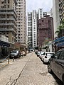 Looking west on Ching Wah St. 2019
Ching Wah Street is a street in North Point in Hong Kong. The short, primarily residential, street runs from west to east, parallel to King's Road, at a higher elevation, just behind St. Jude's Church. It is the location of Kiangsu and Chekiang Primary School and Eng Yu Evangelistic Mission Hong Kong Church.
During the 1967 riots, a bomb exploded in Ching Wah Street, killing two young children. It was one of 15 bombs that exploded during the disturbances, which lasted from April to December that year. [1]


Kwun Tong is an area in the Kwun Tong District of Hong Kong, situated at the eastern part of the Kowloon Peninsula, and its boundary stretches from Lion Rock in the north to Lei Yue Mun in the south, and from the winding paths of Kowloon Peak in the east to the north coast of the former Kai Tak Airport runway in the west.

Yau Ma Tei is an area in the Yau Tsim Mong District in the south of the Kowloon Peninsula in Hong Kong.

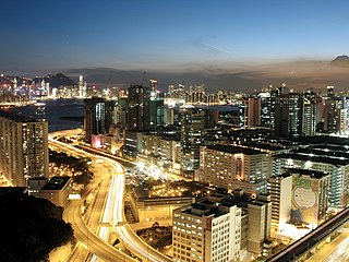
North Point is a mixed-use urban area in the Eastern District of Hong Kong. Located in the northeastern part of Hong Kong Island, the area is named after a cape between Causeway Bay and Tsat Tsz Mui that projects toward Kowloon Bay.

Ho Man Tin is a mostly residential area in Kowloon, Hong Kong, part of the Kowloon City District.

San Po Kong is an area in New Kowloon in Hong Kong. It is largely industrial and partly residential. Administratively, it belongs to Wong Tai Sin District.

Tai Wai is an area in the New Territories, Hong Kong, located between Sha Tin and the Lion Rock, within the Sha Tin District.

Chai Wan Road located in Hong Kong, is one of the major roads in Chai Wan on Hong Kong Island. It runs from Shau Kei Wan to Chai Wan through Chai Wan Gap; with one of the steepest inclines in Hong Kong on either side, with signs posted 1 in 10 gradient. It is therefore popularly referred to as Cheung Meng Che (長命斜), or long-lived incline.

The 1967 Hong Kong riots were large-scale anti-government riots that occurred in Hong Kong during British colonial rule. Beginning as a minor labour dispute, the demonstrations eventually escalated into protests against the British colonial government. The protests were also partially inspired by riots that had occurred just a few months prior in Portuguese Macau, known as the 12-3 incident, which were ultimately much more successful on the side of the protesters.

Hollywood Road is a street in Central and Sheung Wan, on Hong Kong Island, Hong Kong. The street runs between Central and Sheung Wan, with Wyndham Street, Arbuthnot Road, Ladder Street, Upper Lascar Row, and Old Bailey Street in the vicinity.

Sai Ying Pun is an area in Western District, on Hong Kong Island, in Hong Kong. It is administratively part of the Central and Western District.

Victoria Road is a main road near the west shore of Hong Kong Island in Hong Kong connecting Kennedy Town and Wah Fu and an alternative connection of Pok Fu Lam Road. It begins north with Belcher's Street in Kennedy Town and goes along Mount Davis, Sandy Bay, Telegraph Bay and Waterfall Bay and reaches in Kellett Bay.

Lung Cheung Road is a major road in New Kowloon, Hong Kong. It forms part of Route 7 linking Kwun Tong Road at Ngau Chi Wan and Ching Cheung Road near Tai Wo Ping. It is a dual 3-lane carriageway running in the east-west direction for its entire length.

Bonham Road is a main road in West Mid-Levels, Hong Kong Island in Hong Kong, running mainly East-West. The road connects Pok Fu Lam Road in the west, near the University of Hong Kong, and Caine Road in the east, at the junction with Hospital Road and Seymour Road. It was named after Sir George Bonham, the third Governor of Hong Kong. It was renamed Nishi-Taisho Dori (西大正通) during Japanese occupation of Hong Kong.

Johnston Road is a major road in Wan Chai on the Hong Kong Island of Hong Kong.

Tack Ching Girls' Secondary School is a girls school in the Sham Shui Po District of Kowloon, Hong Kong. In 2004 The school was relocated to a new school building at Hing Wah Street West and Sham Mong Road in Cheung Sha Wan.
Articles related to Hong Kong include:

The following is an overview of public housing estates on Tsing Yi, Hong Kong including Home Ownership Scheme (HOS), Private Sector Participation Scheme (PSPS), Flat-for-Sale Scheme (FFSS), Tenant Purchase Scheme (TPS) and Subsidised Sale Flats Project (SSFP) estates.

The Central and Western District located on northwestern part of Hong Kong Island is one of the 18 administrative districts of Hong Kong. It had a population of 243,266 in 2016. The district has the most educated residents with the second highest income and the third lowest population due to its relatively small size.
Scientia Secondary School is a secondary school in Ho Man Tin, Kowloon, Hong Kong.

Hong Kong Chinese Christian Churches Union Pok Fu Lam Road Cemetery or Hong Kong Chinese Christian Churches Union Pokfulam Road Cemetery is a cemetery in Pok Fu Lam, Hong Kong. It is managed by The Hong Kong Chinese Christian Churches Union (香港華人基督教聯會). It lies on the slopes east of Victoria Road between Tung Wah Coffin Home and Pok Fu Lam Road, facing Sandy Bay.
Coordinates: 22°17′20″N114°11′53″E / 22.28902°N 114.19801°E
| | This Hong Kong road article is a stub. You can help Wikipedia by expanding it. |
| | This Hong Kong Island location article is a stub. You can help Wikipedia by expanding it. |