U.S. Route 66, also known as the Will Rogers Highway, the Main Street of America or the Mother Road, was one of the original highways in the U.S. Highway System. US 66 was established on November 11, 1926, with road signs erected the following year. The highway, which became one of the most famous roads in the United States, originally ran from Chicago, Illinois, through Missouri, Kansas, Oklahoma, Texas, New Mexico, and Arizona before ending in Santa Monica in Los Angeles County, California, covering a total of 2,448 miles (3,940 km). It was recognized in popular culture by both the hit song "(Get Your Kicks on) Route 66" and the Route 66 television show in the 1960s. In John Steinbeck's classic American novel, The Grapes of Wrath (1939), the road, "Highway 66", was turned into a powerful symbol of escape and loss.

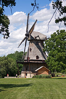
Will County is a county in the northeastern part of the state of Illinois. According to the 2010 census, it had a population of 677,560, which is an increase of 34.9% from 502,266 in 2000, making it the fourth-most populous county in Illinois. The county seat is Joliet.

Vermilion County is a county in the eastern part of the U.S. state of Illinois, between the Indiana border and Champaign County. It was established in 1826 and was the 45th of Illinois' 102 counties. According to the 2010 United States Census, it had a population of 81,625, a decrease of 2.7% in 2000. It contains 21 incorporated settlements; the county seat and largest city is Danville.

Sangamon County is a county located in the center of the U.S. state of Illinois. According to the 2010 census, it had a population of 197,465. Its county seat is Springfield, the state capital.

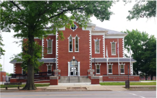
Randolph County is a county located in the U.S. state of Illinois. According to the 2010 census, it had a population of 33,476. Its county seat is Chester.

Peoria County is a county in the U.S. state of Illinois. The 2010 United States Census listed its population at 186,494. Its county seat is Peoria.

McHenry County is a county located in the U.S. state of Illinois. According to the 2010 census, it had a population of 308,760, making it the sixth-most populous county in Illinois. Its county seat is Woodstock.

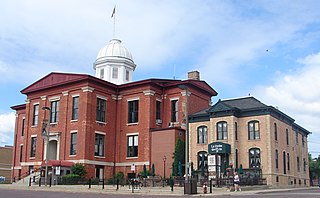
Lake County is a county situated in the northeastern corner of the U.S. state of Illinois along the shores of Lake Michigan. According to the 2010 census, it has a population of 703,462, making it the third-most populous county in Illinois. Its county seat is Waukegan, the ninth-largest city in Illinois. Lake County is one of the collar counties of the Chicago-Naperville-Elgin, IL-IN-WI Metropolitan Statistical Area.

Kane County is a county in the U.S. state of Illinois. According to the 2010 census, it has a population of 515,269, making it the fifth-most populous county in Illinois. Its county seat is Geneva, and its largest city is Aurora.

Cook County is a county in the U.S. state of Illinois. It is the second-most populous county in the United States after Los Angeles County, California. As of 2017, the population was 5,211,263. Its county seat is Chicago, the largest city in Illinois and the third-most populous city in the United States. More than 40% of all residents of Illinois live in Cook County.

Carroll County is a county located in the U.S. state of Illinois. As of the 2010 census, the population was 15,387. Its county seat is Mount Carroll.

U.S. Highway 136 is a spur of U.S. Highway 36. It runs from Edison, Nebraska, at U.S. Highway 6 and U.S. Highway 34 to the Interstate 74/Interstate 465 interchange in Speedway, Indiana. This is a distance of 804 miles (1,294 km). US 136 never meets its parent, US 36. However, it does come within 2 miles of it at its interchange with I-465/I-74 at its Eastern Terminus.

The Illinois Central Railroad, sometimes called the Main Line of Mid-America, was a railroad in the central United States, with its primary routes connecting Chicago, Illinois, with New Orleans, Louisiana, and Mobile, Alabama. A line also connected Chicago with Sioux City, Iowa (1870). There was a significant branch to Omaha, Nebraska (1899), west of Fort Dodge, Iowa, and another branch reaching Sioux Falls, South Dakota (1877), starting from Cherokee, Iowa. The Sioux Falls branch has been abandoned in its entirety.

Forgottonia, also spelled Forgotonia, is the name given to a 16-county region in Western Illinois in the late 1960s and early 1970s. This geographic region forms the distinctive western bulge of Illinois that is roughly equivalent to "The Tract", the Illinois portion of the Military Tract of 1812, along and west of the Fourth Principal Meridian. Since this wedge-shaped region lies between the Illinois and Mississippi rivers, it has historically been isolated from the eastern portion of Central Illinois.

U.S. Route 66 was a United States Numbered Highway in Illinois that connected St. Louis, Missouri, and Chicago, Illinois. The highway had previously been Illinois Route 4 (IL 4) and the road has now been largely replaced with Interstate 55 (I-55). Parts of the road still carry traffic and six separate portions of the roadbed have been listed on the National Register of Historic Places.

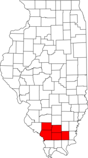
Metro Lakeland is a name that was coined in the 1960s for an area of southern Illinois that is centered on the intersections of Interstate 57, Interstate 24, and Illinois Route 13 — a four-lane east-west highway connecting the communities of Murphysboro, Carbondale, Carterville, Herrin, Marion, and Harrisburg. Metro Lakeland was defined as Jackson, Williamson, Franklin, Saline, and Perry counties, with a combined population of approximately 210,000. Carbondale, Herrin, and Marion are the key urban areas, with a combined city-proper population of over 65,000 Carbondale, the site of Southern Illinois University, is the region's largest city. Metro Lakeland is about 88 miles (142 km) southeast of St. Louis, Missouri, or 120 miles (190 km) by Interstate highway.
Interstate 55 (I-55) is a major north–south Interstate Highway in the U.S. state of Illinois that connects the St. Louis, Missouri, and Chicago metropolitan areas. It enters the state from Missouri on the Poplar Street Bridge near East St. Louis and runs to U.S. Route 41 near downtown Chicago where the highway ends, a distance of 294.38 miles (473.76 km). The Road also runs through the cities of Springfield, Bloomington, and Joliet. The section in DuPage County is officially named Joliet Freeway or Will Rogers Freeway and in Cook County is officially named the Stevenson Expressway.

The organized State Highway System of the U.S. state of Illinois comprises all of the state routes in the state.


