
Will County is a county in the northeastern part of the state of Illinois. According to the 2020 census, it had a population of 696,355, an increase of 2.8% from 677,560 in 2010, making it Illinois's fourth-most populous county. The county seat is Joliet. Will County is one of the five collar counties of the Chicago-Naperville-Elgin, IL-IN-WI Metropolitan Statistical Area. The portion of Will County around Joliet uses area codes 815 and 779, while 630 and 331 are for far northern Will County and 708 is for central and eastern Will County.
Washington County is a county located in the U.S. state of Illinois. As of the 2010 census, it had a population of 14,716. Its county seat is Nashville. It is located in the southern portion of Illinois known locally as "Little Egypt".

St. Clair County is the ninth most populous county in Illinois, located in the southwestern part of the state along the Mississippi River bordering Missouri. Located directly east of St. Louis, the county is part of the Metro East region of the Greater St. Louis metropolitan area. As of the 2020 United States census, St. Clair County had a population of 257,400, making it the third most populous county in Illinois outside the Chicago metropolitan area. Belleville is the county’s seat and largest city.

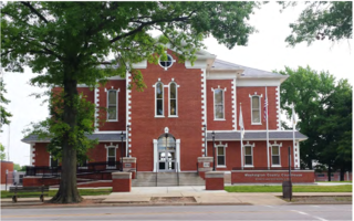
Perry County is in Illinois. According to the 2010 census, it had a population of 22,350. Its county seat is Pinckneyville. It is located in the southern portion of Illinois known as "Little Egypt".

Quincy, known as Illinois's "Gem City", is a city in and the county seat of Adams County, Illinois, United States, located on the Mississippi River. The 2020 census counted a population of 39,463 in the city itself, down from 40,633 in 2010. As of July 1, 2015, the Quincy Micro Area had an estimated population of 77,220. During the 19th century, Quincy was a thriving transportation center as riverboats and rail service linked the city to many destinations west and along the river. It was Illinois' second-largest city, surpassing Peoria in 1870. The city has several historic districts, including the Downtown Quincy Historic District and the South Side German Historic District, which display the architecture of Quincy's many German immigrants from the late 19th century.

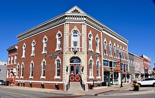
Robinson is a city in and the county seat of Crawford County, Illinois, United States. The population was 7,150 at the 2020 census, down from 7,713 at the 2010 census.
Washington is a city in Tazewell County, Illinois, United States. Washington is on U.S. Route 24 and Illinois Route 8, northeast of East Peoria. The population was 15,134 at the 2010 census, a 39.6 percent increase over 2000. It is a suburb of Peoria and is part of the Peoria Metropolitan Statistical Area.
Landover is an unincorporated community and census-designated place in Prince George's County, Maryland, United States. As of the 2020 census it had a population of 25,998.

Illinois Route 4 is a major north–south highway that runs south from the Interstate 55 business loop around the state capital of Springfield, south to Illinois Route 13 just north of Murphysboro. This is a distance of 170.44 miles (274.30 km).

Illinois Route 116 is a 176.07-mile-long (283.36 km) cross-state rural state highway that runs from U.S. Route 34 by Gladstone east to the intersection of US 45 and Old US 45, on the north side of Ashkum.

Metro East is a region in southern Illinois that contains eastern and northern suburbs and exurbs of St. Louis, Missouri, United States. It encompasses five Southern Illinois counties in the St. Louis Metropolitan Statistical Area. The region's most populated city is Belleville, with 45,000 residents. The Metro East is the second largest urban area in Illinois after the Chicago metropolitan area and, as of the 2000 census, the population of the Metro East statistical area was 599,845 residents, a figure that had risen to above 700,000 in 2010. The significant growth in the Metro East is mainly due to people in smaller outlying towns in Illinois moving to the area for better economic/job opportunities.

Illinois Route 163 is a 9.89-mile-long (15.92 km) north–south highway in southwestern Illinois. It runs from IL 158 in Millstadt north to IL 15 in Alorton; the route is located entirely within St. Clair County. IL 163 is maintained by the Illinois Department of Transportation.

Illinois Route 103 is a 9.18-mile-long (14.77 km) state route in west-central Illinois, United States. The route, entirely in Schuyler County, runs from U.S. Route 24 near Ripley east to the intersection of US 67 and IL 100 across the Illinois River from Beardstown. In addition to connecting Ripley and Beardstown, IL 103 serves the community of Sugar Grove. The highway is part of both the National Highway System and the Lincoln Heritage Trail. It is maintained by the Illinois Department of Transportation. The route was established in 1924 between Ripley and its current eastern terminus; its western terminus was moved north to its current location in 1932.
U.S. Bicycle Route 76 is a cross-country bicycle route east of Colorado in the United States. It is one of the two original U.S. Bicycle Routes, the other being U.S. Bicycle Route 1. USBR 76 runs from the Midwestern state of Kansas to the eastern seaboard state of Virginia. It is also known as the TransAmerica Bike Route and is contained within the TransAmerica Bicycle Trail.

State Route 445 is a 41.890-mile-long (67.415 km) state highway in Washoe County, Nevada. The route follows Pyramid Way, a major thoroughfare in the city of Sparks, and connects the Reno metropolitan area to Pyramid Lake. The route is designated a Nevada Scenic Byway.

U.S. Route 36 in the state of Missouri is an expressway with many freeway sections, connecting Kansas to Illinois. From Cameron to the Illinois state line, it forms part of the principal route between Kansas City and Chicago, known as the Chicago–Kansas City Expressway.

Several special routes of U.S. Route 40 exist. In order from west to east they are as follows.

Several special routes of U.S. Route 30 exist. In order from west to east they are as follows.

Several special routes of U.S. Route 50 exist. In order from west to east they are as follows.

Several special routes exist for U.S. Route 51.


