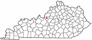
Clermont is a USGS-designated populated place (one of 32) in Bullitt County, Kentucky, United States, south of Louisville. It is an unincorporated community.
Clermont is a USGS-designated populated place (one of 32) in Bullitt County, Kentucky, United States, south of Louisville. It is an unincorporated community.
Clermont is located at (37.5547, -85.3910) and is 531 feet (162 meters) above sea level. This is in the Eastern Time Zone (Standard Time: GMT -5 hours, DST: GMT -4 hours), ZIP code 40110.
A large portion of Clermont consists of the Bernheim Arboretum and Research Forest.
Clermont is home to the famous Jim Beam distillery, and Bullitt County is a "wet" county. [1]
The Boy Scouts of America Camp Crooked Creek, which is associated with the Lincoln Heritage Council, is also located in Clermont.
The area was officially recognized by the USGS on September 20, 1979, during the rapid expansion of Shepherdsville due to the development of Interstate 65.

Washington County is a county located in the U.S. state of Kentucky. As of the 2020 census, the population was 12,027. Its county seat is Springfield. The county is named for George Washington. Washington County was the first county formed in the Commonwealth of Kentucky when it reached statehood, and the sixteenth county formed. The center of population of Kentucky is located in Washington County, in the city of Willisburg. The county is dry, meaning that the sale of alcohol is prohibited, but it contains the "wet" city of Springfield, where retail alcohol sales are allowed. This classifies the jurisdiction as a moist county. Three wineries operate in the county and are licensed separately to sell to the public. Jacob Beam, founder of Jim Beam whiskey, sold his first barrel of whiskey in Washington County.

Spencer County is a county located in the U.S. state of Kentucky. As of the 2020 census, the total population was 19,490. Its county seat is Taylorsville. The county was founded in 1824 and named for Spier Spencer.

Nelson County is a county located in the U.S. state of Kentucky. As of the 2020 census, the population was 48,065. Its county seat is Bardstown. Nelson County comprises the Bardstown, KY Micropolitan Statistical Area, which is also included in the Louisville/Jefferson County-Elizabethtown-Madison, KY-IN Combined Statistical Area.

Bullitt County is a county located in the north central portion of the U.S. state of Kentucky. As of the 2020 census, the population was 82,217. Its county seat is Shepherdsville. The county was founded in 1796. Located just south of the city of Louisville, Bullitt County is included in the Louisville/Jefferson County, KY-IN Metropolitan Statistical Area, commonly known as Kentuckiana. The western fifth of the county is part of the United States Army post of Fort Knox and is reserved for military training.

Hillview is a home rule-class city in Bullitt County, Kentucky, in the United States. The population was 8,172 at the 2010 census. The primary road through the area is Kentucky Route 61.

Lebanon Junction is a home rule-class city in Bullitt County, Kentucky, in the United States. The population was 1,813 as of the 2010 census.

Mount Washington is a home rule-class city in northeast Bullitt County, Kentucky, in the United States. The population was 18,090 at the 2020 census. The city is one of several surrounding Louisville that have experienced a sharp rise in population in the past three decades, becoming a commuter town.
Muldraugh Hill is an escarpment in Bullitt, Hardin, Jefferson, and Nelson counties of central Kentucky separating the Bluegrass on the north and north-east from the Pennyrile on the south and south-west. This escarpment fades into the Pottsville Escarpment on the east, and terminates at the Ohio River in the west, although in truth it continues in Indiana as Floyds Knobs.
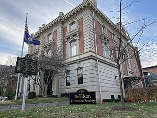
The Filson Historical Society, founded in 1884, is a privately supported historical society located at 1310 South 3rd Street in Louisville, Kentucky. The Filson is an organization dedicated to providing continuing adult education in the form of quarterly peer-reviewed academic journal, Ohio Valley History, a quarterly magazine, The Filson, weekly lectures, historical tours, and exhibits.
Bernheim Arboretum and Research Forest is a 16,137 acre (57 km2) arboretum, forest, and nature preserve located in Clermont, Kentucky.

The Knobs Region or The Knobs is located in the US state of Kentucky. It is a narrow, arc-shaped region consisting of hundreds of isolated hills. The region wraps around the southern and eastern parts of the Bluegrass region in the north central to northeastern part of the state. The western end of the Knobs region begins near Louisville, Kentucky and continues southeastward through Bullitt, Hardin, Nelson, LaRue, Marion, Taylor, Boyle, Casey and Lincoln counties before turning northeast and running along the Pottsville Escarpment and the Appalachian Plateau. The Knob arc has a length of 230 miles (370 km).
Kentucky's 2nd congressional district is a congressional district in the U.S. state of Kentucky. Located in west central Kentucky, the district includes Bowling Green, Owensboro, and Elizabethtown. The district has not seen an incumbent defeated since 1884.

The Salt River is a 150-mile-long (240 km) river in the U.S. state of Kentucky that drains 2,920 square miles (7,600 km2). It begins near Parksville, Kentucky, rising from the north slope of Persimmon Knob south of KY 300 between Alum Springs and Wilsonville, and ends at the Ohio River near West Point. Taylorsville Lake is formed from the Salt River, and Guist Creek Lake is also in its drainage basin.

Louisville is a city in Jefferson County, in the U.S. state of Kentucky. It is located at the Falls of the Ohio River.
Floyds Fork is a 62-mile-long (100 km) tributary of the Salt River in Kentucky, directly south and east of Louisville. It begins in Henry County, near Smithfield Kentucky, flows through eastern Jefferson County and flows into the Salt River near Shepherdsville in Bullitt County.

The United States District Court for the Western District of Kentucky is the federal district court for the western part of the state of Kentucky.
Bullitt's Lick is a historic salt lick 3 miles (4.8 km) west of Shepherdsville in Bullitt County, Kentucky. It was the first commercial supplier of salt in Kentucky, and the first industry in Kentucky as well, supplying jobs for many residents but also using slaves.
The Rolling Fork is a 108-mile-long (174 km) river in central Kentucky. The river flows through Marion and Hardin counties, as well as being the border between LaRue and Nelson counties. The Rolling Fork drains much of the land in these counties, and is a key part of life in this area of the Knob Region. The Rolling Fork is a part of the Salt River Basin, and the larger Ohio River Basin.
Bardstown Junction is an unincorporated community in Bullitt County, Kentucky, in the United States.
The Bird's Nest in Shelby County, Kentucky, about 3 miles (4.8 km) south of Cropper, Kentucky, was built c.1850.
Coordinates: 37°33′17″N85°23′28″W / 37.5547°N 85.3910°W
Municipalities and communities of Bullitt County, Kentucky, United States | ||
|---|---|---|
| Cities |  | |
| CDP | ||
| Unincorporated communities | ||
| | This Bullitt County, Kentucky state location article is a stub. You can help Wikipedia by expanding it. |