Colony, Oklahoma

Last updated

Colony, Oklahoma
OKMap-doton-Colony.PNG
Location of Colony, Oklahoma
Coordinates: 35°20′55″N98°40′17″W / 35.34861°N 98.67139°W / 35.34861; -98.67139
Country United States
State Oklahoma
County Washita
Area
[1]
  Total0.92 sq mi (2.39 km2)
  Land0.92 sq mi (2.39 km2)
  Water0.00 sq mi (0.00 km2)
Elevation
[2]
1,460 ft (450 m)
Population
 (2020)
  Total112
  Density121.48/sq mi (46.92/km2)
Time zone UTC-6 (Central (CST))
  Summer (DST) UTC-5 (CDT)
ZIP code
73021
Area code 405
FIPS code 40-16400 [3]
GNIS feature ID2413229 [2]
Website www.colonyok.com

Colony is a town in northeastern Washita County, Oklahoma, United States. The population was 136 at the 2010 U.S. census, a decrease of 7.5 percent from 147 in 2000. [4] It was named for the Seger Colony, founded in 1886, which taught modern agricultural techniques to the Arapaho and Cheyenne tribes that would be resettled in the vicinity. Colony is 16 miles (26 km) east and 4 miles (6.4 km) north of Cordell. [5]

Contents

History

John Seger, a native of Ohio and a Union veteran of the Civil War, was hired in 1872 to work as a mason/carpenter to build housing and other structures for a school for Native American children at the Darlington Agency. Later, he began a colony for Native Americans with Arapaho Indians, who were joined later by several Cheyennes. By the following year, Seger's colony had over 500 inhabitants. Seger began teaching modern agricultural methods as well as brick-making. By 1892, the colony had also built an industrial arts school, with the Native Americans providing the bricks and cutting stone for all the buildings. [5]

William De Lestinier opened a store near the school with government permission, even before the Land Run of 1892. After the opening, a group of settlers, led by Zack King, created a townsite 4 miles (6.4 km) west of the school and obtained a post office named Seger. De Lestinier moved his store to the new site. In 1895, the Dutch Reformed Church founded a mission at the colony. In 1896, a new post office named Colony opened, and the town took that name. [5]

The colony continued to grow and had an estimated population of 300 by 1911. The Dutch Reformed mission closed in 1912 and the Seger Indian school closed in 1932. [5]

In 1900, students brand cattle at the Seger Colony Students branding cattle at Seger Colony School, Oklahoma, 1900 - NARA - 519189.jpg
In 1900, students brand cattle at the Seger Colony

Geography

Colony is located in Seger Township (T10N R14W), Washita County, Oklahoma. According to the United States Census Bureau, the town has a total area of 0.9 square miles (2.3 km2), all land.

Demographics

Historical population
CensusPop.Note
1970 201
1980 185−8.0%
1990 163−11.9%
2000 147−9.8%
2010 136−7.5%
2020 112−17.6%
U.S. Decennial Census [6]

As of the census [3] of 2000, there were 147 people, 64 households, and 49 families residing in the town. The population density was 156.6 inhabitants per square mile (60.5/km2). There were 79 housing units at an average density of 84.2 per square mile (32.5/km2). The racial makeup of the town was 80.27% White, 10.20% Native American, 4.76% from other races, and 4.76% from two or more races. Hispanic or Latino of any race were 5.44% of the population.

There were 64 households, out of which 28.1% had children under the age of 18 living with them, 71.9% were married couples living together, 4.7% had a female householder with no husband present, and 21.9% were non-families. 20.3% of all households were made up of individuals, and 14.1% had someone living alone who was 65 years of age or older. The average household size was 2.30 and the average family size was 2.62.

In the town, the population was spread out, with 21.1% under the age of 18, 2.7% from 18 to 24, 21.8% from 25 to 44, 26.5% from 45 to 64, and 27.9% who were 65 years of age or older. The median age was 48 years. For every 100 females, there were 96.0 males. For every 100 females age 18 and over, there were 93.3 males.

The median income for a household in the town was $26,912, and the median income for a family was $27,426. Males had a median income of $26,071 versus $16,250 for females. The per capita income for the town was $18,106. There were 15.1% of families and 17.2% of the population living below the poverty line, including 23.5% of under eighteens and 21.6% of those over 64.

Notable people

See also

Related Research Articles

<span class="mw-page-title-main">Washita County, Oklahoma</span> County in Oklahoma, United States

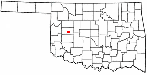
Washita County is a county located in the U.S. state of Oklahoma. As of the 2020 census, the population was 10,924. Its county seat is New Cordell. The county seat was formerly located in Cloud Chief. The county was created in 1891.

<span class="mw-page-title-main">Roger Mills County, Oklahoma</span> County in Oklahoma, United States

Roger Mills County is a county located in the western part of the U.S. state of Oklahoma. As of the 2020 census, the population was 3,442, making it the fourth-least populous county in Oklahoma. Its county seat is Cheyenne. The county was created in 1891.

<span class="mw-page-title-main">Custer County, Oklahoma</span> County in Oklahoma, United States

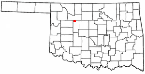
Custer County is a county located in the U.S. state of Oklahoma. As of the 2020 census, the population was 28,513. Its county seat is Arapaho. The county was named in honor of General George Armstrong Custer.

<span class="mw-page-title-main">Canadian County, Oklahoma</span> County in Oklahoma, United States

Canadian County is a county located in the U.S. state of Oklahoma. As of the 2020 census, the population was 154,405, making it the fourth most populous county in Oklahoma. Its county seat is El Reno.

<span class="mw-page-title-main">Beckham County, Oklahoma</span> County in Oklahoma, United States

Beckham County is a county located on the western border of the U.S. state of Oklahoma. As of the 2020 census, the population was 22,410. Its county seat is Sayre. Founded upon statehood in 1907, Beckham County was named for J. C. W. Beckham, who was Governor of Kentucky and the first popularly elected member of the United States Senate from Kentucky. Beckham County comprises the Elk City, OK Micropolitan Statistical Area.

<span class="mw-page-title-main">Longdale, Oklahoma</span> Town in Oklahoma, United States

Longdale is a town in northwestern Blaine County, Oklahoma, United States. The population was 262 at the 2010 census, down 18.3 percent from the figure of 310 in 2000.

<span class="mw-page-title-main">Calumet, Oklahoma</span> Town in Oklahoma, United States

Calumet is a town in Canadian County, Oklahoma, United States. It is part of the Oklahoma City Metropolitan Area. The population was 507 at the 2010 census, a 5.23 percent decrease since 2000.

<span class="mw-page-title-main">Arapaho, Oklahoma</span> Town in Oklahoma, United States

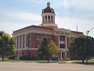
Arapaho is a town in, and the county seat of, Custer County, Oklahoma, United States. The population was 668 at the time of the 2020 census. The town lies long U.S. Route 183 and is named for the Arapaho Native American tribe.

<span class="mw-page-title-main">Camargo, Oklahoma</span> City in Oklahoma, United States

Camargo is a town in Dewey County, Oklahoma, United States. The population was 193 as of the 2020 United States census, an increase over the 178 reported at the 2010 census, and the figure of 115 reported in 2000.

<span class="mw-page-title-main">Hennessey, Oklahoma</span> Town in Oklahoma, United States

Hennessey is a town in Kingfisher County, Oklahoma, United States. The population was 2,131 at the 2010 census, up from 2,058 in 2000.

<span class="mw-page-title-main">Mountain View, Oklahoma</span> Town in Oklahoma, United States

Mountain View is a town in Kiowa County, Oklahoma, United States. Its population was 740 as of the 2020 United States census. It is situated about 23 miles east of the county seat of Hobart, at the intersection of Oklahoma State Highway 9 and Oklahoma State Highway 115.

<span class="mw-page-title-main">Cheyenne, Oklahoma</span> Town in Oklahoma, United States

Cheyenne is a town in Roger Mills County, Oklahoma, United States. As of the 2020 census, the town’s population was 771. It is the county seat of Roger Mills County.

<span class="mw-page-title-main">Strong City, Oklahoma</span> Town in Oklahoma, United States

Strong City is a town in Roger Mills County, Oklahoma, United States. As of the 2020 census, the town’s population was 33.

<span class="mw-page-title-main">Corn, Oklahoma</span> Town in Oklahoma, United States

Corn is a town in Washita County, Oklahoma, United States. The population was 503 at the 2010 census.

<span class="mw-page-title-main">Foss, Oklahoma</span> Town in Oklahoma, United States

Foss is a town in Washita County, Oklahoma, United States. As of the 2010 census, the town population was 151, an 18.9 percent increase from 127 at the 2000 census.

<span class="mw-page-title-main">New Cordell, Oklahoma</span> City in Oklahoma, United States

New Cordell is a city in, and county seat of, Washita County, Oklahoma, United States. It lies along U.S. Route 183. The population was 2,915 at the 2010 census. The community was previously established a few miles from the current site, but was moved about 1900. It was named for a U.S. Postal Service employee in Washington D. C., Wayne W. Cordell. The official name is New Cordell, though it is now commonly called Cordell.

<span class="mw-page-title-main">Sentinel, Oklahoma</span> Town in Oklahoma, United States

Sentinel is a town in Washita County, in the U.S. state of Oklahoma. The population was 901 in the 2010 census, an increase of 4.9 percent from the figure of 859 residents in 2000. Towns near Sentinel are Rocky, Cordell, Canute, and Burnsflat.

<span class="mw-page-title-main">Geary, Oklahoma</span> City in Oklahoma, United States

Geary is a city in Blaine and Canadian counties in the U.S. state of Oklahoma. The population was 994 at the 2020 census. The town was named for Edmund Guerrier, a scout and an interpreter for the U.S. Army.

<span class="mw-page-title-main">Clinton, Oklahoma</span> City in Oklahoma, United States

Clinton is a city in Custer and Washita counties in the U.S. state of Oklahoma. The population was 8,521 at the time of the 2020 census.

<span class="mw-page-title-main">Hammon, Oklahoma</span> Town in Oklahoma, United States

Hammon is a town in the U.S. state of Oklahoma, the majority of which is in Roger Mills County, but some of which extends into Custer County. It is located at the junction of Oklahoma State Highways 33 and 34.

References

  1. "ArcGIS REST Services Directory". United States Census Bureau. Retrieved September 20, 2022.
  2. 1 2 U.S. Geological Survey Geographic Names Information System: Colony, Oklahoma
  3. 1 2 "U.S. Census website". United States Census Bureau . Retrieved January 31, 2008.
  4. CensusViewer: Colony, Oklahoma Population. Retrieved August 4, 2013.
  5. 1 2 3 4 Boothe, Wayne. Encyclopedia of Oklahoma History and Culture. "Colony."
  6. "Census of Population and Housing". Census.gov. Retrieved June 4, 2015.
  7. Boothe, Wayne. "Colony." Encyclopedia of Oklahoma History and Culture. Accessed May 21, 2019.
  8. Longert, Scott. "Dale Mitchell SABR biography". Society for American Baseball Research. Retrieved November 8, 2019.