This article relies largely or entirely on a single source .(January 2021) |
Cooper Creek is a tributary stream of the Braden River, in turn a tributary of the Manatee River, located in both Manatee County, Florida and Sarasota County, Florida. [1]
This article relies largely or entirely on a single source .(January 2021) |
Cooper Creek is a tributary stream of the Braden River, in turn a tributary of the Manatee River, located in both Manatee County, Florida and Sarasota County, Florida. [1]

DeSoto County is a county located in the Florida Heartland region of the U.S. state of Florida. As of the 2020 census, the population was 33,976. Its county seat is Arcadia.

Manatee County is a county in the U.S. state of Florida. As of the 2020 US Census, the population was 399,710. Manatee County is part of the Bradenton-Sarasota-Venice, Florida Metropolitan Statistical Area. Its county seat and largest city is Bradenton. The county was created in 1855 and named for the Florida manatee, Florida's official marine mammal. Features of Manatee County include access to the southern part of the Tampa Bay estuary, the Sunshine Skyway Bridge, and the Manatee River.
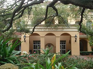
Bradenton is a city in and the county seat of Manatee County, Florida, United States. As of the 2020 census, the city's population is 55,698.

Ellenton is an unincorporated community and census-designated place (CDP) in Manatee County, Florida, United States. The population was 4,129 at the 2020 census. It is part of the Bradenton-Sarasota-Venice, Florida Metropolitan Statistical Area.
The Myakkahatchee Creek is a small stream located near the city of North Port in Sarasota County, Florida. It is a tributary of the Myakka River.

Sarasota Bay is a lagoon located off the central west coast of Florida in the United States. Though no significant single stream of freshwater enters the bay, with a drainage basin limited to 150 square miles in Manatee and Sarasota Counties, it is generally treated as an estuary, with three "passes" or inlets, giving access from the Gulf of Mexico. Its source of freshwater has been increased from natural historical levels by urban runoff.

The Little Manatee River flows 51 miles (82 km), from east of Fort Lonesome, Florida South of Hwy 674 and Earl Reynolds Rd In Hillsborough County through southern Hillsborough County, Florida including towns such as Sun City, Florida, and Gulf City, Florida and northern Manatee County, Florida into Tampa Bay. It has a drainage basin of 222 square miles (570 km2). It flows along the Little Manatee River State Park for part of its route. Portions of the river Such as Hayes Bayou and Mills Bayou have been designated as an Outstanding Florida Water and are part of the Cockroach Bay Aquatic Preserve.
Bowlees Creek is a 4.8 mile stream. This river is located within watershed(s): Sarasota Bay Watershed. Manatee County, Florida, USA.
Tallevast is an unincorporated community in Manatee County, Florida, United States. It is part of the Bradenton–Sarasota–Venice Metropolitan Statistical Area. The ZIP Code for Tallevast is 34270.
The Southwest Florida Water Management District, is one of five regional agencies directed by Florida state law to protect and preserve water resources. Established in 1961 the agency operates and maintains several large properties and flood protection projects, sometimes with other agencies. The District's responsibilities have expanded to include managing water supply and protecting water quality and the natural systems — rivers, lakes, wetlands and associated uplands.The District's stated mission is to protect water resources, minimize flood risks and ensure the public’s water needs are met.

Crystal River is a very short river in Citrus County, Florida, flowing into the Gulf of Mexico. It is just seven miles long, and has a drainage basin of five square miles, joining Kings Bay to the Gulf of Mexico. The river's significance is in the thirty natural springs that add an average of 300 million gallons of warm water to the river every day. These springs include Three Sisters Springs.

The Myakka River is a river in southwestern Florida. It arises near the Hardee-Manatee county line and flows southwest and then southeast through Manatee, Sarasota and Charlotte counties to Charlotte Harbor, an arm of the Gulf of Mexico. The river is 72 miles (116 km) long and has a drainage basin of 602 square miles, of which 314.7 square miles (815 km2) lies in Sarasota county. The last 20 miles (32 km) of the river is tidal and brackish.

The Waccasassa River is a small, isolated river in Levy County, Florida, flowing through the Gulf Hammock wetlands and emptying into the Gulf of Mexico. The river is 29 miles (47 km) long, and has a drainage basin of 610 square miles (1,600 km2). Three-quarters of the river is accessible only by canoe or kayak.
The University of South Florida Sarasota–Manatee is a branch campus of the University of South Florida in Sarasota, Florida. USFSM was established in 1975 as a regional campus of the University of South Florida and gained separate accreditation by the Southern Association of Colleges and Schools Commission on Colleges to award baccalaureate and master's degrees in June 2011. It was consolidated with the other two USF campuses as of July 1, 2020.

The Chassahowitzka River is a spring-fed river located in southwestern Citrus County, Florida. The 5-mile-long (8 km) river is home to hundreds of species of birds including the bald eagle, and is a common refuge for the West Indian manatee. In 1941, approximately 31,000 acres (13,000 ha) of its saltwater creeks, freshwater tributaries, and hardwood hammocks were recognized as Chassahowitzka National Wildlife Refuge. It is accessible by boat from a nearby public boat ramp that is located at the campground that also bears its Indian name which means "land of hanging pumpkins;" a reference to a wild variety that once grew along the banks.
Myakka City is an unincorporated community in southeastern Manatee County, Florida, United States. It lies along State Road 70 near the city of Bradenton, the county seat of Manatee County. Its elevation is 43 feet (13 m), and it is located at 27°20′59″N82°9′41″W. Although Myakka is unincorporated, it has a post office, with the ZIP code of 34251; the ZCTA for ZIP code 34251 had a population of 6,351 at the 2010 census. up from 4,239 in 2000.
Gillette is an unincorporated area and small community in Manatee County, Florida, United States.
Gamble Creek is a stream in Manatee County, Florida, in the United States.

Nathan Benderson Park, previously known as North Metro Park and Cooper Creek Park, is a 600-acre (240 ha) park in the U.S. state of Florida, owned by Sarasota County. It incorporates a 400-acre (160 ha) artificial lake in northern Sarasota County, directly south of the Manatee County county line, west of Interstate 75. The lake is a rowing venue and hosted the 2017 World Rowing Championships.
Coordinates: 27°24′40″N82°26′56″W / 27.41111°N 82.44897°W