Cootamundra

Last updated

Cootamundra
New South Wales
Cootamundra Building A 004.jpg
The CBC bank building and post office on Wallendoon St
Australia New South Wales location map blank.svg
Red pog.svg
Cootamundra
Coordinates 34°38′30″S148°01′30″E / 34.64167°S 148.02500°E / -34.64167; 148.02500
Population5,732 (UCL 2021) [1]
Established1861
Postcode(s) 2590
Elevation318 m (1,043 ft)
Location
  • 390 km (242 mi) from Sydney
  • 161 km (100 mi) from Canberra
  • 53 km (33 mi) from Junee
  • 49 km (30 mi) from Young
  • 105 km (65 mi) from Yass
LGA(s) Cootamundra-Gundagai Regional Council
County Harden
State electorate(s) Cootamundra
Federal division(s) Hume
Mean max tempMean min tempAnnual rainfall
22.3 °C
72 °F
7.8 °C
46 °F
614.3 mm
24.2 in

Cootamundra, nicknamed Coota, is a town in the South West Slopes region of New South Wales, Australia and within the Riverina. It is within the Cootamundra-Gundagai Regional Council. At the 2016 Census, Cootamundra had a population of 6,782. It is located on the Olympic Highway at the point where it crosses the Muttama Creek, between Junee and Cowra. Its railway station is on the Main Southern line, part of the Melbourne-to-Sydney line.

Contents

Cootamundra is the birthplace of Sir Donald Bradman AC , an Australian cricketer universally regarded as the greatest batsman of all time. It is also known for being the site of Cootamundra Domestic Training Home for Aboriginal Girls, an institution housing Aboriginal girls who were forcibly taken from their families.

It is also the home of the Cootamundra wattle. Every year there is a large "Wattle Time" Festival held at the time the wattle starts to bloom, with an art show and festivities.

History

The traditional owners of the area where present day Cootamundra exists are considered to be the Wiradjuri people, with the name "Cootamundra" probably deriving from the Wiradjuri language word guudhamang for "turtle". [2]

Parker St, the main street of Cootamundra Cootamundra Parker Street 001.JPG
Parker St, the main street of Cootamundra

Cootamundra was incorporated as a township on 9 August 1861, and the first settlers bought their lots in early 1862. Like many other towns in the Riverina, it was originally populated by those attracted by the gold rush of the 1860s but became a quiet yet prosperous agricultural community after the local deposits were exhausted. However, the potential sale of a recently disused mine near Adelong may have piqued the curiosity of would-be prospectors. [3]

It is one of the oldest towns in Australia.

The town's rugby league team, the Cootamundra Bulldogs, competed in the Maher Cup.[ citation needed ]

Birthplace of Sir Donald Bradman Cootamundra Bradman's Birthplace Museum 003.JPG
Birthplace of Sir Donald Bradman
Bradman statue in Jubilee Park Bradman statue at Cootamundra.jpg
Bradman statue in Jubilee Park

Timeline

First town lots sold by auction at Gundagai [4]
Cootamundra's railway connection opens on 1 November.
Public school opens on Cooper Street [4]
Bank of NSW building (the current Westpac) constructed [4]
Farmers' and Settlers' Association founded

Churches

The first churches in Cootamundra were:

Primitive Methodist

Rev. Smith was minister from around 1874, succeeded by J. Spalding, who was minister in 1877, and services were held on alternate Sunday afternoons.

Wesleyan Methodist

The church, seating 100 persons, was opened on 17 December 1876. Rev. G. Thompson was minister in 1878 [11] and services were held regularly. [12] In 1880 Rev. R. East was the only minister resident in the town. [13]

Anglican

Christ Church opened on 12 July 1878; the vicar W. Cocks shared with Murrumburrah. In January 1880 Rev. S. B. Holt left Gundagai to take up the position.

Roman Catholic

Eighty confirmations were performed in 1875 in conjunction with a jubilee attended by Bishop Lanigan of Goulburn and Fathers Bermingham (Burrowa), Dunne and O'Dwyer (Gundagai), and Hanley (Goulburn). [14] Mass was held fortnightly in the schoolroom by visiting priests from Gundagai. [15] St Columba's church was consecrated on 30 November 1879. [16] The first resident pastor was Rev. Richard Butler in 1881.

Military history

During World War II, Cootamundra was the location of RAAF No.3 Inland Aircraft Fuel Depot (IAFD), completed in 1942 and closed on 14 June 1944. It was located in an area of land near the intersection of Olympic Highway and Thompson Street. Usually consisting of 4 tanks, 31 fuel depots were built across Australia for the storage and supply of aircraft fuel for the RAAF and the US Army Air Forces at a total cost of £900,000 ($1,800,000). [17]

It was also home to the No 1 Air Observers School, commemorated by a plaque at Cootamundra Airfield.

A plane from the No. 31 Beaufighter Squadron, RAAF, from Wagga Wagga, crashed nearby on 21 September 1942 during training exercises, resulting in the death of Flt/Sgt J. E. Jenkins and Sgt V. Sutherst. A memorial alongside the main road to Young, dedicated on 28 April 1990, [18] is regularly tended. See Gallery below.

Heritage listings

Aerial view of Cootamundra Cootamundra NSW Australia 20070223.jpg
Aerial view of Cootamundra

Cootamundra has a number of heritage-listed sites, including:

Description and attractions

Cootamundra is located in the South West Slopes region of New South Wales, within the Riverina region.

It is within the local government area of Cootamundra-Gundagai Regional Council. Abb McAlister was elected mayor of the newly-formed Cootamundra-Gundagai Regional Council on 21 September 2017. [23]

The town is known as the birthplace of the great cricketer Sir Donald Bradman. Although he never lived in the town and his parents left Yeo Yeo (some 18 km from Cootamundra) when he was two, the town celebrates this connection with the Sir Donald Bradman Birthplace Museum, the home where "The Don" was born, a fully restored visitors' site featuring cricketing memorabilia and artefacts. [24]

The Coota Ex-Services Club is an ex-servicemen's club that is open to the public as a restaurant. [25]

Hemet, California, is a sister city. [26]

Cricket Captains' Walk

Cricket Captains' Walk Coota Captains Walk.jpg
Cricket Captains' Walk

In 1998 a collection of 14 captains of the Australia International Test XI cricket team was unveiled in Jubilee Park, adjacent the Caravan Park. Specially commissioned, they were all the work of Harden-Murrumburrah sculptor Carl Valerius.[ citation needed ]

In 2008 a further 30 busts were installed on either side of a looping path, making a full set of Australian Test cricket captains, with three more added in 2020 to bring the list up to date. These are by various artists from the Tom Bass sculpture studio. The all-weather path, which starts and ends at Wallendoon Street is family, jogger, and wheelchair friendly, and approximately 250 metres long.[ citation needed ]

A life-sized bronze statue of Bradman in action, also by Valerius, is nearby, as is a newly-installed barbecue and playground. Jubilee Park, the site of these attractions, is on land reclaimed from the original stock dam, memorialised by a plaque on the Morgan Arch on Wallendoon Street.[ citation needed ]

The Giant

"The Giant" The Giant, Cootamundra.jpg
"The Giant"

The large effigy of a fairytale giant gesturing towards to his crotch was created by an unknown artist around 1975 in fibreglass as a mascot for "The Giant Supermarket" on the corner of Cooper and Wallendoon streets.

This location was in 1882 the site of Kibby's "Trade Palace" department store; [27] and taken over by Solomon Cohen (c. 1848–1922) in 1886. [28] In 1943 it became "Cohen's Corner", [29] a name which endures to this day. "Hammond and Hanlon" were tenants in 1962 and "The Giant" in 1975, subsequently "U-Mark-it", "Half-case Warehouse", "Payless", and "Food World". It next became Mark Ward's hardware store, then "GV Bargains".

When the statue was taken down it was purchased by Allan and Phuong Jenkins, who ran a florist shop nearby. In 1985 Allan participated in a Round-Australia marathon run by Rotary International and the Australian Cancer Society as a fundraiser, and his support vehicle was surmounted by "The Giant". In 2014 the Jenkins couple donated the statue to the Cootamundra Heritage Centre.[ citation needed ]

Local artist Jim Newman did its original paintwork back in 1975, and his brother Robert Newman was responsible for its restoration in 2015. [30] The statue is located alongside the Heritage Centre on Hovell Street, near the railway station.

The Giant, [31] along with Don Bradman's Bat and Stumps in Bradman Oval, [32] are considered to be two of Australia's many Big Things.

Population

According to the 2016 Australian census, there were 6,782 people in Cootamundra. Of these: [33]

Historical population
YearPop.±%
19211,748    
19334,683+167.9%
19475,259+12.3%
19545,760+9.5%
19615,939+3.1%
19666,219+4.7%
19716,530+5.0%
19766,384−2.2%
19816,540+2.4%
19866,314−3.5%
19916,386+1.1%
19965,879−7.9%
20015,486−6.7%
20065,566+1.5%
20115,579+0.2%
20165,669+1.6%
20215,732+1.1%
Source: Australian Bureau of Statistics data. [34] [35]

Transport

Cootamundra railway station Cootamundra Railway Station from Footbridge.JPG
Cootamundra railway station

Cootamundra railway station is located on the Main Southern railway line, with passengers served in each direction by twice daily NSW TrainLink XPT railway services between Sydney and Melbourne, and the twice weekly Xplorer railway services to Griffith. Interstate freight trains also pass through the town.

Regional Rail Logistics previously operated a containerised freight service from Junee to Sydney stopping in the town, [36]

Preceding station TfNSW T.png NSW TrainLink Following station
Junee
towards Griffith or Melbourne
NSW TrainLink Southern Line
Griffith Xplorer
Melbourne XPT
Harden
towards Sydney

Cootamundra acts as a hub for coach services, run by Transport for NSW, to other regional centres with departures and arrivals timed to connect with certain New South Wales XPT train arrivals. The exception is Services 704/703 (coloured row), provided for those who have business in Canberra civic, the major hospitals, or to connect with the Canberra–Sydney rail service (three trains per day both directions).

Seats are allocated and must be booked ahead. [37] must be consulted for conditions of travel and coach stop locations. On-line booking and more information [38]

Destination/sOther stopsService #FrequencyReturn #FrequencyNotes
Condobolinsee timetable717Daily718Daily
Tumbarumbasee timetable723Tue/Thu/Sun724Tue/Thu/Sun
Griffith, Hay, Mildurasee timetable725Daily726Daily~20 min. refreshment stop at Hay
Yass Junction, Canberra, Queanbeyansee timetable782Daily781Daily~15 min. stop at Yass Junction. Wheelchair access
Parkes, Dubbosee timetable791Mon/Wed/Sat792Sun/Tue/ThuWheelchair access
Orange, Bathurstsee timetable793Tue/Thu/Fri/Sun794Mon/Wed/Fri/Sat
Major stop on route: Wagga Wagga–Cootamundra–Canberra–Queanbeyansee timetable [39] 704 [40] Tue/Thu/Sat (morning)703 [41] Tue/Thu/Sat (evening)currently (2019) a trial service, trial timetable, Wheelchair access

Airport

Cootamundra Airport, is one of the oldest country airports outside of Mascot to be continually licensed.

From 1991 to 2002 local business Country Connection Airlines offered regional flights from Cootamundra to Sydney, as well as to many other regional locations such as West Wyalong, Cowra, Forbes and Young.

Sport

Cootamundra has a long and proud sporting history, with the region most notably producing Sir Donald Bradman, the greatest test cricketer ever.

Today, the most popular sport in Cootamundra is rugby league. The local team, the Cootamundra Bulldogs, compete in the George Tooke Shield competition, which is part of the broader Canberra Rugby League. The club formerly competed in the Group 9 Rugby League competition, in which they were among the most successful clubs, winning nine titles, and their junior sides remain in this league. The club famously produced Les Boyd, whom the club's home ground is named after, Eric Weissel, and Paul Field, a local player who was picked to represent New South Wales in the 1983 State of Origin series, one of only three players to ever be selected for the side from a Country Rugby League club.

Cootamundra also has an Australian rules football side, nicknamed the Blues, who play in the AFL Canberra lower divisions, and a rugby union team, the Cootamundra Tri-Colours, in the Central West Rugby Union Division 3 South. The region also has a strong local cricket competition.

Notable residents

Climate

Cootamundra has hot, dry summers interspersed with severe thunderstorms, and cool, cloudy winters with many rain days. Occasionally, snow may fall during the winter months, with the most recent settled snowfall having occurred in August 2019. Under the Köppen climate classification scheme, the town has a humid subtropical climate (Cfa), receiving enough precipitation to avoid the cold semi-arid (BSk) climate classification.

Climate data for Cootamundra Airport (1995–2022); 335 m AMSL; 34.63° S, 148.04° E
MonthJanFebMarAprMayJunJulAugSepOctNovDecYear
Record high °C (°F)45.0
(113.0)
43.0
(109.4)
39.7
(103.5)
33.5
(92.3)
27.0
(80.6)
22.0
(71.6)
20.5
(68.9)
24.8
(76.6)
30.2
(86.4)
34.9
(94.8)
41.0
(105.8)
42.2
(108.0)
45.0
(113.0)
Mean daily maximum °C (°F)32.1
(89.8)
30.4
(86.7)
27.2
(81.0)
22.7
(72.9)
17.5
(63.5)
13.9
(57.0)
13.0
(55.4)
14.6
(58.3)
18.3
(64.9)
22.4
(72.3)
26.1
(79.0)
29.3
(84.7)
22.3
(72.1)
Mean daily minimum °C (°F)16.1
(61.0)
15.5
(59.9)
12.4
(54.3)
7.5
(45.5)
3.5
(38.3)
2.2
(36.0)
1.2
(34.2)
1.5
(34.7)
3.5
(38.3)
6.3
(43.3)
10.4
(50.7)
13.0
(55.4)
7.8
(46.0)
Record low °C (°F)2.0
(35.6)
2.9
(37.2)
0.9
(33.6)
−4.0
(24.8)
−6.5
(20.3)
−7.3
(18.9)
−7.8
(18.0)
−7.0
(19.4)
−6.0
(21.2)
−3.5
(25.7)
−1.4
(29.5)
2.1
(35.8)
−7.8
(18.0)
Average precipitation mm (inches)49.3
(1.94)
52.3
(2.06)
53.9
(2.12)
35.3
(1.39)
38.0
(1.50)
60.7
(2.39)
58.5
(2.30)
58.4
(2.30)
52.9
(2.08)
48.6
(1.91)
64.6
(2.54)
52.7
(2.07)
614.3
(24.19)
Average precipitation days (≥ 0.2 mm)6.85.46.55.17.610.812.911.89.08.58.46.799.5
Average afternoon relative humidity (%)33383843536665615346393648
Source: Bureau of Meteorology [48]

Related Research Articles

<span class="mw-page-title-main">Wagga Wagga</span> City in New South Wales, Australia

Wagga Wagga is a major regional city in the Riverina region of New South Wales, Australia. Straddling the Murrumbidgee River, with an urban population of more than 57,003 as of 2021, Wagga Wagga is the state's second largest inland city after Maitland, and is an important agricultural, military, and transport hub of Australia. The ninth largest inland city in Australia, Wagga Wagga is located midway between the two largest cities in Australia—Sydney and Melbourne—and is the major regional centre for the Riverina and South West Slopes regions.

<span class="mw-page-title-main">Harden, New South Wales</span> Town in New South Wales, Australia

Harden–Murrumburrah is a township and community in the Hilltops Region and is located in the South West Slopes of New South Wales in Australia. Harden is adjacent to both the Canberra region of the Australian Capital Territory and the Riverina Region in the southwest area of NSW. The town is a twin town between Harden and Murrumburrah.

<span class="mw-page-title-main">Junee</span> Town in New South Wales, Australia

Junee is a medium-sized town in the Riverina region of New South Wales, Australia. The town's prosperity and mixed services economy is based on a combination of agriculture, rail transport, light industry and government services, and in particular correctional services. In 2015 Junee's urban population was 4,762.

<span class="mw-page-title-main">Gundagai</span> Town in New South Wales, Australia

Gundagai is a town in New South Wales, Australia. Although a small town, Gundagai is a popular topic for writers and has become a representative icon of a typical Australian country town. Located along the Murrumbidgee River and Muniong, Honeysuckle, Kimo, Mooney Mooney, Murrumbidgee and Tumut mountain ranges, Gundagai is 390 kilometres (240 mi) south-west of Sydney. Until 2016, Gundagai was the administrative centre of Gundagai Shire local government area. In the 2021 census, the population of Gundagai was 2,057.

<span class="mw-page-title-main">Riverina</span> Region in New South Wales, Australia

The Riverina is an agricultural region of south-western New South Wales, Australia. The Riverina is distinguished from other Australian regions by the combination of flat plains, warm to hot climate and an ample supply of water for irrigation. This combination has allowed the Riverina to develop into one of the most productive and agriculturally diverse areas of Australia. Bordered on the south by the state of Victoria and on the east by the Great Dividing Range, the Riverina covers those areas of New South Wales in the Murray and Murrumbidgee drainage zones to their confluence in the west.

<span class="mw-page-title-main">Griffith, New South Wales</span> City in New South Wales, Australia

Griffith is a major regional city in the Murrumbidgee Irrigation Area that is located in the north-western part of the Riverina region of New South Wales, known commonly as the food bowl of Australia. It is also the seat of the City of Griffith local government area. Like the Australian capital, Canberra, and extensions to the nearby town of Leeton, Griffith was designed by Walter Burley Griffin and Marion Mahony Griffin. Griffith was named after Arthur Hill Griffith, the then New South Wales Secretary for Public Works. Griffith was proclaimed a city in 1987, and at the 2021 census had a population of 20,569.

<span class="mw-page-title-main">Group 9 Rugby League</span>

Group 9 is a rugby league competition based in Wagga Wagga, New South Wales, Australia, and surrounding areas. The competition is played in six grades, with these being Under 16s, Under 18s, Women's Tackle, Women's League-Tag, Reserve-Grade and First-Grade.

<span class="mw-page-title-main">Tumut</span> Town in New South Wales, Australia

Tumut is a town in the Riverina region of New South Wales, Australia, situated on the banks of the Tumut River.

<span class="mw-page-title-main">Temora, New South Wales</span> Town in New South Wales, Australia

Temora is a town in the north-east of the Riverina area of New South Wales, 418 kilometres (260 mi) south-west of the state capital, Sydney. At the 2021 census the population of Temora was 4,016.

<span class="mw-page-title-main">Coolamon, New South Wales</span> Town in New South Wales, Australia

Coolamon is a town in the Riverina region of south-west New South Wales, Australia. Coolamon is 40 kilometres (25 mi) north-west of Wagga Wagga and 506 kilometres (314 mi) south-west of Sydney via the Hume and Sturt Highways. The town is situated on the railway line between Junee and Narrandera. Coolamon had a population of 2,275 at the 2021 census and is 290 metres (950 ft) above sea level. It is the administrative and service centre for the local government area which bears its name—Coolamon Shire.

<span class="mw-page-title-main">Stockinbingal</span> Town in New South Wales, Australia

Stockinbingal is a town in the South West Slopes and Riverina regions of New South Wales, Australia. The town is in the Cootamundra–Gundagai Regional Council local government area and on the Burley Griffin Way. At the 2016 census, Stockinbingal had a population of 374.

<span class="mw-page-title-main">Cootamundra Shire</span> Former local government area in New South Wales, Australia

Cootamundra Shire was a local government area in the Riverina region of New South Wales, Australia. The Shire was located adjacent to the Olympic Highway, the Burley Griffin Way and the Main South railway line. The Shire included the town of Cootamundra and the small towns of Stockinbingal, Brawlin and Wallendbeen and the locality of Frampton. The Shire was created on 1 April 1975 by the amalgamation of Jindalee Shire and the Municipality of Cootamundra.

<span class="mw-page-title-main">Jugiong</span> Town in New South Wales, Australia

Jugiong is a locality and town on the banks of the Murrumbidgee River near its confluence with Jugiong Creek. in the Hilltops Council Local Government area, New South Wales, Australia. It is situated just off the Hume Highway, by road, about 30 kilometres southwest from Bookham and 40 kilometres northeast from Gundagai.

<span class="mw-page-title-main">Eric Weissel</span> Australian rugby league footballer

Eric Weissel (;) (1903–1972) was an Australian rugby league footballer, a state and national representative goal-kicking five-eighth. He played his club career in country New South Wales and is considered one of the nation's finest footballers of the 20th century.

<i>Gundagai Times and Tumut, Adelong and Murrumbidgee District Advertiser</i>

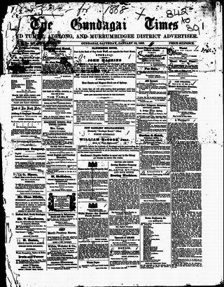
The Gundagai Times and Tumut, Adelong, and Murrumbidgee District Advertiser, often referred to as simply the Gundagai Times, was a newspaper published in Gundagai, New South Wales, Australia from 1868 to 1931. It was a direct successor of The Wynyard Times and Tumut and Adelong Advertiser and The Tumut and Adelong Times, published in Tumut, New South Wales, and was absorbed into The Gundagai Independent in 1931.

The Maher Cup was an Australian rugby league challenge cup contested between towns of the South West Slopes and northern Riverina areas of New South Wales between 1920 and 1971. The main teams involved were Cootamundra, Tumut, Gundagai, Temora, West Wyalong, Young, Harden-Murrumburrah, Junee, Barmedman, Cowra, Grenfell and Boorowa.

<i>Cootamundra Herald</i> Australian periodical

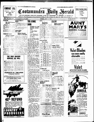
The Cootamundra Herald is a former printed bi-weekly newspaper now existing only on-line and containing little or no news of direct relevance to the community of Cootamundra, New South Wales, Australia. The Herald website carries syndicated non-local copy with occasional government media releases referring to local issues. Following the purchase of the masthead in 2019 by Australian Community Media, the Herald office which had existed for 144 years in the main street was closed and local staff were forced to work part-time from home. The staff resigned or were eventually sacked, and there are now no local Herald employees generating content related to the town.

The Cootamundra Jazz Band, based in the New South Wales town of Cootamundra, was one of Australia's foremost traditional jazz bands of the 1950s, and the fore-runner of the Riverina Jazz Band based in nearby Wagga Wagga.

The Salt Clay Creek railway disaster was one of Australia's first railway accidents involving multiple fatalities. It occurred on the evening of 25 January 1885, when a mail train from Albury to Sydney failed to negotiate a flooded creek, around 5 km from Cootamundra. Seven people were killed and dozens seriously injured.

Cootamundra is a place in New South Wales, Australia. It may also refer to:

References

  1. Australian Bureau of Statistics (28 June 2022). "Cootamundra (urban centre and locality)". Australian Census 2021.  OOjs UI icon edit-ltr-progressive.svg
  2. McNicol, Sally; Hosking, Dianne (1994). "Wiradjuri". Macquarie Aboriginal Words. Sydney: Macquarie Library. p. 97.
  3. Horn, Emma (12 August 2019). "Gold remains to be found throughout the Riverina". Cootamundra Herald. Retrieved 5 May 2021.
  4. 1 2 3 4 5 6 7 8 9 Marie Scott (2023). Chronicles of Cootamundry: The Early Years. ISBN   9780645813609.
  5. "Cootamundra Church of England". The Burrangong Argus . New South Wales, Australia. 17 July 1878. p. 2. Retrieved 10 August 2020 via National Library of Australia.
  6. "Opening of St Columba Catholic Church". Cootamundra Herald . Vol. III, no. 45. New South Wales, Australia. 6 December 1879. p. 2. Retrieved 10 August 2020 via National Library of Australia.
  7. "Barrinjuck Electricity Supply". Cootamundra Herald . New South Wales. 11 September 1942. p. 3. Retrieved 3 July 2023 via National Library of Australia.
  8. "The River Water". Cootamundra Herald . New South Wales, Australia. 20 February 1933. p. 2. Retrieved 3 July 2023 via National Library of Australia.
  9. SMH 2 February 2004
  10. "History – Cootamundra Blues". SportsTG.
  11. "Advertising". Cootamundra Herald . Vol. I, no. 49. New South Wales, Australia. 1 January 1878. p. 9. Retrieved 11 August 2020 via National Library of Australia.
  12. "Description of Cootamundra". Cootamundra Herald . Vol. III, no. 1. New South Wales, Australia. 18 January 1879. p. 2. Retrieved 11 August 2020 via National Library of Australia.
  13. "The Australian Handbook". Cootamundra Herald . Vol. IV, no. 17. New South Wales, Australia. 1 May 1880. p. 7. Retrieved 11 August 2020 via National Library of Australia.
  14. "Cungegong, Cootamundra". Wagga Wagga Advertiser . Vol. VIII, no. 39. New South Wales, Australia. 18 September 1875. p. 3. Retrieved 10 August 2020 via National Library of Australia.
  15. "Cootamundra". Freeman's Journal . Vol. XXX, no. 1850. New South Wales, Australia. 16 August 1879. p. 10. Retrieved 10 August 2020 via National Library of Australia.
  16. "Advertising". Gundagai Times and Tumut, Adelong and Murrumbidgee District Advertiser . Vol. XXI, no. 1504. New South Wales, Australia. 21 November 1879. p. 3. Retrieved 10 August 2020 via National Library of Australia.
  17. "Logistics units", Royal Australian Air Force; Historical Section, Australia: AGPS Press, 1995, ISBN   978-0-644-42798-2
  18. "Flight Sergeant J. Jenkins & Sergeant V. Sutherst". Monuments Australia. Retrieved 5 February 2023.
  19. "Cootamundra West Railway Station group". New South Wales State Heritage Register . Department of Planning & Environment. H01119. Retrieved 18 May 2018. CC BY icon.svg Text is licensed by State of New South Wales (Department of Planning and Environment) under CC-BY 4.0 licence .
  20. "Cootamundra Railway Station and yard group". New South Wales State Heritage Register . Department of Planning & Environment. H01118. Retrieved 18 May 2018. CC BY icon.svg Text is licensed by State of New South Wales (Department of Planning and Environment) under CC-BY 4.0 licence .
  21. "Cootamundra Aboriginal Girls' Training Home". New South Wales State Heritage Register . Department of Planning & Environment. H01873. Retrieved 18 May 2018. CC BY icon.svg Text is licensed by State of New South Wales (Department of Planning and Environment) under CC-BY 4.0 licence .
  22. "Cootamundra World War II Fuel Depot Site (former No.3 AIFD)". New South Wales State Heritage Register . Department of Planning & Environment. H01943. Retrieved 18 February 2020. CC BY icon.svg Text is licensed by State of New South Wales (Department of Planning and Environment) under CC-BY 4.0 licence .
  23. "Mayor – Cr Abb McAlister | Cootamundra Gundagai Regional Council". www.cgrc.nsw.gov.au.
  24. "Cootamundra". VisitNSW.com. Retrieved 17 June 2013.
  25. "The Coota Ex-Services Club". The Coota Ex-Services Club - Cootamundra. Retrieved 11 April 2022.
  26. "Sister Partnerships by US State". Asia Matters for America.
  27. "Another New Building". The Cootamundra Herald . Vol. VI, no. 49. New South Wales, Australia. 14 June 1882. p. 2. Retrieved 30 June 2020 via National Library of Australia.
  28. "Trade Palace". Cootamundra Herald . Vol. X, no. 10. New South Wales, Australia. 3 February 1886. p. 5. Retrieved 30 June 2020 via National Library of Australia.
  29. "Local & General". Cootamundra Herald . New South Wales, Australia. 9 November 1943. p. 2. Retrieved 30 June 2020 via National Library of Australia.
  30. From plaque accompanying the statue
  31. "The Giant, Cootamundra, NSW - Land of the Bigs". 18 January 2022. Retrieved 28 September 2023.
  32. "Bradman's Bat, Cootamundra, NSW - Land of the Bigs". 18 January 2022. Retrieved 28 September 2023.
  33. Australian Bureau of Statistics (27 June 2017). "Cootamundra (State Suburb)". 2016 Census QuickStats. Retrieved 4 February 2018. OOjs UI icon edit-ltr-progressive.svg
  34. "Statistics by Catalogue Number". Australian Bureau of Statistics. Retrieved 8 January 2024.
  35. "Search Census data". Australian Bureau of Statistics. Retrieved 8 January 2024.
  36. "New rail service a boost for Riverina". The Daily Advertiser (Wagga Wagga) . dailyadvertiser.com.au. 10 December 2008. Retrieved 8 January 2009.
  37. "Southern timetable". NSW TrainLink. 7 September 2019.
  38. Regional travel information Transport for NSW
  39. New day trip coach services Transport for NSW
  40. Wagga Wagga to Queanbeyan Bus Interchange Transport for NSW
  41. Queanbeyan Bus Interchange to Wagga Wagga Transport for NSW
  42. "Donald George Bradman". Bradman Museum. Archived from the original on 1 September 2007. Retrieved 23 August 2008.
  43. "Meet Bob Holder, the rodeo rider still going strong at 88 years old". Australian Broadcasting Corporation. 19 August 2019. Retrieved 22 August 2019.(transcript of TV interview with Holder by Dominique Schwartz) for The 7.30 Report.
  44. "How 92yo Bob Holder hangs on to the title of 'world's oldest competitive cowboy'". ABC News. 6 November 2023. Retrieved 7 November 2023.
  45. "The Marriage of Miss Watson". Bendigo Advertiser . Vol. XXXI, no. 9, 172. Victoria, Australia. 10 December 1884. p. 1 (Supplement). Retrieved 5 February 2023 via National Library of Australia.
  46. "Primrose, Hubert Leslie". Australian dictionary of biography. Retrieved 30 March 2015.
  47. "Southee, Ethelbert Ambrook (1890–1968)". Australian Dictionary of Biography. Retrieved 30 March 2015.
  48. "Cootamundra, NSW Climate (1995-2022)". Australian Bureau of Meteorology . Retrieved 1 March 2023.
  49. The Two Ronnies (2014). The Two Ronnies The Australians (Web Video). YouTube. Archived from the original on 13 December 2021. Retrieved 11 July 2020.
  50. National Film and Sound Archive: Does your town have its own song?
  51. "Cootamundra Wattle". John Williamson. Retrieved 21 November 2018.
  52. "Group 9 Leaders to Meet". The Gundagai Independent . Vol. 53, no. 82. New South Wales, Australia. 5 July 1951. p. 8. Retrieved 16 November 2023 via National Library of Australia.