Related Research Articles
Hancock County is a county in the U.S. state of West Virginia. As of the 2020 census, the population was 29,095. Its county seat is New Cumberland and its largest city is Weirton. The county was created from Brooke County in 1848 and named for John Hancock, first signer of the Declaration of Independence. Hancock County is the northernmost point in both West Virginia and, by some definitions, the Southern United States; being at the tip of the state's Northern Panhandle. Hancock County is part of the Weirton-Steubenville, WV-OH Metropolitan Statistical Area, which is also included in the Pittsburgh-New Castle-Weirton, PA-WV-OH Combined Statistical Area.

Hancock County is a county located in the U.S. state of Ohio. As of the 2020 census, the population was 74,920. Its county seat and largest city is Findlay. The county was created in 1820 and later organized in 1828. It was named for John Hancock, the first signer of the Declaration of Independence.
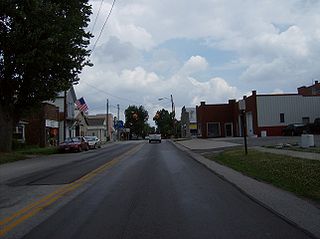
Arlington is a village in Hancock County, Ohio, United States. The population was 1,492 at the 2020 census.

Jenera is a village in Hancock County, Ohio, United States. The population was 257 at the 2020 census. It is surrounded by Van Buren Township and is part of the Cory-Rawson Local School District.

Mount Cory is a village in Hancock County, Ohio, United States. The population was 225 at the 2020 census.

McGuffey is a village in Hardin County, Ohio, United States. The population was 466 at the 2020 census.
East Deer Township is a township in Allegheny County, Pennsylvania, United States. The population was 1,490 at the 2020 census.
Ohio's 4th congressional district spans sections of the central part of the state. It is currently represented by Republican Jim Jordan, the current chair of the House Judiciary Committee, who has represented the district since 2007.

Maysville is an unincorporated community in Allen and Hardin counties, in the U.S. state of Ohio.
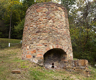
Cannonsburg is an unincorporated community in Hancock County, in the U.S. state of Ohio.
Deweyville is an unincorporated community in Hancock County, in the U.S. state of Ohio.
New Stark is an unincorporated community in Hancock County, in the U.S. state of Ohio.
Portage Center is an unincorporated community in Hancock County, in the U.S. state of Ohio.
Shawtown is an unincorporated community in Hancock County, in the U.S. state of Ohio.
West Independence is an unincorporated community in Hancock County, in the U.S. state of Ohio.
Dialton is an unincorporated community in Clark County, in the U.S. state of Ohio.
Stratford is an unincorporated community in Delaware County, in the U.S. state of Ohio.
Harrisburg is an unincorporated community in Gallia County, in the U.S. state of Ohio.
Hatley is an unincorporated community in Crisp County, in the U.S. state of Georgia.
McKendree is an unincorporated community in Pleasant Township, Madison County, Ohio, United States. It is located at 39°47′09″N83°16′19″W, at the intersection of Nioga-Toops Road and McKendree Road, southeast of Kiousville.
References
- ↑ U.S. Geological Survey Geographic Names Information System: Cordelia, Ohio
- ↑ "Hancock County". Jim Forte Postal History. Archived from the original on January 31, 2016. Retrieved January 3, 2016.
- ↑ History of Hancock County, Ohio: Containing a History of the County, Its Townships, Towns. Warner, Beers. 1886. p. 467.
Municipalities and communities of Hancock County, Ohio, United States | ||
|---|---|---|
| Cities |  | |
| Villages | ||
| Townships | ||
| Unincorporated communities | ||
| Footnotes | ‡This populated place also has portions in an adjacent county or counties | |
40°53′58″N83°47′09″W / 40.89944°N 83.78583°W
| | This Hancock County, Ohio state location article is a stub. You can help Wikipedia by expanding it. |