County of Newell

Last updated

County of Newell
Scandia 002a.jpg
Last remaining prairie grain elevators in the Scandia district. Scandia
AB County of Newell logo.png
AB locator COUNTY OF NEWELL.svg
Location within Alberta
Coordinates: 50°33′51″N111°53′56″W / 50.56417°N 111.89889°W / 50.56417; -111.89889
CountryCanada
Province Alberta
Region Southern Alberta
Census division 2
Established1948
Incorporated1953
Government
[1]
  ReeveMolly Douglass
  Governing bodyCounty of Newell Council
   Administrative office south of Brooks
Area
 (2021) [2]
  Land5,810.15 km2 (2,243.31 sq mi)
Population
 (2021) [2]
  Total7,465
  Density1.3/km2 (3/sq mi)
Time zone UTC−7 (MST)
  Summer (DST) UTC−6 (MDT)
Website countyofnewell.ab.ca

The County of Newell is a municipal district in southern Alberta, Canada. Located in Census Division No. 2, its municipal office is located south of the City of Brooks.

Contents

History

It was incorporated as the County of Newell No. 4 on January 1, 1953, through the amalgamation of the Municipal District of Newell No. 28 and part of the Municipal District of Bow Valley No. 40. Its name was changed to the County of Newell on September 9, 2011. [3]

Geography

Communities and localities

Demographics

In the 2021 Census of Population conducted by Statistics Canada, the County of Newell had a population of 7,465 living in 2,404 of its 2,642 total private dwellings, a change of

The population of the County of Newell according to its 2020 municipal census is 7,502. [7]

In the 2016 Census of Population conducted by Statistics Canada, the County of Newell had a population of 7,524 living in 2,412 of its 2,627 total private dwellings, a

See also

Related Research Articles

Bassano is a town in Alberta, Canada. It is located on the Trans-Canada Highway approximately 140 kilometres (87 mi) southeast of Calgary and 160 kilometres (99 mi) northwest of Medicine Hat. It is also on the main line of the Canadian Pacific Kansas City. A short distance south of the town is the Bassano Dam, serves as a diversion structure which routes water through a canal into Lake Newell Reservoir which supplies water to the majority of the County of Newell for purposes like irrigation, recreation, and the County's drinking water.

<span class="mw-page-title-main">County of Grande Prairie No. 1</span> Municipal district in Alberta, Canada

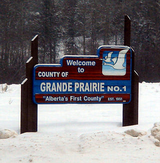
The County of Grande Prairie No. 1 is a municipal district in northwestern Alberta, Canada in Census Division No. 19.

<span class="mw-page-title-main">Clearwater County, Alberta</span> Municipal district in Alberta, Canada

Clearwater County is a municipal district in west central Alberta, Canada in Division No. 9. Its northwest boundary is the Brazeau River. The municipal office is located in the Town of Rocky Mountain House. The county has a land area of 18,691.65 km2 and comprises close to 99% of Census Division No. 9's land area of 18,921.38 km2. Although the territory excluded is rather small in geographical area, it comprises the major population centre of Rocky Mountain House, which has one-third of Division No. 9's population, in addition to the communities of Caroline, Burnstick Lake and three Indian reserves. The County's 2021 census population was 11,865.

<span class="mw-page-title-main">Athabasca County</span> Municipal district in Alberta, Canada

Athabasca County is a municipal district in north central Alberta, Canada. It is located northeast of Edmonton and is in Census Division No. 13. Prior to an official renaming on December 1, 2009, Athabasca County was officially known as the County of Athabasca No. 12.

<span class="mw-page-title-main">County of Stettler No. 6</span> Municipal district in Alberta, Canada

The County of Stettler No. 6 is a municipal district in central Alberta, Canada.

Duchess is a village in southern Alberta, Canada that is surrounded by the County of Newell. It is north of Brooks and the Trans-Canada Highway.

<span class="mw-page-title-main">Westlock County</span> Municipal district in Alberta, Canada

Westlock County is a municipal district in central Alberta, Canada that is north of Edmonton. The county was formerly known as the Municipal District of Westlock No. 92, and was created in 1943 from the merger of five smaller municipal districts.

<span class="mw-page-title-main">Thorhild County</span> Municipal district in Alberta, Canada

Thorhild County is a municipal district located in the central part of northern Alberta, Canada, in Census Division 13. It was incorporated in 1955. It changed its name from the County of Thorhild No. 7 to Thorhild County on March 20, 2013.

<span class="mw-page-title-main">Kneehill County</span> Municipal district in Alberta, Canada

Kneehill County is a municipal district in central Alberta, Canada within Census Division No. 5.

<span class="mw-page-title-main">Camrose County</span> Municipal district in Alberta, Canada

Camrose County is a municipal district in central Alberta, Canada. It is located in Census Division 10, around the City of Camrose.

<span class="mw-page-title-main">Cardston County</span> Municipal district in Alberta, Canada

Cardston County is a municipal district in southern Alberta, Canada. It is located in Census Division 3 around the Town of Cardston.

<span class="mw-page-title-main">County of Forty Mile No. 8</span> Municipal district in Alberta, Canada

The County of Forty Mile No. 8 is a municipal district in south eastern Alberta, Canada. It is located in Census Division 1, southwest of Medicine Hat. Its municipal office is located in the Village of Foremost.

<span class="mw-page-title-main">Lacombe County</span> Municipal district in Alberta, Canada

Lacombe County is a municipal district in central Alberta, Canada. It is within Census Division No. 8 north of the City of Red Deer. Its municipal office is 4 km (2.5 mi) west of Highway 2 and the City of Lacombe, and 6 km (3.7 mi) east of the Summer Village of Gull Lake, at the intersection of Highway 12 and Spruceville Road.

<span class="mw-page-title-main">Woodlands County</span> Municipal district in Alberta, Canada

Woodlands County is a municipal district in north-central Alberta, Canada. Located in Census Division No. 13, its municipal office is located outside but adjacent to the Town of Whitecourt. A second municipal office is located in the Hamlet of Fort Assiniboine.

<span class="mw-page-title-main">County of Northern Lights</span> Municipal district in Alberta, Canada

The County of Northern Lights is a municipal district in northwest Alberta, Canada. Located in Census Division 17, its municipal office is located in the Town of Manning.

<span class="mw-page-title-main">County of Wetaskiwin No. 10</span> Municipal district in Alberta, Canada

The County of Wetaskiwin No. 10 is a municipal district in central Alberta, Canada that is south of Edmonton. Located in Census Division No. 11, its municipal office is in located in the City of Wetaskiwin.

<span class="mw-page-title-main">County of Two Hills No. 21</span> Municipal district in Alberta, Canada

The County of Two Hills No. 21 is a municipal district in east-central Alberta, Canada. Located in Census Division No. 10, its municipal office is located in the Town of Two Hills.

<span class="mw-page-title-main">Smoky Lake County</span> Municipal district in Alberta, Canada

Smoky Lake County is a municipal district in north-eastern Alberta, Canada. Located in Census Division No. 12, its municipal office is located in the Town of Smoky Lake.

<span class="mw-page-title-main">County of Paintearth No. 18</span> Municipal district in Alberta, Canada

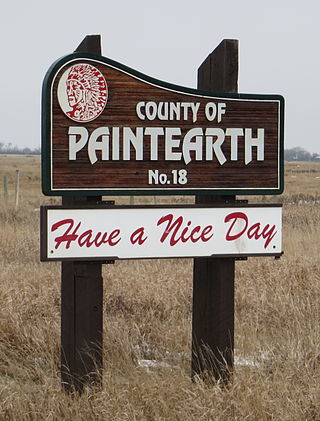
The County of Paintearth No. 18 is a municipal district in east central Alberta, Canada. Located in Census Division No. 7, its municipal office is located southeast of the Town of Castor near the intersection of Highway 12 and Highway 36.

<span class="mw-page-title-main">Scandia, Alberta</span> Hamlet in Alberta, Canada

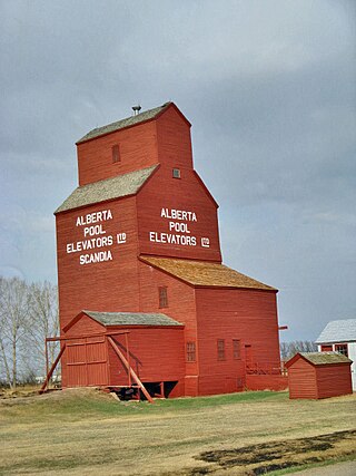
Scandia is a hamlet in Alberta, Canada within the County of Newell. It is located 2 kilometres (1.2 mi) west of Highway 36, approximately 34 kilometres (21 mi) southwest of Brooks.

References

  1. "Municipal Officials Search". Alberta Municipal Affairs. May 9, 2019. Retrieved October 1, 2021.
  2. 1 2 3 "Population and dwelling counts: Canada, provinces and territories, and census subdivisions (municipalities)". Statistics Canada. February 9, 2022. Retrieved February 9, 2022.
  3. "O.C. 417/2011". Province of Alberta. September 9, 2011. Retrieved September 13, 2011.
  4. "Brooks, City (Census Subdivision), Alberta". Statistics Canada. June 20, 2012. Archived from the original on March 4, 2016. Retrieved August 13, 2012.
  5. 1 2 "Specialized and Rural Municipalities and Their Communities" (PDF). Alberta Municipal Affairs. January 12, 2022. Retrieved January 21, 2022.
  6. "Standard Geographical Classification (SGC) 2006, Economic Regions: 4802031 - Newell County No. 4, geographical codes and localities, 2006". Statistics Canada. March 5, 2010. Archived from the original on May 25, 2013. Retrieved August 11, 2012.
  7. "Municipal Census Report 2020". County of Newell. Retrieved October 24, 2020.
  8. "Population and dwelling counts, for Canada, provinces and territories, and census subdivisions (municipalities), 2016 and 2011 censuses – 100% data (Alberta)". Statistics Canada. February 8, 2017. Retrieved February 8, 2017.