County routes in New Jersey

Last updated
County routes in New Jersey
County 571.svg Middlesex County Route 612 NJ.svg Bergen County 77.svg
Standard route markers
Highway names
County routes:County Route X (CR X)
System links
A standard pentagonal county route shield To CR 619.jpg
A standard pentagonal county route shield

In the U.S. state of New Jersey, county routes exist in all 21 counties. They are typically the fourth type of roadway classified below the Interstate Highway, the U.S. Route numbered highway and the state highway. The County Route system is defined by two types in New Jersey. First, 500 Series County Routes, also called state secondary routes (to the state highway), are county highways numbered in a statewide system with three-digit numbers that begin with 5. These roads form a second network of routes that supplement the facilitation of the State Routes. Each 500 Series route is unique and is not permitted to be duplicated in another county for a separate route. The second category is defined as Non-500 Series County Routes. Non-500 Series County Routes include 1-digit, 2-digit, 600 Series, 700 Series and 800 Series. These, by definition, are discontinuous across county borders and must be contained entirely within that county. Unlike 500 Series County routes, these route numbers are unique to each county, and are typically assigned to more local routes than the statewide 500-series county route system. They are typically of a lesser classification of streets like minor arterials or collector roadways rather than major arterials or thoroughfares. In the counties that use 600-series numbers, the selection of this range was coordinated within the state[ citation needed ], gradually replacing older systems of mainly one- and two-digit routes. [1]

Contents

With very rare exceptions (such as County Route 537), the 500 series follows the rule of cardinal direction used for Interstate Highways and U.S. Routes: even-numbered roads run east and west, while odd-numbered roads run north and south. Eastwest routes tend to be numbered with the lowest numbers in the northern part of the state and the highest numbers in the southern part of the state, also like the U.S. Routes. In northern New Jersey, northsouth routes range from CR 501 in the east to CR 521 in the west, although numbering in the southern part of the state tends to be more haphazard.

County route numbers have not wholly replaced the preexisting names of the local roads to which they were assigned. Street signs at major intersections will denote both the local road name and the county route number if it has one. Residents who live along county routes rarely, if ever, give their address as "123 County Route 5xx" unless no name for the route has been established, as is the case in some rural areas.

History of the 500-series

County routes in New Jersey
Bergen County 200 Series County Routes

The precursor to the 500 series was a group of three roads in Bergen County which received the numbers 200, 201, and 203 in the late 1930s. 200 ran from Oakland to Alpine; 201 ran from Ridgewood to Alpine; and 203 ran from Weehawken to Alpine. [2] US 202 runs through Bergen County, thus the planners skipped this number.[ citation needed ]

In February 1942, a group of civil defense routes was assigned with numbers in the 500s in New York, New Jersey, and Connecticut. These roads were designed as through routes for civilian use in case the state highway system was needed by the military during World War II operations. These routes were numbered in relation to existing routes. For example, Civil Route 501 ran parallel to US 1 and Civil Route 532 was an extension of NY 32 into New Jersey. [3]

The current series of roads in the 500s was established by the New Jersey Department of Transportation (NJDOT) on January 1, 1953. The 500-series county routes were established as a secondary highway system in case the state highway system was needed to be closed to all vehicles except military vehicles and emergency traffic if an air raid or major disaster happened. The secondary system was designed to carry through traffic and bypassed cities where possible. [4] [5] Some of the roads had spurs or alternate routes established; about one-third of these survive today even though such designations were eliminated from the primary state system in the 1953 New Jersey State Highway renumbering. (The others have become 600-series county routes as described below.)

Other county routes

An example of a route beginning with 7 in Camden County, marked with an older square shield design CR 726.jpg
An example of a route beginning with 7 in Camden County, marked with an older square shield design
A sign for Middlesex County's pre-600-series numbering Middlesex County 4R11.jpg
A sign for Middlesex County's pre-600-series numbering

Though historically many counties had their own numbering systems, today most counties in New Jersey follow the 500-series county routes with their own county routes numbered otherwise, typically in the 600-series. Only two counties Bergen County [6] and Monmouth County [7] have not adopted 600-series numbers. Ocean County [8] also has a number of minor one- and two-digit routes in addition to their 600-series routes. While the majority of New Jersey's counties put signs on their 600 (or secondary) routes, Hudson County apparently doesn't sign any of them, and Ocean County has chosen to sporadically sign them[ citation needed ]. The only 600 signage to appear in Ocean County has been put up as a result of recent construction projects, which can cause confusion for those not familiar with the area.[ citation needed ]

In some counties, the 600-series numbers can break into the 700s and even 800s. Atlantic, [9] Camden, [10] Cumberland, [11] Hudson, [12] Hunterdon, [13] Gloucester, [14] and Passaic Counties [15] continue past the 600-series into routes beginning with 7, and Middlesex County [16] includes one route in the 800s, even though it has only three beginning with 7.

As every piece of New Jersey is part of an incorporated municipality, every road not designated a county or state route is locally maintained.

See also

Related Research Articles

In the U.S. state of New Jersey, the New Jersey Department of Transportation (NJDOT) maintains a system of state highways. Every significant section of roadway maintained by the state is assigned a number, officially State Highway Route X. Interstate Highways and U.S. Highways are included in the system. State Routes are signed with the circular highway shield.

<span class="mw-page-title-main">New Jersey Route 139</span> State highway in Hudson County, New Jersey, US

Route 139 is a state highway in Jersey City, New Jersey in the United States that heads east from the Pulaski Skyway over Tonnele Circle to the state line with New Jersey and New York in the Holland Tunnel, which is under the Hudson River, to New York City. The western portion of the route is a two level highway that is charted by the New Jersey Department of Transportation (NJDOT) as two separate roadways: The 1.45-mile (2.33 km) lower roadway (Route 139) between U.S. Route 1/9 (US 1/9) over Tonnele Circle and Interstate 78 (I-78) at Jersey Avenue, and the 0.83-mile (1.34 km) upper roadway running from County Route 501 and ending where it joins the lower highway as part of the 12th Street Viaduct, which ends at Jersey Avenue. The lower roadway is listed on the federal and NJ state registers of historic places since 2005. The eastern 1.32 miles (2.12 km) of the route includes the Holland Tunnel approach that runs concurrent with Interstate 78 on the one-way pair of 12th Street eastbound and 14th Street westbound. Including the concurrency, the total length of Route 139 is 2.77 miles (4.46 km).

<span class="mw-page-title-main">County highway</span> Type of highway

A county highway is a road in the United States and in the Canadian province of Ontario that is designated and/or maintained by the county highway department. Route numbering can be determined by each county alone, by mutual agreement among counties, or by a statewide pattern.

<span class="mw-page-title-main">Interstate 80 in New Jersey</span> Highway in New Jersey

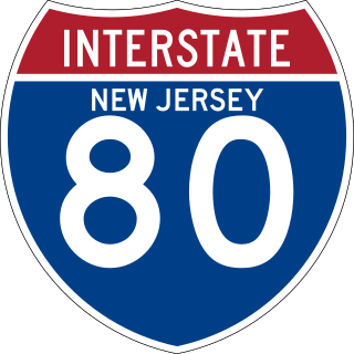
Interstate 80 (I-80) is a major Interstate Highway in the United States, running from San Francisco, California, eastward to the New York metropolitan area. In New Jersey, I-80 runs for 68.35 miles (110.00 km) from the Delaware Water Gap Toll Bridge at the Pennsylvania state line to its eastern terminus at I-95 in Teaneck, Bergen County. I-95 continues from the end of I-80 to the George Washington Bridge for access to New York City. The highway runs parallel to U.S. Route 46 (US 46) through rural areas of Warren and Sussex counties before heading into more suburban surroundings in Morris County. As the road continues into Passaic and Bergen counties, it heads into more urban areas. The New Jersey Department of Transportation (NJDOT) identifies I-80 within the state as the Christopher Columbus Highway.

<span class="mw-page-title-main">County Route 575 (New Jersey)</span> County highway in New Jersey, U.S.

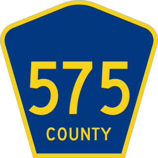
County Route 575 is a county highway in the U.S. state of New Jersey. The highway extends 20.96 miles (33.73 km) from Somers Point-Mays Landing Road in Egg Harbor Township to New York Road in Port Republic.

<span class="mw-page-title-main">County Route 561 (New Jersey)</span> County highway in New Jersey, U.S.

County Route 561 is a county highway in the U.S. state of New Jersey. The highway extends 50.95 miles (82.00 km) from New York Road in Galloway Township to Federal Street in Camden.

<span class="mw-page-title-main">County Route 550 (New Jersey)</span>

County Route 550 is a county highway in the U.S. state of New Jersey. The highway extends 15.92 miles (25.62 km) from Delsea Drive in Maurice River Township to Shore Drive in Dennis Township. The road travels through Maurice River Township, Dennis Township and Woodbine.

<span class="mw-page-title-main">County Route 549 (New Jersey)</span> County highway in New Jersey, U.S.

County Route 549 is a county highway in the U.S. state of New Jersey. The highway extends 17.82 miles (28.68 km) from Main Street at County Route 527 in Toms River to County Route 547 at Monmouth CR 21 in Howell. The highway has the distinction of being the only 500-series route left with two separate spur routes.

<span class="mw-page-title-main">County Route 548 (New Jersey)</span> County highway in New Jersey, U.S.

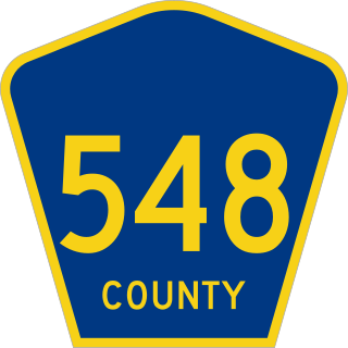
County Route 548 is a county highway in the U.S. state of New Jersey. The highway extends 9.18 miles (14.77 km) from Delsea Drive (Route 47 in Maurice River Township to Route 49 in Upper Township.

<span class="mw-page-title-main">County Route 526 (New Jersey)</span> County highway in New Jersey, U.S.

County Route 526 is a county highway in the U.S. state of New Jersey. The highway extends 35.56 miles (57.23 km) from Princeton–Hightstown Road in West Windsor Township to Lanes Mill Road in Lakewood Township.

<span class="mw-page-title-main">County Route 502 (New Jersey)</span> Road in Bergen County, New Jersey

County Route 502 (CR 502) is a county highway in the U.S. state of New Jersey. The highway extends 23.79 miles (38.29 km) from Paterson-Hamburg Turnpike (CR 504) in Wayne to Palisades Boulevard in Alpine.

<span class="mw-page-title-main">U.S. Route 30 in New Jersey</span> Highway in New Jersey

U.S. Route 30 is a U.S. highway running from Astoria, Oregon east to Atlantic City, New Jersey. In the U.S. state of New Jersey, US 30 runs 58.26 miles (93.76 km) from the Benjamin Franklin Bridge at the Delaware River in Camden, Camden County, while concurrent with Interstate 676 (I-676), southeast to Virginia Avenue in Atlantic City, Atlantic County. Most of the route in New Jersey is known as the White Horse Pike and is four lanes wide. The road runs through mostly developed areas in Camden County, with surroundings becoming more rural as the road approaches Atlantic County. US 30 runs through several towns including Collingswood, Berlin, Hammonton, Egg Harbor City, and Absecon.

<span class="mw-page-title-main">Sandy Ridge, New Jersey</span> Populated place in Hunterdon County, New Jersey, US

Sandy Ridge is an unincorporated community located within Delaware Township in Hunterdon County, in the U.S. state of New Jersey. As its name implies, the community is located at the top of a small hill that is sandwiched between the Hunterdon Plateau and the Sourland Mountains. Sandy Ridge Road is the main road east and west through the community while County Route 605 is a minor arterial road that passes north and south through the area. CR 605 enters from the south on Sandy Ridge-Mt. Airy Road, jogs to the west on Sandy Ridge Road for 0.04 miles (64 m), and exits to the north on Cemetery Road towards CR 523. The area consists of mainly residences with some farmland and forestland. The Sandy Ridge Church is a Baptist church founded in 1818 with its current building constructed in 1866 and is located in the center of Sandy Ridge.

References

  1. Historical Maps of New Jersey
  2. Yonkers (Map). United States Geological Survey. 1947. Archived from the original on 2021-06-07. Retrieved 2021-06-07.
  3. "Civilian Route Signs For War Emergency". The New York Times. February 6, 1942. p. 8.
  4. "Somerset Road Links Charted for Emergency". The Sunday Times . New Brunswick, New Jersey. March 22, 1953. p. 8. Retrieved January 17, 2021 via Newspapers.com.
  5. "State Ready to Push Traffic Off Major Roads in Air Raid". The Sunday Times . New Brunswick, New Jersey. March 15, 1953. pp. 1, 39 . Retrieved January 17, 2021 via Newspapers.com.
  6. NJDOT Straight-line diagrams table of contents for Bergen County
  7. NJDOT Straight-line diagrams table of contents for Monmouth County
  8. NJDOT Straight-line diagrams table of contents for Ocean County
  9. NJDOT Straight-line diagrams table of contents for Atlantic County
  10. NJDOT Straight-line diagrams table of contents for Camden County
  11. NJDOT Straight-line diagrams table of contents for Cumberland County
  12. NJDOT Straight-line diagrams table of contents for Hudson County
  13. NJDOT Straight-line diagrams table of contents for Hunterdon County
  14. NJDOT Straight-line diagrams table of contents for Gloucester County
  15. NJDOT Straight-line diagrams table of contents for Passaic County
  16. NJDOT Straight-line diagrams table of contents for Middlesex County