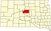
Sully County is a county in the U.S. state of South Dakota. As of the 2020 census, the population was 1,446, making it the fifth-least populous county in South Dakota. Its county seat is Onida. The county was created in 1873 and organized in 1883. It is named after General Alfred Sully, who built Fort Sully.

Platte is a city in Charles Mix County, South Dakota, United States. The population was 1,311 at the 2022 census. The community is named after the Platte Creek, a tributary of the Missouri River reservoir Lake Francis Case. Platte is located 15 miles east of Lake Francis Case on the Missouri River.

Wanblee is a census-designated place on the Pine Ridge Indian Reservation, located in Jackson County, South Dakota, United States. The population was 674 at the 2020 census, virtually all of whom are members of the Oglala band of Lakota Sioux. Wanbli is the Lakota word for eagle, and the town was named for its proximity to Wanbli hohpi paha. Wanblee is a few miles directly northeast of the North American continental pole of inaccessibility.

Vivian is an unincorporated community and census-designated place (CDP) in Lyman County, South Dakota, United States. The population was 98 at the 2020 census.
Cherry Creek is an unincorporated community and census-designated place (CDP) in Ziebach County, South Dakota, United States. The population was 282 at the 2020 census. Cherry Creek has been assigned the ZIP code of 57622.
Chester is an unincorporated community and census-designated place (CDP) in Lake County, South Dakota, United States. The population was 257 as of the 2020 census. Chester has been assigned the ZIP code of 57016.
Fedora is an unincorporated community in Miner County, South Dakota, United States, founded in 1881. The Census Bureau began tracking Fedora as a CDP in 2010. Fedora has been assigned the ZIP code of 57337. The population of the CDP was 26 at the 2020 census.
Gann Valley is a census-designated place in and the county seat of Buffalo County, South Dakota, United States. The town had a population of 10 as of the 2020 census. It is the smallest unincorporated county seat in the United States.
Norris is an unincorporated community in Mellette County, South Dakota, United States, which is not specifically tracked by the Census Bureau, but rather is only included in the census-designated place of the same name. The population of the CDP was 150 at the 2020 census. Norris has the post office which serves the 57560 ZIP code area, which also includes the town of Corn Creek.
Saint Onge is an unincorporated community and census-designated place (CDP) in Lawrence County, South Dakota, United States. As of the 2020 census, the population was 170.
Stephan is an unincorporated community and census-designated place (CDP) in Hyde County, South Dakota, United States. Stephan has been assigned the ZIP code of 57346. The population of the CDP was 68 at the 2020 census.
Shindler is an unincorporated community and census-designated place (CDP) in Lincoln County, South Dakota, United States. The population was 607 at the 2020 census.
Blucksberg Mountain is an unincorporated community and census-designated place in Meade County, South Dakota, United States. Its population was 467 as of the 2020 census. Interstate 90 passes through the community.
Corn Creek is an unincorporated community and census-designated place in Mellette County, South Dakota, United States. Its population was 113 as of the 2020 census. The community is located near the intersection of South Dakota Highway 44 and South Dakota Highway 63.
Soldier Creek is an unincorporated community and census-designated place in Todd County, South Dakota, United States. Its population was 205 as of the 2020 census. U.S. Route 18 passes through the community.
Brant Lake South is a census-designated place (CDP) in Lake County, South Dakota, United States. The population was 140 at the 2020 census. It was established after the 2010 census.
Prairiewood Village is an unincorporated community and census-designated place (CDP) in Brown County, South Dakota, United States. It was first listed as a CDP prior to the 2020 census. The CDP had a population of 303 at the 2020 census.
Boulder Canyon is an unincorporated area and census-designated place (CDP) in Lawrence County, South Dakota, United States. The population was 561 at the 2020 census. It was first listed as a CDP prior to the 2020 census.
Spring Creek Colony is a census-designated place (CDP) and Hutterite colony in McPherson County, South Dakota, United States. It was first listed as a CDP prior to the 2020 census. The CDP had a population of 229 at the 2020 census.
Horse Creek is an unincorporated community and census-designated place (CDP) in Mellette County, South Dakota, United States. It was first listed as a CDP prior to the 2020 census. The population of the CDP was 187 at the 2020 census.