The Cree are a North American Indigenous people. They live primarily in Canada, where they form one of the country's largest First Nations.

The Saulteaux, otherwise known as the Plains Ojibwe, are a First Nations band government in Ontario, Manitoba, Saskatchewan, Alberta and British Columbia, Canada. They are a branch of the Ojibwe who pushed west. They formed a mixed culture of woodlands and plains Indigenous customs and traditions.

The Missionary Oblates of Mary Immaculate (OMI) is a missionary religious congregation in the Catholic Church. It was founded on January 25, 1816, by Eugène de Mazenod, a French priest later recognized as a Catholic saint. The congregation was given recognition by Pope Leo XII on February 17, 1826. As of January 2020, the congregation was composed of 3,631 priests and lay brothers usually living in community. Their traditional salutation is Laudetur Iesus Christus, to which the response is Et Maria Immaculata. Members use the post-nominal letters, "OMI".

The Qu'Appelle River is a river in the Canadian provinces of Saskatchewan and Manitoba that flows 430 kilometres (270 mi) east from Lake Diefenbaker in south-western Saskatchewan to join the Assiniboine River in Manitoba, just south of Lake of the Prairies, near the village of St. Lazare. It is in a region called the Prairie Pothole Region of North America, which extends throughout three Canadian provinces and five U.S. states. It is also within Palliser's Triangle and the Great Plains ecoregion.
First Nations in Alberta are a group of people who live in the Canadian province of Alberta. The First Nations are peoples recognized as Indigenous peoples or Plains Indians in Canada excluding the Inuit and the Métis. According to the 2011 Census, a population of 116,670 Albertans self-identified as First Nations. Specifically there were 96,730 First Nations people with registered Indian Status and 19,945 First Nations people without registered Indian Status. Alberta has the third largest First Nations population among the provinces and territories. From this total population, 47.3% of the population lives on an Indian reserve and the other 52.7% live in urban centres. According to the 2011 Census, the First Nations population in Edmonton totalled at 31,780, which is the second highest for any city in Canada. The First Nations population in Calgary, in reference to the 2011 Census, totalled at 17,040. There are 48 First Nations or "bands" in Alberta, belonging to nine different ethnic groups or "tribes" based on their ancestral languages.
Treaty Five is a treaty between Queen Victoria and Saulteaux and Swampy Cree non-treaty band governments and peoples around Lake Winnipeg in the District of Keewatin. Much of what is today central and northern Manitoba was covered by the treaty, as were a few small adjoining portions of the present-day provinces of Saskatchewan and Ontario.
The George Gordon First Nation is a First Nations band government located near the village of Punnichy, Saskatchewan, in Canada. The nation has an enrolled population of 3,752 people, 1,191 of whom live on the band's reserves. Chief Byron Bitternose leads the First Nation. Their territory is located on the Gordon 86 reserve, as arranged by Treaty 4.

Treaty 4 is a treaty established between Queen Victoria and the Cree and Saulteaux First Nation band governments. The area covered by Treaty 4 represents most of current day southern Saskatchewan, plus small portions of what are today western Manitoba and southeastern Alberta. This treaty is also called the Qu'Appelle Treaty, as its first signings were conducted at Fort Qu'Appelle, North-West Territories, on 15 September 1874. Additional signings or adhesions continued until September 1877. This treaty is the only indigenous treaty in Canada that has a corresponding indigenous interpretation.
The Pine Creek First Nation is a Saulteaux First Nation in Manitoba, Canada. The First Nation's homeland is the Pine Creek 66A reserve, located approximately 110 kilometres north of Dauphin along the southwestern shore of Lake Winnipegosis between the communities of Camperville and Duck Bay. The Rural Municipality of Mountain (South) borders it on the southwest.
Muskowekwan First Nation is a Saulteaux (Ojibway) First Nation who inhabit approximately 100 km northwest of Melville, Saskatchewan, Canada. As of May, 2008, the First Nation has 1,517 registered people, of which their on-reserve population was 400.
Fishing Lake First Nation is a First Nation of the Saulteaux branch of the Ojibwe nation. Fishing Lake First Nation are Anishinabek people. The band can trace their origins to central Canada, and were pushed westward to avoid encroachment by European settlers. The First Nation was originally part of the Yellow-quill Saulteaux Band, a Treaty Band named after a Treaty 4 signatory Chief Ošāwaškokwanēpi, whose name means "Green/Blue-quill." However, due to "š" merging with "s" in Nakawēmowin, this led to a mistranslation of his name as "Yellow-quill"—"yellow" being osāw-, while "green/blue" being ošāwaško-. The band was given three reserves, at Fishing and Nut Lakes and Kinistino, Saskatchewan. The Fishing Lake Indian Reserve 89 was approximately 22,850 acres (92.5 km2). Soon after the death of Chief Ošāwaškokwanēpi, the Band divided into three groups, the Fishing Lake First Nation, the Yellow Quill First Nation, and the Kinistin Saulteaux Nation
Marieval is a hamlet in Saskatchewan.

Star Blanket Cree Nation is a First Nations band government in Saskatchewan, Canada. Its reserves are in the Fort Qu'Appelle area. The Star Blanket Cree Nation is one of the bands covered by Treaty 4.

The Treaty Four Reserve Grounds 77 are an Indian reserve in Saskatchewan, Canada, shared by 33 band governments from Saskatchewan and Manitoba. The Reserve Grounds are located adjacent to and west of Fort Qu'Appelle. In the 2016 Canadian Census, they recorded a population of 15 living in 6 of their 8 total private dwellings.

Carry the Kettle Nakoda Nation is a Nakota (Assiniboine) First Nation located about 80 km (50 mi) east of Regina, Saskatchewan and 13 km (8.1 mi) south of Sintaluta. The reservation is in Treaty 4 territory.

Qu'Appelle Indian Residential School (Q.I.R.S.) or Qu'Appelle Industrial School was a Canadian residential school in the Qu'Appelle Valley, Saskatchewan. As one of the early residential schools in western Canada, it was operated from 1884 to 1969 by the Roman Catholic Church for First Nations children and was run by the Missionary Oblates of Mary Immaculate and the Grey Nuns. As of November 8, 2021 Star Blanket Cree Nation started searching for unmarked graves using ground-penetrating radar.

The Muscowpetung Saulteaux Nation is a Saulteaux band government in southern Saskatchewan, Canada. Their reserves include:

Peepeekisis Cree Nation (Cree: ᐲᐦᐲᑭᓰᐢ, pîhpîkisîs, literal meaning: Sparrow Hawk) is a Cree First Nation in southern Saskatchewan, Canada. Its reserves include Peepeekisis 81; Treaty Four Reserve Grounds 77, which is shared with 32 other bands; and Peepeekisis Cree Nation, which is located 19 km (12 mi) east of Balcarres, Saskatchewan, on Highway 10.
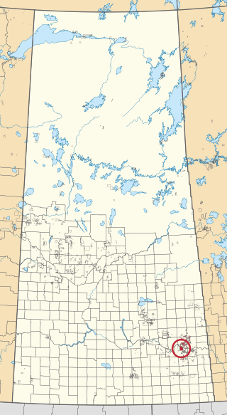
Cowessess 73 is an Indian reserve of the Cowessess First Nation in Saskatchewan. It is 13 kilometres northwest of Broadview. In the 2016 Canadian Census, it recorded a population of 540 living in 190 of its 214 total private dwellings. In the same year, its Community Well-Being index was calculated at 63 of 100, compared to 58.4 for the average First Nations community and 77.5 for the average non-Indigenous community.

The Marieval Indian Residential School was part of the Canadian Indian residential school system. Located on the Cowessess 73 reserve in Marieval, Saskatchewan, it operated from 1898 to 1997. It was located in Qu'Appelle Valley, east of Crooked Lake and 24 km (15 mi) north of Broadview.