
Hayward Regional Shoreline is a regional park located on the shores of the San Francisco Bay in Hayward, California. It is part of the East Bay Regional Parks system. The 1,713-acre (693 ha) park extends to the shores of San Lorenzo. Part of the park is former commercial salt flats purchased in 1996. A former landfill, now capped with soil and plants, is located in the park. The park includes the 250-acre (100 ha) tidal wetland, Cogswell Marsh, and the 364-acre (147 ha) Oro Loma Marsh. Located to the south of the park is the Hayward Shoreline Interpretive Center, which provides information on the Bay shore habitats. The San Francisco Bay Trail runs through the park, which connects the park with San Lorenzo Creek.
Fluvius Innominatus or Central Creek is a stream in Richmond and El Cerrito, California, in western Contra Costa County. There is one main source and a secondary unnamed tributary. The creek drains into Hoffman Marsh and then flows into the bay through Point Isabel Regional Shoreline's Hoffman Channel. However, before the area was developed and as early as 1899 the creek had as many as 11 sources which stretched far higher into the Berkeley Hills.
Hoffman Marsh is a wetlands on San Francisco Bay in Richmond, California. The marsh has been protected within Eastshore State Park, and adjacent to Point Isabel Regional Shoreline. The marsh is an important nesting ground for wildfowl and stopping ground on the Pacific Flyway, as it is one of only a handful of undestroyed wetlands in the Bay Area. It borders Point Isabel Regional Shoreline and Interstate 80.
Alpine Creek is a small river in San Mateo County, California. It flows about 5 miles (8 km), from its source near West Alpine Road about a mile southwest of Skyline Boulevard (CA 35), to its confluence with La Honda Creek to form San Gregorio Creek in La Honda at California State Route 84.
Harrington Creek is a small river in San Mateo County, California and is a tributary of San Gregorio Creek.
Bogess Creek is a small river in San Mateo County, California and is a tributary of San Gregorio Creek.
El Corte de Madera Creek is a small river in the Santa Cruz Mountains, San Mateo County, northern California. It is a tributary of San Gregorio Creek.
Clear Creek is a small river in San Mateo County, California and is a tributary of San Gregorio Creek.
Coyote Creek is a stream in San Mateo County, California, and is a tributary of San Gregorio Creek.

Vesuvio Cafe is an historic bar in San Francisco, California, United States. Located at 255 Columbus Avenue, across an alley from City Lights Bookstore, the building was designed by Italian architect Italo Zanolini and finished in 1916.

Museo ItaloAmericano, also known as the Italian American Museum, is a museum in San Francisco, California, that focuses on Italian-American history, art and culture.
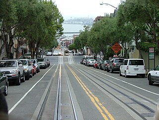
Hyde Street is a street in San Francisco, California. Hyde Street connects the Aquatic Park Historic District to Market Street. A portion of the street is served by the Powell–Hyde line of the San Francisco cable car system, and the northern terminal of that line is on Hyde Street. The street is known for Rice-A-Roni commercials; almost every commercial ends with a cable car on the street.
The Comstock Saloon is a historic saloon in San Francisco, California. Located in San Francisco's North Beach, and was founded in 1907. The bar is named after Henry Comstock and for his Comstock Lode. The building itself was home to the oldest microbrewery in San Francisco, San Francisco Brewing Company (1907-2012). Currently, it is owned by Jeff Hollinger and Jonny Raglin, both also bartenders for Absinthe Brasserie & Bar.

Yerba Buena Cove was a cove on San Francisco Bay where the Mexican pueblo of Yerba Buena was located. It lay between Clarks Point to the north and Rincon Point to the south. The beach of the cove was set back as far as what is now Montgomery Street between Clay and Washington Streets.

Bird Island is an island in San Francisco Bay. It is in San Mateo County, California. Its coordinates are 37°33′04″N122°14′13″W, and the United States Geological Survey gave its elevation as 7 ft (2.1 m) in 1998. It appears on a 2012 USGS map of the area.

Corinthian Island is a former island in the San Francisco Bay, that was later attached to the mainland. It is in Marin County, California, by the Tiburon Peninsula. Its coordinates are 37°52′22″N122°27′32″W, and the United States Geological Survey gave its elevation as 72 ft (22 m) in 1981. It appears on a 1950 USGS map of the area.
Acquerello is a Michelin Guide-starred Italian restaurant in San Francisco, in the U.S. state of California.
This page is based on this
Wikipedia article Text is available under the
CC BY-SA 4.0 license; additional terms may apply.
Images, videos and audio are available under their respective licenses.

