
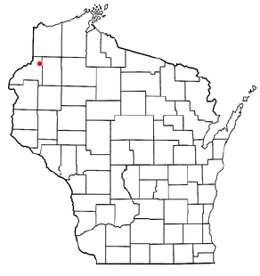
Burnett County is a county located in the U.S. state of Wisconsin. As of the 2020 census, the population was 16,526. Its county seat is Siren, with the majority of county governmental services located at the Burnett County Government Center. The county was created in 1856 and organized in 1865. The St. Croix Chippewa Indians of Wisconsin have reservation lands in Burnett County and are the county's largest employer.

Pickford Township is a civil township of Chippewa County in the U.S. state of Michigan. As of the 2010 census, the township population was 1,595.

Raber Township is a civil township of Chippewa County in the U.S. state of Michigan. The population was 647 at the 2010 census.

Chippewa Township is a civil township of Isabella County in the U.S. state of Michigan. As of the 2000 census, the township population was 4,617. The city of Mount Pleasant is nearby to the west, and the Mount Pleasant post office, with ZIP code 48858, also serves the northern portion of Chippewa Township.

Swiss is a town in Burnett County in the U.S. state of Wisconsin. The population was 790 at the 2010 census. The unincorporated community of Danbury is located within the town.
Webb Lake is a town in Burnett County in the U.S. state of Wisconsin. The population was 311 at the 2010 census. It is along Wisconsin Highway 77 near County Road H. The unincorporated community of Webb Lake is located within the town of Webb Lake.

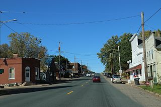
Webster is a village in Burnett County in the U.S. state of Wisconsin. The population was 653 at the 2010 census. It is along Wisconsin Highway 35.

Chippewa Falls is a city located on the Chippewa River in Chippewa County in the northwestern part of the U.S. state of Wisconsin. The population was 14,778 in the 2021 census. Incorporated as a city in 1869, it is the county seat of Chippewa County.

Cornell is a city in Chippewa County, Wisconsin, United States. The population was 1,467 at the 2010 census. It is located on the Chippewa River, upstream from Lake Wissota and Chippewa Falls, where Highway 64 crosses the river and Highway 27.

Hallie is a town in Chippewa County in the U.S. state of Wisconsin. As of the 2010 census its population was 161. In 2000, the town population was 4,703 according to the federal census. On February 18, 2003, however, most of the town incorporated as the village of Lake Hallie, taking with it nearly all of the town's population and reducing the town's remaining land area to 7.5 square miles (19.3 km2).

Lake Nebagamon is a village in Douglas County, Wisconsin, United States. The population was 1,069 at the 2010 census.

Clam Falls is a town in Polk County, Wisconsin, United States. The population was 547 at the 2000 census. The unincorporated communities of Clam Falls and Lewis are located in the town.
Tony is a village in Rusk County, Wisconsin, United States. The population was 113 at the 2010 census.

Ojibwa is a town in Sawyer County, Wisconsin, United States. The population was 267 at the 2000 census. The unincorporated community of Ojibwa is located in the town.
Deer Park is a village in St. Croix County, Wisconsin, United States. The population was 216 at the 2010 census.
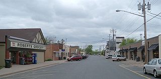
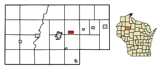
Roberts is a village in St. Croix County, Wisconsin, United States. The population was 1,651 at the 2010 census. The village is surrounded by the town of Warren.

Turtle Lake is a village in Barron and Polk counties in the U.S. state of Wisconsin. Its population was 1,064 at the 2010 census. Of these, 972 were in Barron County and 93 were in Polk County. The village is located between the towns of Almena, in Barron County, and Beaver, in Polk County.
Nelson is a town in Buffalo County in the U.S. state of Wisconsin. The population was 571 at the 2010 census. The village of Nelson is located within the town. The unincorporated community of Misha Mokwa and railroad junction Trevino are located in the town. The unincorporated community of Urne is located partially in the town.

River Falls is a city in Pierce and St. Croix counties in the U.S. state of Wisconsin. It is located mostly within the town of River Falls, and adjacent to the town of Kinnickinnic in St. Croix County. River Falls is the most populous city in Pierce County. The population was 16,182 at the 2020 census, with 12,546 residing in Pierce County and 3,636 in St. Croix County. It is part of the Minneapolis-St. Paul metropolitan area and located approximately 30 miles (48 km) east of the center of that region.

St. Croix Falls is a city in Polk County, Wisconsin, United States. The population was 2,208 at the 2020 census. The city is located within the Town of St. Croix Falls.

