DeWitt Charter Township, Michigan

Last updated
DeWitt Township, Michigan
DeWitt Charter Township
DeWitt Charter Township, MI location.png
Location within Clinton County
USA Michigan location map.svg
Red pog.svg
DeWitt Township
Location within the state of Michigan
Usa edcp location map.svg
Red pog.svg
DeWitt Township
Location within the United States
Coordinates: 42°48′41″N84°32′22″W / 42.81139°N 84.53944°W / 42.81139; -84.53944
CountryUnited States
State Michigan
County Clinton
Established1836
Government
  SupervisorRichard Galardi
   Clerk Adam Cramton
Area
  Total31.27 sq mi (80.99 km2)
  Land31.03 sq mi (80.37 km2)
  Water0.24 sq mi (0.62 km2)
Elevation
830 ft (253 m)
Population
 (2020)
  Total15,073
  Density480/sq mi (190/km2)
Time zone UTC-5 (EST)
  Summer (DST) UTC-4 (EDT)
ZIP code(s)
48808 (Bath)
48820 (DeWitt)
48906 (Lansing)
Area code 517
FIPS code 26-22140 [1]
GNIS feature ID1626183 [2]
Website Official website

DeWitt Charter Township is a charter township of Clinton County in the U.S. state of Michigan. The population was 15,073 at the 2020 census [3] , which was an increase from 14,321 at the 2010 census. [4]

Contents

The original survey township now includes portions of the cities of DeWitt, East Lansing, and Lansing, but all are administered autonomously or through 425 Agreements.

Communities

Description and history

The township is situated directly north of the city of Lansing, Michigan's capital city. One of the fastest growing areas in the state, the township is quickly developing along the Business US 127 thoroughfare, and near its intersection with I-69. The township is also home to Lansing Capital Region International Airport.

DeWitt was named after DeWitt Clinton, Governor of New York from 1817 to 1822, and again from 1825 until his death in 1828. It was first settled by Captain David Scott, who moved there from Ann Arbor in 1833, and platted the land. The State Legislature formally created DeWitt Township on March 23, 1836. The first township meeting was held at the house of Captain Scott on April 8, 1836. A gentleman by the name of Welcome J. Partelo was named the township's first Supervisor at that meeting.

It did not take long for the State to divide DeWitt Township into the many townships that we recognize today. In 1837, the township was split in half by a north–south line with the western half becoming Watertown Township. Two years later, the township was again split in half by an East–west line with the northern half becoming Bingham Township. One day later, the Governor approved an act, which split the remaining township area in half by a north–south line with the eastern half becoming Ossowa Township (renamed Bath Township in 1843). The final split of the township came in 1841 with the northern half of the remaining land becoming Olive Township. In four years, DeWitt Township went from encompassing the entire County to its current boundary.

The county seat for Clinton County was also located in DeWitt Township from the inception of the county. The county seat remained in DeWitt Township until December 1857 when it was moved to Plumstead Hall, in the village of St. Johns, until a new courthouse could be built.

In the early 1900s, the Lansing, St. Johns and St. Louis Railway opened the community to a new era of prosperity.

It was not until 1929 when the town was incorporated as a village, and then was no longer under the full jurisdiction of the township.[3]

The Village of DeWitt was incorporated into a city in 1965.

The Township became a Charter Township on November 7, 1978.

The DeWitt area was ranked as the 75th best place to live in the United States by CNN Money in 2005.[4]

DeWitt Township has three primary schools district; DeWitt Public Schools, Bath Public Schools and Lansing Public Schools.

The DeWitt area is the home of gymnast Jordyn Wieber, who was part of the gold medal-winning women's gymnastics team at the 2012 London Summer Olympics.

Geography

According to the United States Census Bureau, the township has a total area of 31.27 square miles (80.99 km2), of which 31.03 square miles (80.37 km2) is land and 0.24 square miles (0.62 km2) (0.77%) is water. [4]

Demographics

Historical population
CensusPop.Note
1960 7,649
1970 9,90929.5%
1980 10,0381.3%
1990 10,4484.1%
2000 12,14316.2%
2010 14,32117.9%
2020 15,0735.3%
2021 (est.)15,323 [5] 1.7%
U.S. Decennial Census

As of the census [1] of 2000, there were 12,143 people, 4,839 households, and 3,450 families residing in the township. The population density was 383.5 inhabitants per square mile (148.1/km2). There were 5,119 housing units at an average density of 161.7 per square mile (62.4/km2). The racial makeup of the township was 94.16% White, 1.34% African American, 0.81% Native American, 0.86% Asian, 0.02% Pacific Islander, 1.22% from other races, and 1.58% from two or more races. Hispanic or Latino of any race were 4.02% of the population.

There were 4,839 households, out of which 32.1% had children under the age of 18 living with them, 58.4% were married couples living together, 9.1% had a female householder with no husband present, and 28.7% were non-families. 23.5% of all households were made up of individuals, and 7.2% had someone living alone who was 65 years of age or older. The average household size was 2.49 and the average family size was 2.94.

In the township the population was spread out, with 25.0% under the age of 18, 6.9% from 18 to 24, 29.5% from 25 to 44, 26.2% from 45 to 64, and 12.5% who were 65 years of age or older. The median age was 38 years. For every 100 females, there were 96.4 males. For every 100 females age 18 and over, there were 93.8 males.

The median income for a household in the township was $49,782, and the median income for a family was $61,202. Males had a median income of $45,013 versus $36,297 for females. The per capita income for the township was $24,624. About 3.2% of families and 5.4% of the population were below the poverty line, including 6.3% of those under age 18 and 5.7% of those age 65 or over.

Related Research Articles

<span class="mw-page-title-main">Clinton County, Michigan</span> County in Michigan, United States

Clinton County is a county in the U.S. state of Michigan. As of the 2020 Census, the population was 79,128. The county seat is St. Johns. The county was created in 1831 and organized in 1839. It is named after early American politician DeWitt Clinton. Clinton County is included in the Lansing-East Lansing, MI Metropolitan Statistical Area.

<span class="mw-page-title-main">Shiawassee County, Michigan</span> County in Michigan, United States

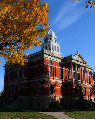
Shiawassee County is a county located in the U.S. state of Michigan. As of the 2020 United States Census, the population was 68,094. The county seat is Corunna, and the largest city in the county is Owosso. In 2010, the center of population of Michigan was located in Shiawassee County, in Bennington Township.

<span class="mw-page-title-main">Ingham County, Michigan</span> County in Michigan, United States

Ingham County is a county located in the U.S. state of Michigan. As of the 2020 Census, the population was 284,900. The county seat is Mason. Lansing, the state capital of Michigan, is largely located within the county. Lansing is the only state capital in the United States located in a county of which it is not also the seat of government. The county is home to Michigan State University, Lansing Community College, and the Class A minor league baseball team Lansing Lugnuts. Ingham County is included in the Lansing–East Lansing, MI Metropolitan Statistical Area. It is considered to be a part of Mid Michigan.

<span class="mw-page-title-main">Eaton County, Michigan</span> County in Michigan, United States

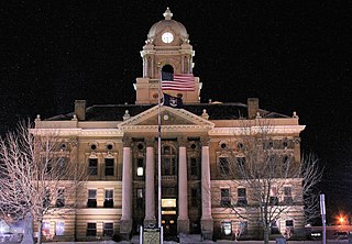
Eaton County is a county in the U.S. state of Michigan. As of the 2020 United States Census, the population was 109,175. The county seat is Charlotte. The county was organized in 1837 and was named for John Eaton, who was Secretary of War under U.S. President Andrew Jackson, making it one of Michigan's Cabinet counties. Eaton County is included in the Lansing-East Lansing, Metropolitan Statistical area in Central Michigan.

<span class="mw-page-title-main">Bath Charter Township, Michigan</span> Local government area in Michigan, United States

Bath Charter Township is a charter township of Clinton County in the U.S. state of Michigan. As of the 2020 census, the township population was 13,292, an increase from 11,598 at the 2010 census. It is situated directly north of the city of East Lansing.

<span class="mw-page-title-main">Bingham Township, Clinton County, Michigan</span> Civil township in Michigan, United States

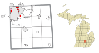
Bingham Township is a civil township of Clinton County in the U.S. state of Michigan. As of the 2020 census, the township had a population of 2,919.

<span class="mw-page-title-main">DeWitt, Michigan</span> City in Michigan, United States

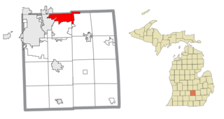
DeWitt is a city in Clinton County in the U.S. state of Michigan. The population was 4,776 at the 2020 census. The city is located north of Interstate 69 and west of U.S. Route 127, just north of the city of Lansing.

Delta Charter Township, officially known as the Charter Township of Delta and commonly known as simply Delta Township, is a charter township of Eaton County in the U.S. state of Michigan. As of the 2020 census, it had a population of 33,119 making it the most populous municipality in Eaton County. The township operates its own fire department, but contracts with the Eaton County Sheriff Department for police protection. The township is a major community in metropolitan Lansing.

<span class="mw-page-title-main">Alaiedon Township, Michigan</span> Civil township in Michigan, United States

Alaiedon Township is a civil township of Ingham County in the U.S. state of Michigan. As of the 2020 census, the township population was 2,910.

<span class="mw-page-title-main">Delhi Charter Township, Michigan</span> Charter township in Michigan, United States

Delhi Charter Township is a charter township of Ingham County in the U.S. state of Michigan. The population was 27,710 at the 2020 census, an increase from 25,877 in 2010 census.

<span class="mw-page-title-main">Haslett, Michigan</span> Census-designated place in Michigan, United States

Haslett is a census-designated place (CDP) in Ingham County in the U.S. state of Michigan. It is located mostly within Meridian Charter Township with a small portion extending east into Williamstown Township. The population was 19,220 at the 2010 census. Haslett contains its own school district, as well as its own post office with the 48840 ZIP Code.

<span class="mw-page-title-main">Lansing Charter Township, Michigan</span> Charter township in Michigan, United States

Lansing Charter Township is a charter township of Ingham County in the U.S. state of Michigan. The population was 8,143 at the 2020 census.

<span class="mw-page-title-main">Meridian Charter Township, Michigan</span> Charter township in Michigan, United States

Meridian Charter Township is a charter township of Ingham County in the U.S. state of Michigan. As of the 2020 census, the township had a population of 43,916.

<span class="mw-page-title-main">Blackman Charter Township, Michigan</span> Charter township in Michigan, United States

Blackman Charter Township is a charter township of Jackson County in the U.S. state of Michigan. As of the 2010 census, the township population was 24,051.

<span class="mw-page-title-main">Clinton Township, Lenawee County, Michigan</span> Civil township in Michigan, United States

Clinton Township is a civil township of Lenawee County in the U.S. state of Michigan. The population was 3,624 at the 2000 census. The village of Clinton is located within the township.

<span class="mw-page-title-main">Genoa Township, Michigan</span> Charter township in Michigan, United States

Genoa Charter Township is a charter township of Livingston County in the U.S. state of Michigan. As of the 2020 census, the township population was 20,692.

<span class="mw-page-title-main">Clinton Township, Macomb County, Michigan</span> Charter township in Michigan, United States

Clinton Township is a charter township in Macomb County in the U.S. state of Michigan. A northern suburb of Detroit, Clinton Township is located about 22 miles (35 km) northeast of downtown Detroit. As of the 2020 census, the township had a population of 100,513, making it the most populous township in Michigan, and the state's 8th-most populous community overall.

<span class="mw-page-title-main">Royal Oak Charter Township, Michigan</span> Charter township in Michigan, United States

Royal Oak Township is a charter township in Oakland County in the U.S. state of Michigan. An inner-ring suburb of Detroit, Royal Oak Township borders Detroit to the north, roughly 11 miles (17.7 km) north of downtown Detroit. As of the 2020 census, the township had a population of 2,374. It is independent of the city of Royal Oak.

<span class="mw-page-title-main">East Lansing, Michigan</span> City in Michigan, United States

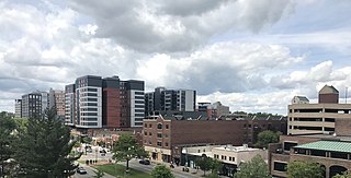
East Lansing is a city in the U.S. state of Michigan. Most of the city lies within Ingham County with a smaller portion extending north into Clinton County. At the 2020 Census the population was 47,741. Located directly east of the state capital of Lansing, East Lansing is well-known as the home of Michigan State University. The city is part of the Lansing–East Lansing metropolitan area.

<span class="mw-page-title-main">Lansing–East Lansing metropolitan area</span> Metropolitan Area in Michigan, United States

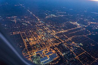
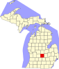
The Lansing–East Lansing Metropolitan Statistical Area is a metropolitan area located in Central Michigan defined by the Office of Management and Budget, and encompassing the counties of Eaton, Clinton, Ingham and Shiawassee. The region is colloquially referred to as "Mid" or Central Michigan, and less often as "Greater Lansing" or the "Capital Area". As of the 2020 census, the MSA had a population of 541,297. It ranks as Michigan's third-largest metropolitan area behind metropolitan Detroit and Grand Rapids.

References

  1. 1 2 "U.S. Census website". United States Census Bureau . Retrieved 2008-01-31.
  2. U.S. Geological Survey Geographic Names Information System: DeWitt Charter Township, Michigan
  3. "Explore Census Data". data.census.gov. Retrieved 2024-04-24.
  4. 1 2 "Michigan: 2010 Population and Housing Unit Counts 2010 Census of Population and Housing" (PDF). 2010 United States Census . United States Census Bureau. September 2012. p. 19 Michigan. Archived (PDF) from the original on 2012-10-19. Retrieved January 19, 2021.
  5. "DeWitt Charter Township, Clinton County, Michigan". census.gov. Retrieved July 7, 2022.