Deer Valley, Phoenix

Last updated
Deer Valley
Deer Valley Village
Phoenix Urban Villages Deer Valley highlighted.svg
Location of Deer Valley highlighted in red.
CountryUnited States
State Arizona
County Maricopa
City Phoenix
Area
  Total56.9 sq mi (147 km2)
Population
 (2010)
  Total165,656
Website Deer Valley Village Planning Committee

Deer Valley is located in the city of Phoenix, Arizona, United States. As of 2010, the population was 165,656, 25% of whom were under 18 years of age. [1] The origin of the name is unclear; it first appeared on a 1921 United States General Land Office map of the area describing the valley created by Skunk Creek. [2]

Contents

Geography

It is located in the northwestern portion of the city, and borders the cities of Glendale and Peoria. Within Phoenix, it borders four other urban villages (North Mountain, Paradise Valley, Desert View, and North Gateway). The village is 56.9 square miles (147 km2) in size and is centered at Interstate 17 and Arizona Loop 101. The core of the village includes commercial, industrial, and multifamily housing developments. Outer areas have more lower density residential land. [3]

Significant geographic features of the village include the volcanic Adobe Mountains and Hedgpeth Hills, Adobe Dam, Skunk Creek, and Scatter Wash. [3]

Climate

According to the Köppen Climate Classification system, Deer Valley has a hot desert climate, abbreviated "BWh" on climate maps. The hottest temperature recorded in Deer Valley was 117 °F (47.2 °C) on June 19, 2016 and June 20, 2017, while the coldest temperature recorded was 22 °F (−5.6 °C) on January 14, 2007. [4]

Climate data for Deer Valley, Arizona (Phoenix Deer Valley Airport), 1991–2020 normals, extremes 1998–present
MonthJanFebMarAprMayJunJulAugSepOctNovDecYear
Record high °F (°C)82
(28)
85
(29)
97
(36)
101
(38)
101
(38)
117
(47)
116
(47)
115
(46)
112
(44)
103
(39)
95
(35)
82
(28)
117
(47)
Mean maximum °F (°C)77.0
(25.0)
80.0
(26.7)
88.1
(31.2)
96.7
(35.9)
102.4
(39.1)
111.3
(44.1)
112.5
(44.7)
110.9
(43.8)
106.3
(41.3)
97.3
(36.3)
87.9
(31.1)
76.2
(24.6)
114.0
(45.6)
Mean daily maximum °F (°C)65.4
(18.6)
68.1
(20.1)
75.0
(23.9)
82.5
(28.1)
91.5
(33.1)
101.5
(38.6)
104.0
(40.0)
102.5
(39.2)
97.5
(36.4)
86.3
(30.2)
74.0
(23.3)
63.9
(17.7)
84.4
(29.1)
Daily mean °F (°C)54.8
(12.7)
57.1
(13.9)
62.9
(17.2)
69.6
(20.9)
78.1
(25.6)
87.1
(30.6)
92.4
(33.6)
91.5
(33.1)
86.1
(30.1)
74.5
(23.6)
62.4
(16.9)
53.3
(11.8)
72.5
(22.5)
Mean daily minimum °F (°C)44.1
(6.7)
46.1
(7.8)
50.9
(10.5)
56.6
(13.7)
64.7
(18.2)
72.7
(22.6)
80.8
(27.1)
80.5
(26.9)
74.7
(23.7)
62.7
(17.1)
50.8
(10.4)
42.7
(5.9)
60.6
(15.9)
Mean minimum °F (°C)31.9
(−0.1)
34.7
(1.5)
40.9
(4.9)
46.2
(7.9)
53.9
(12.2)
64.7
(18.2)
72.1
(22.3)
72.2
(22.3)
64.4
(18.0)
50.9
(10.5)
39.1
(3.9)
32.0
(0.0)
29.9
(−1.2)
Record low °F (°C)22
(−6)
24
(−4)
32
(0)
37
(3)
47
(8)
57
(14)
66
(19)
69
(21)
56
(13)
40
(4)
30
(−1)
28
(−2)
22
(−6)
Average precipitation inches (mm)1.17
(30)
1.21
(31)
1.09
(28)
0.35
(8.9)
0.19
(4.8)
0.03
(0.76)
0.81
(21)
0.96
(24)
0.71
(18)
0.67
(17)
0.90
(23)
0.81
(21)
8.90
(226)
Average precipitation days (≥ 0.01 in)3.93.83.01.81.00.53.84.52.92.72.64.134.6
Source 1: NOAA [5]
Source 2: National Weather Service (mean maxima/minima 20062020) [4]

Employment

Within Deer Valley is approximately 9.3 million sq ft (0.86 m2) of office space, 11.9 million sq ft (1.11 m2) of industrial space, and 3 million sq ft (0.28 m2) of mixed space. As of 2013, major employers were: [6]

Features and attractions

Deer Valley Airport Deer Valley Airport.jpg
Deer Valley Airport
Deer Valley Petroglyph Preserve Phoenix-Deer Valley Rock Art Center Museum-2.JPG
Deer Valley Petroglyph Preserve

Deer Valley Airport, one of the busiest general aviation airports in the country [7] is located in the village. Turf Paradise, a horse racetrack and Wet'n'Wild Phoenix, a 35-acre (14 ha) waterpark and the Arizona's largest theme park are both located in Deer Valley.

The Central Arizona Project canal carrying water from the Colorado River at Lake Havasu to Phoenix and Tucson passes through the village. The Deer Valley Petroglyph Preserve, a 47-acre (19 ha) archaeological site containing over 1500 petroglyphs, [8] listed on the National Register of Historic Places and as a Phoenix Points of Pride, is located just west of the village core. [3]

The Adobe Dam Regional Park, a 1,514-acre (613 ha) Maricopa County park, is located here. [3] The park is located behind Adobe Dam in an area primarily designated for flood control. The park includes a sports complex for softball and sand volleyball, a golf course, kart racing track, a radio-controlled aircraft flight facility serving an AMA-chartered model aircraft club, [9] a paintball field, and a 44-acre (18 ha) large scale model railroad. [10]

Education

Most children in Deer Valley attend schools of the Deer Valley Unified School District. The school district is much larger than the village, and includes area from several surrounding Phoenix urban villages, as well as parts of Glendale and Peoria. A small portion of the village south of Bell Road is in other school districts. [11] The district has five high schools, two of which are located in the village, Barry Goldwater High School and Sandra Day O'Connor High School. The eponymous Deer Valley High School is located just outside the village boundary in Glendale. [12]

Related Research Articles

<span class="mw-page-title-main">Phoenix, Arizona</span> Capital of Arizona, United States

Phoenix is the capital and most populous city of the U.S. state of Arizona, with 1,608,139 residents as of 2020. It is the fifth-most populous city in the United States and the most populous state capital in the country.

<span class="mw-page-title-main">Maricopa County, Arizona</span> County in Arizona, United States

Maricopa County is in the south-central part of the U.S. state of Arizona. As of the 2020 census the population was 4,420,568, or about 62% of the state's total, making it the fourth-most populous county in the United States and the most populous county in Arizona, and making Arizona one of the nation's most centralized states. The county seat is Phoenix, the state capital and fifth-most populous city in the United States.

<span class="mw-page-title-main">Glendale, Arizona</span> City in Arizona, United States

Glendale is a city in Maricopa County, Arizona, United States. Located about nine miles northwest of the state capital Phoenix, Glendale is known for State Farm Stadium, which is the home of the Arizona Cardinals football team. The city also contains the Arrowhead Towne Center shopping mall. As of the 2020 census, Glendale had a population of 248,325.

<span class="mw-page-title-main">Peoria, Arizona</span> City in Arizona, United States

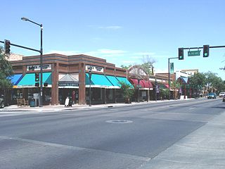
Peoria is a city in Maricopa and Yavapai counties in the U.S. state of Arizona. Most of the city is located in Maricopa County, while a portion of it in the north is in Yavapai County. It is a major suburb of Phoenix. As of the 2020 census, the population of Peoria was 190,985, up from 154,065 in 2010. It is the sixth-largest city in Arizona in land area and the ninth-largest in population. It was named after Peoria, Illinois. The word peoria is a corruption of the Miami-Illinois word for "prairie fire". It is the spring training home of the San Diego Padres and Seattle Mariners, who share the Peoria Sports Complex.

<span class="mw-page-title-main">Arizona Canal</span> Canal in Maricopa County, Arizona, United States

The Arizona Canal is a major canal in central Maricopa County that led to the founding of several communities, now among the wealthier neighborhoods of suburban Phoenix, constructed in the late 1880s. Flood irrigation of residential yards is still common in these neighborhoods, using a system of lateral waterways connected via gates to the canal itself. Like most Valley canals, its banks are popular with joggers and bicyclists.

<span class="mw-page-title-main">Anthem, Arizona</span> Place in Arizona, United States

Anthem is a planned community partially located within Phoenix and partially located within New River, a census-designated place. The community is entirely located in Maricopa County, Arizona, United States, within the Phoenix Metropolitan Area. As of the 2020 census, the population of the Anthem was 23,190.

<span class="mw-page-title-main">Lake Pleasant Regional Park</span> Regional county park in Arizona, US

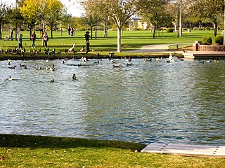
Lake Pleasant Regional Park is a large outdoors recreation area straddling the Maricopa and Yavapai county border northwest of Phoenix, Arizona. The park is located within the municipal boundaries of Peoria, Arizona, and serves as a major recreation hub for the northwest Phoenix metropolitan area.

<span class="mw-page-title-main">White Tank Mountain Regional Park</span> Regional park in Maricopa County, Arizona

The White Tank Mountain Regional Park is a large regional park located in west-central Maricopa County, Arizona. Encompassing 29,271 acres of desert and mountain landscape, it is the largest regional park in the county. The bulk of the White Tank Mountains range is located within the park's boundaries.

The Maricopa County Community College District (MCCCD), also known as Maricopa Community Colleges, is a public community college district in Maricopa County, Arizona. Headquartered in Tempe, MCCCD is among the largest community college districts in the United States, serving more than 100,000 students each year in the Phoenix metropolitan area.

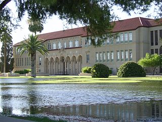
Deer Valley Unified School District #97 (DVUSD) is a Pre-K–12 school district, headquartered in Phoenix, Arizona, United States. DVUSD is the fifth largest school district in the state of Arizona, serving areas of Phoenix, Glendale, Peoria, Anthem, New River and numerous unincorporated areas of northwest Maricopa County. Situated within the Sonoran Desert, the District has grown from its modest beginnings as a county accommodation school located in New River in 1934 to 37 campuses serving 36,261 students: 15 K–6 elementary schools, 13 K–8 schools, three middle schools, and five comprehensive high schools, plus an online school and an alternative school. Early childhood education opportunities are offered through DVUSD Community Education Preschool/PreKindergarten, and Head Start. Twelve schools receive Title I funding. District facilities include District Office, Support Services Center, Transportation and Administrative Services.

Westgate Entertainment District, formerly known as "Westgate City Center" is a mixed-use development in Glendale, Arizona. Westgate is described as a super-regional destination for shopping, dining, entertainment, and commercial offices. Funded by millionaire New York architect Ron Elsensohn and anchored by the Desert Diamond Arena, the former home of the NHL team Arizona Coyotes, the complex has 8,000,000 sq ft (740,000 m2) of retail space and is one of the premier entertainment destinations in the region, attracting over 22 million visitors annually. In 2011, the property went into foreclosure and reverted to lenders. The shopping center was reopened under the name Westgate Entertainment District, operated by Vestar Capital Partners, which also manages other properties in the Phoenix area.

<span class="mw-page-title-main">North/Northwest Phoenix</span> Region of the city

North/Northwest Phoenix is a region in the city of Phoenix, Arizona. While the area with this name has no official separate status, it usually refers to the Urban Villages of Paradise Valley, North Mountain, Deer Valley, Desert View, and North Gateway.

Many arterial roads in the Phoenix metropolitan area have the same name in multiple cities or towns. Some roads change names or route numbers across town borders, resulting in occasional confusion. For example, the road known as Apache Boulevard in Tempe continues east as Main Street in neighboring Mesa and then as Apache Trail in Apache Junction. Although Broadway Road maintains the same name through Goodyear, Avondale, Phoenix, Tempe, Mesa, and Apache Junction, each town uses a different reference point for address numbers.

The West Valley is a region within the Phoenix metropolitan area, in central Arizona.

<span class="mw-page-title-main">Sahuaro Ranch</span> United States historic place

Sahuaro Ranch was founded in 1886, by William Henry Bartlett, a native of Illinois. The ranch, located north of what eventually became the city of Glendale, Arizona, was rich in figs and other fruit orchards, vineyards, and fields of alfalfa. The ranch has all of its historical structures restored, and the "Sahuaro Ranch Park" is administered by the Parks and Recreation Department of Glendale.

The following is a timeline of the history of the city of Phoenix, Arizona, United States.

<span class="mw-page-title-main">Deer Valley Petroglyph Preserve</span> United States historic place in Maricopa County, Arizona

The Deer Valley Petroglyph Preserve, formerly known as the Deer Valley Rock Art Center, is a 47-acre nature preserve featuring over 1500 Hohokam, Patayan, and Archaic petroglyphs visible on 500 basalt boulders in the Deer Valley area of Phoenix, Arizona. In 1980, the US Army Corps of Engineers contracted J. Simon Bruder to conduct an archaeological investigation prior to the construction of the Adobe Dam at the Hedgpeth Hills. The petroglyphs are between 500 and 5,000 years old. The site was listed on the National Register of Historic Places in 1984, and it was also listed with the Phoenix Points of Pride. The preserve and museum are operated by the ASU College of Liberal Arts and Sciences's School of Human Evolution and Social Change.

<span class="mw-page-title-main">Timeline of Arizona</span> Timeline of the history of Arizona

The following is a timeline of the history of the area which today comprises the U.S. state of Arizona. Situated in the desert southwest, for millennia the area was home to a series of Pre-Columbian peoples. By 1 AD, the dominant groups in the area were the Hohokam, the Mogollon, and the Ancestral Puebloans. The Hohokam dominated the center of the area which is now Arizona, the Mogollon the southeast, and the Puebloans the north and northeast. As these cultures disappeared between 1000 and 1400 AD, other Indian groups settled in Arizona. These tribes included the Navajo, Apache, Southern Paiute, Hopi, Yavapai, Akimel O'odham, and the Tohono O'odham.

References

  1. "Deer Valley Village 2010 Census Summary" (PDF). phoenix.gov. Archived from the original (PDF) on January 15, 2017. Retrieved November 18, 2016.
  2. Barnes, Will Croft (October 1, 2016). Arizona Place Names. University of Arizona Press. p. 125. ISBN   978-0-8165-1074-0.
  3. 1 2 3 4 "Deer Valley Village" (PDF). phoenix.gov. City of Phoenix. Archived from the original (PDF) on January 15, 2017. Retrieved November 17, 2016.
  4. 1 2 "NOAA Online Weather Data – NWS Phoenix". National Weather Service. Retrieved March 29, 2023.
  5. "U.S. Climate Normals Quick Access – Station: Phoenix Deer Valley MUNI AP, AZ". National Oceanic and Atmospheric Administration. Retrieved March 29, 2023.
  6. "City of Phoenix Employment Center Profile Deer Valley" (PDF). phoenix.gov. City of Phoenix. Retrieved November 18, 2016.
  7. "Business Aviation Airports: A Contrast to the Commercial Airline Hubs". nbss.ord. Retrieved November 21, 2016.
  8. "Deer Valley Rock Art Center". About.Com. Archived from the original on December 13, 2013. Retrieved December 12, 2013.
  9. Arizona Model Pilots Society homepage
  10. "Maricopa County Parks and Recreation Adobe Dam Regional Park". maricopacountyparks.net. Maricopa County. Retrieved November 19, 2016.
  11. "Attendance Boundary Maps - Deer Valley Unified School District". dvusd.org. Retrieved November 18, 2016.
  12. "Attendance Areas for DVUSD High Schools". dvusd.schoolwires.net. Retrieved November 19, 2016.

33°40′08″N112°06′47″W / 33.669021°N 112.113117°W / 33.669021; -112.113117