Deposit, New York | |
---|---|
Coordinates: 42°03′36″N75°25′41″W / 42.06°N 75.42806°W | |
Country | United States |
State | New York |
County | Delaware |
Government | |
• Type | Town Council |
• Town Supervisor | Thomas A. Axtell (R) |
• Town Council | Members |
Area | |
• Total | 44.6 sq mi (115.5 km2) |
• Land | 43.0 sq mi (111.4 km2) |
• Water | 1.6 sq mi (4.1 km2) |
Elevation | 990 ft (300 m) |
Population | |
• Total | 1,427 |
Time zone | UTC-5 (Eastern (EST)) |
• Summer (DST) | UTC-4 (EDT) |
ZIP code | 13754 |
Area code | 607 |
FIPS code | 36-025-20357 |
GNIS feature ID | 978899 |
Website | townofdepositny |
Deposit is a town in Delaware County, New York, United States. As of the 2020 census, the town's population was 1,427. [2] [1]
The town of Deposit is on the western border of the county. It contains a village also named Deposit, the western portion of which is located in the adjacent town of Sanford in Broome County. [3]
The town name was derived from the deposits of logs made by lumbermen, [4] prior to forming rafts to float down the Delaware River; usually to Philadelphia. The Town of Deposit was organized in 1880 from the western part of the town of Tompkins.
In the 1890s, Deposit was a center of publishing with the relocation of the Outing Publishing Company to the town (from New York). Several magazines, including The Bohemian, were published and printed from Deposit. The Outing Publishing Company went out of business a few years after the failure of the Knapp Bros. Bank in 1909. [5] Charles J. Knapp was president of Outing and on the board of Knapp Brothers, which was run by his nephew, Charles P. Knapp.
The western town line is the border of Broome County. The village is located at the confluence of Oquaga Creek and the West Branch of the Delaware River. The Southern Tier Expressway (NY 17) follows the western town boundary.
The southern end of New York State Route 8 is at NY 17 just south of the village of Deposit.
According to the United States Census Bureau, the town has a total area of 44.6 square miles (115.5 km2), of which 43.0 square miles (111.4 km2) is land and 1.6 square miles (4.1 km2), or 3.51%, is water. [6]
Census | Pop. | Note | %± |
---|---|---|---|
1880 | 1,714 | — | |
1890 | 1,664 | −2.9% | |
1900 | 1,747 | 5.0% | |
1910 | 1,641 | −6.1% | |
1920 | 1,415 | −13.8% | |
1930 | 1,469 | 3.8% | |
1940 | 1,443 | −1.8% | |
1950 | 1,570 | 8.8% | |
1960 | 1,560 | −0.6% | |
1970 | 1,656 | 6.2% | |
1980 | 1,810 | 9.3% | |
1990 | 1,824 | 0.8% | |
2000 | 1,687 | −7.5% | |
2010 | 1,712 | 1.5% | |
2020 | 1,427 | −16.6% | |
U.S. Decennial Census [7] [8] |
As of the census [9] of 2000, there were 1,687 people, 700 households, and 445 families residing in the town. The population density was 39.2 inhabitants per square mile (15.1/km2). There were 1,048 housing units at an average density of 24.4 per square mile (9.4/km2). The racial makeup of the town was 97.27% White, 1.30% African American, 0.18% Native American, 0.47% Asian, 0.06% Pacific Islander, 0.18% from other races, and 0.53% from two or more races. Hispanic or Latino of any race were 1.13% of the population.
There were 700 households, out of which 31.3% had children under the age of 18 living with them, 47.6% were married couples living together, 10.6% had a female householder with no partner present, and 36.3% were non-families. 31.6% of all households were made up of individuals, and 17.6% had someone living alone who was 65 years of age or older. The average household size was 2.41 and the average family size was 2.99.
In the town, the population was spread out, with 26.4% under the age of 18, 8.6% from 18 to 24, 25.1% from 25 to 44, 22.6% from 45 to 64, and 17.4% who were 65 years of age or older. The median age was 38 years. For every 100 females, there were 91.1 males. For every 100 females age 18 and over, there were 85.9 males.
The median income for a household in the town was $28,750, and the median income for a family was $35,536. Males had a median income of $27,434 versus $20,602 for females. The per capita income for the town was $15,068. About 11.5% of families and 15.8% of the population were below the poverty line, including 26.3% of those under age 18 and 8.3% of those age 65 or over.
The Cannonsville Reservoir, which supplies the New York City water system, is located on the West Branch of the Delaware River, 3 miles (5 km) upstream (east) of Deposit. The hamlet of Cannonsville and several others were submerged by the reservoir. [10]
Westerlo is a town in Albany County, New York, United States. The population was 3,194 at the 2020 census.
Colchester is a town in Delaware County, New York, United States. The population was 1,782 at the 2020 census. The town is in the southwestern part of the county.
Davenport is a town in Delaware County, New York, United States. The population was 2,955 at the 2020 census. The town is in the northeastern part of the county.
Harpersfield is a town in Delaware County, New York, United States. The population was 1,442 at the 2020 census. The town is on the northern border of the county.
Kortright is a town in Delaware County, New York, United States. The population was 1,544 at the 2020 census. The town is in the northern part of the county.
Masonville is a town in Delaware County, New York, United States. The population was 1,239 at the 2020 census. The town is in the western part of the county.
Meredith is a town in Delaware County, New York, United States. The population was 1,484 at the 2020 census. It is an interior town in the northern part of the county.
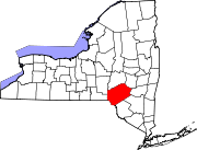
Tompkins is a town in Delaware County, New York, United States. The population was 1,290 at the 2020 census. The town is named after Daniel D. Tompkins, the fourth governor of New York and sixth vice president of the United States.
Halcott is a town in Greene County, New York, United States. The population was 249 in 2020, down from 258 at the 2010 census. The town is in the southwestern corner of the county.
Prattsville is a town in Greene County, New York, United States. The town is in the northwestern part of the county. As of the 2020 census, the population was 774.
Gilboa is a town in Schoharie County, New York, United States. The population was 1,111 at the 2020 census.
Olive is a town in Ulster County, New York, United States. The town is west of Kingston, New York and is inside the Catskill Park. The population was 4,226 at the 2020 census.
Rochester is a town in Ulster County, New York, United States. The population was 7,272 at the 2020 census. It is an interior town located near the center of Ulster County. The northwestern part of the town is in the Catskill Park.
Hancock is a town in Delaware County, New York, United States. The town contains a village, also named Hancock. The town is in the southwest part of the county. The population was 2,764 at the 2020 census. The town is the largest by area in Delaware County. The town borders two other counties, Sullivan County, NY, to the south and Wayne County, PA, to the west. The town is located partially in the Catskill Park.
Sidney is a town in Delaware County, New York, United States. The population was 5,536 at the 2020 census. The town is at the northwestern corner of the county and contains the village of Sidney.
Walton is a town in Delaware County, New York, United States. The population was 5,270 at the 2020 census. The town is in the west-central part of the county and contains the village of Walton. The town claims to be the "Scarecrow Capital of the World."
Cairo is a town in Greene County, New York, United States. The population was 6,644 at the 2020 census. The town is in the southern part of the county, partly in the Catskill Park. The town contains a hamlet, also named Cairo.
Greenville is a town on the northern border of Greene County, New York, United States. The population was 3,741 at the 2020 census. The town contains a hamlet also named Greenville.
Middleburgh is a town in Schoharie County, New York, United States. The population was 3,112 at the 2000 census.
Plattekill is a town in Ulster County, New York, United States. The population was 10,424 in 2020, a slight decrease from 10,499 at the 2010 census. The name is derived from a stream, the Platte Kill.