
The Mississippi River is the second-longest river and chief river of the second-largest drainage system in North America, second only to the Hudson Bay drainage system. From its traditional source of Lake Itasca in northern Minnesota, it flows generally south for 2,340 miles (3,770 km) to the Mississippi River Delta in the Gulf of Mexico. With its many tributaries, the Mississippi's watershed drains all or parts of 32 U.S. states and two Canadian provinces between the Rocky and Appalachian mountains. The main stem is entirely within the United States; the total drainage basin is 1,151,000 sq mi (2,980,000 km2), of which only about one percent is in Canada. The Mississippi ranks as the thirteenth-largest river by discharge in the world. The river either borders or passes through the states of Minnesota, Wisconsin, Iowa, Illinois, Missouri, Kentucky, Tennessee, Arkansas, Mississippi, and Louisiana.

Tiffin is a city in and the county seat of Seneca County, Ohio, United States. Developed along the Sandusky River, which flows to Lake Erie, Tiffin is about 55 miles southeast of Toledo. The population was 17,963 at the 2010 census. The National Arbor Day Foundation has designated Tiffin as a Tree City USA.

The Maumee River is a river running in the United States Midwest from northeastern Indiana into northwestern Ohio and Lake Erie. It is formed at the confluence of the St. Joseph and St. Marys rivers, where Fort Wayne, Indiana has developed, and meanders northeastwardly for 137 miles (220 km) through an agricultural region of glacial moraines before flowing into the Maumee Bay of Lake Erie. The city of Toledo is located at the mouth of the Maumee. The Maumee was designated an Ohio State Scenic River on July 18, 1974. The Maumee watershed is Ohio’s breadbasket; it is two-thirds farmland, mostly corn and soybeans. It is the largest watershed of any of the rivers feeding the Great Lakes, and supplies five percent of Lake Erie’s water.

The Auglaize River is a 113-mile-long (182 km) tributary of the Maumee River in northwestern Ohio in the United States. It drains a primarily rural farming area in the watershed of Lake Erie. The name of the river was derived from the French term for it. The French called it "rivière à la Grande Glaize", referring to the soil in the area.

The Smith River flows from the Klamath Mountains to the Pacific Ocean in Del Norte County in extreme northwestern California, on the West Coast of the United States. The river, about 25.1 miles (40.4 km) long, all within Del Norte County, flows through the Rogue River – Siskiyou National Forest, Six Rivers National Forest, and Jedediah Smith Redwoods State Park.

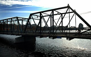
A truss bridge is a bridge whose load-bearing superstructure is composed of a truss, a structure of connected elements, usually forming triangular units. The connected elements may be stressed from tension, compression, or sometimes both in response to dynamic loads. The basic types of truss bridges shown in this article have simple designs which could be easily analyzed by 19th and early 20th-century engineers. A truss bridge is economical to construct because it uses materials efficiently.

The Farmington River is a river, 46.7 miles (75.2 km) in length along its main stem, located in northwest Connecticut with major tributaries extending into southwest Massachusetts. The longest route of the river, from the origin of its West Branch, is 80.4 miles (129.4 km) long, making it the Connecticut River's longest tributary by 2.3 miles (3.7 km) over the major river directly to its north, the Westfield River. The Farmington River's watershed covers 609 square miles (1,580 km2). Historically, the river played an important role in small-scale manufacturing in towns along its course, but it is now mainly used for recreation and drinking water.

The Ohio and Erie Canal was a canal constructed during the 1820s and early 1830s in Ohio. It connected Akron with the Cuyahoga River near its outlet on Lake Erie in Cleveland, and a few years later, with the Ohio River near Portsmouth. It also had connections to other canal systems in Pennsylvania.

Pennypack Creek is a 22.6-mile-long (36.4 km) creek in southeastern Pennsylvania in the United States. It runs southeast through lower Bucks County, eastern Montgomery County and the northeast section of Philadelphia, before emptying into the Delaware River.

The Delaware River is a 94-mile-long (151 km) river located in the northeastern part of the state of Kansas. The Delaware River basin drains 1,117 square miles (2,890 km2) from the outflow of the Perry Lake reservoir. The river has been classified as a Category 1 watershed by the Kansas Department of Health and Environment, meaning that the watershed is in need of immediate restoration and protection. The river is one of the major tributaries of the Kansas River.

German Township is one of the twelve townships of Fulton County, Ohio, United States. The 2010 census found 6,443 people in the township, 2,097 of whom lived in the unincorporated portions of the township.
The Beech Fork, or Beech Fork River, is a 112-mile-long (180 km) river in central Kentucky in the United States. It is a tributary of the Rolling Fork of the Salt River, with its waters flowing eventually to the Ohio River and ultimately the Mississippi River.

The Whipple Cast and Wrought Iron Bowstring Truss Bridge, is located near the entrance to Stevens Farm in southwestern Albany, New York, United States. It was built in 1867, but not moved to its present location until 1899. It is one of the oldest surviving iron bridges in the county, one of the few that use both cast and wrought iron and one of only two surviving examples of the Whipple bowstring truss type. In 1971 it was listed on the National Register of Historic Places, the only bridge in the city of Albany so far to be listed individually.
The Massillon Bridge Company, most commonly abbreviated Massillon Bridge Co., was located in Massillon, Ohio and founded by Joseph Davenport in 1869. The company became incorporated in 1887 and remained in operation through the early 1900s. Steel truss bridges built by the Massillon Bridge Co. can be found throughout the midwest.

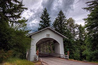
The Ballard Road Covered Bridge is a historic wooden covered bridge in the southwestern part of the U.S. state of Ohio. Built in the late nineteenth century and since bypassed, the bridge has been named a historic site.

The Capon Lake Whipple Truss Bridge, formerly known as South Branch Bridge or Romney Bridge, is a historic Whipple truss bridge in Capon Lake, West Virginia. It is located off Carpers Pike and crosses the Cacapon River. The bridge formerly carried Capon Springs Road over the river, connecting Capon Springs and Capon Lake.

U.S. Route 60 and U.S. Route 62 (US 60/US 62) run for a very short distance within the state of Illinois. The highways run concurrently for their entire existence within the state. The joint highway runs around Fort Defiance in Cairo, from the Cairo Mississippi River Bridge over the Mississippi River east to the Cairo Ohio River Bridge over the Ohio River; the Ohio River Bridge also carries US 51. The bridges cross the two rivers just north of the mouth of the Ohio.
Thomas Creek is a stream, about 35 miles (56 km) long, in Linn County in the U.S. state of Oregon. Beginning in Willamette National Forest on the western slopes of the Cascade Range, the creek flows generally west through Santiam State Forest and farmland to meet the South Santiam River west of Scio.
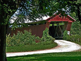
The Johnson Road Covered Bridge is a covered bridge located near Petersburg, Jackson County, Ohio, United States.
Reuben L. Partridge was an American pioneer and engineer in Union County, Ohio, known locally as "The Bridge Builder".


