Didsbury, Alberta

Last updated
Didsbury
Town
Town of Didsbury
Alberta mainstreet Didsbury RR station 016.jpg
Didsbury railway station
Didsbury-logo.png
Alberta County Point Locator.svg
Red pog.svg
Didsbury
Location of Didsbury in Alberta
Coordinates: 51°39′57″N114°07′52″W / 51.66583°N 114.13111°W / 51.66583; -114.13111
CountryCanada
Province Alberta
Region Central Alberta
Census division 6
Municipal district Mountain View County
Incorporated [1]  
   Village December 24, 1901
   Town September 27, 1906
Government
[2]
  TypeMunicipality
  MayorRhonda Hunter
  CAOEthan Gorner
  Governing bodyDidsbury Town Council
   MP Blake Richards
   MLA Nathan Cooper
Area
 (2021) [3]
  Land16.12 km2 (6.22 sq mi)
Elevation
[4]
1,037 m (3,402 ft)
Population
 (2021) [3] [5]
  Total5,070
  Density314.5/km2 (815/sq mi)
Demonym Didsburian [6]
Time zone UTC−7 (MST)
  Summer (DST) UTC−6 (MDT)
Postal code span
T0M
Highways Highway 2A
Highway 582
Waterway Rosebud River
Website Official website

Didsbury is a town in central Alberta, Canada at the foothills of the Rocky Mountains. It is located next to Alberta Highway 2A, near the Queen Elizabeth II Highway. Didsbury is within the Calgary-Edmonton corridor. Didsbury is approximately the half-way point between the cities of Calgary and Red Deer.

Contents

Didsbury is surrounded by Mountain View County, which has its municipal office located to the north of the town. The nearest neighbouring communities are the towns of Olds to the north and Carstairs to the south.

History

Didsbury, circa 1905 Didsbury, Alberta (circa 1905).jpg
Didsbury, circa 1905
Main Street in Didsbury Alberta mainstreet Didsbury 019.jpg
Main Street in Didsbury

The town is named after the township of Didsbury, which is now a suburban area of Manchester, England. [7] The first settlers were German Mennonites who left their homes in Pennsylvania following the American Revolution and emigrated to Waterloo County in Ontario. They were granted the area around Didsbury in 1894 by the government of Sir John A. Macdonald. [8]

Original settlement in the area was sparse, and this in part explains the initial slow development of the town-site as a service centre. The first concern of the Mennonite settlers was to build a church; and the primary task of the settlers was to create farmsteads. Settlement prior to the post-1900 land rush was limited to the small group who came west in 1894.

1897 saw the arrival of the Canadian Pacific Railway, which pushed forward the town's development. The CPR constructed a station in the town in 1904. Didsbury was incorporated as a village in 1905 and as a town on September 6, 1906.

Fires in 1914 and 1924 destroyed the early "boomtown" commercial streetscape and led to the passing by Town Council of a bylaw which required masonry construction for all new downtown commercial buildings. Many of these brick buildings stand as of 2005.

On July 1, 2023, a large EF4 tornado caused severe damage just south of the town.

Demographics

In the 2021 Census of Population conducted by Statistics Canada, the Town of Didsbury had a population of 5,070 living in 2,047 of its 2,157 total private dwellings, a change of

In the 2016 Census of Population conducted by Statistics Canada, the Town of Didsbury recorded a population of 5,268 living in 2,031 of its 2,119 total private dwellings, a

Infrastructure

The town's recreational facilities include six parks, a golf course, aquatic centre, and a hockey rink. There is also a hospital and a Royal Canadian Mounted Police detachment serving the town and the surrounding area.

Didsbury has three schools that are under the jurisdiction of the Chinook's Edge School Division.

The Olds-Didsbury Airport, which is used primarily for small aircraft and general aviation, is located north of Didsbury along Highway 2A.

Media

The town is served by the Didsbury Review , which is part of the Great West Newspapers chain. [10]

Sport and recreation

Didsbury is home to the Mountainview Colts of the Heritage Junior B Hockey League.

Organizations

Organizations present in Didsbury include the Royal Canadian Army Cadets and the 1st Didsbury Scouts, Didsbury Jazzercise, as well as the Elks and Lions clubs.[ citation needed ]

See also

Related Research Articles

Bassano is a town in Alberta, Canada. It is located on the Trans-Canada Highway approximately 140 kilometres (87 mi) southeast of Calgary and 160 kilometres (99 mi) northwest of Medicine Hat. It is also on the main line of the Canadian Pacific Railway. A short distance south of the town is the Bassano Dam, serves as a diversion structure which routes water through a canal into Lake Newell Reservoir which supplies water to the majority of the County of Newell for purposes like irrigation, recreation, and the County's drinking water.

Penhold is a town in central Alberta, Canada. Penhold is surrounded by Red Deer County, 16 km (9.9 mi) south of Red Deer at the junction of Highway 2A and Highway 42. It is located 128 kilometres (80 mi) north of Calgary, east of the Red Deer River.

<span class="mw-page-title-main">Division No. 6, Alberta</span> Census division in Alberta, Canada

Division No. 6 is a census division in Alberta, Canada. It includes the City of Calgary and surrounding areas. The majority of the division consists of Alberta's Calgary Region, while the northern portion of the division includes parts of central Alberta. The division also forms the southern segment of the Calgary–Edmonton Corridor. Division No. 6 is the largest census division in Alberta according to population and also has the highest population density.

<span class="mw-page-title-main">Rocky View County</span> Municipal district in Alberta, Canada

Rocky View County is a municipal district in southern Alberta, Canada that is named for its views of the nearby Rocky Mountains to the west. It surrounds most of Calgary, forming the city's northern boundary and most of the city's western and eastern boundaries. At a population of 41,028 in 2021, Rocky View County is the most populous municipal district in Alberta. Though predominantly rural in nature, Rocky View County is home to 14 hamlets, including Langdon, one of Alberta's most populous hamlets. Its rural areas are home to numerous country residential subdivisions.

<span class="mw-page-title-main">Irricana</span> Town in Alberta, Canada

Irricana is a town in the Calgary Metropolitan Region of Alberta, Canada. Surrounded by Rocky View County, it is adjacent to Highway 9, approximately 53 kilometres (33 mi) northeast of Calgary.

<span class="mw-page-title-main">Olds, Alberta</span> Town in Alberta, Canada

Olds is a town in central Alberta, Canada within Mountain View County and the Calgary–Edmonton Corridor. It is approximately 61 km (38 mi) south of Red Deer and 90 km (56 mi) north of Calgary. The nearest towns are Didsbury to the south, Bowden to the north, Sundre to the west and Three Hills to the east. Olds is located at the intersection of Highway 27 and Highway 2A, 5 km (3.1 mi) west of the Queen Elizabeth II Highway. The Canadian Pacific Railway's main Edmonton-Calgary line runs through the town.

<span class="mw-page-title-main">Carstairs, Alberta</span> Town in Alberta, Canada

Carstairs is a town in central Alberta, Canada. It is located on Highway 2A, 241 kilometres (150 mi) south of the provincial capital, Edmonton, and 48 kilometres (30 mi) north of Calgary, the nearest major city. The closest neighbouring communities are the towns of Didsbury and Crossfield. Carstairs is located entirely within the rural Mountain View County.

<span class="mw-page-title-main">High River</span> Town in Alberta, Canada

High River is a town within the Calgary Metropolitan Region of Alberta, Canada. It is approximately 68 kilometres (42 mi) south of Calgary, at the junction of Alberta Highways 2 and 23. High River had a population of 14,324 in 2021.

<span class="mw-page-title-main">Chestermere</span> City in Alberta, Canada

Chestermere, originally named Chestermere Lake, is a city in the Canadian province of Alberta, within Rocky View County. It is largely a commuter town of Calgary and is a member municipality of the Calgary Region. The city, which surrounds Chestermere Lake, was known as Chestermere Lake from 1977 to 1993.

Claresholm is a town located within southern Alberta, Canada. It is located on Highway 2, approximately 91 km (57 mi) northwest of the City of Lethbridge and 125 km (78 mi) south of the City of Calgary.

<span class="mw-page-title-main">Daysland</span> Town in Alberta, Canada

Daysland is a town in central Alberta, Canada. It is on Highway 13, approximately 43 kilometres (27 mi) east of Camrose.

<span class="mw-page-title-main">Innisfail, Alberta</span> Town in Alberta, Canada

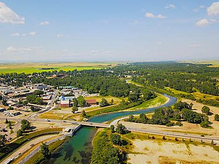
Innisfail is a town in central Alberta, Canada. It is located in the Calgary-Edmonton Corridor, south of Red Deer at the junction of Highway 2 and Highway 54.

<span class="mw-page-title-main">Wembley, Alberta</span> Town in Alberta, Canada

Wembley is a town in northern Alberta, Canada. It is approximately 23 km (14 mi) west of Grande Prairie at the junction of Highway 43 and Highway 724.

<span class="mw-page-title-main">Crossfield, Alberta</span> Town in Alberta, Canada

Crossfield is a town in the Calgary Metropolitan Region of Alberta, Canada that is surrounded by Rocky View County. It is located on Highway 2A 43 km (27 mi) north of the City of Calgary.

<span class="mw-page-title-main">Carbon, Alberta</span> Village in Alberta, Canada

Carbon is a village in central Alberta, Canada.

<span class="mw-page-title-main">Donnelly, Alberta</span> Village in Alberta, Canada

Donnelly is a village in northern Alberta, Canada within the Municipal District of Smoky River No. 130. It is located near the intersection of Highway 2 and Highway 49, located approximately 65 km (40 mi) south of Peace River and 427 km (265 mi) northwest of Edmonton.

<span class="mw-page-title-main">Hussar, Alberta</span> Village in Alberta, Canada

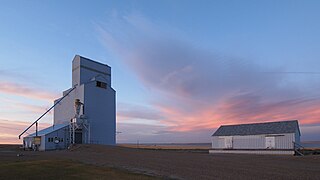
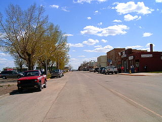
Hussar is a village in southern Alberta, Canada within Wheatland County. It is located on Highway 561, approximately 93 km (58 mi) east of Calgary and 55 km (34 mi) south of Drumheller.

<span class="mw-page-title-main">Vilna, Alberta</span> Village in Alberta, Canada

Vilna is a historic village in central Alberta, Canada.

<span class="mw-page-title-main">Municipal District of Bighorn No. 8</span> Municipal district in Alberta, Canada

The Municipal District of Bighorn No. 8 is a municipal district (MD) situated in Census Division No. 15 of Alberta, Canada. It is located between Calgary and Banff National Park, north of Kananaskis Improvement District. Highway 1 passes through the municipal district.

<span class="mw-page-title-main">Mountain View County</span> Municipal district in Alberta, Canada

Mountain View County is a municipal district in Division No. 6 in central Alberta, Canada. Located between the cities of Calgary and Red Deer within the Calgary-Edmonton corridor, its municipal office is located north of the Town of Didsbury. Mountain View County is a member of the Rural Municipalities of Alberta, along with numerous local boards, commissions and committees.

References

  1. "Location and History Profile: Town of Didsbury" (PDF). Alberta Municipal Affairs. October 7, 2016. p. 197. Retrieved October 11, 2016.
  2. "Municipal Officials Search". Alberta Municipal Affairs. 2019-05-09. Retrieved 2021-10-01.
  3. 1 2 3 "Population and dwelling counts: Canada, provinces and territories, and census subdivisions (municipalities)". Statistics Canada. February 9, 2022. Retrieved February 9, 2022.
  4. "Alberta Private Sewage Systems 2009 Standard of Practice Handbook: Appendix A.3 Alberta Design Data (A.3.A. Alberta Climate Design Data by Town)" (PDF) (PDF). Safety Codes Council. January 2012. pp. 212–215 (PDF pages 226–229). Archived from the original (PDF) on October 16, 2013. Retrieved October 8, 2013.
  5. "Population and dwelling counts: Canada and population centres". Statistics Canada. February 9, 2022. Retrieved February 13, 2022.
  6. "Mayor Rhonda Hunter Biography" (PDF). Town of Didsbury.
  7. "Didsbury History". Archived from the original on 2006-05-29. Retrieved 2006-06-22.
  8. Kinette Club of Didsbury (1969). Echoes of an Era. Didsbury, Alberta: Didsbury Booster.
  9. "Population and dwelling counts, for Canada, provinces and territories, and census subdivisions (municipalities), 2016 and 2011 censuses – 100% data (Alberta)". Statistics Canada. February 8, 2017. Retrieved February 8, 2017.
  10. Didsbury Review Newspaper site