
Charlotte is the most populous city in the U.S. state of North Carolina. Located in the Piedmont region, it is the county seat of Mecklenburg County. The population was 874,579 at the 2020 census, making Charlotte the 15th-most populous city in the United States, the seventh-most populous city in the South, and the second-most populous city in the Southeast behind Jacksonville, Florida. The city is the cultural, economic, and transportation center of the Charlotte metropolitan area, whose 2020 population of 2,660,329 ranked 22nd in the United States. Metrolina is part of a sixteen-county market region or combined statistical area with a 2020 population of 2,822,352.

Mecklenburg County is a county located in the southwestern region of the state of North Carolina, in the United States. As of the 2020 census, the population was 1,115,482, making it the second-most populous county in North Carolina and the first county in the Carolinas to surpass one million in population. Its county seat is Charlotte, the state's largest community.

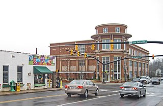
Concord is the county seat and most populous city in Cabarrus County, in the U.S. state of North Carolina. At the 2020 census, the city had a population of 105,240. In terms of population, the city of Concord is the second-most populous city in the Charlotte metropolitan area and is the 10th-most populous city in North Carolina and 287th-most populous city in the U.S.
Huntersville is a large suburban town in northern Mecklenburg County, North Carolina, United States. At the 2020 census, its population was 61,376, making Huntersville the 15th-most populous municipality in North Carolina. It is located in the Charlotte metropolitan area and 14 mi (23 km) north of Charlotte.

Davidson is a suburban town located in Iredell and Mecklenburg counties, North Carolina, United States, on the banks of Lake Norman. It is a suburb in the Charlotte metropolitan area. The population was 10,944 at the 2010 census, and in 2019 the estimated population was 13,054. The town was founded in 1837 with the establishment of the Presbyterian Davidson College, named for Brigadier General William Lee Davidson, a local Revolutionary War hero. The land for Davidson College came from Davidson's estate, a large portion of which was donated by his son.

Charlotte Douglas International Airport, typically referred to as Charlotte Douglas, Douglas Airport, or simply CLT, is an international airport in Charlotte, North Carolina, United States, located roughly six miles west of the city's central business district. Charlotte Douglas is the primary airport for commercial and military use in the Charlotte metropolitan area. Operated by the city of Charlotte's aviation department, the airport covers 5,558 acres of land.

U.S. Route 74 (US 74) is an east–west United States highway that runs for 515 miles (829 km) from Chattanooga, Tennessee to Wrightsville Beach, North Carolina. Primarily in North Carolina, it serves as an important highway from the mountains to the sea, connecting the cities of Asheville, Charlotte and Wilmington. The entire length of the route is known as Andrew Jackson Highway.

Interstate 485 (I-485) is a 66.68-mile-long (107.31 km) auxiliary Interstate Highway encircling Charlotte, North Carolina. As a complete loop, it is primarily signed with "inner" and "outer" designations, though at some major interchanges, supplemental signage reflects the local compass orientation of the road. The entire route lies within Mecklenburg County.
The Charlotte Area Transit System (CATS) is the agency responsible for public transportation in the Charlotte metropolitan area. CATS operates bus and rail transit services in Mecklenburg County and surrounding areas. Established in 1999, CATS' bus and rail operations carry about 320,000 riders on an average week. CATS is governed by the Metropolitan Transit Commission and is operated as a department of the City of Charlotte. In 2022, the system had a ridership of 10,759,300, or about 32,900 per weekday as of the second quarter of 2023.
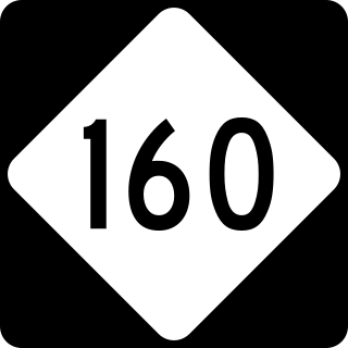
North Carolina Highway 160 is a primary state highway in the U.S. state of North Carolina. The highway runs north–south, connecting the Steele Creek neighborhood of Charlotte, Charlotte Douglas International Airport, and Uptown Charlotte.

Route 4 is an 18.6-mile (29.9 km) partial ring road located in Charlotte, North Carolina. Beginning and ending at Interstate 85 (I-85), it loops south around Uptown Charlotte along state-maintained secondary roads, connecting the Charlotte Douglas International Airport and several city neighborhoods including Madison Park, Myers Park, Windsor Park and Sugar Creek. The route is posted by the Charlotte Department of Transportation (CDOT), using a modified pentagonal county road shield, with a green background and the city's crown logo above the number. The loop has a radius of about 4 miles (6.4 km), hence the number.
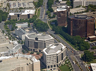
SouthPark is an area edge city in Charlotte, North Carolina, United States. Its name is derived from the upscale SouthPark Mall, which opened on February 12, 1970. At nearly 1.8 million square feet, SouthPark Mall is the largest shopping mall in Charlotte and all of the Carolinas. The area is geographically centered at the intersection of Fairview Road and Sharon Road in the south central sector of the city, about six miles south of Uptown Charlotte. In addition to being home to the mall, SouthPark is also a residential area and one of the larger business districts in Charlotte. SouthPark is typical of the mixed-use developments found in many larger cities.
The Garden Parkway was a proposed limited access toll road that was to be built in the US state of North Carolina. The route would have passed through portions of Gaston and Mecklenburg counties.
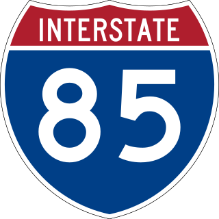
Interstate 85 (I-85) is an Interstate Highway that runs from Montgomery, Alabama, to Petersburg, Virginia. In North Carolina, I-85 travels 231.23 miles (372.13 km) from the South Carolina state line near Grover, North Carolina, to the Virginia state line near Wise. Despite being signed north–south, I-85 physically travels in a southwest–northeast direction across the state. The Interstate Highway connects the three most populous metropolitan areas of North Carolina: the Charlotte metropolitan area, Piedmont Triad, and Research Triangle, as well as nine of the 20 largest municipalities in the state. Outside of North Carolina, I-85 connects the state with Richmond, Virginia, to the north and Upstate South Carolina and Atlanta, Georgia, to the south. I-85 parallels several US Highways including US Highway 29 (US 29) between South Carolina and Greensboro, US 70 between Greensboro and Durham, US 15 between Durham and Oxford, and US 1 between Henderson and Virginia.
Steele Creek is primarily considered to be a community and neighborhood in the southwestern part of Mecklenburg County in North Carolina. It is generally defined geographically by the original boundaries of Steele Creek Township. Most of Steele Creek is within the city limits of Charlotte but the areas that have not yet been annexed are also recognized as a Township of North Carolina.
The LYNX Silver Line is a proposed east–west light rail line in Charlotte, North Carolina. The Silver Line would connect the outlying cities and towns of Belmont, Matthews, Stallings and Indian Trail to Uptown Charlotte and the Charlotte Douglas International Airport. In the refined locally preferred alternative (LPA), released in early 2021, the route is estimated to be around 29 miles (47 km), with 29 stations and one maintenance facility.

North Carolina Highway 280 (NC 280) is a primary state highway in the U.S. state of North Carolina that runs from the city of Brevard in Transylvania County to the town of Fletcher in Henderson County. It is 18 miles (29 km) in length, starting at the intersection with US 64 and US 276 north of Brevard to US 25 and US 25A in the Asheville community of Arden.
The Charlotte metropolitan area, sometimes referred to as Metrolina, is a metropolitan area of the U.S. states of North and South Carolina, containing the city of Charlotte. The metropolitan area also includes the cities of Gastonia, Concord, Huntersville, and Rock Hill as well as the large suburban area in the counties surrounding Mecklenburg County, which is at the center of the metro area. Located in the Piedmont, it is the largest metropolitan area in the Carolinas, and the fourth largest in the Southeastern United States. The Charlotte metropolitan area is one of the fastest growing metropolitan areas in the United States.
Paw Creek is primarily considered to be a community and neighborhood in the northwest part of Mecklenburg County in North Carolina. It is generally defined geographically by the original boundaries of Paw Creek Township. Most of Paw Creek is within the city limits of Charlotte but the areas that have not yet been annexed are also recognized as a Township of North Carolina.


