Sadang Station is a station on the Seoul Subway Line 2 and Seoul Subway Line 4 in South Korea.

Sillim Station is a station on Seoul Subway Line 2 and the Sillim Line. It is located in Sillim-dong, Gwanak-gu, Seoul.
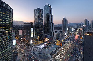
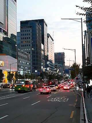
Gangnam District is one of the 25 districts of Seoul, South Korea. The term Gangnam translates to "South of the [Han] River". Gangnam District is the third largest district in Seoul, with an area of 39.5 km2 (15.3 sq mi). As of the 2017 census, Gangnam District had a population of 561,052. There is a high concentration of wealth in the district, with prices for an apartment as of 2020 nearly double those in the rest of Seoul. Gangnam District is part of Gangnam School District Eight, along with the Seocho District. This district shares half of Gangnam-daero Gangnam Station area with Seocho District, which is one of the most crowded places in South Korea.

Yeongdeungpo District is an administrative district in southwest Seoul, South Korea. Although the origin of the name is uncertain, the first two syllables are thought to be from "yeongdeung" (靈登) or "divine ascent", a shamanic rite. The third syllable is "po", representing the bank of a river (浦), referring to the district's position on the Han River. The 2006 population was 408,819.

In Seoul, public transit buses are operated by the Seoul Metropolitan Government and private bus operators.

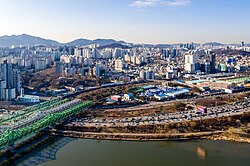
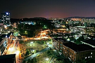
Gwanak District (Gwanak-gu) is an administrative subdivision (gu) of Seoul, South Korea. It lies on the southern skirt of Seoul, bordering Anyang of Gyeonggi Province. The southern border of Gwanak-gu, bordering Anyang, consists of the craggy ridgeline of Gwanaksan, which dominates the local geography.

Seocho District is one of the 25 local government districts which make up the city of Seoul, South Korea. Seocho is a part of the Gangnam region, along with the Gangnam district of Seoul. Seocho District ranks as one of the richest neighborhoods in South Korea and among the most expensive areas in Seoul with an average sales price of 47.75 million South Korean won per 3.3 square meters. Many of the wealthiest residents are concentrated in the three Gangnam districts including Seocho, known as Gangnam School District Eight.
Mapo District is one of the 25 districts of Seoul, South Korea.

Ichon Station (Korean: 이촌역) is a station in Yongsan-gu, Seoul on Seoul Subway Line 4 and the Gyeongui–Jungang Line. This station is the closest to the National Museum of Korea, situated in the interior of Yongsan Family Park. It also serves eastern Ichon-dong, home to the largest Japanese community in South Korea with some 1,300 Japanese residents.
Seoul Metropolitan Fire and Disaster Management Headquarters is a department of the Seoul Metro government in charge of fire and rescue services in Seoul, South Korea.
Nowon District (Nowon-gu) is a residential district of Seoul, South Korea, located in the most northeastern part of the metropolitan city. It has the highest population density in Seoul, with 619,509 people living in the area of 35.44 km².

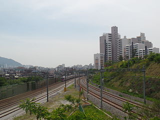
Guro District (Guro-gu) is a district of Seoul, South Korea, which was separated from Yeongdeungpo District on April 1, 1980. Located in the southwestern part of the city, where besides Yangcheon District and Geumcheon District Guro District has an important position as a transport link which contains railroads, land routes from the rest of Seoul to the south of the country. The Gyeongbu and Gyeongin railway lines connect Seoul to Busan and Incheon. In addition, Seoul Metropolitan Subway lines 1, 2, and 7, and major highways intersect in Guro District.

Bangbae-dong is a dong, or neighbourhood of the greater Gangnam area Seocho-gu district of the South Korean city of Seoul. Bangbae-dong is divided into 5 different dongs which are Bangbaebon-dong, Bangbae 1-dong, 2-dong, 3-dong and 4-dong. The origin of Bangbae-dong is derived from the name Bangbae, meaning "dong-ri with my back to Mt. Myeon-ri," which rises on the border between Gwanak-gu and Seocho-gu. Bangbae-dong was Bangbae-ri, Sangbuk-myeon, Gwacheon-gun, Gyeonggi-do until the end of the Joseon Dynasty, but became Bangbae-ri, Sindong-myeon, Siheung-gun, Gyeonggi-do in 1914 when the area was confirmed during the Japanese colonial period. It was incorporated into the Seoul Metropolitan Government following the expansion of the Seoul Metropolitan Government's zone in 1963, and became Bangbae-dong to this day. The location is Dong at the western end of Seocho-gu, and it is an area from the intersection of the road from Seoul to Gwacheon City and the southern circulation road to Umyeon Mountain.
Jungnang District (Jungnang-gu) is one of the 25 gu, or districts, of Seoul, South Korea. It is located on the north side of the Han River.
Seoul, the capital and largest city in South Korea, accounts for only 0.6% of the country's total land area, yet it is home to around 19% of the population. The population density in Seoul demands a great deal of the city's transportation systems, which are regarded by many as among the best and most advanced in the world. Seoul is very well connected by its subway and bus systems, and the city is also very supportive of pedestrian foot travel. In 2006 it won the Sustainable Transport Award.

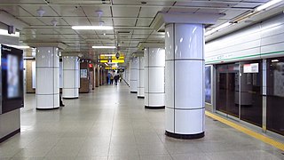
Noryangjin Station is a metro station in central Seoul, South Korea. The station is located in the Noryangjin-dong (neighborhood) of Dongjak-gu (ward) and is also a stop on Seoul Subway Line 1 and Seoul Subway Line 9. This stop is a popular destination for those seeking to eat raw fish, and other assorted seafood, as a large, covered sea food market is located next to the station, accessible by foot bridge. The Line 1 station is also notable in that Exit 1 and 2 have the same number as Exit 1 and 2 of Line 9's station.
Sadang-dong is a dong (neighborhood) of Dongjak-gu in Seoul, South Korea.

Yangjae-dong is a dong, neighbourhood of the greater Gangnam area Seocho District in Seoul, South Korea. Yangjae-dong is divided into 2 different dong which are Yangjae 1-dong and 2-dong.
Siheung County, alternatively Shihŭng County was a county (gun) in Gyeonggi Province, South Korea. This county was abolished in 1989 as its one town(읍) of Sorae and two townships(면) of Gunja and Suam became Siheung City at the same time. Today's Siheung City area did not belong to Siheung County before 1914. The area rather was part of old Incheon or Ansan.

Seoul Metropolitan City Route 21 is a road located in Seoul, South Korea. With a total length of 17.7 km (11.0 mi), this road starts from the Siheung-dong in Geumcheon District, Seoul to Jungnim-dong in Jung District.