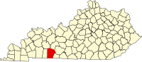
Muhlenberg County is a county in the U.S. Commonwealth of Kentucky. As of the 2020 census, the population was 30,928. Its county seat is Greenville and its largest city is Central City.

Logan County is a county in the southwest Pennyroyal Plateau area of the U.S. Commonwealth of Kentucky. As of the 2020 census, the population was 27,432. Its county seat is Russellville.
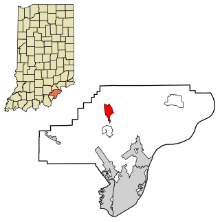
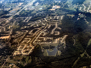
Henryville is a census-designated place (CDP) in Monroe Township, Clark County, in the U.S. state of Indiana. The population was 1,905 at the 2010 census.
Burlington is a census-designated place (CDP) in and the county seat of Boone County, Kentucky, United States. The population was 17,318 at the 2020 census.
Russellville is a home rule-class city in Logan County, Kentucky, in the United States. It is the seat of its county. The population was 6,960 at the time of the 2010 census.

Stearns is an unincorporated community and census-designated place (CDP) in McCreary County, Kentucky, United States. The population was 1,365 at the 2020 census. It was founded by Justus Smith Stearns.

Gamaliel is a home rule-class city in Monroe County, Kentucky, in the United States. The population was 391 at the 2020 census.

Hubbell is an unincorporated community and census-designated place (CDP) in Houghton County in the U.S. state of Michigan. As of the 2010 census, the CDP population was 946, down from 1,105 at the 2000 census. The community is partially within Torch Lake Township and partially within Osceola Township.

Greilickville is an unincorporated community and census-designated place (CDP) in Leelanau County in the U.S. state of Michigan. At the 2020 census, the population was 1,634, up from 1,530 at the 2010 census. The community is located within Elmwood Charter Township, and is located in the extreme southeast of the Leelanau Peninsula.

Ravalli is an unincorporated community and census-designated place (CDP) in Lake County, Montana, United States. The population was 76 at the 2010 census, down from 119 in 2000. At one time Charlie Allard, the country's leading expert on breeding bison, owned the country's largest herd of buffalo in Ravalli.

Olmito is a census-designated place (CDP) in Cameron County, Texas, United States. Olmito is Spanish for "little elm". The population was 1,210 at the 2010 census. It is part of the Brownsville–Harlingen Metropolitan Statistical Area. Olmito is the self-described "mesquite capital of the world."
Stonewall is an unincorporated community and census-designated place (CDP) in Gillespie County, Texas, United States. The population was 525 at the 2010 census. It was named for Confederate General Thomas J. (Stonewall) Jackson, by Israel P. Nunez who established a stage station near the site in 1870.
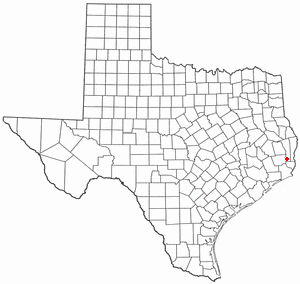
Evadale is an unincorporated community and census-designated place (CDP) in Jasper County, Texas, United States. The population was 1,246 at the 2020 census.
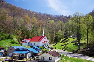
Kermit is a town in Mingo County, West Virginia, United States. The population was 406 at the 2010 census. Kermit is located along the Tug Fork, opposite Warfield, Kentucky. The Norfolk Southern Railway's Kenova District runs through town.
Summer Shade is an unincorporated community and census-designated place (CDP) in Metcalfe County, Kentucky, United States. As of the 2020 census, the population was 294.
Gilbertsville is a census-designated place and unincorporated community in Marshall County, Kentucky, United States. It is the closest village to the Kentucky Dam. The town was relocated to its present site when Kentucky Dam and Kentucky Dam Village State Resort Park replaced the former site. As of the 2020 census, the population of Gilbertsville was 332.
Artemus is an unincorporated community and census-designated place in Knox County, Kentucky, United States. As of the 2010 United States Census the population was 590.
Beechmont is a census-designated place and unincorporated community in Muhlenberg County, Kentucky, United States. As of the 2020 census, the population was 776, up from 689 in 2010.
Cleaton is an unincorporated community and census-designated place in Muhlenberg County, Kentucky, United States. As of the 2020 census, it had a population of 168.
Conner is a census-designated place (CDP) in Ravalli County, Montana, United States. The population was 216 at the 2010 census.