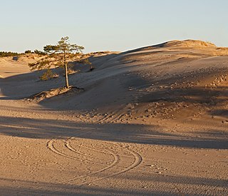
A dune is a landform composed of wind- or water-driven sand. It typically takes the form of a mound, ridge, or hill. An area with dunes is called a dune system or a dune complex. A large dune complex is called a dune field, while broad, flat regions covered with wind-swept sand or dunes with little or no vegetation are called ergs or sand seas. Dunes occur in different shapes and sizes, but most kinds of dunes are longer on the stoss (upflow) side, where the sand is pushed up the dune, and have a shorter slip face in the lee side. The valley or trough between dunes is called a dune slack.

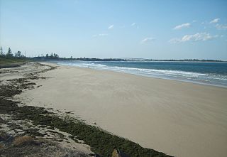
A beach is a landform alongside a body of water which consists of loose particles. The particles composing a beach are typically made from rock, such as sand, gravel, shingle, pebbles, etc., or biological sources, such as mollusc shells or coralline algae. Sediments settle in different densities and structures, depending on the local wave action and weather, creating different textures, colors and gradients or layers of material.
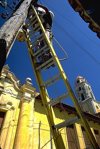
A ladder is a vertical or inclined set of rungs or steps used for climbing or descending. There are two types: rigid ladders that are self-supporting or that may be leaned against a vertical surface such as a wall, and rollable ladders, such as those made of rope or aluminium, that may be hung from the top. The vertical members of a rigid ladder are called stringers or rails (US) or stiles (UK). Rigid ladders are usually portable, but some types are permanently fixed to a structure, building, or equipment. They are commonly made of metal, wood, or fiberglass, but they have been known to be made of tough plastic.

Indiana Dunes National Park is a United States national park located in northwestern Indiana managed by the National Park Service. It was authorized by Congress in 1966 as the Indiana Dunes National Lakeshore and was redesignated as the nation's 61st national park on February 15, 2019. The park runs for about 20 miles (32 km) along the southern shore of Lake Michigan and covers 15,349 acres (6,212 ha). Along the lakefront, the eastern area is roughly the lake shore south to U.S. 12 or U.S. 20 between Michigan City, Indiana, on the east and the Cleveland-Cliffs steel plant on the west. A small extension south of the steel mill continues west along Salt Creek to Indiana 249. The western area is roughly the shoreline south to U.S. 12 between the Burns Ditch west to Broadway in downtown Gary, Indiana. In addition, there are several outlying areas, including Pinhook Bog, in LaPorte County to the east; the Heron Rookery in Porter County, the center of the park; and the Calumet Prairie State Nature Preserve and the Hobart Prairie Grove, both in Lake County, the western end of the park.

Great Sand Dunes National Park and Preserve is an American national park that conserves an area of large sand dunes up to 750 feet (230 m) tall on the eastern edge of the San Luis Valley, and an adjacent national preserve in the Sangre de Cristo Range, in south-central Colorado, United States. The park was originally designated Great Sand Dunes National Monument on March 17, 1932, by President Herbert Hoover. The original boundaries protected an area of 35,528 acres. A boundary change and redesignation as a national park and preserve was authorized on November 22, 2000, and then established on September 24, 2004. The park encompasses 107,342 acres while the preserve protects an additional 41,686 acres for a total of 149,028 acres. The recreational visitor total was 527,546 in 2019.

Southwick Beach State Park is a New York State park that lies along an unusual stretch of sandy beach on the eastern shore of Lake Ontario. The park is 464 acres (188 ha) in size with a 3,500 foot (1,100 m) length of beach, and is visited annually by about 100,000 people. Immediately to the south is the Lakeview Wildlife Management Area, which extends the publicly accessible beach by several miles. They are in the Town of Ellisburg in Jefferson County, New York south of the lakeside community of Jefferson Park.
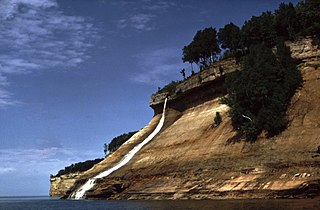
Pictured Rocks National Lakeshore is a U.S. National Lakeshore in the Upper Peninsula of Michigan, United States. It extends for 42 miles (67 km) along the shore of Lake Superior and covers 73,236 acres. The park has extensive views of the hilly shoreline between Munising and Grand Marais in Alger County, with picturesque rock formations, waterfalls, and sand dunes.

Beach nourishment describes a process by which sediment, usually sand, lost through longshore drift or erosion is replaced from other sources. A wider beach can reduce storm damage to coastal structures by dissipating energy across the surf zone, protecting upland structures and infrastructure from storm surges, tsunamis and unusually high tides. Beach nourishment is typically part of a larger integrated coastal zone management aimed at coastal defense. Nourishment is typically a repetitive process since it does not remove the physical forces that cause erosion but simply mitigates their effects.
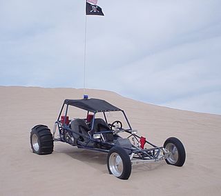
A sandrail, also called a sand rail, rail, or sand car, is a lightweight off-road motor vehicle specifically built for traveling in sandy terrain. Similar in some respects and often mistakenly referred to as a dune buggy or sand car, a sandrail is a different type of speciality vehicle. Sandrails are popularly operated on actual sand dunes. Sandrails can be driven on other types of terrain but are designed specifically for sand.

The Oregon Dunes National Recreation Area is located on the Oregon Coast, stretching approximately 40 miles (64 km) north of the Coos River in North Bend to the Siuslaw River in Florence, and adjoining Honeyman State Park on the west. It is part of Siuslaw National Forest and is administered by the United States Forest Service.
Indiana Dunes State Park is an Indiana State Park located in Porter County, Indiana, United States, 47 miles (75.6 km) east of Chicago. The park is bounded by Lake Michigan to the northwest and is surrounded by as well as within the authorized boundaries of Indiana Dunes National Park, a unit of the National Park Service; the NPS owns the water from the ordinary high water mark to 300 feet (91 m) offshore. The 1,530-acre (619.2 ha) Dunes Nature Preserve makes up the bulk of eastern part of the park, and includes most of the park's hiking trails and dune landscape. This was one of the first places Richard Lieber considered when establishing the Indiana State Park system. Like all Indiana state parks, there is a fee for entrance. Indiana Dunes State Park was established in 1925 and designated a National Natural Landmark in 1974.

Eureka Valley is located in Inyo County, in eastern California in the southwestern United States. It is approximately 28 miles (45 km) long and up to 10 miles (16 km) wide, with elevations varying from 2870 feet up to 8456 feet. The southern section of the valley is now part of the Death Valley National Park - Death Valley itself lies just to the southeast. To the north is Deep Springs Valley, Fish Lake Valley, and the White Mountain Range. To the east the Last Chance Range rises over 5500 feet above the valley floor. To the west are the Saline Mountains, and to the southwest lies Saline Valley.

Médanos de Coro National Park is a Venezuelan national park located in the state of Falcón, near the city of Coro on the road that leads to Paraguaná. The National Park was created in 1974. The park is easily reached by bus or taxi from Coro.

The Algodones Dunes is a large sand dune field, or erg, located in the southeastern portion of the U.S. state of California, near the border with Arizona and the Mexican state of Baja California. The field is approximately 45 miles (72 km) long by 6 miles (9.7 km) wide and extends along a northwest-southeast line that correlates to the prevailing northerly and westerly wind directions. The name "Algodones Dunes" refers to the entire geographic feature, while the administrative designation for that portion managed by the Bureau of Land Management is the Imperial Sand Dunes Recreation Area. In 1966, Imperial Sand Hills was designated as a National Natural Landmark by the National Park Service. The Algodones Dunes are split into many different sections. These sections include Glamis, Gordon's Well, Buttercup, Midway, and Patton's Valley. Although the Arabic-derived Spanish word algodones translates to "cotton plants", the origin of the toponym is unknown.

Topsail Hill Preserve State Park is a 1,640-acre (6.6 km2) Florida State Park located in Santa Rosa Beach, ten miles (16 km) east of Destin, off U.S. 98, in northwestern Florida. The address is 7525 W. Scenic Highway 30A.

Sand dune stabilization is a coastal management practice designed to prevent erosion of sand dunes. Sand dunes are common features of shoreline and desert environments. Dunes provide habitat for highly specialized plants and animals, including rare and endangered species. They can protect beaches from erosion and recruit sand to eroded beaches. Dunes are threatened by human activity, both intentional and unintentional. Countries such as the United States, Australia, Canada, New Zealand, the United Kingdom, and Netherlands, operate significant dune protection programs.
Stockton Beach is located north of the Hunter River in New South Wales, Australia. It is 32 km (20 mi) long and stretches from Stockton, to Anna Bay. Over many years Stockton Beach has been the site of numerous shipwrecks and aircraft crash sites. In World War II it was fortified against a possible attack by Imperial Japanese forces. During that time it served as a bombing and gunnery range as well as a dumping area for unused bombs by aircraft returning from training sorties. The length of the beach, its generally hard surface and numerous items of interest along the beach make it popular with four-wheel drive (4WD) enthusiasts. Four-wheel drive vehicles are permitted to drive on Stockton Beach provided the vehicles are in possession of valid permits. The beach is also popular with fishermen and several different varieties of fish may be caught.

Ladder toss is a lawn game played by throwing bolas onto a ladder.

Zapata Falls is a waterfall located in the San Luis Valley near the base of the Sangre de Cristo Mountains on Bureau of Land Management land adjacent to Rio Grande National Forest and south of Great Sand Dunes National Park and Preserve in Alamosa County, Colorado. The waterfall has a drop of about 30 feet (9 m). Access to this waterfall entails a mildly steep 0.5-mile (800 m) hike. Viewing the falls requires fording the stream and climbing rocks.

De Maasduinen National Park(duinen = dunes) is a national park in the Dutch province of Limburg, founded in 1996 and covering approximately 4500 ha. The landscape consists of forests and heathlands on a sandy plateau along the river Meuse close to the German border. The estate 'de Hamert' is the heart of the park. Until 1998 the national park was called 'De Hamert' after this estate. The present name is derived from the parabolic dunes which date from the last glaciation.
