Eagle Bend, Minnesota

Last updated

Eagle Bend
Eagle Bend MN Main Street.jpg
Motto: 
"Minnesota Hometown"
Todd County Minnesota Incorporated and Unincorporated areas Eagle Bend Highlighted.svg
Location of Eagle Bend, Minnesota
Coordinates: 46°09′51″N95°02′03″W / 46.16417°N 95.03417°W / 46.16417; -95.03417
Country United States
State Minnesota
County Todd
Area
[1]
  Total1.35 sq mi (3.50 km2)
  Land1.35 sq mi (3.50 km2)
  Water0.00 sq mi (0.00 km2)
Elevation
[2]
1,362 ft (415 m)
Population
 (2020)
  Total546
  Density404.44/sq mi (156.14/km2)
Time zone UTC-6 (Central (CST))
  Summer (DST) UTC-5 (CDT)
ZIP code
56446
Area code 218
FIPS code 27-17342 [3]
GNIS feature ID2394587 [2]

Eagle Bend is a city in Todd County, Minnesota, United States. The population was 535 at the 2010 census. [4] By the 2020 Census the population had increased slightly to 546. [5]

Contents

History

Eagle Bend was first settled in the early 1880s. The first pioneers were Charles O'Dell, a merchant, and Marion Crider, a homesteader from eastern Kentucky. When O'Dell opened his general store, his first customer was Crider, who bought a pound of coffee. The townsite was purchased by a railroad executive, Benjamin F. Abbott, who wished to change the name of the town to Abbottsville; however, sensibility prevailed and the evocative name of Eagle Bend was retained. The post office was established in O'Dell's store in 1882, and the village was incorporated on January 21, 1890. [6]

In June 1933, Clarence Olson, alias Tuffy, a Prohibition era bootlegger and gangster based in Eagle Bend who, according to The Long Prairie Leader, "has long had a reputation as a liquor runner and hijacker and who has been claimed by many to be the toughest man between Minneapolis and Duluth", met his destiny in a Holdingford area gunfight. After arriving with two associates at the farmhouse of Holdingford bootleggers Joseph and Anthony Dzierweczynski to buy 85 gallons of Minnesota 13 moonshine, Tuffy Olson first announced that the Dzierweczynskis would now be paid in cash. Then, however, Tuffy Olson and his enforcer Harley Buchan drew their sidearms and announced that they intended to take to 85 gallons of moonshine for free. Joseph Dzierweczynski, however, managed to flee the room and returned with a loaded shotgun. As he and Buchan fled back to their escape vehicle, Tuffy Olson received two fatal shotgun blasts in the back. Following an investigation by the Stearns and Toddy County Sheriff's Departments, Tuffy's two surviving enforcers and the Dzierweczynski brothers were both arrested pending criminal charges. [7]

According to the Long Prairie Leader, "Tuffy Olson has for years had a reputation of being a booze runner who has had many conflicts with the law. At the time of his death, a Federal charge of illegal possession of liquor was hanging over his head, the trial being scheduled for later in the year. It is alleged that he peddled liquor at dance halls over a wide area and other rumors credit him with having hijacked many liquor runners in this section of the State." [8]

Eagle Bend City Hall. Eagle Bend MN City Hall.jpg
Eagle Bend City Hall.

Geography

According to the United States Census Bureau, the city has a total area of 1.35 square miles (3.50 km2), all land. [9] The village is located at a bend of Eagle Creek. Eagle Creek drains Harris Creek, and in turn flows into Long Prairie River.

Demographics

Historical population
CensusPop.Note
1890 306
1900 54778.8%
1910 5510.7%
1920 6008.9%
1930 575−4.2%
1940 68218.6%
1950 6911.3%
1960 611−11.6%
1970 557−8.8%
1980 5936.5%
1990 524−11.6%
2000 59513.5%
2010 535−10.1%
2020 5462.1%
U.S. Decennial Census [10]

2010 census

As of the census [11] of 2010, there were 535 people, 246 households, and 143 families living in the city. The population density was 396.3 inhabitants per square mile (153.0/km2). There were 290 housing units at an average density of 214.8 per square mile (82.9/km2). The racial makeup of the city was 97.2% White, 0.2% African American, 0.2% Native American, 0.6% Asian, 0.4% from other races, and 1.5% from two or more races. Hispanic or Latino of any race were 1.3% of the population.

There were 246 households, of which 24.4% had children under the age of 18 living with them, 43.5% were married couples living together, 11.0% had a female householder with no husband present, 3.7% had a male householder with no wife present, and 41.9% were non-families. 37.4% of all households were made up of individuals, and 21.5% had someone living alone who was 65 years of age or older. The average household size was 2.17 and the average family size was 2.87.

The median age in the city was 45.2 years. 22.2% of residents were under the age of 18; 6.5% were between the ages of 18 and 24; 21.4% were from 25 to 44; 26.1% were from 45 to 64; and 23.9% were 65 years of age or older. The gender makeup of the city was 48.6% male and 51.4% female.

2000 census

As of the census [3] of 2000, there were 595 people, 268 households, and 165 families living in the city. The population density was 470.1 inhabitants per square mile (181.5/km2). There were 284 housing units at an average density of 224.4 per square mile (86.6/km2). The racial makeup of the city was 98.99% White, 0.67% Native American and 0.34% Asian. Hispanic or Latino of any race were 0.84% of the population.

There were 268 households, out of which 25.7% had children under the age of 18 living with them, 48.9% were married couples living together, 10.4% had a female householder with no husband present, and 38.4% were non-families. 34.3% of all households were made up of individuals, and 21.3% had someone living alone who was 65 years of age or older. The average household size was 2.22 and the average family size was 2.82.

In the city, the population was spread out, with 23.7% under the age of 18, 8.4% from 18 to 24, 22.7% from 25 to 44, 21.3% from 45 to 64, and 23.9% who were 65 years of age or older. The median age was 41 years. For every 100 females, there were 91.3 males. For every 100 females age 18 and over, there were 90.0 males.

The median income for a household in the city was $27,308, and the median income for a family was $33,750. Males had a median income of $28,000 versus $21,250 for females. The per capita income for the city was $12,517. About 9.1% of families and 14.9% of the population were below the poverty line, including 14.3% of those under age 18 and 17.6% of those age 65 or over.

Related Research Articles

<span class="mw-page-title-main">Rock Valley, Iowa</span> City in Iowa, United States

Rock Valley is a city in Sioux County, Iowa, the North Western corner of Iowa, United States, along the Rock River. The population was 4,059 at the time of the 2020 census.

<span class="mw-page-title-main">Hill City, Minnesota</span> City in Minnesota, United States

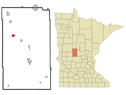
Hill City is a city in Aitkin County, Minnesota, United States. The population was 613 at the 2020 census.

<span class="mw-page-title-main">Eagle Lake, Minnesota</span> Town in Minnesota, United States

Eagle Lake is in Blue Earth County, Minnesota, United States. The population was 3,278 at the 2020 census. It is part of the Mankato-North Mankato Metropolitan Statistical Area.

Mankato Township is a township in Blue Earth County, Minnesota, United States. The population was 1,969 as of the 2010 census.

<span class="mw-page-title-main">Lake Shore, Minnesota</span> City in Minnesota, United States

Lake Shore is a city in Cass County, Minnesota, United States. The population was 1,056 at the 2020 census. It is part of the Brainerd Micropolitan Statistical Area.

Big Bend Township is a township in Chippewa County, Minnesota, United States. The population was 257 at the 2000 census.

Great Bend Township is a township in Cottonwood County, Minnesota, United States. The population was 287 at the 2010 census.

<span class="mw-page-title-main">Lake Lillian, Minnesota</span> City in Minnesota, United States

Lake Lillian is a city in Kandiyohi County, Minnesota, United States. The population was 238 at the 2010 census.

Eagle Point Township is a township in Marshall County, Minnesota, United States. The population was 33 at the 2000 census.

<span class="mw-page-title-main">Mapleview, Minnesota</span> City in Minnesota, United States

Mapleview is a city in Lansing Township, Mower County, Minnesota, United States. It is a suburb of Austin, the county seat. The population was 144 at the 2020 census, down from 176 in 2010. It was named for a row of maple trees that once stood on the west side of town.

<span class="mw-page-title-main">Fisher, Minnesota</span> City in Minnesota, United States

Fisher is a town in Polk County, Minnesota, United States. It is part of the Grand Forks-ND-MN Metropolitan Statistical Area. The population was 422 at the 2020 census. Fisher has become a bedroom community for the nearby Greater Grand Forks Metropolitan Area.

<span class="mw-page-title-main">Fairfax, Minnesota</span> City in Minnesota, United States

Fairfax is a city in Renville County, Minnesota, United States. The population was 1,235 at the 2010 census.

Holding Township is a township in Stearns County, Minnesota, United States. It includes the city of Holdingford. The township population was 1,139 at the 2010 census.

<span class="mw-page-title-main">Browerville, Minnesota</span> City in Minnesota, United States

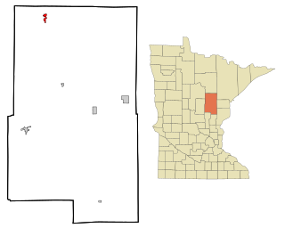
Browerville is a city in Todd County, Minnesota. The population was 790 at the time of the 2010 census. By the 2020 Decennial Census the population had increased to 839.

<span class="mw-page-title-main">Grey Eagle, Minnesota</span> City in Minnesota, United States

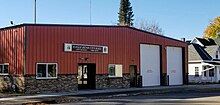
Grey Eagle is a city in Todd County, Minnesota, United States. The population was 348 at the 2010 census. By the 2020 Decennial Census the population had declined to 330.

Wykeham Township is a township in Todd County, Minnesota, United States. Wykeham Township was originally called Eden Township and was organized in 1880 under the latter name. The township's name has its origins in England. Several post offices were briefly located in the township.

<span class="mw-page-title-main">Holdingford, Minnesota</span> City in Minnesota, United States

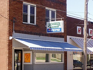
Holdingford is a city in Stearns County, Minnesota, United States. The population was 708 at the 2010 census. It claims to be "The Gateway to Lake Wobegon", the fictional central Minnesota town created by author Garrison Keillor.

<span class="mw-page-title-main">North Bend, Ohio</span> Village in Ohio, United States

North Bend is a village in Miami Township, Hamilton County, Ohio, United States, along the Ohio River. It is a part of the Greater Cincinnati area. The population was 835 at the 2020 census.

<span class="mw-page-title-main">South Bend, Washington</span> City in Washington, United States

South Bend is a city in and the county seat of Pacific County, Washington, United States. The population was 1,746 as of the 2020 census. The town is widely-known for its oyster production and scenery.

<span class="mw-page-title-main">Blooming Prairie, Minnesota</span> City in Minnesota, United States

Blooming Prairie is a city in Dodge and Steele counties in the U.S. state of Minnesota. The population was 1,996 at the 2010 census. Most of the city is located within Steele County; only a small part of the city extends into Dodge County.

References

  1. "2020 U.S. Gazetteer Files". United States Census Bureau. Retrieved July 24, 2022.
  2. 1 2 U.S. Geological Survey Geographic Names Information System: Eagle Bend, Minnesota
  3. 1 2 "U.S. Census website". United States Census Bureau . Retrieved January 31, 2008.
  4. "2010 Census Redistricting Data (Public Law 94-171) Summary File". American FactFinder. U.S. Census Bureau, 2010 Census. Retrieved April 23, 2011.[ dead link ]
  5. Bureau, US Census. "Minnesota's Population at 5,706,494 in 2020, Up 7.6% Since 2010". Census.gov. Retrieved August 13, 2023.
  6. Upham, Warren (2001). Minnesota Place Names, A Geographical Encyclopedia, 3rd Edition. Saint Paul, Minnesota: Minnesota Historical Society. p. 590. ISBN   0-87351-396-7.
  7. Vincent A. Yzermans (1985), The Ford in the River, The Catholic Community of Holdingford. Pages 155-156.
  8. Vincent A. Yzermans (1985), The Ford in the River, The Catholic Community of Holdingford. Page 156.
  9. "US Gazetteer files 2010". United States Census Bureau. Archived from the original on July 2, 2012. Retrieved November 13, 2012.
  10. "Census of Population and Housing". Census.gov. Retrieved June 4, 2015.
  11. "U.S. Census website". United States Census Bureau . Retrieved November 13, 2012.