
Cook Strait separates the North and South Islands of New Zealand. The strait connects the Tasman Sea on the northwest with the South Pacific Ocean on the southeast, and runs next to the capital city, Wellington. It is 22 kilometres (14 mi) wide at its narrowest point, and is considered one of the most dangerous and unpredictable waters in the world. Regular ferry services run between Picton in the Marlborough Sounds and Wellington.

Gisborne is a city in northeastern New Zealand and the largest settlement in the Gisborne District. It has a population of 37,000. The district council has its headquarters in Whataupoko, in the central city.

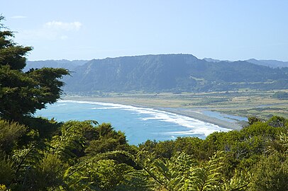
Young Nick's Head is a headland at the southern end of Poverty Bay in New Zealand's North Island.The area is the landing place of the Horouta and Te Ikaroa-a-Rauru waka which carried Māori settlers to the region around 1350 AD. In Māori, the promontory is named Te Kuri o Pāoa.
Ruatoria is a town in the Waiapu Valley of the Gisborne Region in the northeastern corner of New Zealand's North Island. The town was originally known as Cross Roads, and was named Ruatorea in 1913, from the Māori Rua-a-Tōrea. In 1925 the name was changed to "Ruatoria", although some texts retain the original spelling.

Tolaga Bay is both a bay and small town on the East Coast of New Zealand's North Island located 45 kilometres northeast of Gisborne and 30 kilometres south of Tokomaru Bay.

Cape Palliser is a promontory on the southern coast of New Zealand's North Island and is the southernmost point of the North Island; it is in fact considerably farther south than Nelson or Blenheim in the South Island.
This East Cape to Cape Egmont Traverse is not so much a trail, more a Kiwi pilgrimage to our early pioneers and landscape.

Nicholas Young was a British cabin boy aboard the Endeavour during Captain James Cook's first voyage of discovery. In 1769, Cook named the headland Young Nick's Head in Poverty Bay, New Zealand after him. In The Remarkable Story of Andrew Swan, it is stated that Young hailed from Greenock, on the Clyde.

The East Coast Main Trunk (ECMT) is a railway line in the North Island of New Zealand, originally running between Hamilton and Taneatua via Tauranga, connecting the Waikato with the Bay of Plenty. The ECMT now runs between Hamilton and Kawerau, with a branch line to Taneatua from the junction at Hawkens. The line is built to narrow gauge of 1,067 mm, the uniform gauge in New Zealand. It was known as the East Coast Main Trunk Railway until 2011, when the word "Railway" was dropped.

Whangaokeno / East Island is a small island approximately 2 km (1.2 mi) east of East Cape in the North Island of New Zealand. Reaching an elevation of 129 m (423 ft), it was the original location for the East Cape Lighthouse, which was built in 1900. However, the island is prone to earthquakes and its steep cliffs cause numerous landslides. By 1920, the danger to the lighthouse was considered great enough to trigger a decision to move the lighthouse to the mainland. In 1922, the lighthouse was extinguished and relocated to its current position.

Te Aitanga-a-Hauiti is a Māori iwi (tribe) on the East Coast of New Zealand's North Island. Its rohe covers the area from Tawhiti-a-Paoa Tokomaru Bay to Te Toka-a-Taiau Gisborne on the East Coast of the North Island of New Zealand.

Wharekahika / Hicks Bay, formerly called Hicks Bay, is a bay and coastal area in the Gisborne District of the North Island of New Zealand. It is situated 150 km east of Opotiki and 186 km north of Gisborne city, along State Highway 35 between Potaka and Te Araroa.

The Gisborne District is an area of northeastern New Zealand governed by the Gisborne District Council. A unitary authority, it is also known as the Gisborne Region. It is named after its largest settlement, the city of Gisborne. The region is also commonly referred to as the East Coast.

The Bay of Plenty is a region of New Zealand, situated around a bight of the same name in the northern coast of the North Island. The bight stretches 260 km from the Coromandel Peninsula in the west to Cape Runaway in the east. The Bay of Plenty Region, governed by the Bay of Plenty Regional Council, incorporates several large islands in the bay, in addition to the mainland area. Called Te Moana-a-Toi in the Māori language after Toi, an early ancestor, the name 'Bay of Plenty' was bestowed by James Cook in 1769 when he noticed the abundant food supplies at several Māori villages there, in stark contrast to observations he had made earlier in Poverty Bay.

Waipiro Bay is a small coastal settlement in the Gisborne District on the East Coast of the North Island of New Zealand. The name also refers to the bay that the settlement is built on. It was named Waipiro by Chief Paoa, which translates literally to "putrid water", referring to the area's sulphuric properties. It is in the Waiapu ward, along with nearby towns Te Puia Springs, Tokomaru Bay, and Ruatoria. It is located 15 km (9 mi) south of Ruatoria, 77 km (48 mi) north-east of Gisborne, and 41 km (25 mi) south-west of the East Cape Lighthouse, the easternmost point of mainland New Zealand. By road, it is 103 km (64 mi) from Gisborne, and 231 km (144 mi) from Ōpōtiki. Waipiro Bay is governed by the Gisborne District Council, and is in the East Coast electorate.
Tōrere, previously known as Torere, is a small settlement in the Ōpōtiki District of the Bay of Plenty Region on New Zealand's North Island. It is the ancestral home of the Ngāitai people.
The Gisborne Region has a deep and complex history which dates back to the early 1300s. The region, on the East Coast of New Zealand's North Island, has many culturally and historically significant sites that relate to early Māori exploration in the 14th century and important colonial events, such as Captain Cook's first landfall in New Zealand.
Horoera is a village and rural community in Gisborne District of New Zealand's North Island. It is located east of Te Araroa and north of East Cape, at Horoera Point.

Anaura Bay is a bay and community in the Gisborne District of New Zealand's North Island. It is located just south of Tokomaru Bay and north of Tolaga Bay.


 East Cape Islands or Sun Rise Islands
 View from East Cape looking towards East Island / Whangaokeno
